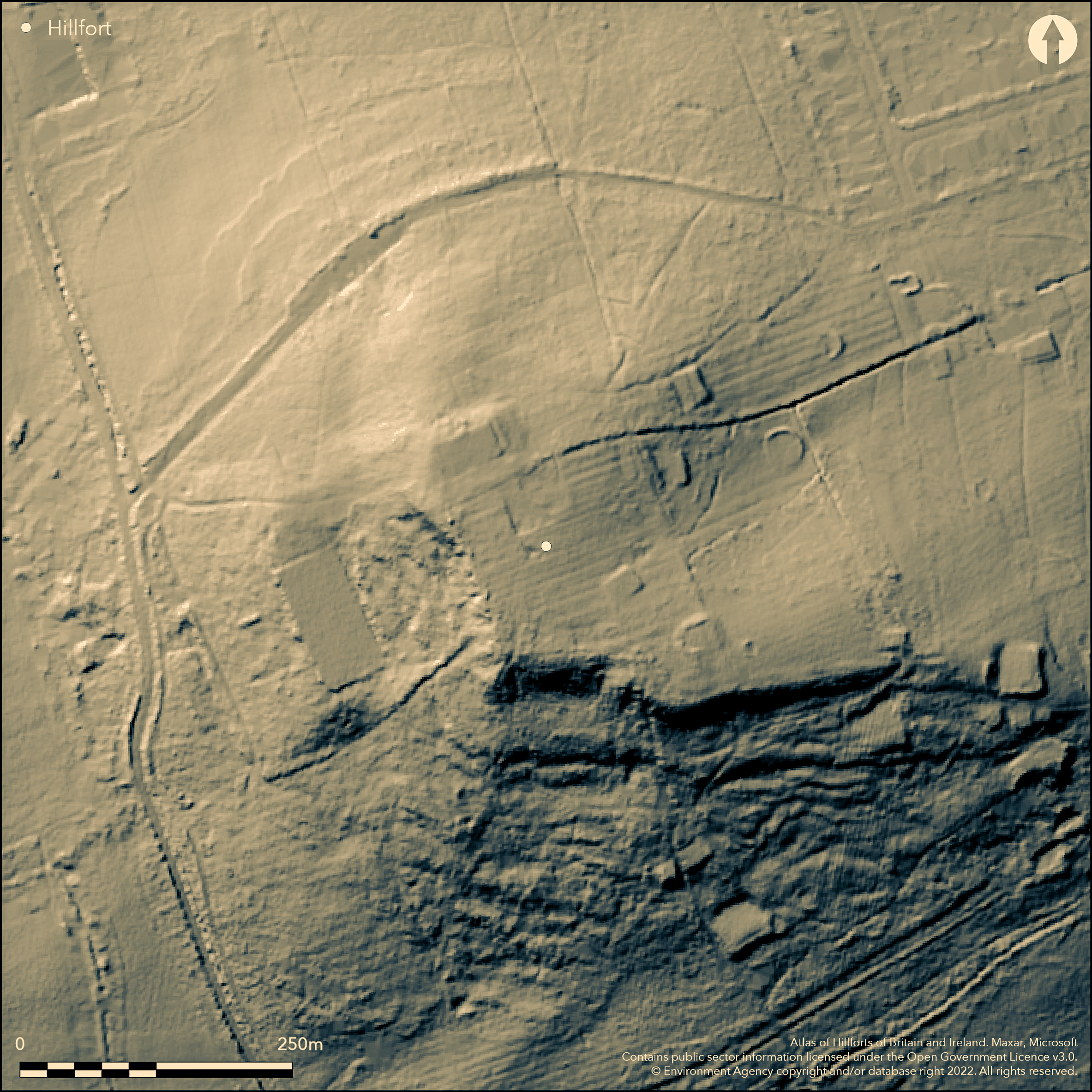
LiDAR 1m DTM Hillshade
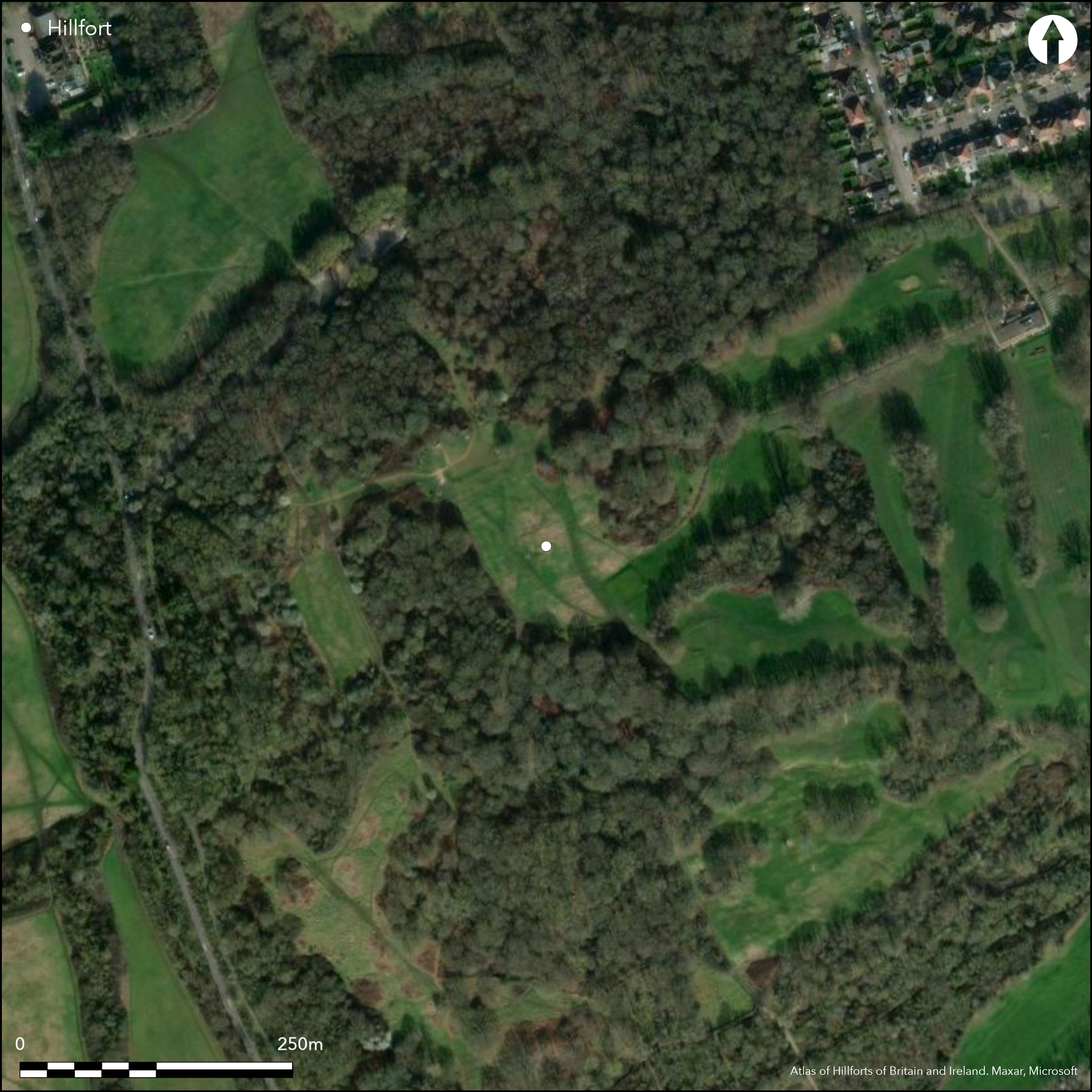
Satellite Imagery
LiDAR 1m DTM Hillshade
Satellite Imagery
Scroll left/right to view further images.
HER: Greater London MLO4511; MLO427 (None)
NMR: TQ 18 SE 3 (398121)
SM: 1001970
NGR: TQ 1620 8440
X: 516200 Y: 184400 (OSGB36)
A possible hillfort lying at 80m OD on Horsenden Hill within Horsenden Hill Golf Course. It comprises the remains of banks and ditches on the S and W of the hill forming a semi-circle 150m in diameter. Fragments of coarse pottery have been recovered from the eroding western slope. Partial excavations in 1973-77, 1987-88 and 1995 recovered considerable quantities of Iron Age pottery and an enamelled chariot lynchpin dated to AD 40-70 (Bloice 1974, 1976; Richardson 1977). Other finds included Neolithic worked flint, and Bronze Age, Roman and medieval pottery sherds. Survey and excavation in 1987 suggested the banks and ditches on the W, S and E were unlikely to be artificial but the result of natural slumping (Girardon and Heathcote 1988). Augering suggested that deposits on the summit of the hill had remained undisturbed from modern intrusions. A watching brief by Museum of London Archaeology Service in 1995 during work to stabilize the earthworks from damage caused by human activity, recorded two unstratified pieces of worked Neolithic flint and modern archaeological deposits (Seeley 1995). Not recorded on OS mapping. Scheduled as an Iron Age settlement
Citizen Science: ✗
Reliability of Data: Confirmed
Reliability of Interpretation: Unconfirmed
X: -36248 Y: 6718536 (EPSG: 3857)
Longitude: -0.32562159637716465 Latitude: 51.54648681186179 (EPSG:4326)
Country: England
Current County or Unitary Authority: Greater London Authority
Historic County: Middlesex
Current Parish/Community/Council/Townland: None
None
| Extant | ✓ |
| Cropmark | ✗ |
| Likely Destroyed | ✓ |
Golf course, some woodland
| Woodland | ✓ |
| Commercial Forestry Plantation | ✗ |
| Parkland | ✗ |
| Pasture (Grazing) | ✗ |
| Arable | ✗ |
| Scrub/Bracken | ✗ |
| Bare Outcrop | ✗ |
| Heather/Moorland | ✗ |
| Heath | ✗ |
| Built-up | ✗ |
| Coastal Grassland | ✗ |
| Other | ✓ |
A possible former contour fort lying at 80m OD on Horsendon Hill
| Contour Fort | ✓ |
| Partial Contour Fort | ✗ |
| Promontory Fort | ✗ |
| Hillslope Fort | ✗ |
| Level Terrain Fort | ✗ |
| Marsh Fort | ✗ |
| Multiple Enclosure Fort | ✗ |
| Hilltop | ✓ |
| Coastal Promontory | ✗ |
| Inland Promontory | ✗ |
| Valley Bottom | ✗ |
| Knoll/Hillock/Outcrop | ✗ |
| Ridge | ✗ |
| Cliff/Plateau-edge/Scarp | ✗ |
| Hillslope | ✗ |
| Lowland | ✓ |
| Spur | ✗ |
Dominant Topographic Feature: Horsendon Hill
| North | ✗ |
| Northeast | ✗ |
| East | ✗ |
| Southeast | ✗ |
| South | ✗ |
| Southwest | ✗ |
| West | ✗ |
| Northwest | ✗ |
| Level | ✓ |
Altitude: 80.0m
N/A
Prehistoric pottery and a Roman chariot lynch pin recovered. Mesolithic flint flakes show earlier activity in the region
Reliability: B - Medium
| Pre 1200BC | ✗ |
| 1200BC - 800BC | ✗ |
| 800BC - 400BC | ✓ |
| 400BC - AD50 | ✓ |
| AD50 - AD400 | ✗ |
| AD400 - AD 800 | ✗ |
| Post AD800 | ✗ |
| Unknown | ✗ |
| Pre Hillfort: | None |
| Post Hillfort: | None |
| Artefactual: | None |
General reference in Potter (1926). Partial excavations in 1973-77, 1987-88 and 1995. Watching brief. magnetometer and auger survey in 1987. Scheduled
| 1st Identified Written Reference (1926): | None |
| Other (1976): | Scheduled |
| Geophysical Survey (1987): | AML |
| Other (1987): | Watching brief |
| Excavation (1995): | None |
| Excavation (None): | None |
| Excavation (None): | None |
No internal features. Pottery, metal and lithics from excavation.
None
| None | ✓ |
| Spring | ✗ |
| Stream | ✗ |
| Pool | ✗ |
| Flush | ✗ |
| Well | ✗ |
| Other | ✗ |
None
| No Known Features | ✓ |
| Round Stone Structures | ✗ |
| Rectangular Stone Structures | ✗ |
| Curvilinear Platforms | ✗ |
| Other Roundhouse Evidence | ✗ |
| Pits | ✗ |
| Quarry Hollows | ✗ |
| Other | ✗ |
No features are recovered
| No Known Excavation | ✗ |
| Pits | ✗ |
| Postholes | ✗ |
| Roundhouses | ✗ |
| Rectangular Structures | ✗ |
| Roads/Tracks | ✗ |
| Quarry Hollows | ✗ |
| Other | ✗ |
| Nothing Found | ✓ |
None
| No Known Geophysics | ✗ |
| Pits | ✗ |
| Roundhouses | ✗ |
| Rectangular Structures | ✗ |
| Roads/Tracks | ✗ |
| Quarry Hollows | ✗ |
| Other | ✗ |
| Nothing Found | ✓ |
None
| No Known Finds | ✗ |
| Pottery | ✓ |
| Metal | ✓ |
| Metalworking | ✗ |
| Human Bones | ✗ |
| Animal Bones | ✗ |
| Lithics | ✓ |
| Environmental | ✗ |
| Other | ✗ |
None
| APs Not Checked | ✓ |
| None | ✗ |
| Roundhouses | ✗ |
| Rectangular Structures | ✗ |
| Pits | ✗ |
| Postholes | ✗ |
| Roads/Tracks | ✗ |
| Other | ✗ |
The location of entrances is not recorded, possibly destroyed
| 0: | None |
| 2: | None |
Guard Chambers: ✗
Chevaux de Frise: ✗
The remains of banks and ditches on the S and W of the hill forming a semi-circle 150m in diameter. Survey and excavation in 1987 suggested the banks and ditches on the W, S and E were unlikely to be man-made but the result of natural slumping (Girardon and Heathcote 1988)
| Area 1: | Noneha. |
| Total: | Noneha. |
Total Footprint Area: Noneha.
None
| ✗ | Area not defined. |
| ✗ | None |
| NE Quadrant: | None |
| SE Quadrant: | None |
| SW Quadrant: | 1 |
| NW Quadrant: | None |
| Total: | 1 |
| Partial Univallate | ✓ |
| Univallate | ✗ |
| Partial Bivallate | ✗ |
| Bivallate | ✗ |
| Partial Multivallate | ✗ |
| Multivallate | ✗ |
| Unknown | ✗ |
| Partial Univallate | ✗ |
| Univallate | ✗ |
| Partial Bivallate | ✗ |
| Bivallate | ✗ |
| Partial Multivallate | ✗ |
| Multivallate | ✗ |
None
| None | ✗ |
| Earthen Bank | ✓ |
| Stone Wall | ✗ |
| Rubble | ✗ |
| Wall-walk | ✗ |
| Evidence of Timber | ✗ |
| Vitrification | ✗ |
| Other Burning | ✗ |
| Palisade | ✗ |
| Counter Scarp Bank | ✗ |
| Berm | ✗ |
| Unfinished | ✗ |
| Other | ✗ |
None
| None | ✗ |
| Earthen Bank | ✓ |
| Stone Wall | ✗ |
| Murus Duplex | ✗ |
| Timber-framed | ✗ |
| Timber-laced | ✗ |
| Vitrification | ✗ |
| Other Burning | ✗ |
| Palisade | ✗ |
| Counter Scarp Bank | ✗ |
| Berm | ✗ |
| Unfinished | ✗ |
| No Known Excavation | ✗ |
| Other | ✗ |
| ✗ | None |
| ✓ | None |
Number of Ditches: 1
| ✗ | None |
Bloice, B. 1976. Excavation Round-up 1975. Horsenden Hill. London Arch. 2/1976/14, 370
Bloice, B. 1974. Excavation Round-up 1973. Horsenden Hill. London Arch. 2/1974/6, 134
Girardon, S. and Heathcote, J. 1988. Excavation Round-up 1987. London Arch. 5/1988/15, 411
Potter, S. 1926. The Story of Willesden, Sir Isaac Pitman & Sons, 21
Richardson, B. 1977. Excavation Round-up 1976. Horsenden Hill. London Arch 3/1977/2, 37
Seeley, D. 1995. GLSMR Archaeological Report Form concerning a watching brief at Horsenden Hill. Museum of London Archaeology Service. Unpublished
Sharpe, M. 1932. Middlesex in British, Roman and Saxon Times, Methuen & Co. 7
Atlas of Hillforts:
Wikidata:
This work is licensed under CC BY-SA 4.0

 and should be cited as:
Lock, Gary and Ralston, Ian. 2024. Atlas of Hillforts of Britain and Ireland. Available at: https://hillforts.arch.ox.ac.uk
Document Version 1.1