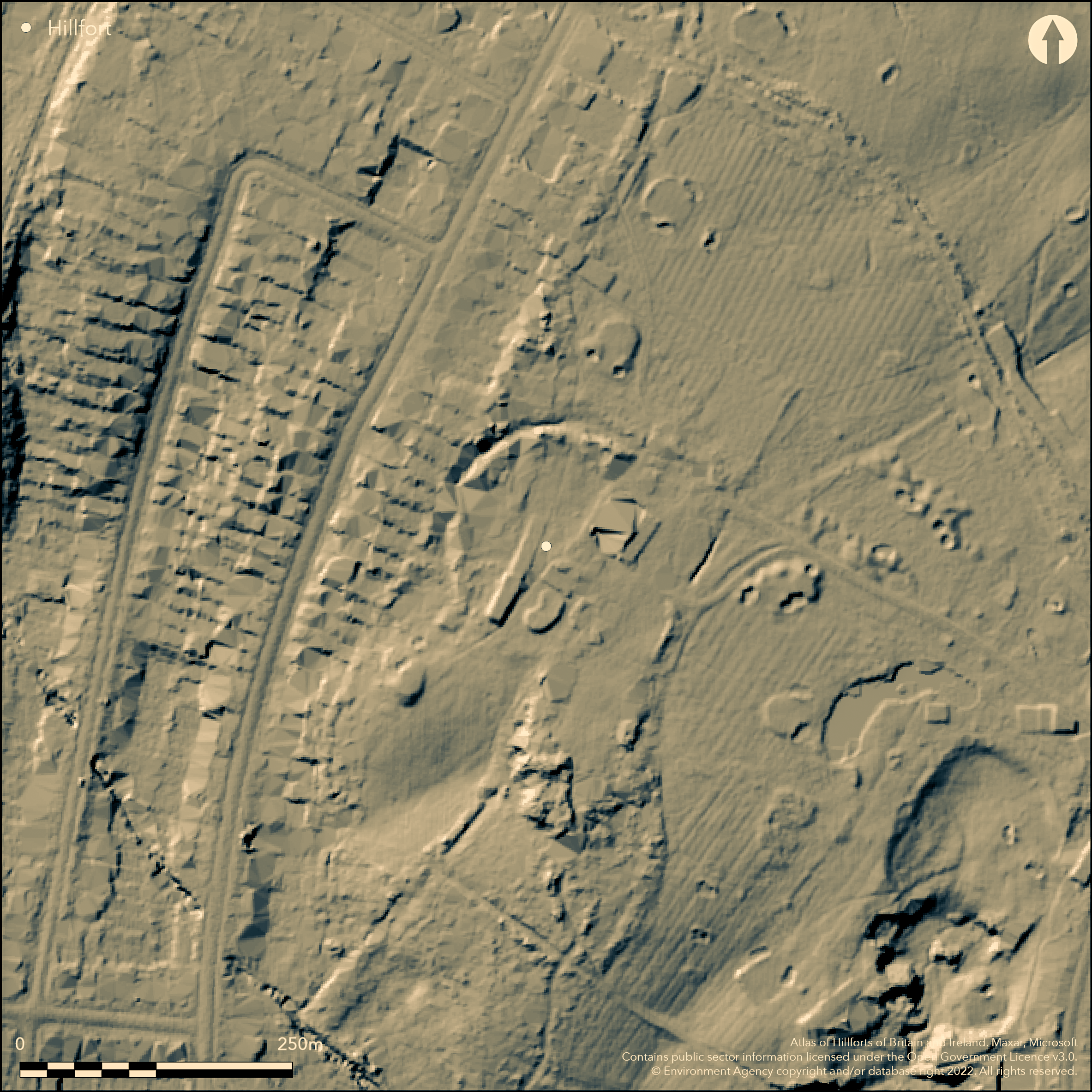
LiDAR 1m DTM Hillshade
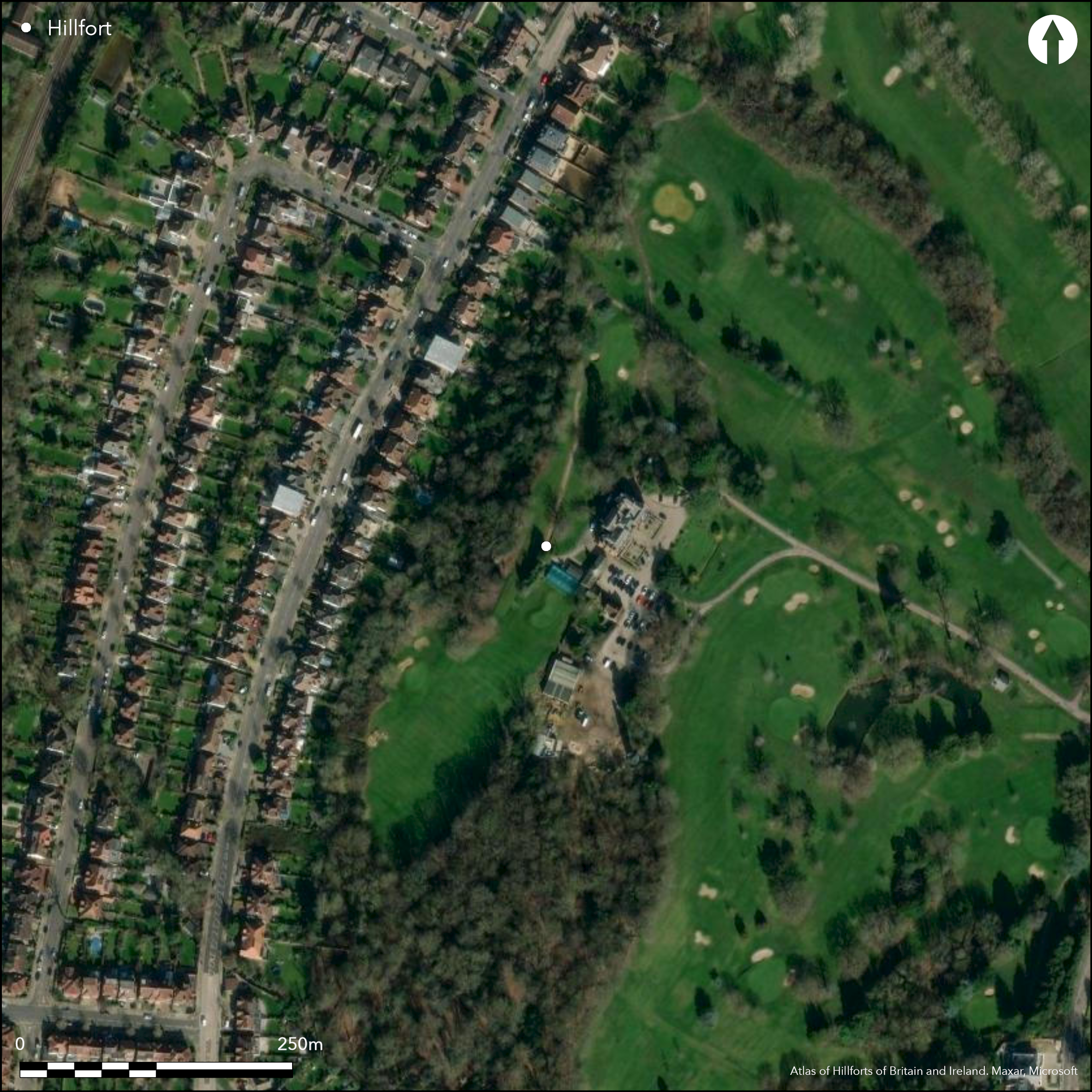
Satellite Imagery
LiDAR 1m DTM Hillshade
Satellite Imagery
Scroll left/right to view further images.
HER: Greater London MLO20417 (None)
NMR: TQ 39 NW 6 (405526)
SM: 1002047
NGR: TQ 3217 9568
X: 532179 Y: 195680 (OSGB36)
The remains of a univallate hillfort, lying within Bush Hill Park Golf Course, Enfield, bordered by New River to the E and Salmon's Brook to the W. It occupied the crest of a low spur at 48m OD, the ramparts placed at a natural break of slope (Dearne 2006). It survives as a single bank and ditch in the W and NW and is estimated to have been 120m in diameter. The rampart was recorded as 2.5m high above the ditch in the early 20th century. Partial excavation in 1956 by Enfield Archaeological Society showed the bank was constructed from gravel, fronted by a U-shaped ditch. The E site was levelled in the 18th century during landscaping for Old Park House. The ramparts are now overlain by the car park and club house in the SE. A fibula brooch and fragments of a pudding stone (conglomerate) were found during the cutting of Scheduled
Citizen Science: ✗
Reliability of Data: Confirmed
Reliability of Interpretation: Confirmed
X: -10137 Y: 6736072 (EPSG: 3857)
Longitude: -0.09106182778743102 Latitude: 51.644341232192886 (EPSG:4326)
Country: England; None
Current County or Unitary Authority: Greater London Authority
Historic County: Middlesex
Current Parish/Community/Council/Townland: None
None
| Extant | ✓ |
| Cropmark | ✗ |
| Likely Destroyed | ✓ |
Golf course
| Woodland | ✗ |
| Commercial Forestry Plantation | ✗ |
| Parkland | ✗ |
| Pasture (Grazing) | ✗ |
| Arable | ✗ |
| Scrub/Bracken | ✗ |
| Bare Outcrop | ✗ |
| Heather/Moorland | ✗ |
| Heath | ✗ |
| Built-up | ✗ |
| Coastal Grassland | ✗ |
| Other | ✓ |
A contour fort occupying the crest of a low spur at 48m OD
| Contour Fort | ✓ |
| Partial Contour Fort | ✗ |
| Promontory Fort | ✗ |
| Hillslope Fort | ✗ |
| Level Terrain Fort | ✗ |
| Marsh Fort | ✗ |
| Multiple Enclosure Fort | ✗ |
| Hilltop | ✗ |
| Coastal Promontory | ✗ |
| Inland Promontory | ✗ |
| Valley Bottom | ✗ |
| Knoll/Hillock/Outcrop | ✗ |
| Ridge | ✗ |
| Cliff/Plateau-edge/Scarp | ✗ |
| Hillslope | ✗ |
| Lowland | ✓ |
| Spur | ✓ |
Dominant Topographic Feature: Low spur
| North | ✗ |
| Northeast | ✗ |
| East | ✗ |
| Southeast | ✗ |
| South | ✗ |
| Southwest | ✗ |
| West | ✗ |
| Northwest | ✗ |
| Level | ✓ |
Altitude: 48.0m
Boundary between the borough constituencies of Edmonton and Enfield runs to the S. Shown as a parish boundary on historic OS mapping
Boundary Type: Other
Only finds of a Roman date are recorded from the site
Reliability: D - None
| Pre 1200BC | ✗ |
| 1200BC - 800BC | ✗ |
| 800BC - 400BC | ✗ |
| 400BC - AD50 | ✗ |
| AD50 - AD400 | ✗ |
| AD400 - AD 800 | ✗ |
| Post AD800 | ✗ |
| Unknown | ✓ |
| Pre Hillfort: | None |
| Post Hillfort: | None |
| Artefactual: | None |
Recorded on 1877 1:2,500 OS mapping. Field investigation in 1975. Small excavation by Enfield Archaeological Society in 1956. Scheduled
| 1st Identified Written Reference (1873): | None |
| 1st Identified Map Depiction (1877): | None |
| Other (1946): | Scheduled |
| Excavation (1956): | None |
| Other (1975): | Field investigation |
No known internal features. Fibula brooch, fragments of a pudding stone (conglomerate), Roman coins
New River to the E and Salmon's Brook to the W
| None | ✓ |
| Spring | ✗ |
| Stream | ✗ |
| Pool | ✗ |
| Flush | ✗ |
| Well | ✗ |
| Other | ✗ |
None
| No Known Features | ✓ |
| Round Stone Structures | ✗ |
| Rectangular Stone Structures | ✗ |
| Curvilinear Platforms | ✗ |
| Other Roundhouse Evidence | ✗ |
| Pits | ✗ |
| Quarry Hollows | ✗ |
| Other | ✗ |
None
| No Known Excavation | ✗ |
| Pits | ✗ |
| Postholes | ✗ |
| Roundhouses | ✗ |
| Rectangular Structures | ✗ |
| Roads/Tracks | ✗ |
| Quarry Hollows | ✗ |
| Other | ✗ |
| Nothing Found | ✓ |
None
| No Known Geophysics | ✓ |
| Pits | ✗ |
| Roundhouses | ✗ |
| Rectangular Structures | ✗ |
| Roads/Tracks | ✗ |
| Quarry Hollows | ✗ |
| Other | ✗ |
| Nothing Found | ✗ |
Coins, pudding stone
| No Known Finds | ✗ |
| Pottery | ✗ |
| Metal | ✓ |
| Metalworking | ✗ |
| Human Bones | ✗ |
| Animal Bones | ✗ |
| Lithics | ✗ |
| Environmental | ✗ |
| Other | ✓ |
Landscaped, built-up
| APs Not Checked | ✓ |
| None | ✗ |
| Roundhouses | ✗ |
| Rectangular Structures | ✗ |
| Pits | ✗ |
| Postholes | ✗ |
| Roads/Tracks | ✗ |
| Other | ✗ |
The location of entrances is unknown
| None: | None |
| 2: | None |
Guard Chambers: ✗
Chevaux de Frise: ✗
Univallate, it survives as a single bank and ditch in the W and NW the whole estimated to have been 120m in diameter. The rampart was recorded as 2.5m high above the ditch in the early 20th century. Partial excavation showed the bank was constructed from gravel fronted by a U-shaped ditch. The E site was levelled in the 18th century during landscaping for Old Park House.
| Area 1: | 1.1ha. |
| Total: | 1.1ha. |
Total Footprint Area: Noneha.
None
| ✗ | Area estimated |
| ✓ | Now destroyed in places |
| NE Quadrant: | 1 |
| SE Quadrant: | 1 |
| SW Quadrant: | 1 |
| NW Quadrant: | 1 |
| Total: | 1 |
| Partial Univallate | ✗ |
| Univallate | ✓ |
| Partial Bivallate | ✗ |
| Bivallate | ✗ |
| Partial Multivallate | ✗ |
| Multivallate | ✗ |
| Unknown | ✗ |
| Partial Univallate | ✗ |
| Univallate | ✗ |
| Partial Bivallate | ✗ |
| Bivallate | ✗ |
| Partial Multivallate | ✗ |
| Multivallate | ✗ |
None
| None | ✗ |
| Earthen Bank | ✓ |
| Stone Wall | ✗ |
| Rubble | ✗ |
| Wall-walk | ✗ |
| Evidence of Timber | ✗ |
| Vitrification | ✗ |
| Other Burning | ✗ |
| Palisade | ✗ |
| Counter Scarp Bank | ✗ |
| Berm | ✗ |
| Unfinished | ✗ |
| Other | ✗ |
gravel bank
| None | ✗ |
| Earthen Bank | ✗ |
| Stone Wall | ✗ |
| Murus Duplex | ✗ |
| Timber-framed | ✗ |
| Timber-laced | ✗ |
| Vitrification | ✗ |
| Other Burning | ✗ |
| Palisade | ✗ |
| Counter Scarp Bank | ✗ |
| Berm | ✗ |
| Unfinished | ✗ |
| No Known Excavation | ✗ |
| Other | ✓ |
| ✗ | None |
| ✓ | None |
Number of Ditches: 1
| ✗ | None |
Dearne, M. 2006. Re-excavation (Mitigation) of Unauthorised Foul Water Pipe Installation on the Site of Bush Hill Park Hillfort, Bush Hill Park Golf Course, Enfield, 2006. Enfield Archaeological Society
Hodson, G.H. and Ford, E. 1873. History of Enfield in the County of Middlesex. Enfield Press. 121-2
Enfield Archaeological Society,1973. Prehistoric and Roman Enfield Report No 3. Enfield Archaeological Society Research Reports, 8-9
Atlas of Hillforts:
Wikidata:
This work is licensed under CC BY-SA 4.0

 and should be cited as:
Lock, Gary and Ralston, Ian. 2024. Atlas of Hillforts of Britain and Ireland. Available at: https://hillforts.arch.ox.ac.uk
Document Version 1.1