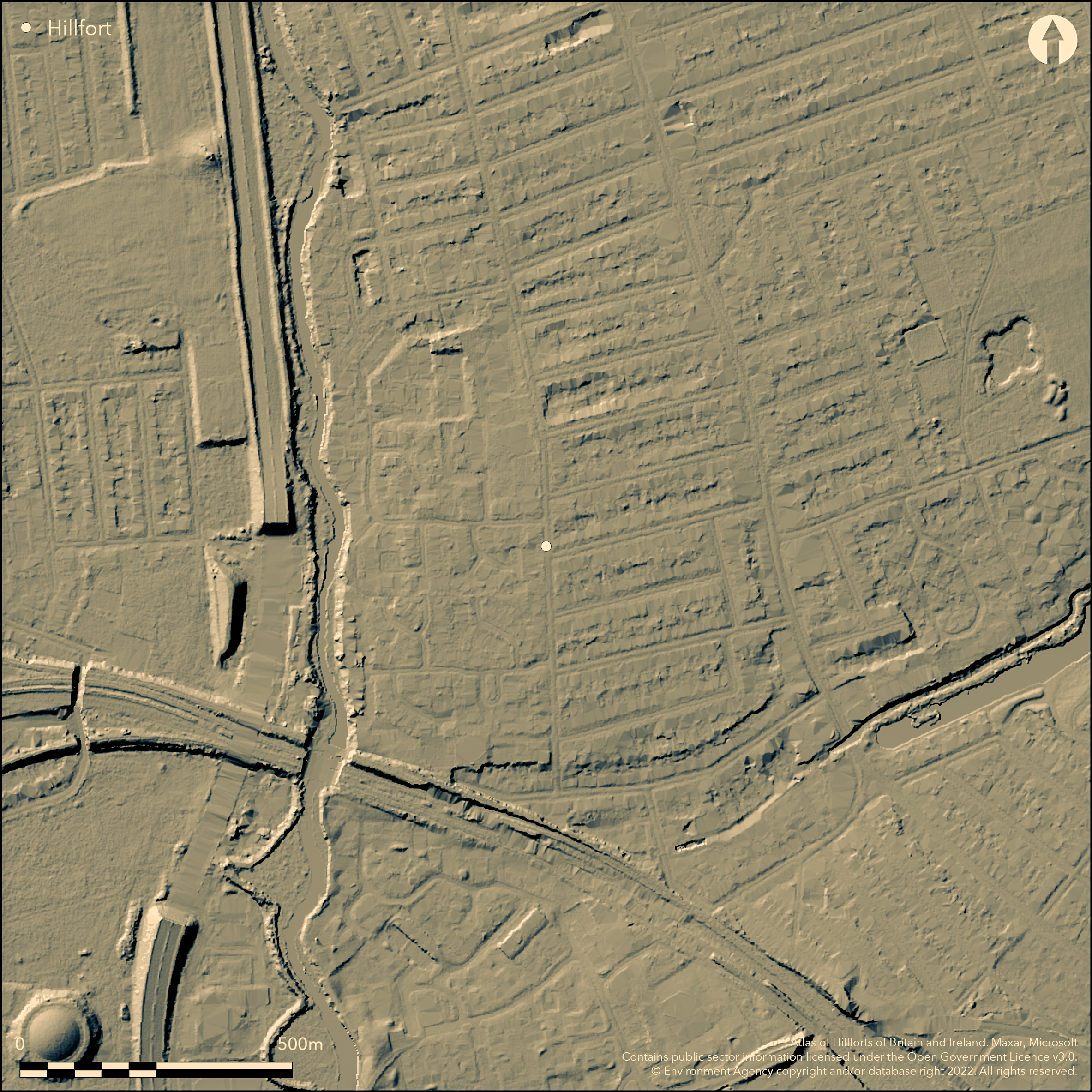
LiDAR 1m DTM Hillshade
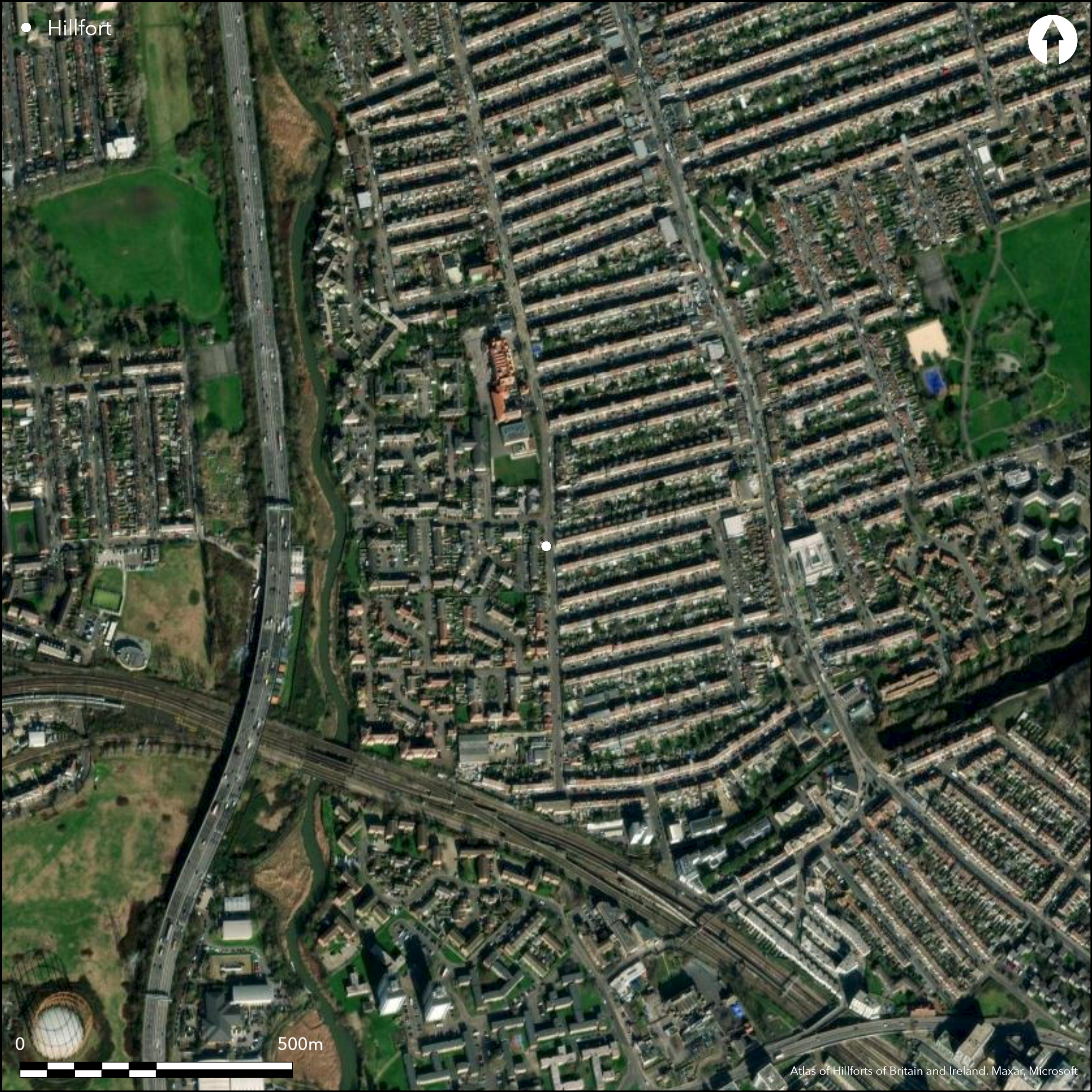
Satellite Imagery
LiDAR 1m DTM Hillshade
Satellite Imagery
Scroll left/right to view further images.
HER: Greater London MLO22746 (None)
NMR: TQ 48 NW 34 (408130)
SM: None
NGR: TQ 4383 8506
X: 543836 Y: 185061 (OSGB36)
Situated at the confluence of the River Roding and a stream known as Loxford Water, a former hillfort recorded by Noble c.1735, now mostly destroyed. Documentary and cartographic evidence suggests it was square in form measuring approximately 550m N-S and between 400m and 500m E-W and enclosing approximately 19.4ha, with a whole site footprint in excess of 24ha. Brief descriptions in the 18th century by Lysons provide details of the earthworks before they were destroyed (Crouch 1906; Wilkinson 1978). Crouch recorded the ramparts as 3.7m high in 1867 although subsequent surveys in 1899, 1906 and 1909 document their erosion (Telfer 2004). The enclosure is believed to have been univallate except in the W where a double bank was recorded but which was destroyed by canalisation of the River Roding in the 18th century. The site is covered by housing and related development in the E, but redevelopment in the W allowed investigations to be carried out in 1960_1961, 1983_1984 and 1987_1989 by P. Greenwood for the Passmore Edwards Museum (summarised in Telfer 2004). Excavations in the E recorded a large bank, a ditch 2m deep and 8m wide and traces of a palisade along with middle Iron Age pottery. The only recorded entrance lay in the NW corner where there was a small creek leading off the River Roding although this is probably not original and it is uncertain if the breaks in the N and S which today carry the Uphall Road, were original. Excavation has shown the interior is well preserved with the majority of the features belonging to the middle Iron Age including nine round buildings of between 7.20m-15m in diameter, possibly of more than one phase, two penannular structures, possibly stock enclosures, six four post structures associated with abundant charred grain, possibly granaries, four or more rectangular sleeper-beam and post-fast structures, possibly sheds or workshops, numerous pits, postholes and ditches. Three potin coins and abundant finds of a domestic nature were recovered, along with evidence for the smithing of iron and the casting of copper alloys (Starley, 1997). Evidence for settlement within the circuit of the hillfort has also been recorded from the middle-late Bronze Age, throughout the Roman period, Early Saxon and medieval and post-medieval periods. Two possible burial groups is surmised from the recovery of flagons, samian and other vessels, and urns containing burnt human bones (Crouch, 1906) and a single complete flagon excavated in 1989. A coin of Severus Alexander (AD 222_235) is also recorded. The surviving ramparts in the NW corner were recorded on 1892-1905 OS mapping.
Citizen Science: ✗
Reliability of Data: Confirmed
Reliability of Interpretation: Confirmed
X: 8121 Y: 6718461 (EPSG: 3857)
Longitude: 0.0729498099760511 Latitude: 51.54606460477456 (EPSG:4326)
Country: England
Current County or Unitary Authority: Greater London Authority
Historic County: Essex
Current Parish/Community/Council/Townland: None
None
| Extant | ✗ |
| Cropmark | ✗ |
| Likely Destroyed | ✓ |
None
| Woodland | ✗ |
| Commercial Forestry Plantation | ✗ |
| Parkland | ✗ |
| Pasture (Grazing) | ✗ |
| Arable | ✗ |
| Scrub/Bracken | ✗ |
| Bare Outcrop | ✗ |
| Heather/Moorland | ✗ |
| Heath | ✗ |
| Built-up | ✓ |
| Coastal Grassland | ✗ |
| Other | ✗ |
A lowland fort lying on level ground at the confluence of the River Roding and Loxford Water at 9m OD
| Contour Fort | ✗ |
| Partial Contour Fort | ✗ |
| Promontory Fort | ✗ |
| Hillslope Fort | ✗ |
| Level Terrain Fort | ✓ |
| Marsh Fort | ✗ |
| Multiple Enclosure Fort | ✗ |
| Hilltop | ✗ |
| Coastal Promontory | ✗ |
| Inland Promontory | ✗ |
| Valley Bottom | ✗ |
| Knoll/Hillock/Outcrop | ✗ |
| Ridge | ✗ |
| Cliff/Plateau-edge/Scarp | ✗ |
| Hillslope | ✗ |
| Lowland | ✓ |
| Spur | ✗ |
Dominant Topographic Feature: Confluence of the River Roding and a stream known as Loxford Water
| North | ✗ |
| Northeast | ✗ |
| East | ✗ |
| Southeast | ✗ |
| South | ✗ |
| Southwest | ✗ |
| West | ✗ |
| Northwest | ✗ |
| Level | ✓ |
Altitude: 9.0m
N/A
Middle Iron Age excavated pottery. Stray finds of Mesolithic and Neolithic flintwork suggest activity in the area along the River Roding. Evidence recovered during excavation for Bronze Age-post medeval settlement and other activity within the circuit of the hillfort defences.
Reliability: B - Medium
| Pre 1200BC | ✗ |
| 1200BC - 800BC | ✗ |
| 800BC - 400BC | ✗ |
| 400BC - AD50 | ✓ |
| AD50 - AD400 | ✗ |
| AD400 - AD 800 | ✗ |
| Post AD800 | ✗ |
| Unknown | ✗ |
| Pre Hillfort: | None |
| Post Hillfort: | None |
| Artefactual: | None |
Plan by John Noble c.1735 (Essex Record Office No T/P 93), described by Morant 1768. Recorded on 1892-1905 OS mapping. Plan in Crouch 1906; Excavations in 1960-61 and 1983-4 and 1987-9. Watching brief in 1989.
| 1st Identified Written Reference (1768): | None |
| 1st Identified Written Reference (1768): | None |
| Other (1989): | Watching brief |
| 1st Identified Map Depiction (None): | None |
| 1st Identified Map Depiction (None): | None |
| Excavation (None): | None |
| Excavation (None): | None |
| Excavation (None): | None |
| Earthwork Survey (None): | Plan by Noble |
Well preserved with the majority of the features belonging to the middle Iron Age including nine round buildings of between 7.20m-15m in diameter, possibly of more than one phase, two penannular structures, possibly stock enclosures, six four post structures associated with abundant charred grain, possibly granaries, four or more rectangular sleeper-beam and post-fast structures, possible sheds or workshops, numerous pits, postholes and ditches.
River Roding runs along the western boundary
| None | ✓ |
| Spring | ✗ |
| Stream | ✗ |
| Pool | ✗ |
| Flush | ✗ |
| Well | ✗ |
| Other | ✓ |
None
| No Known Features | ✓ |
| Round Stone Structures | ✗ |
| Rectangular Stone Structures | ✗ |
| Curvilinear Platforms | ✗ |
| Other Roundhouse Evidence | ✗ |
| Pits | ✗ |
| Quarry Hollows | ✗ |
| Other | ✗ |
Stock enclosures, six four post structures possibly granaries, four or more rectangular sleeper-beam and post-fast structures, possibly sheds or workshops, numerous pits, postholes and ditches.
| No Known Excavation | ✗ |
| Pits | ✓ |
| Postholes | ✓ |
| Roundhouses | ✓ |
| Rectangular Structures | ✓ |
| Roads/Tracks | ✗ |
| Quarry Hollows | ✗ |
| Other | ✓ |
| Nothing Found | ✗ |
None
| No Known Geophysics | ✓ |
| Pits | ✗ |
| Roundhouses | ✗ |
| Rectangular Structures | ✗ |
| Roads/Tracks | ✗ |
| Quarry Hollows | ✗ |
| Other | ✗ |
| Nothing Found | ✗ |
Charred plant remains, charcoal, daub, pottery vessels. Fragments of bronze and iron, crucibles, an iron file, punches and a mould
| No Known Finds | ✗ |
| Pottery | ✓ |
| Metal | ✓ |
| Metalworking | ✓ |
| Human Bones | ✓ |
| Animal Bones | ✓ |
| Lithics | ✓ |
| Environmental | ✓ |
| Other | ✗ |
Built up
| APs Not Checked | ✓ |
| None | ✗ |
| Roundhouses | ✗ |
| Rectangular Structures | ✗ |
| Pits | ✗ |
| Postholes | ✗ |
| Roads/Tracks | ✗ |
| Other | ✗ |
The location of any original entrances is unconfirmed. The only recorded entrance lay in the NW corner where there was a small creek leading off the River Roding although this is probably not original and it is uncertain if the breaks in the N and S which today carry the Uphall Road, were original.
| 3: | None |
| 2: | None |
Guard Chambers: ✗
Chevaux de Frise: ✗
Square in form measuring approximately 550m N-S and between 400m and 500m E-W and enclosing approximately 19.4ha, with a whole site footprint in excess of 24ha. Crouch (1867) recorded the ramparts as 3.7m high at that time. Believed to have been univallate except in the W where a double bank was recorded but is now destroyed by canalisation of the River Roding in the 18th century. Excavations in the E recorded a large bank, a ditch 2m wide and 8m deep and traces of a palisade.
| Area 1: | 19.4ha. |
| Total: | 19.4ha. |
Total Footprint Area: 24.0ha.
None
| ✗ | None |
| ✗ | Double bank and ditch in the W |
| NE Quadrant: | 1 |
| SE Quadrant: | 1 |
| SW Quadrant: | 2 |
| NW Quadrant: | 2 |
| Total: | 2 |
| Partial Univallate | ✓ |
| Univallate | ✗ |
| Partial Bivallate | ✓ |
| Bivallate | ✗ |
| Partial Multivallate | ✗ |
| Multivallate | ✗ |
| Unknown | ✗ |
| Partial Univallate | ✗ |
| Univallate | ✗ |
| Partial Bivallate | ✗ |
| Bivallate | ✗ |
| Partial Multivallate | ✗ |
| Multivallate | ✗ |
None
| None | ✗ |
| Earthen Bank | ✓ |
| Stone Wall | ✗ |
| Rubble | ✗ |
| Wall-walk | ✗ |
| Evidence of Timber | ✗ |
| Vitrification | ✗ |
| Other Burning | ✗ |
| Palisade | ✗ |
| Counter Scarp Bank | ✗ |
| Berm | ✗ |
| Unfinished | ✗ |
| Other | ✗ |
None
| None | ✗ |
| Earthen Bank | ✓ |
| Stone Wall | ✗ |
| Murus Duplex | ✗ |
| Timber-framed | ✗ |
| Timber-laced | ✗ |
| Vitrification | ✗ |
| Other Burning | ✗ |
| Palisade | ✓ |
| Counter Scarp Bank | ✗ |
| Berm | ✗ |
| Unfinished | ✗ |
| No Known Excavation | ✗ |
| Other | ✗ |
| ✗ | None |
| ✓ | None |
Number of Ditches: 2
| ✗ | None |
Crouch W. 1906. Uphall Camp: Notes on Ancient Entrenchments near Barking, on the left bank of the river Roding. Essex Archaeol Hist. New Series ix, 408-412
Greenwood, P. 2001. Uphall Camp, Ilford - an up-date. London Archaeol. 9, 207-216
Greenwood, P. 1989. Uphall Camp, Ilford, Essex: an Iron Age fortification. London Archaeol 6, 94-101
Morant, P. 1768. History of Essex, Vol.I, 1-2
Starley, D. 1997. An Assesment of Metalworking Debris from Uphall Camp, Ilford, Essex. Ancient Monuments Laboratory Report 4/97. https://services.english-heritage.org.uk/ResearchReportsPdfs/004-1997.pdf accessed Jan 2016
Telfer, A. 2004. Uphall Camp, Uphall Road, Ilford. A post-excavation assessment. Site Codes HOW60, HOW61, ILF-UC83, ILF-UC87. Museum of London Archaeology Service. https://archaeologydataservice.ac.uk/archiveDS/archiveDownload?t=arch-1120-1/dissemination/pdf/Documents/PXAs/UELG-pxa01h-IL-UC8387.pdf. Accessed Jan 2016
Wilkinson, P.M. 1978. Uphall Camp. Essex Archaeol Hist 10, 220-1
Atlas of Hillforts:
Wikidata:
This work is licensed under CC BY-SA 4.0

 and should be cited as:
Lock, Gary and Ralston, Ian. 2024. Atlas of Hillforts of Britain and Ireland. Available at: https://hillforts.arch.ox.ac.uk
Document Version 1.1