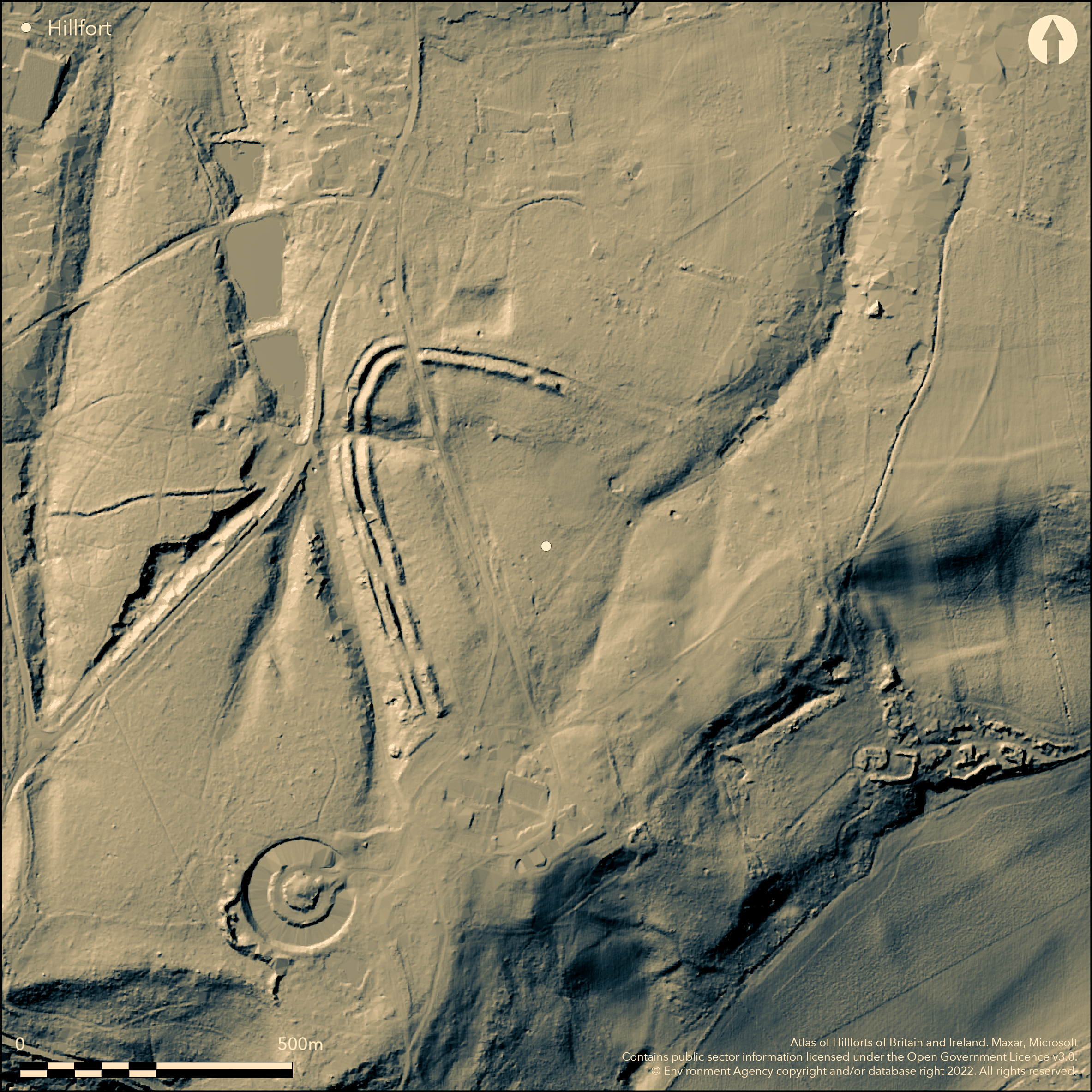
LiDAR 1m DTM Hillshade
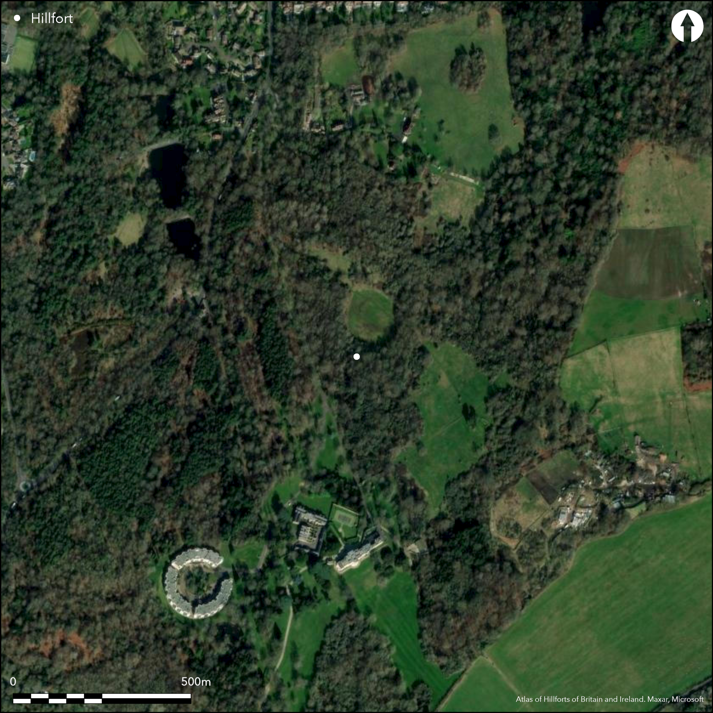
Satellite Imagery
LiDAR 1m DTM Hillshade
Satellite Imagery
Scroll left/right to view further images.
HER: Greater London MLO18021 (None)
NMR: TQ 46 SW 5; TQ46SW 20 (407826; 407871)
SM: 1002023
NGR: TQ 4223 6390
X: 542230 Y: 163900 (OSGB36)
Within the grounds of Holwood House, to the E of Keston Common, a large bivallate hillfort of 17.4 ha. It lies on sloping ground at 160-149m OD partially occupying the summit of a hill with the ground falling away steeply in the SE. The defences in the S were destroyed during landscaping for Holwood House. In the W, double banks and ditches give a combined width of 40m with a counterscarp in places. The bank stands approximately 3m above the original land surface. The ditches are 9m wide and 4.5m deep. Two banks and one ditch lie in the N and E. Three low parallel scarps and banks are thought to be the remains of the ramparts along the scarp edge although a geophysical survey was unable to support this. A small settlement of possible medieval date was also recorded. Partial excavation between 1956-7 showed the inner rampart had three stages of construction; the initial construction of the bank, later the height of the bank was raised and the top was flattened, finally the height at the rear of the rampart was raised to form a flat crest 2.4m wide. Pottery gave a construction date of 200 BC (Piercy Fox 1957). A slightly in-turned entrance lies in the NW, exaggerated by the presence of a small dry valley which runs into the interior. Investigations showed three phases of flint revetting and timber lacing (Piercy Fox 1969). There was also evidence for destruction through burning of the timbers throughout 26m of the northern in-turn. It was suggested at that time that the hillfort was a component of an extensive Iron Age system of land division. Two trenches excavated within the grounds of Holwood House located the southern edge of the hillfort as depicted on a survey carried out for the Society of Antiquaries by Thomas Milne in 1790, and included the outer rampart, outer ditch and counterscarp bank. They were shown to lie outside the Scheduled Ancient Monument perimeter. This line was found to coincide with existing earthworks which had previously been presumed to be related to garden landscaping (Knight 2000). In the W, on Keston Common, a linear bank and ditch is possibly associated with the hillfort. A topographic survey on the SE side was undertaken in 1997 by RCHME (Pattison 1997). Recorded on 1871-2 1:10,560 OS mapping. Scheduled.
Citizen Science: ✗
Reliability of Data: Confirmed
Reliability of Interpretation: Confirmed
X: 4598 Y: 6684566 (EPSG: 3857)
Longitude: 0.041303458785465284 Latitude: 51.356318856917646 (EPSG:4326)
Country: England; None
Current County or Unitary Authority: Greater London Authority
Historic County: Kent
Current Parish/Community/Council/Townland: None
None
| Extant | ✓ |
| Cropmark | ✗ |
| Likely Destroyed | ✓ |
None
| Woodland | ✓ |
| Commercial Forestry Plantation | ✗ |
| Parkland | ✓ |
| Pasture (Grazing) | ✗ |
| Arable | ✗ |
| Scrub/Bracken | ✗ |
| Bare Outcrop | ✗ |
| Heather/Moorland | ✗ |
| Heath | ✗ |
| Built-up | ✗ |
| Coastal Grassland | ✗ |
| Other | ✗ |
A large bivallate hillfort of 17.4 ha. It lies on sloping ground at 160-149m OD partially occupying the summit of a hill with the ground falling away steeply in the SE.
| Contour Fort | ✗ |
| Partial Contour Fort | ✗ |
| Promontory Fort | ✗ |
| Hillslope Fort | ✓ |
| Level Terrain Fort | ✗ |
| Marsh Fort | ✗ |
| Multiple Enclosure Fort | ✗ |
| Hilltop | ✓ |
| Coastal Promontory | ✗ |
| Inland Promontory | ✗ |
| Valley Bottom | ✗ |
| Knoll/Hillock/Outcrop | ✗ |
| Ridge | ✗ |
| Cliff/Plateau-edge/Scarp | ✗ |
| Hillslope | ✓ |
| Lowland | ✗ |
| Spur | ✗ |
Dominant Topographic Feature: Hilltop
| North | ✗ |
| Northeast | ✗ |
| East | ✗ |
| Southeast | ✓ |
| South | ✗ |
| Southwest | ✗ |
| West | ✗ |
| Northwest | ✗ |
| Level | ✗ |
Altitude: 160.0m
Boundary between the borough constituencies of Beckenham and Orpington runs to the SE. Shown as a parish boundary on historic OS mapping
Boundary Type: Other
Pottery recovered from ditch fills suggests a construction date of 200 BC
Reliability: B - Medium
| Pre 1200BC | ✗ |
| 1200BC - 800BC | ✗ |
| 800BC - 400BC | ✗ |
| 400BC - AD50 | ✓ |
| AD50 - AD400 | ✗ |
| AD400 - AD 800 | ✗ |
| Post AD800 | ✗ |
| Unknown | ✗ |
| Pre Hillfort: | None |
| Post Hillfort: | None |
| Artefactual: | None |
Surveyed for the Society of Antiquaries by Thomas Milne in 1790; recorded on 1871-2 1:10,560 OS mapping. General reference in Smith (1880). Excavations between 1956-7 and 1997-9. Geophysical survey 1997. Field investigation in 1964. RCHME survey, 1997, ref. no. 1088226. Scheduled
| Earthwork Survey (1790): | Thomas Milne |
| 1st Identified Written Reference (1880): | (Smith 1880) |
| Other (1935): | Scheduled |
| Other (1964): | Field investigation |
| Geophysical Survey (1997): | None |
| Earthwork Survey (1997): | (Pattison 1997) |
| 1st Identified Map Depiction (None): | None |
| Excavation (None): | (Piercy Fox 1957) |
| Excavation (None): | (Knight 2000) |
No internal features contemporary with the enclosure are recorded
None
| None | ✓ |
| Spring | ✗ |
| Stream | ✗ |
| Pool | ✗ |
| Flush | ✗ |
| Well | ✗ |
| Other | ✗ |
None
| No Known Features | ✓ |
| Round Stone Structures | ✗ |
| Rectangular Stone Structures | ✗ |
| Curvilinear Platforms | ✗ |
| Other Roundhouse Evidence | ✗ |
| Pits | ✗ |
| Quarry Hollows | ✗ |
| Other | ✗ |
None
| No Known Excavation | ✗ |
| Pits | ✗ |
| Postholes | ✗ |
| Roundhouses | ✗ |
| Rectangular Structures | ✗ |
| Roads/Tracks | ✗ |
| Quarry Hollows | ✗ |
| Other | ✗ |
| Nothing Found | ✓ |
Report unpublished
| No Known Geophysics | ✗ |
| Pits | ✗ |
| Roundhouses | ✗ |
| Rectangular Structures | ✗ |
| Roads/Tracks | ✗ |
| Quarry Hollows | ✗ |
| Other | ✗ |
| Nothing Found | ✓ |
No finds recorded
| No Known Finds | ✓ |
| Pottery | ✗ |
| Metal | ✗ |
| Metalworking | ✗ |
| Human Bones | ✗ |
| Animal Bones | ✗ |
| Lithics | ✗ |
| Environmental | ✗ |
| Other | ✗ |
Woodland and parkland
| APs Not Checked | ✓ |
| None | ✗ |
| Roundhouses | ✗ |
| Rectangular Structures | ✗ |
| Pits | ✗ |
| Postholes | ✗ |
| Roads/Tracks | ✗ |
| Other | ✗ |
A slightly in-turned entrance lies in the NW exaggerated by the presence of a small dry valley which runs into the interior. Investigations in 1957 showed three phases of flint revetting and timber lacing in this area (Piercy Fox 1969). There was also evidence for destruction from burnt timbers and cracked stone, throughout 26m of the northern in-turn.
| 7: | Seven breaks recorded on Milne's plan but only the entrance in the NW is considered original |
| 2: | None |
Guard Chambers: ✗
Chevaux de Frise: ✗
| 1. In-turned (North west): | None |
Large bivallate hillfort of 17.4 ha. The defences in the S were destroyed during landscaping for Holwood House. In the W, double banks and ditches together total 40m wide with a counterscarp in places. The bank stands approximately 3m above the original land surface. The ditches are 9m wide and 4.5m deep. Two banks and one ditch lie in the N and E. A topographic survey on the SE side recorded three low parallel scarps and banks thought to be the remains of the defences along the scarp edge. Partial excavation between 1956-7 showed the inner rampart had three stages of construction; the initial construction of the bank, later a raising of the height of the bank and giving it a flattened top, finally raising the height at the rear of the rampart to form a flat crest 2.4m wide.
| Area 1: | 17.4ha. |
| Total: | 17.4ha. |
Total Footprint Area: Noneha.
None
| ✓ | Inner rampart had three-phases of construction |
| ✗ | None |
| NE Quadrant: | 2 |
| SE Quadrant: | None |
| SW Quadrant: | 2 |
| NW Quadrant: | 2 |
| Total: | 2 |
| Partial Univallate | ✗ |
| Univallate | ✗ |
| Partial Bivallate | ✓ |
| Bivallate | ✗ |
| Partial Multivallate | ✗ |
| Multivallate | ✗ |
| Unknown | ✗ |
| Partial Univallate | ✗ |
| Univallate | ✗ |
| Partial Bivallate | ✗ |
| Bivallate | ✓ |
| Partial Multivallate | ✗ |
| Multivallate | ✗ |
None
| None | ✗ |
| Earthen Bank | ✓ |
| Stone Wall | ✗ |
| Rubble | ✗ |
| Wall-walk | ✗ |
| Evidence of Timber | ✗ |
| Vitrification | ✗ |
| Other Burning | ✗ |
| Palisade | ✗ |
| Counter Scarp Bank | ✓ |
| Berm | ✗ |
| Unfinished | ✗ |
| Other | ✗ |
Flint revetting. Burning observed where the ramparts turn inwards at the entrance
| None | ✗ |
| Earthen Bank | ✓ |
| Stone Wall | ✗ |
| Murus Duplex | ✗ |
| Timber-framed | ✗ |
| Timber-laced | ✓ |
| Vitrification | ✗ |
| Other Burning | ✓ |
| Palisade | ✗ |
| Counter Scarp Bank | ✓ |
| Berm | ✗ |
| Unfinished | ✗ |
| No Known Excavation | ✗ |
| Other | ✗ |
| ✗ | None |
| ✓ | None |
Number of Ditches: 2
| ✗ | None |
Knight, M. 2000 Archaeological Investigations at The Holwood Estate, Bromley. Interim Statement. (Report No. 372). Cambridge Archaeological Unit. 2000. Unpublished
Pattison, P. 1997. Caesar's Camp Survey: July 1997. RCHME
Piercy Fox, N. 1957. An interim note on the excavation of Caesar's Camp, Keston. Arch Cant 71, 243-5
Piercy Fox, N. 1969. Caesar's Camp, Keston. Arch Cant 89, 185-199
Smith, C.R. 1880. Holwood and Keston. Arch Cant 13, 1-7
Atlas of Hillforts:
Wikidata:
This work is licensed under CC BY-SA 4.0

 and should be cited as:
Lock, Gary and Ralston, Ian. 2024. Atlas of Hillforts of Britain and Ireland. Available at: https://hillforts.arch.ox.ac.uk
Document Version 1.1