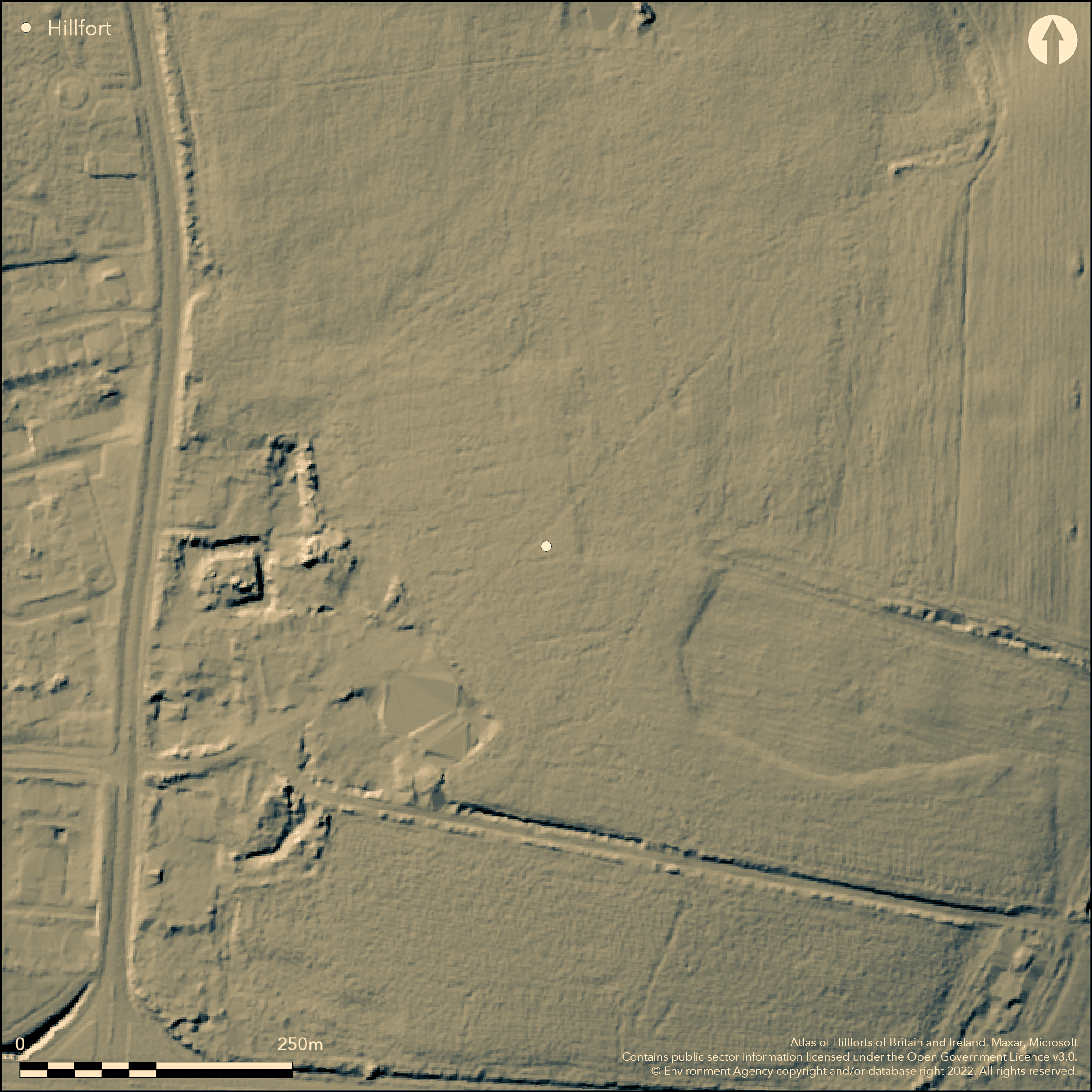
LiDAR 1m DTM Hillshade
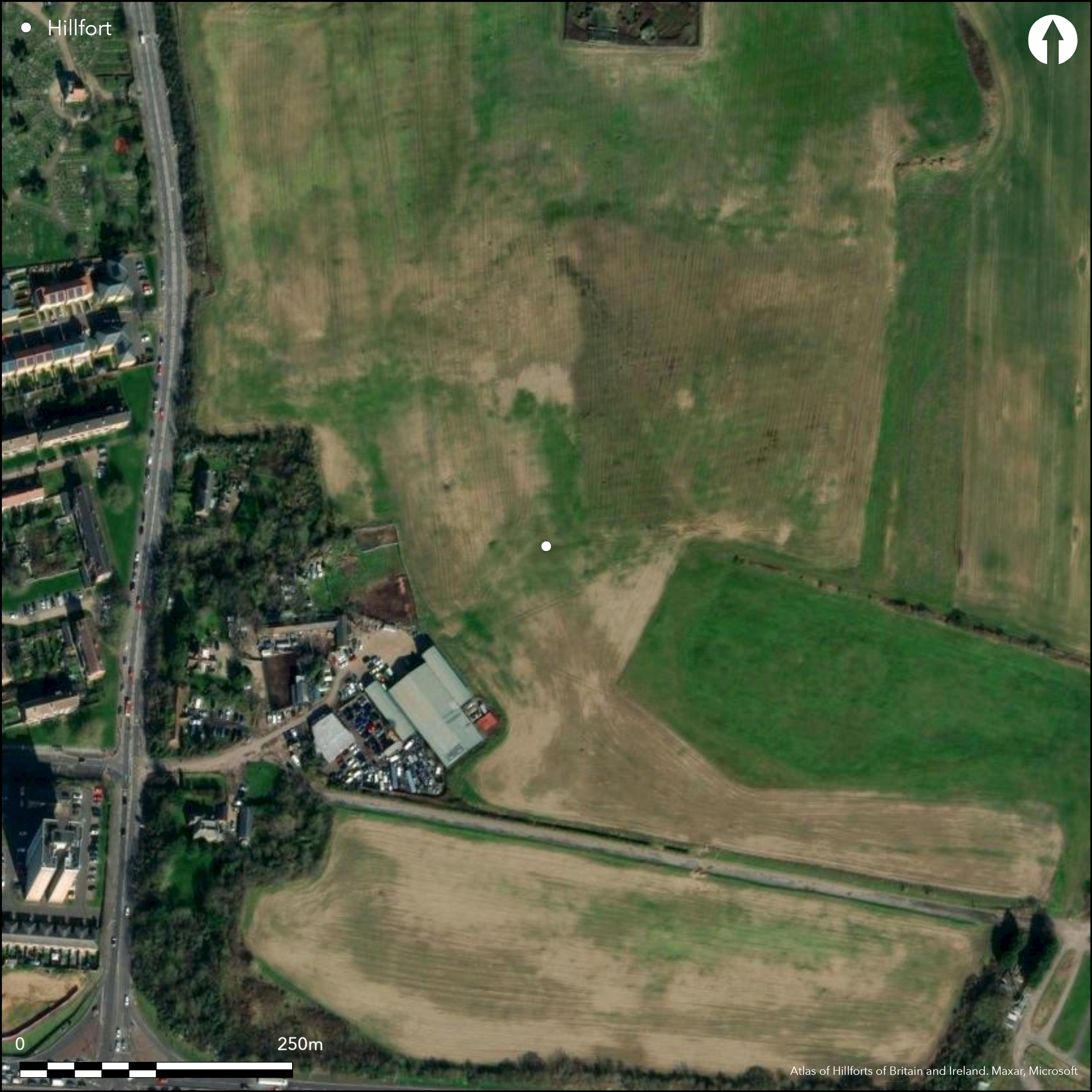
Satellite Imagery
LiDAR 1m DTM Hillshade
Satellite Imagery
Scroll left/right to view further images.
HER: Greater London MLO23737 (None)
NMR: None (None)
SM: None
NGR: TQ 4870 8940
X: 548700 Y: 189400 (OSGB36)
To the NE of the junction of Eastern Avenue West and Whalebone Lane North, at what is now Warren Farm/Marks Warren Quarry, sections of a double ditched enclosure, possibly a hillfort, recorded on aerial photographs. Estimated as 100m in diameter, it is slighly flattened in the SW and truncated on the eastern side by a medieval windmill. Investigation by Passmore Edwards Museum in 1988 recorded banks constructed from subsoil gravel and sand and an outer ditch 3-4m wide and 1.6m deep with one side cut vertically. Three breaks, one 20m wide in the N, 2.3m wide in the W and the cropmarks of a further entrance in the E. Large quantities of late Bronze Age to early Iron Age pottery was recovered from the ploughsoil but no further evidence for occupation. A well or waterhole adjacent to the enclosure produced a small pottery assemblage of similar date. A small pit and a posthole was recorded inside the western entrance. Watching briefs in 2000 revealed a series of prehistoric pits, postholes and part of a Roman enclosure. Early-middle Iron Age pottery was recovered. A watching brief in 2002 recorded two large pits in the NE from which lithic material, a shale bracelet and flint tempered pottery was recovered. Further late Bronze Age to early Iron Age activity recorded by Archaeological Solutions in 2008 comprising ditches of an enclosure. A late Bronze Age globular beaker was recovered from the fills. Not recorded on OS mapping.
Citizen Science: ✗
Reliability of Data: Unconfirmed
Reliability of Interpretation: Irreconciled issues
X: 16128 Y: 6725217 (EPSG: 3857)
Longitude: 0.1448793889108714 Latitude: 51.58379182303331 (EPSG:4326)
Country: England; None
Current County or Unitary Authority: Greater London Authority
Historic County: Essex
Current Parish/Community/Council/Townland: None
None
| Extant | ✗ |
| Cropmark | ✗ |
| Likely Destroyed | ✓ |
Quarry
| Woodland | ✗ |
| Commercial Forestry Plantation | ✗ |
| Parkland | ✗ |
| Pasture (Grazing) | ✗ |
| Arable | ✗ |
| Scrub/Bracken | ✗ |
| Bare Outcrop | ✗ |
| Heather/Moorland | ✗ |
| Heath | ✗ |
| Built-up | ✗ |
| Coastal Grassland | ✗ |
| Other | ✓ |
Unmapped and now destroyed, possibly a lowland contour fort sited on a spur at 33m OD
| Contour Fort | ✓ |
| Partial Contour Fort | ✗ |
| Promontory Fort | ✗ |
| Hillslope Fort | ✗ |
| Level Terrain Fort | ✗ |
| Marsh Fort | ✗ |
| Multiple Enclosure Fort | ✗ |
| Hilltop | ✓ |
| Coastal Promontory | ✗ |
| Inland Promontory | ✗ |
| Valley Bottom | ✗ |
| Knoll/Hillock/Outcrop | ✗ |
| Ridge | ✗ |
| Cliff/Plateau-edge/Scarp | ✗ |
| Hillslope | ✗ |
| Lowland | ✓ |
| Spur | ✓ |
Dominant Topographic Feature: Spur
| North | ✗ |
| Northeast | ✗ |
| East | ✗ |
| Southeast | ✗ |
| South | ✗ |
| Southwest | ✗ |
| West | ✗ |
| Northwest | ✗ |
| Level | ✓ |
Altitude: 38.0m
Boundary between the borough constituencies of Dagenham and Rainham and Romford runs to the E. Shown as a parish boundary on historic OS mapping
Boundary Type: Other
Dated by pottery to the late Bronze Age/early Iron Age. Excavations also showed the site had been periodically occupied from the Mesolithic to the post medieval periods
Reliability: B - Medium
| Pre 1200BC | ✗ |
| 1200BC - 800BC | ✗ |
| 800BC - 400BC | ✓ |
| 400BC - AD50 | ✗ |
| AD50 - AD400 | ✗ |
| AD400 - AD 800 | ✗ |
| Post AD800 | ✗ |
| Unknown | ✗ |
| Pre Hillfort: | None |
| Post Hillfort: | None |
| Artefactual: | None |
1988 excavation (Passmore Edwards Museum). Commercial watching briefs and interventions during gravel extraction.
| Excavation (1988): | None |
| Other (None): | Watching brief |
Pits and a posthole observed during watching briefs. Pottery and shale bracelet.
None
| None | ✓ |
| Spring | ✗ |
| Stream | ✗ |
| Pool | ✗ |
| Flush | ✗ |
| Well | ✗ |
| Other | ✗ |
None
| No Known Features | ✓ |
| Round Stone Structures | ✗ |
| Rectangular Stone Structures | ✗ |
| Curvilinear Platforms | ✗ |
| Other Roundhouse Evidence | ✗ |
| Pits | ✗ |
| Quarry Hollows | ✗ |
| Other | ✗ |
None
| No Known Excavation | ✗ |
| Pits | ✓ |
| Postholes | ✓ |
| Roundhouses | ✗ |
| Rectangular Structures | ✗ |
| Roads/Tracks | ✗ |
| Quarry Hollows | ✗ |
| Other | ✗ |
| Nothing Found | ✗ |
None
| No Known Geophysics | ✓ |
| Pits | ✗ |
| Roundhouses | ✗ |
| Rectangular Structures | ✗ |
| Roads/Tracks | ✗ |
| Quarry Hollows | ✗ |
| Other | ✗ |
| Nothing Found | ✗ |
None
| No Known Finds | ✗ |
| Pottery | ✓ |
| Metal | ✗ |
| Metalworking | ✗ |
| Human Bones | ✗ |
| Animal Bones | ✗ |
| Lithics | ✓ |
| Environmental | ✗ |
| Other | ✓ |
None
| APs Not Checked | ✓ |
| None | ✗ |
| Roundhouses | ✗ |
| Rectangular Structures | ✗ |
| Pits | ✗ |
| Postholes | ✗ |
| Roads/Tracks | ✗ |
| Other | ✗ |
Three breaks, one 20m wide in the N, 2.3m wide in the W and the cropmarks of a further entrance in the E. It is uncertain if any of these are original
| 3: | None |
| 2: | None |
Guard Chambers: ✗
Chevaux de Frise: ✗
Possible former contour fort. Investigation recorded banks constructed from subsoil gravel and sand and an outer ditch 3-4m wide and 1.6m deep with one side cut vertically.
| Area 1: | Noneha. |
| Total: | Noneha. |
Total Footprint Area: Noneha.
None
| ✗ | None |
| ✗ | Destroyed |
| NE Quadrant: | None |
| SE Quadrant: | None |
| SW Quadrant: | None |
| NW Quadrant: | None |
| Total: | None |
| Partial Univallate | ✗ |
| Univallate | ✗ |
| Partial Bivallate | ✗ |
| Bivallate | ✗ |
| Partial Multivallate | ✗ |
| Multivallate | ✗ |
| Unknown | ✓ |
| Partial Univallate | ✗ |
| Univallate | ✗ |
| Partial Bivallate | ✗ |
| Bivallate | ✗ |
| Partial Multivallate | ✗ |
| Multivallate | ✗ |
None
| None | ✗ |
| Earthen Bank | ✓ |
| Stone Wall | ✗ |
| Rubble | ✗ |
| Wall-walk | ✗ |
| Evidence of Timber | ✗ |
| Vitrification | ✗ |
| Other Burning | ✗ |
| Palisade | ✗ |
| Counter Scarp Bank | ✗ |
| Berm | ✗ |
| Unfinished | ✗ |
| Other | ✗ |
gravel and sand
| None | ✗ |
| Earthen Bank | ✗ |
| Stone Wall | ✗ |
| Murus Duplex | ✗ |
| Timber-framed | ✗ |
| Timber-laced | ✗ |
| Vitrification | ✗ |
| Other Burning | ✗ |
| Palisade | ✗ |
| Counter Scarp Bank | ✗ |
| Berm | ✗ |
| Unfinished | ✗ |
| No Known Excavation | ✗ |
| Other | ✓ |
| ✗ | None |
| ✓ | None |
Number of Ditches: 1
| ✗ | None |
AOC Archaeology Group, 2003. Archive for an Archaeological Watching Brief at Marks Warren Quarry, Barking and Dagenham [MWQ02].
Archaeological Solutions Ltd, 2008. Archive for Marks Warren Quarry, Whalebone Lane North, Romford, Essex, Area 9, Archaeological Monitoring And Recording Interim Report [GLHER Report LAG 01/052].
Maloney, C. 2001. Fieldwork Round-up 2000. London Arch. 9/2001, 67
Museum of London Archaeology Service, 2004. Archive for Understanding the East London Gravels Part 1: A Post-Excavation Assessment. Passmore Edwards Museum (1988)
Atlas of Hillforts:
Wikidata:
This work is licensed under CC BY-SA 4.0

 and should be cited as:
Lock, Gary and Ralston, Ian. 2024. Atlas of Hillforts of Britain and Ireland. Available at: https://hillforts.arch.ox.ac.uk
Document Version 1.1