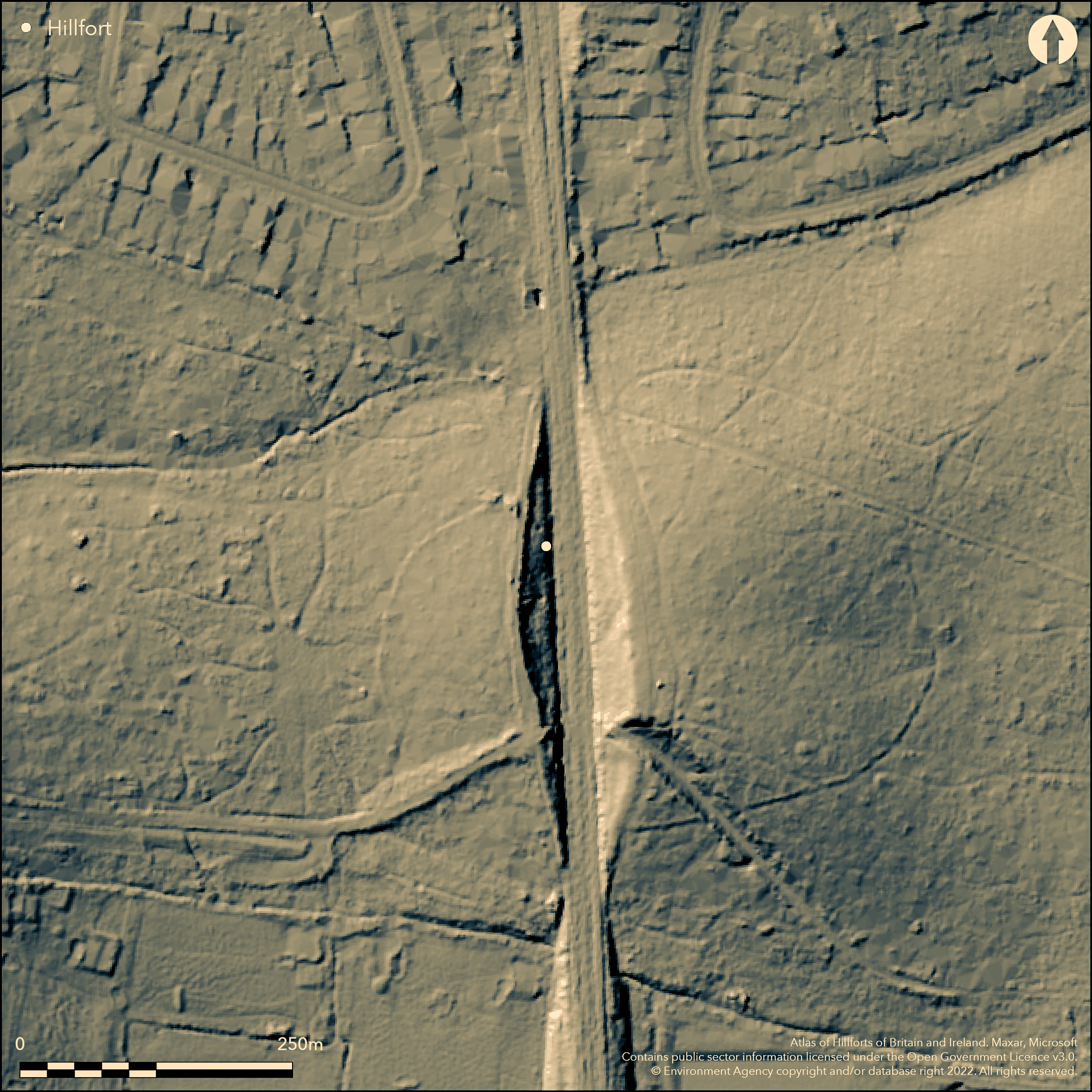
LiDAR 1m DTM Hillshade
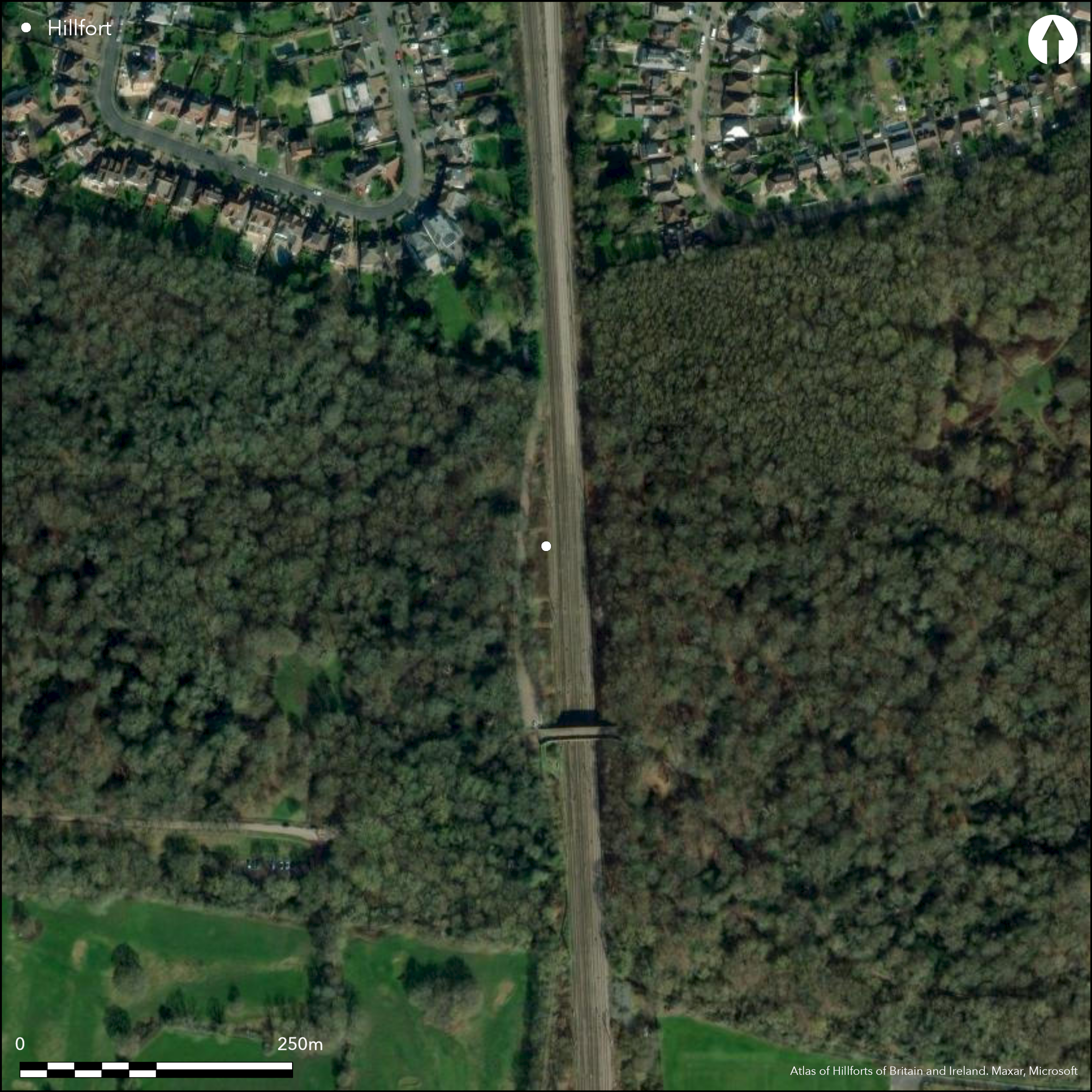
Satellite Imagery
LiDAR 1m DTM Hillshade
Satellite Imagery
Scroll left/right to view further images.
HER: Greater London MLO15580 (None)
NMR: TQ 29 NE 4 (401552)
SM: None
NGR: TQ 2627 9725
X: 526279 Y: 197254 (OSGB36)
On Monken Hadley Common, a large banked and ditched enclosure of approximately 4ha in Hadley Wood. The site, which lies on a slight knoll with views across the Thames Valley, was first noted in 1913 and described as a possible hillfort (Taylor 1922). Oval in plan, a survey in 1983 showed only approximately 60 percent survived. Excavations by Renn in 1952-3 revealed a shallow V-shaped ditch approximately 3m wide (Renn 1952-4, 204) with a much disturbed bank which stood approximately 1.5m above the bottom of the ditch and appeared to be discontinuous in the S. A possible gateway lies in the SE (Taylor 1922, 92) which appears to have overlapping terminals on a plan by Renn (1952-4, 205), but is cut by a railway line which runs N-S through the enclosure. Mounds within the enclosure have been described as 'the long barrow type' (Taylor 1922). Burnt mounds have also been recorded suggesting at least some Bronze Age activity. Small excavations in 1952-3 and 1973 ((Bloice 1973) and 1983 (Richardson 1984) have produced no dating evidence. Some flint implements have been found but it is unclear if these are derived from the track ballast. Suggested as a minor oppidum (Cunliffe and Rowley 1976) but no evidence. Not recorded on OS mapping. Undated.
Citizen Science: ✗
Reliability of Data: Confirmed
Reliability of Interpretation: Unconfirmed
X: -19561 Y: 6738853 (EPSG: 3857)
Longitude: -0.17571756356959037 Latitude: 51.65984136418778 (EPSG:4326)
Country: England; None
Current County or Unitary Authority: Greater London Authority
Historic County: Middlesex
Current Parish/Community/Council/Townland: None
Cut N-S by a railway line
| Extant | ✓ |
| Cropmark | ✗ |
| Likely Destroyed | ✓ |
None
| Woodland | ✓ |
| Commercial Forestry Plantation | ✗ |
| Parkland | ✗ |
| Pasture (Grazing) | ✗ |
| Arable | ✗ |
| Scrub/Bracken | ✗ |
| Bare Outcrop | ✗ |
| Heather/Moorland | ✗ |
| Heath | ✗ |
| Built-up | ✗ |
| Coastal Grassland | ✗ |
| Other | ✗ |
A possible contour fort lying on a knoll at 88m OD.
| Contour Fort | ✓ |
| Partial Contour Fort | ✗ |
| Promontory Fort | ✗ |
| Hillslope Fort | ✗ |
| Level Terrain Fort | ✗ |
| Marsh Fort | ✗ |
| Multiple Enclosure Fort | ✗ |
| Hilltop | ✓ |
| Coastal Promontory | ✗ |
| Inland Promontory | ✗ |
| Valley Bottom | ✗ |
| Knoll/Hillock/Outcrop | ✗ |
| Ridge | ✗ |
| Cliff/Plateau-edge/Scarp | ✗ |
| Hillslope | ✗ |
| Lowland | ✗ |
| Spur | ✗ |
Dominant Topographic Feature: Knoll
| North | ✗ |
| Northeast | ✗ |
| East | ✗ |
| Southeast | ✗ |
| South | ✗ |
| Southwest | ✗ |
| West | ✗ |
| Northwest | ✗ |
| Level | ✓ |
Altitude: 88.0m
The former counties of Middlesex and Hertfordshire, now Enfield and Chipping Barnet Borough Constituencies, lay 27m to the N of the enclosure.
Boundary Type: Other
The site is undated
Reliability: D - None
| Pre 1200BC | ✗ |
| 1200BC - 800BC | ✗ |
| 800BC - 400BC | ✗ |
| 400BC - AD50 | ✗ |
| AD50 - AD400 | ✗ |
| AD400 - AD 800 | ✗ |
| Post AD800 | ✗ |
| Unknown | ✓ |
| Pre Hillfort: | None |
| Post Hillfort: | Remaining fragment of the Royal Forest of Enfield. Until 1777 the Wood was part of Enfield Chase and used as a royal hunting ground (Renn 1952-4) |
First identified in 1913 and reported in 1922 (Taylor 1922). Excavations in 1952-3, 1973, 1983. Surveyed by Hendon and District Archaeological Society (HADAS) in 1983
| 1st Identified Written Reference (1922): | With plan |
| Excavation (1973): | None |
| Earthwork Survey (1983): | None |
| Excavation (1983): | None |
| Excavation (None): | None |
Features described as burnt mounds
None
| None | ✓ |
| Spring | ✗ |
| Stream | ✗ |
| Pool | ✗ |
| Flush | ✗ |
| Well | ✗ |
| Other | ✗ |
Possible barrow and burnt mounds
| No Known Features | ✗ |
| Round Stone Structures | ✗ |
| Rectangular Stone Structures | ✗ |
| Curvilinear Platforms | ✗ |
| Other Roundhouse Evidence | ✗ |
| Pits | ✗ |
| Quarry Hollows | ✗ |
| Other | ✓ |
None
| No Known Excavation | ✗ |
| Pits | ✗ |
| Postholes | ✗ |
| Roundhouses | ✗ |
| Rectangular Structures | ✗ |
| Roads/Tracks | ✗ |
| Quarry Hollows | ✗ |
| Other | ✗ |
| Nothing Found | ✓ |
None
| No Known Geophysics | ✓ |
| Pits | ✗ |
| Roundhouses | ✗ |
| Rectangular Structures | ✗ |
| Roads/Tracks | ✗ |
| Quarry Hollows | ✗ |
| Other | ✗ |
| Nothing Found | ✗ |
Fling implements found in ditch but it is unclear if these are derived from the track ballast
| No Known Finds | ✗ |
| Pottery | ✗ |
| Metal | ✗ |
| Metalworking | ✗ |
| Human Bones | ✗ |
| Animal Bones | ✗ |
| Lithics | ✓ |
| Environmental | ✗ |
| Other | ✗ |
Wooded
| APs Not Checked | ✓ |
| None | ✗ |
| Roundhouses | ✗ |
| Rectangular Structures | ✗ |
| Pits | ✗ |
| Postholes | ✗ |
| Roads/Tracks | ✗ |
| Other | ✗ |
Slight evidence for a gateway identified in the SE
| 1: | None |
| 2: | None |
Guard Chambers: ✗
Chevaux de Frise: ✗
| 1. Simple Gap (South east): | None |
A 4ha ovate banked and ditched enclosure, now partially destroyed. Excavations showed ditch to be shallow and approximately 3m wide.
| Area 1: | 4.0ha. |
| Total: | 4.0ha. |
Total Footprint Area: Noneha.
None
| ✗ | None |
| ✗ | None |
| NE Quadrant: | 1 |
| SE Quadrant: | 1 |
| SW Quadrant: | 1 |
| NW Quadrant: | 1 |
| Total: | 1 |
| Partial Univallate | ✗ |
| Univallate | ✓ |
| Partial Bivallate | ✗ |
| Bivallate | ✗ |
| Partial Multivallate | ✗ |
| Multivallate | ✗ |
| Unknown | ✗ |
| Partial Univallate | ✗ |
| Univallate | ✗ |
| Partial Bivallate | ✗ |
| Bivallate | ✗ |
| Partial Multivallate | ✗ |
| Multivallate | ✗ |
None
| None | ✗ |
| Earthen Bank | ✓ |
| Stone Wall | ✗ |
| Rubble | ✗ |
| Wall-walk | ✗ |
| Evidence of Timber | ✗ |
| Vitrification | ✗ |
| Other Burning | ✗ |
| Palisade | ✗ |
| Counter Scarp Bank | ✗ |
| Berm | ✗ |
| Unfinished | ✗ |
| Other | ✗ |
None
| None | ✗ |
| Earthen Bank | ✓ |
| Stone Wall | ✗ |
| Murus Duplex | ✗ |
| Timber-framed | ✗ |
| Timber-laced | ✗ |
| Vitrification | ✗ |
| Other Burning | ✗ |
| Palisade | ✗ |
| Counter Scarp Bank | ✗ |
| Berm | ✗ |
| Unfinished | ✗ |
| No Known Excavation | ✗ |
| Other | ✗ |
| ✗ | None |
| ✓ | None |
Number of Ditches: 1
| ✗ | None |
Bloice, B. 1973. Excavation Round-up 1972. London Arch. 2/1973, 41
Cunliffe, B. and Rowley, T. (eds) 1976. Oppida: the beginnings of urbanisation in Barbarian Europe, BAR Int Ser 11, 330.
Renn, D.F. 1952-4. Hadley Wood: Earthwork.Trans East Hertfordshire Archaeol Soc, 87, 204-6
Richardson, B. 1984. Excavation Round-up 1983. London Arch. 4/1984, 386
Taylor, H.D. 1922. A Prehistoric Camp in Hadley Wood. Trans London Middlesex Archaeol Soc. 4, 97-9
Atlas of Hillforts:
Wikidata:
This work is licensed under CC BY-SA 4.0

 and should be cited as:
Lock, Gary and Ralston, Ian. 2024. Atlas of Hillforts of Britain and Ireland. Available at: https://hillforts.arch.ox.ac.uk
Document Version 1.1