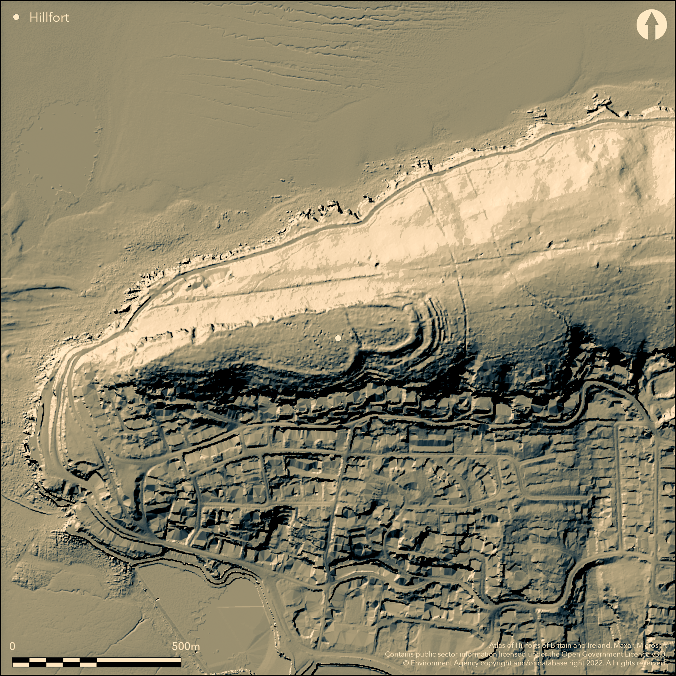
LiDAR 1m DTM Hillshade
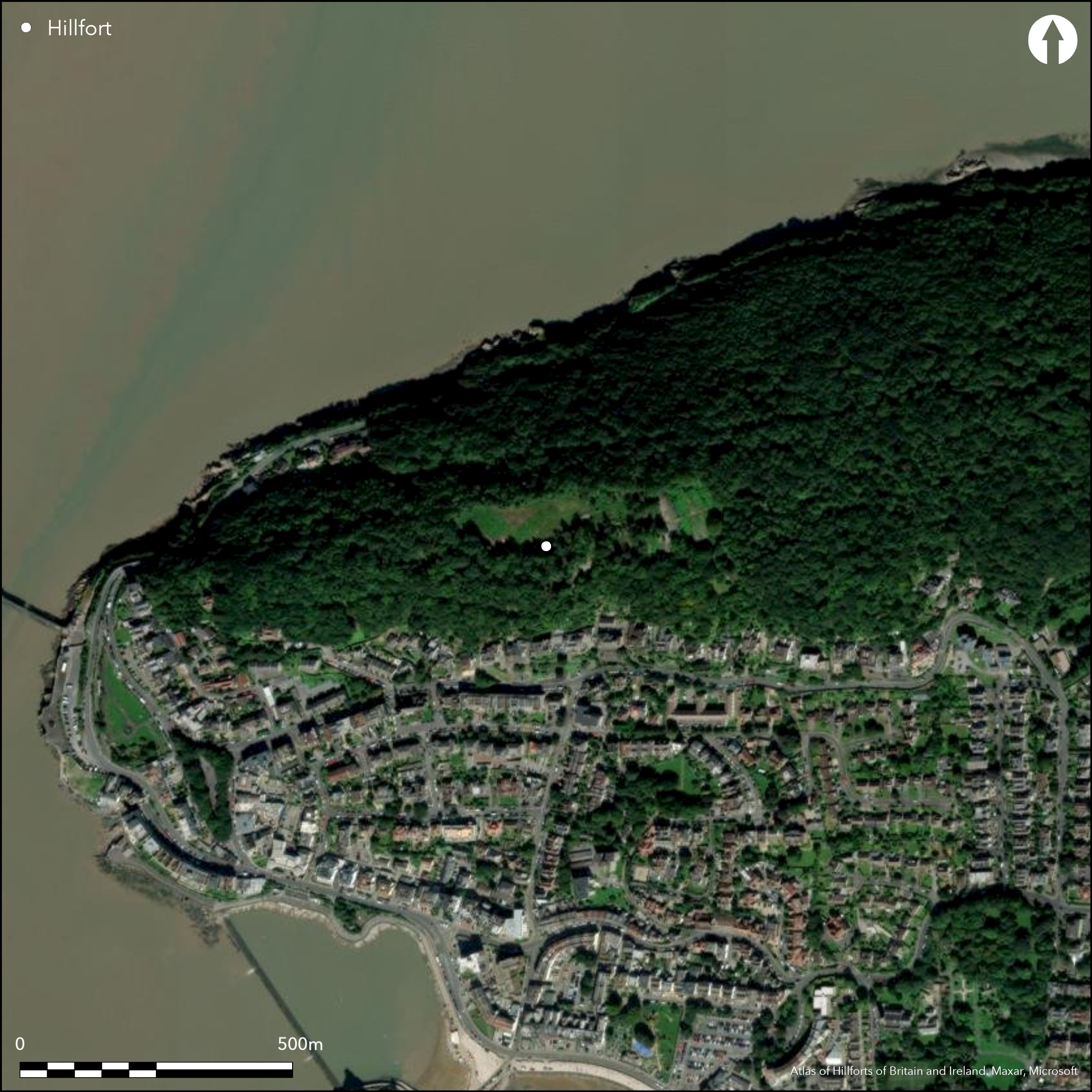
Satellite Imagery
LiDAR 1m DTM Hillshade
Satellite Imagery
Scroll left/right to view further images.
HER: North Somerset MNS121 (None)
NMR: ST 36 SW 1 (192721)
SM: 1011260
NGR: ST31406250
X: 331400 Y: 162500 (OSGB36)
Fine, large, stone-built, multivallate, contour hillfort located at W end of carboniferous limestone E-W spur/promontory of Worlebury Hill overlooking Sand Bay and Bristol Channel to N and Weston Bay and sea to SW and area of Levels to E at Weston-super-Mare. Precipitous and very steep cliffs cliffs with associated terracing to raised beach and Bristol channel on N, steep to very steep S and W, moderate along ridge to E. Sub-rectangular interior measures c. 690m E-W by 200m, with enclosed area c. 14ha. Overgrown and tree-covered, but an outstanding example of a stone-built, multivallate, hillfort. Defined by tumbled, dry-stone, stepped limestone ramparts, formerly to over 11m high from ditch bottom. On N the precipitous cliffs, although giving adequate protection, may have possible wall remnant near cliff edge, as on the W. To S, where natural slopes less steep, single rampart of stone built bank to 8m wide and c. 0.8m high. To E, along ridge, where slope only moderate or level system of enclosing banks and ditches constructed. These of curvilinear form, comprising three, still substantial, large stone-built banks with four smaller ramparts beyond. Inner bank is largest, averaging 10m wide and c. 2m high, but, in places, at least 4m high from ditch bottom. Six further banks are progressively smaller, varying in size from 9m wide and c. 1.2m high in W to 2m wide and c. 0.5m high in E. All seven banks have external ditches from which material was quarried during construction. Two innermost ditches average 15m wide and c. 1m deep, with remaining five smaller to E between 10m wide and 0.8m deep to 3m wide and c. 0.5m deep. Maximum width of E end ramparts 100m. Quarrying and public access have masked entrance details; that on W, formerly small postern approached by five rock-cut steps, now seemingly destroyed as result, and on NE modern path runs through ruined simple entrance gap. On SE, a possible main gate utilises natural re-entrant into interior with possible inturn. Rock-cut cross ridge across interior could indicate an earlier phase, but unproven. The 19th century excavations produced much interior information. Dymond and Tomkins (1886) investigated some 93 rock-cut pits, averaging 2m by 2m and 1.5m deep, but also to c. 2.5m deep. Evidence of storage, with barley and wheat, peas, pottery and burnt woven baskets. Also slingstones and spindle whorls dated 1st or 2nd century BC. Also evidence of hut platforms. Number of 'platforms' on slopes of hill suggested as platforms for warfare and some slingstones found in vicinity and mentioned by Dymond and Tomkins (ibid.) - uncertain and may be natural features. Other finds include gouged skull from Dymond's second investigation and 18 full skeletons from 18 pits, ten of which showed violent death, Iron Age pottery, middle Bronze Age cast copper alloy penannular collar, animal bone and metal domestic items and weapons. Roman coins and pottery. Overgrown and tree-covered, but, despite quarry damage, still an outstanding example of a stone-built, multivallate, hillfort. Local council clearances of trees and vegetation in past. OS Town Plan 1:500 of Weston-super Mare 1886. On 1st Ed. OS 1:2500 map (1888).
Citizen Science: ✗
Reliability of Data: Confirmed
Reliability of Interpretation: Confirmed
X: -332470 Y: 6684752 (EPSG: 3857)
Longitude: -2.9866256369912407 Latitude: 51.35736095325074 (EPSG:4326)
Country: England
Current County or Unitary Authority: North Somerset
Historic County: Somerset
Current Parish/Community/Council/Townland: Weston-super-Mare
Overgrown and tree-covered, but, despite quarry damage, still an outstanding example of a stone-built, multivallate, hillfort. Local council clearances of trees and vegetation from banks and pits.
| Extant | ✓ |
| Cropmark | ✗ |
| Likely Destroyed | ✗ |
Dense trees and scrub. Quarrying.
| Woodland | ✓ |
| Commercial Forestry Plantation | ✗ |
| Parkland | ✗ |
| Pasture (Grazing) | ✗ |
| Arable | ✗ |
| Scrub/Bracken | ✗ |
| Bare Outcrop | ✗ |
| Heather/Moorland | ✗ |
| Heath | ✗ |
| Built-up | ✗ |
| Coastal Grassland | ✗ |
| Other | ✓ |
Fine, large, stone-built, multivallate, contour hillfort located at W end of carboniferous limestone E-W spur/promontory of Worlebury Hill overlooking Sand Bay and Bristol Channel to N and Weston Bay and sea to SW and area of Levels to E at Weston-super-Mare. Precipitous and very steep cliffs with associated terracing to raised beach and Bristol channel on N, steep to very steep S and W, moderate along ridge to E.
| Contour Fort | ✓ |
| Partial Contour Fort | ✗ |
| Promontory Fort | ✗ |
| Hillslope Fort | ✗ |
| Level Terrain Fort | ✗ |
| Marsh Fort | ✗ |
| Multiple Enclosure Fort | ✗ |
| Hilltop | ✗ |
| Coastal Promontory | ✗ |
| Inland Promontory | ✗ |
| Valley Bottom | ✗ |
| Knoll/Hillock/Outcrop | ✗ |
| Ridge | ✓ |
| Cliff/Plateau-edge/Scarp | ✗ |
| Hillslope | ✗ |
| Lowland | ✗ |
| Spur | ✗ |
Dominant Topographic Feature: Ridge
| North | ✗ |
| Northeast | ✗ |
| East | ✗ |
| Southeast | ✗ |
| South | ✗ |
| Southwest | ✗ |
| West | ✗ |
| Northwest | ✗ |
| Level | ✓ |
Altitude: 91.0m
N/A
Finds, including Glastonbury type bead-rim pottery, suggest Iron Age site. Sling stones and spindle whorls dated to 1st or 2nd century BC. It is possible that the hillfort was taken by the Romans and later occupied.
Reliability: B - Medium
| Pre 1200BC | ✗ |
| 1200BC - 800BC | ✗ |
| 800BC - 400BC | ✗ |
| 400BC - AD50 | ✓ |
| AD50 - AD400 | ✗ |
| AD400 - AD 800 | ✗ |
| Post AD800 | ✗ |
| Unknown | ✗ |
| Pre Hillfort: | None |
| Post Hillfort: | None |
| Artefactual: | Glastonbury type bead-rim pottery, slingstones and spindle whorls. Roman coin and pottery. |
Plan of Worle Hill encampment Publisher: Surveyor 1851. On OS Town Plan 1:500 of Weston-super Mare 1886. On 1st Ed. OS 1:2500 map (1888). Excavation C.W. Dymond and H.G. Tomkins, 1851-2. Excavation C.W. Dymond 1880-1. Excavation Woodspring Museum, Weston-super-Mare 1987-8. Avon Extensive Urban Study team assessment 1998. Air Photograph Interpretation Gloucestershire County Council: Severn Estuary NMP, Rapid Coastal Zone Assessment Survey 2006-08.
| 1st Identified Map Depiction (1851): | Publisher: surveyor - no details. |
| Other (1886): | OS Town Plan 1:500 of Weston-super Mare 1886. |
| Other (1888): | OS map. |
| Other (1980): | Visit by Hillfort Study Group |
| Other (1998): | Avon Extensive Urban Study team assessment. |
| Excavation (None): | C.W. Dymond, E.M. Atkins and Rev. F. Warre. |
| Excavation (None): | C.W. Dymond. |
| Excavation (None): | Woodspring Museum, Weston-super-Mare |
| Other (None): | Air Photograph Interpretation Gloucestershire County Council: Severn Estuary NMP, Rapid Coastal Zone Assessment Survey. |
Dymond investigated some 93 rock-cut pits, averaging 2m by 2m and 1.5m deep, but also to c. 2.5m deep. Evidence of storage, with barley and wheat, peas, pottery and burnt woven baskets. Glastonbury type bead-rim pottery. 18 full skeletons from pits. Animal bones of pigs, oxen, horses, deer, goats, and small birds and limpet shells found near the bones. Iron objects include chisel or borer, several spearheads, javelin heads, and iron cone with charred wood inside and rivet hole through cone, Dymond assuming plowshare. Stone artefacts, mainly slingstones, spindle whorls and scrapers. Roman coins found together with glass beads, coarse Roman pottery and some bronze fragments. Many of the Roman coins bear the image of the Western Roman Emperor Honorius. Some pits cleared (at c. 2006) and left open. Also evidence of hut platforms.
None
| None | ✓ |
| Spring | ✗ |
| Stream | ✗ |
| Pool | ✗ |
| Flush | ✗ |
| Well | ✗ |
| Other | ✗ |
Some pits cleared c. 2006 and left open. Evidence of hut platforms.
| No Known Features | ✗ |
| Round Stone Structures | ✗ |
| Rectangular Stone Structures | ✗ |
| Curvilinear Platforms | ✓ |
| Other Roundhouse Evidence | ✗ |
| Pits | ✓ |
| Quarry Hollows | ✗ |
| Other | ✗ |
Details of 93 pits recorded by Dymond.
| No Known Excavation | ✗ |
| Pits | ✓ |
| Postholes | ✗ |
| Roundhouses | ✗ |
| Rectangular Structures | ✗ |
| Roads/Tracks | ✗ |
| Quarry Hollows | ✗ |
| Other | ✗ |
| Nothing Found | ✗ |
None
| No Known Geophysics | ✓ |
| Pits | ✗ |
| Roundhouses | ✗ |
| Rectangular Structures | ✗ |
| Roads/Tracks | ✗ |
| Quarry Hollows | ✗ |
| Other | ✗ |
| Nothing Found | ✗ |
Glastonbury type bead-rim pottery. 18 full skeletons from pits. Animal bones of pigs, oxen, horses, deer, goats, and small birds and limpet shells found near the bones. Iron objects include chisel or borer, several spearheads, javelin heads, and iron cone with charred wood inside and rivet hole through cone, Dymond assuming plowshare. Barley and wheat kernals, peas and burnt woven baskets. Stone artefacts, mainly slingstones, spindle whorls and scrapers. Roman coins found together with glass beads, coarse Roman pottery and some bronze fragments. Many of the Roman coins bear the image of the Western Roman Emperor Honorius.
| No Known Finds | ✗ |
| Pottery | ✓ |
| Metal | ✓ |
| Metalworking | ✗ |
| Human Bones | ✓ |
| Animal Bones | ✓ |
| Lithics | ✓ |
| Environmental | ✓ |
| Other | ✓ |
None
| APs Not Checked | ✓ |
| None | ✗ |
| Roundhouses | ✗ |
| Rectangular Structures | ✗ |
| Pits | ✗ |
| Postholes | ✗ |
| Roads/Tracks | ✗ |
| Other | ✗ |
Quarry and public access have masked entrance details; that on W, formerly small postern approached by five rock-cut steps, now seemingly destroyed as result, and on NE modern path runs through ruined simple entrance gap. On SE, a possible main gate utilises natural re-entrant into interior with possible inturn trace.
| 3: | None |
| 2: | None |
Guard Chambers: ✗
Chevaux de Frise: ✗
| 1. Simple Gap (North east): | Modern path runs through. |
| 2. In-turned (South east): | Possible main gate utilises natural re-entrant into interior with possible inturn. |
| 3. Postern Gate (West): | Now seemingly destroyed. |
Defined by tumbled, dry-stone, stepped limestone ramparts, formerly to over 11m high from ditch bottom. On N the precipitous cliffs, although giving adequate protection, may have possible wall remnant near cliff edge, as on the W. To S, where natural slopes less steep, single rampart of stone built bank to 8m wide and c. 0.8m high. To E, along ridge, where slope only moderate or level system of enclosing banks and ditches constructed. These of curvilinear form, comprising three, still substantial, large stone-built banks with four smaller ramparts beyond. Inner bank is largest, averaging 10m wide and c. 2m high, but, in places, at least 4m high from ditch bottom. Six further banks are progressively smaller, varying in size from 9m wide and c. 1.2m high in W to 2m wide and c. 0.5m high in E. All seven banks have external ditches from which material was quarried during construction. Two innermost ditches average 15m wide and c. 1m deep, with remaining five smaller to E between 10m wide and 0.8m deep to 3m wide and c. 0.5m deep. Maximum width of E end ramparts 100m.
| Area 1: | 14.0ha. |
| Total: | 14.0ha. |
Total Footprint Area: Noneha.
None
| ✓ | Possibly. Rock-cut cross ridge across interior could indicate an earlier phase, but unproven. |
| ✓ | Possible walls on W and NW. |
| NE Quadrant: | 7 |
| SE Quadrant: | 7 |
| SW Quadrant: | 1 |
| NW Quadrant: | 1 |
| Total: | 7 |
| Partial Univallate | ✓ |
| Univallate | ✗ |
| Partial Bivallate | ✗ |
| Bivallate | ✗ |
| Partial Multivallate | ✓ |
| Multivallate | ✗ |
| Unknown | ✗ |
| Partial Univallate | ✗ |
| Univallate | ✗ |
| Partial Bivallate | ✗ |
| Bivallate | ✗ |
| Partial Multivallate | ✗ |
| Multivallate | ✗ |
Tumbled limestone walls.
| None | ✗ |
| Earthen Bank | ✗ |
| Stone Wall | ✓ |
| Rubble | ✓ |
| Wall-walk | ✗ |
| Evidence of Timber | ✗ |
| Vitrification | ✗ |
| Other Burning | ✗ |
| Palisade | ✗ |
| Counter Scarp Bank | ✗ |
| Berm | ✗ |
| Unfinished | ✗ |
| Other | ✗ |
Excavation confirmed walls c. 10m-11m thick and more than 3m high and stone wall detail.
| None | ✗ |
| Earthen Bank | ✗ |
| Stone Wall | ✓ |
| Murus Duplex | ✓ |
| Timber-framed | ✗ |
| Timber-laced | ✗ |
| Vitrification | ✗ |
| Other Burning | ✗ |
| Palisade | ✗ |
| Counter Scarp Bank | ✗ |
| Berm | ✗ |
| Unfinished | ✗ |
| No Known Excavation | ✗ |
| Other | ✗ |
| ✗ | None |
| ✓ | On E all seven banks have external ditches from which material was quarried during construction. Two innermost ditches average 15m wide and c. 1m deep, with remaining five smaller to E between 10m wide and 0.8m deep to 3m wide and c. 0.5m deep. |
Number of Ditches: 7
| ✗ | None |
Brown, I. 2009. Beacons in the landscape. The hillforts of England and Wales, Oxford: Windgather Press/Oxbow Books.
Burrow, E.J. 1924. Ancient earthworks and camps of Somerset, Cheltenham: E.J. Burrow, 100-101.
Dymond, C.W. and Tomkins, H. G. 1886. Worlebury. An ancient stronghold in the County of Somerset, Bristol: privately published.
Evans, J.1980. Worlebury The Story of an Iron Age Hillfort at Weston-super-Mare, Weston-super-Mare: Woodspring Museum.
Lawson, A.J, 1976. An Imported Bronze Collar From Somerset, Somerset Arch Natur Hist , 120, 109.
La Trobe-Bateman E. 1999. Avon Extensive Urban Survey Weston-Super-Mare, North Somerset, Archaeological assessment report Avon Extensive Urban Survey.
Page, W. ed. 1911. Ancient earthworks, The Victoria History of Somerset, Volume Two, The Victoria History of the Counties of England, London: Constable and Co, 501-2.
Warre, Rev. F. 1851-1853, Worle camp. Somerset Arch Natur. Hist, 2, 1851, 64-85, 125-127; 4, 1853, 124-127.
Atlas of Hillforts:
Wikidata:
This work is licensed under CC BY-SA 4.0

 and should be cited as:
Lock, Gary and Ralston, Ian. 2024. Atlas of Hillforts of Britain and Ireland. Available at: https://hillforts.arch.ox.ac.uk
Document Version 1.1