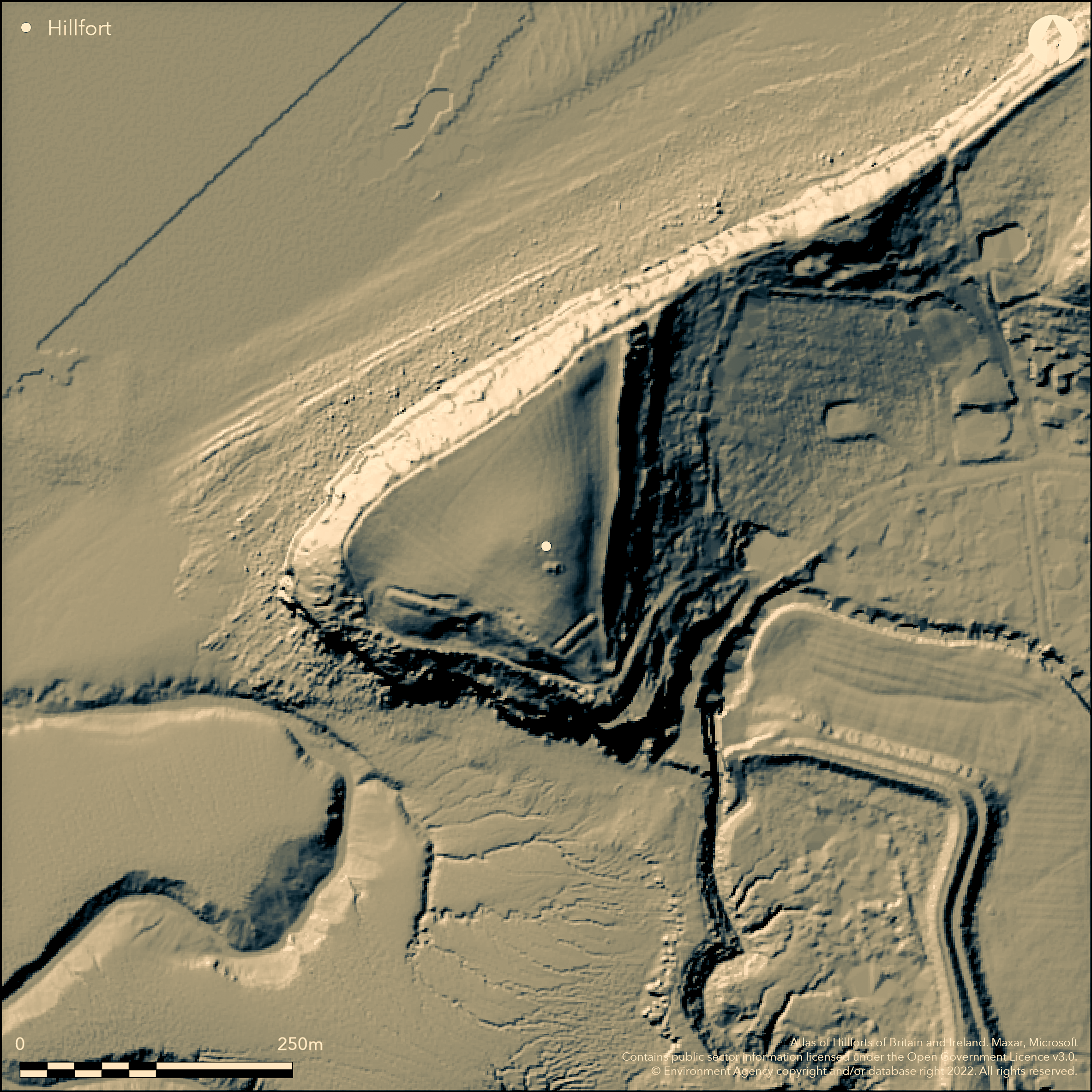
LiDAR 1m DTM Hillshade
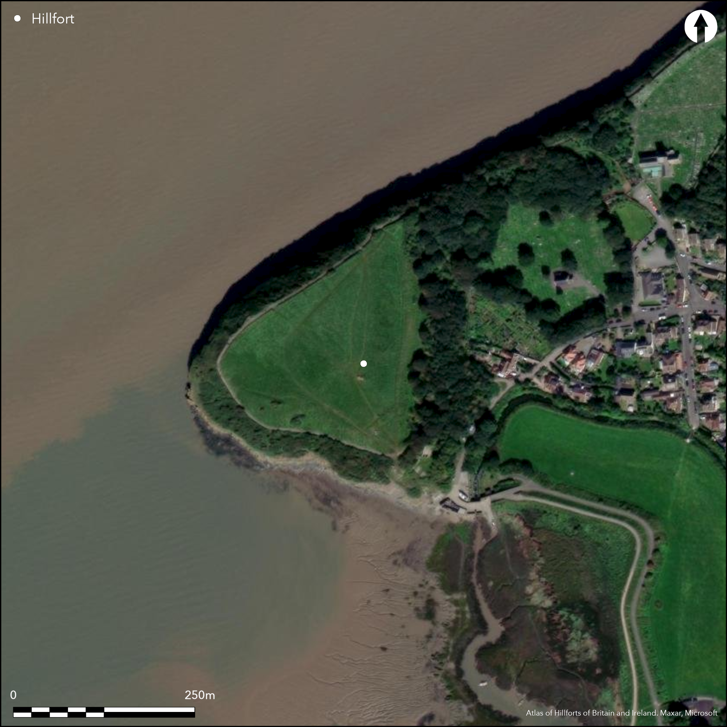
Satellite Imagery
LiDAR 1m DTM Hillshade
Satellite Imagery
Scroll left/right to view further images.
HER: North Somerset MNS184 (None)
NMR: ST 39 NW (192815)
SM: 1007908
NGR: ST391706
X: 339114 Y: 170664 (OSGB36)
Slight, coastal promontory hillfort situated on crest of WSW-facing carboniferous limestone coastal promontory of Wain';s Hill overlooking Bristol Channel and Salthouse Bay to N, Woodspring Bay to SW, estuary of River Blind Yeo to S and area of Levels to E. Irregular interior measures 220m N-S max. by 175m with internal area c. 2.5ha. Defined by steep natural slopes to N, S and W and by single rampart on only landward approach to site possible to E, running N-S across promontory at top of slope down to a saddle. Bank rubble-built 8m-10m wide and 1.5m-2m high. This flanked by external terrace, a possible filled-in ditch, 10m-12m wide, downslope, possibly result of rampart construction. Earthworks difficult to interpret on S, main rampart turning to E to flank an apparent original entrance with its S side. Here, public access has resulted in modern path, the 'Poet's Walk', around site's perimeter, probably coming through this possible entrance. Traces of drystone walling on bank at its N end. Quantity of Romano-British pottery from interior and around hillfort. Three linear earthworks within S interior possible pillow mounds, ranging 15m-30m long by 1m-6m wide and 0.5m-0.85m high; probably post-medieval. Block of former ridge and furrow medieval or post-medieval. WWII pill-box situated in SE interior. Although seemingly univallate, 1st edition of 1:2500 scale OS map 1884-1885 clearly shows two earthwork ramparts with ditches, also indicated on aerial photographs 1946 and 1950. Aerial photographs 1985 show larger inner rampart visible, surviving as earthwork bank, but that ditch and outer rampart covered by woodland scrub and the ridge and furrow block no longer visible. Ramparts possibly originally longer, but seem truncated by the perimeter walkway. Site therefore probably originally bivallate with two ditches. Now rough public access grassland. Site in poor condition. On 1st Ed. OS map 1884-5. Undated.
Citizen Science: ✗
Reliability of Data: Confirmed
Reliability of Interpretation: Confirmed
X: -320295 Y: 6698004 (EPSG: 3857)
Longitude: -2.8772561733578583 Latitude: 51.43164200995801 (EPSG:4326)
Country: England
Current County or Unitary Authority: North Somerset
Historic County: Somerset
Current Parish/Community/Council/Townland: Clevedon
Poor condition and damaged by wartime installations and public paths.
| Extant | ✓ |
| Cropmark | ✗ |
| Likely Destroyed | ✓ |
Public access rough grassland with scrub. WWII pill-box situated in SE interior. Faced path.
| Woodland | ✗ |
| Commercial Forestry Plantation | ✗ |
| Parkland | ✓ |
| Pasture (Grazing) | ✗ |
| Arable | ✗ |
| Scrub/Bracken | ✓ |
| Bare Outcrop | ✗ |
| Heather/Moorland | ✗ |
| Heath | ✗ |
| Built-up | ✓ |
| Coastal Grassland | ✗ |
| Other | ✓ |
Slight, coastal promontory hillfort situated on crest of WSW-facing carboniferous limestone coastal promontory of Wain';s Hill overlooking Bristol Channel and Salthouse Bay to N, Woodspring Bay to SW, estuary of River Blind Yeo to S and area of Levels to E. Steep natural slopes to N, S and W.
| Contour Fort | ✗ |
| Partial Contour Fort | ✗ |
| Promontory Fort | ✓ |
| Hillslope Fort | ✗ |
| Level Terrain Fort | ✗ |
| Marsh Fort | ✗ |
| Multiple Enclosure Fort | ✗ |
| Hilltop | ✗ |
| Coastal Promontory | ✓ |
| Inland Promontory | ✗ |
| Valley Bottom | ✗ |
| Knoll/Hillock/Outcrop | ✗ |
| Ridge | ✗ |
| Cliff/Plateau-edge/Scarp | ✗ |
| Hillslope | ✗ |
| Lowland | ✗ |
| Spur | ✗ |
Dominant Topographic Feature: Coastal promontory.
| North | ✗ |
| Northeast | ✗ |
| East | ✗ |
| Southeast | ✗ |
| South | ✗ |
| Southwest | ✗ |
| West | ✗ |
| Northwest | ✗ |
| Level | ✓ |
Altitude: 34.0m
N/A
None.
Reliability: D - None
| Pre 1200BC | ✗ |
| 1200BC - 800BC | ✗ |
| 800BC - 400BC | ✗ |
| 400BC - AD50 | ✗ |
| AD50 - AD400 | ✗ |
| AD400 - AD 800 | ✗ |
| Post AD800 | ✗ |
| Unknown | ✓ |
| Pre Hillfort: | None |
| Post Hillfort: | Three linear earthworks within S interior possible pillow mounds, ranging 15m-30m long by 1m-6m wide and 0.5m-0.85m high; probably post-medieval.post-medieval. Block of former ridge and furrow medieval or post-medieval. WWII pill-box situated in SE interior. |
On 1st Ed. OS map 1884-5. Field Investigation RCHME, N.V. Quinell 1987. Desk based assessment Clevedon Extensive Urban Survey 1998. Air Photograph Interpretation Gloucestershire County Council: Severn Estuary NMP, Rapid Coastal Zone Assessment Survey 2006-08. Geophysical survey 2005, Cleat Comm. Arch. Group.
| Other (1987): | Field Investigation RCHME, N.V. Quinell. |
| Other (1998): | Desk based assessment Clevedon Extensive Urban Survey. |
| Geophysical Survey (2005): | None |
| 1st Identified Map Depiction (None): | OS map. |
| Other (None): | Air Photograph Interpretation Gloucestershire County Council: Severn Estuary NMP, Rapid Coastal Zone Assessment Survey. |
None.
None
| None | ✓ |
| Spring | ✗ |
| Stream | ✗ |
| Pool | ✗ |
| Flush | ✗ |
| Well | ✗ |
| Other | ✗ |
None
| No Known Features | ✓ |
| Round Stone Structures | ✗ |
| Rectangular Stone Structures | ✗ |
| Curvilinear Platforms | ✗ |
| Other Roundhouse Evidence | ✗ |
| Pits | ✗ |
| Quarry Hollows | ✗ |
| Other | ✗ |
None
| No Known Excavation | ✓ |
| Pits | ✗ |
| Postholes | ✗ |
| Roundhouses | ✗ |
| Rectangular Structures | ✗ |
| Roads/Tracks | ✗ |
| Quarry Hollows | ✗ |
| Other | ✗ |
| Nothing Found | ✗ |
Geophysics not checked.
| No Known Geophysics | ✗ |
| Pits | ✗ |
| Roundhouses | ✗ |
| Rectangular Structures | ✗ |
| Roads/Tracks | ✗ |
| Quarry Hollows | ✗ |
| Other | ✓ |
| Nothing Found | ✗ |
None
| No Known Finds | ✓ |
| Pottery | ✗ |
| Metal | ✗ |
| Metalworking | ✗ |
| Human Bones | ✗ |
| Animal Bones | ✗ |
| Lithics | ✗ |
| Environmental | ✗ |
| Other | ✗ |
None
| APs Not Checked | ✓ |
| None | ✗ |
| Roundhouses | ✗ |
| Rectangular Structures | ✗ |
| Pits | ✗ |
| Postholes | ✗ |
| Roads/Tracks | ✗ |
| Other | ✗ |
Earthworks difficult to interpret on S, main rampart turning to E to flank an apparent original entrance with its S side. Here, public access has resulted in modern path, the 'Poet's Walk', around site's perimeter, probably coming through this possible entrance.
| None: | Any entrance destroyed and cannot be determined. |
| 2: | Probably destroyed. |
Guard Chambers: ✗
Chevaux de Frise: ✗
| 1. In-turned (South east): | Public access has resulted in modern path around site perimeter, probably coming through original entrance on SE. Possible type only estimated. |
| 1. In-turned (None): | None |
Irregular interior measures 220m N-S max. by 175m and defined by steep natural slopes to N, S and W by single rampart to E where single rubble-built bank 8m-10m wide and 1.5m-2m high with outer ditch on summit of E slope of the carboniferous outcrop across which only landward approach to site possible. This flanked by external terrace 10m-12m wide downslope result of rampart construction. Although seemingly univallate, 1st edition of 1:2500 scale OS map 1884-1885 clearly shows two earthwork ramparts, also indicated on aerial photographs 1946 and 1950. Aerial photographs 1985 show inner rampart visible, surviving as earthwork bank, but that ditch and outer rampart covered by woodland scrub. Ramparts possibly originally longer, but seem truncated by the perimeter walkway.
| Area 1: | 2.4ha. |
| Total: | 2.4ha. |
Total Footprint Area: Noneha.
None
| ✗ | None |
| ✗ | Although seemingly univallate, 1st edition of 1:2500 scale OS map 1884-1885 clearly shows two earthwork ramparts, also indicated on aerial photographs 1946 and 1950. Aerial photographs 1985 show inner rampart visible, surviving as earthwork bank, but that ditch and outer rampart covered by woodland scrub. Site therefore probably originally bivallate with two ditches. |
| NE Quadrant: | 2 |
| SE Quadrant: | 2 |
| SW Quadrant: | 0 |
| NW Quadrant: | 0 |
| Total: | 2 |
| Partial Univallate | ✗ |
| Univallate | ✗ |
| Partial Bivallate | ✓ |
| Bivallate | ✗ |
| Partial Multivallate | ✗ |
| Multivallate | ✗ |
| Unknown | ✗ |
| Partial Univallate | ✗ |
| Univallate | ✗ |
| Partial Bivallate | ✗ |
| Bivallate | ✗ |
| Partial Multivallate | ✗ |
| Multivallate | ✗ |
Rubble-built bank. Traces of drystone walling on bank at its N end.
| None | ✗ |
| Earthen Bank | ✗ |
| Stone Wall | ✓ |
| Rubble | ✓ |
| Wall-walk | ✗ |
| Evidence of Timber | ✗ |
| Vitrification | ✗ |
| Other Burning | ✗ |
| Palisade | ✗ |
| Counter Scarp Bank | ✗ |
| Berm | ✗ |
| Unfinished | ✗ |
| Other | ✗ |
None
| None | ✗ |
| Earthen Bank | ✗ |
| Stone Wall | ✗ |
| Murus Duplex | ✗ |
| Timber-framed | ✗ |
| Timber-laced | ✗ |
| Vitrification | ✗ |
| Other Burning | ✗ |
| Palisade | ✗ |
| Counter Scarp Bank | ✗ |
| Berm | ✗ |
| Unfinished | ✗ |
| No Known Excavation | ✓ |
| Other | ✗ |
| ✗ | None |
| ✓ | Vsible terrace probable infilled ditch. Probably two ditches. |
Number of Ditches: 2
| ✗ | None |
Burrow, E. 1924. Ancient earthworks and camps of Somerset, Cheltenham: E.J. Burrow, 142-3.
Brown, I. 2009. Beacons in the landscape. The hillforts of England and Wales, Oxford: Windgather Press/Oxbow Books.
Burrow, I. 1981. Hillfort and hill-top settlement in Somerset in the first to eighth centuries AD, British Archaeological Report (BAR) British Series 1, 91, 231
La Trobe-Bateman, E. 1999. Clevedon, North Somerset, Avon Extensive Urban Survey.
Smisson, R. 2006. Resistivity survey of Wain's Hill, Clevedon, Unpublished.
Atlas of Hillforts:
Wikidata:
This work is licensed under CC BY-SA 4.0

 and should be cited as:
Lock, Gary and Ralston, Ian. 2024. Atlas of Hillforts of Britain and Ireland. Available at: https://hillforts.arch.ox.ac.uk
Document Version 1.1