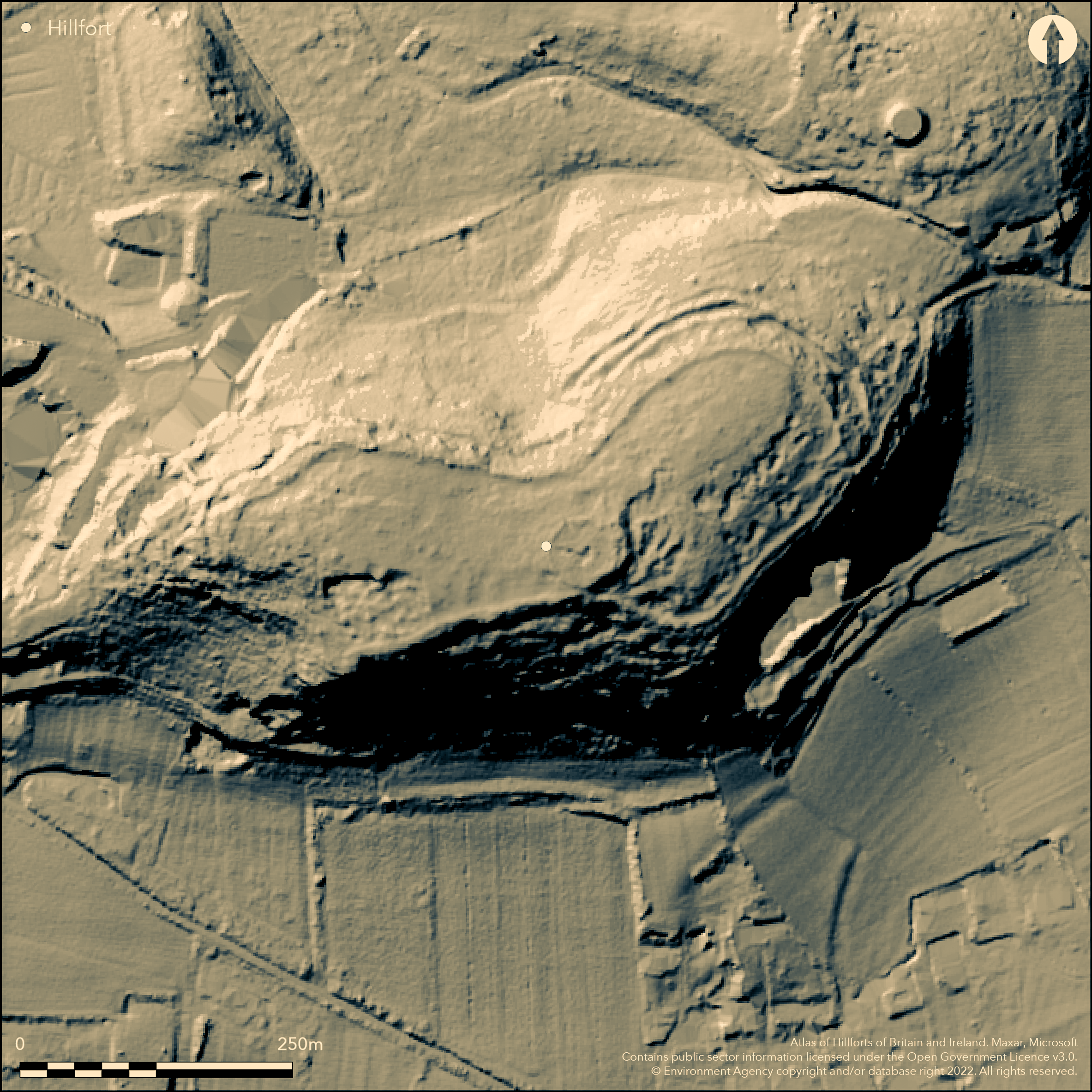
LiDAR 1m DTM Hillshade
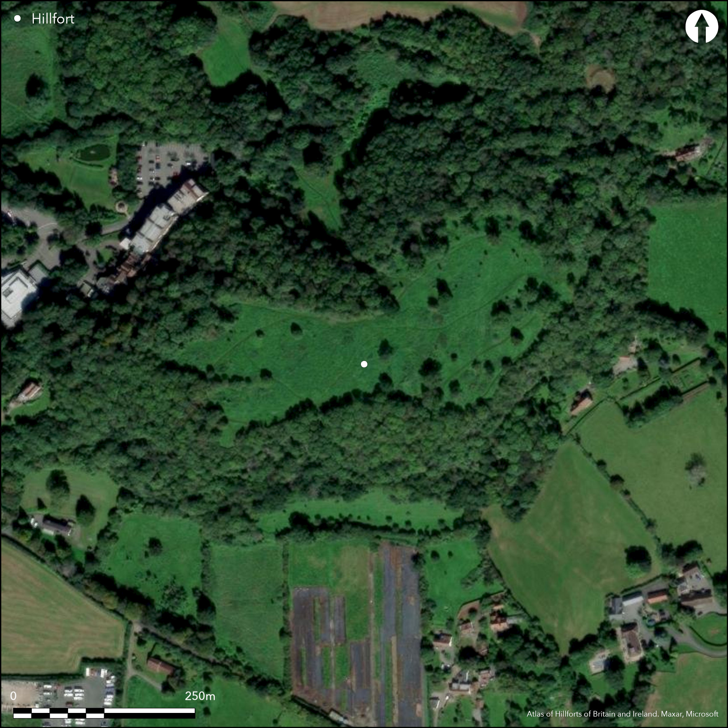
Satellite Imagery
LiDAR 1m DTM Hillshade
Satellite Imagery
Scroll left/right to view further images.
HER: North Somerset MNS386 (None)
NMR: ST 46 SW 1 (195114)
SM: 1011258
NGR: ST44156493
X: 344150 Y: 164930 (OSGB36)
Complex and substantial, part multivallate, partial contour hillfort located on prominent elongated carboniferous limestone NE-SW ridge, overlooking valley of the Congresbury Yeo to S and extensive area of Levels to N and W. Steep surrounding slopes, very steep in parts, but less steep on NE and SW. Sloping interior, E end 40m higher than W. Sub-rectangular interior has max. dimensions 340m E-W by 125m N-S, narrowing to 68m N-S in centre, with area 3.5ha. Hut circles in W half recorded by antiquarians. Surrounding interior system of ramparts varying in size and complexity according to topography. On the steeper N, S and W slopes give good defence and here defined by single stone-built rampart 10m wide and 1m high with external terrace on S side; possibly ditch remains. Traces internal, and probably quarry, providing bank stone. Total width of all these 25m. On less steep SW side, additional inner rampart to 10m wide and c. 0.5m high. On more vulnerable still NE, three banks to 10m-15m wide and c. 1.5m high, each with external ditch 10m wide. Banks stand to 3m above associated ditches and whole large complex c. 62.5m wide in total. Possible inturned entrance at E end with possible guard chambers. Excavations by P.J. Fowler, K.S. Gardner and P.A. Rahtz, 1959- 1970 (1971) confirmed an Iron Age date for hillfort, with hut circles, post holes, large quantities of Iron Age pottery and 830 sling-stones from interior. Also found earlier activity on hill top, with quantity of Neolithic flintwork of blades and waste flakes, and two Bronze Age barbed and tanged arrowheads. Later Romano-British occupation, with two hearths and associated rectangular building in interior dated AD 430-450. Later also, again re-fortified and AD 450-480 evidence of stone-based timber-framed rampart constructed over area occupied during the late Romano-British period. These, orientated N-S within area of Iron Age hillfort, abandoned by 6th century AD. Further phase of occupation developed over the area of these ramparts. This late occupation included eight huts, two circular with diameters 15m, as well as rectangular 'longhouse' structure of 8m by 3m. Finds from this period included Romano-British pottery, Roman and post-Roman beads, glass, bricks, bronze and iron objects including four penannular brooches, as well as local, Gaulish and Mediterranean pottery dating to the 5th and 6th centuries AD. Some of inscribed with symbols, suggesting that later settlement possibly associated with pagan or early Christian shrine. This early medieval use probably 'British' rather than Saxon. Grazed pasture and scrub interior, wooded banks and surrounds. Well-preserved site. Information board at base of hill. Most of Cadbury Hill owned by North Somerset Council but hillfort, S slopes and part of woodland owned jointly by Yatton and Congresbury Parish Councils. On 1st Ed. OS map (1884-5).
Citizen Science: ✗
Reliability of Data: Confirmed
Reliability of Interpretation: Confirmed
X: -312131 Y: 6688897 (EPSG: 3857)
Longitude: -2.8039164747855763 Latitude: 51.38060783126819 (EPSG:4326)
Country: England; None
Current County or Unitary Authority: North Somerset
Historic County: Somerset
Current Parish/Community/Council/Townland: Congresbury; Yatton
Well-preserved site. Information board at base of hill. Most of Cadbury Hill owned by North Somerset Council but hillfort, S slopes and part of woodland owned jointly by Yatton and Congresbury Parish Councils. Yatton Congresbury Claverham and Cleeve Archaeological Trust (YCCCART) local group of amateur archaeologists working under guidance of North Somerset archaeologist Vince Russett. They have been carrying out surveys on the hill for several years.
| Extant | ✓ |
| Cropmark | ✗ |
| Likely Destroyed | ✗ |
Grazed pasture and scrub interior, wooded banks and surrounds.
| Woodland | ✓ |
| Commercial Forestry Plantation | ✗ |
| Parkland | ✗ |
| Pasture (Grazing) | ✓ |
| Arable | ✗ |
| Scrub/Bracken | ✗ |
| Bare Outcrop | ✗ |
| Heather/Moorland | ✗ |
| Heath | ✗ |
| Built-up | ✗ |
| Coastal Grassland | ✗ |
| Other | ✗ |
Substantial, multivallate, partial contour hillfort located on prominent elongated carboniferous limestone NE-SW ridge, overlooking valley of the Congresbury Yeo to S and extensive area of Levels to N and W. Steep surrounding slopes, very steep in parts, but less steep on NE and SW. Sloping interior, E end 40m higher than W.
| Contour Fort | ✗ |
| Partial Contour Fort | ✓ |
| Promontory Fort | ✗ |
| Hillslope Fort | ✗ |
| Level Terrain Fort | ✗ |
| Marsh Fort | ✗ |
| Multiple Enclosure Fort | ✗ |
| Hilltop | ✗ |
| Coastal Promontory | ✗ |
| Inland Promontory | ✗ |
| Valley Bottom | ✗ |
| Knoll/Hillock/Outcrop | ✗ |
| Ridge | ✓ |
| Cliff/Plateau-edge/Scarp | ✗ |
| Hillslope | ✗ |
| Lowland | ✗ |
| Spur | ✗ |
Dominant Topographic Feature: Ridge
| North | ✗ |
| Northeast | ✗ |
| East | ✗ |
| Southeast | ✗ |
| South | ✗ |
| Southwest | ✗ |
| West | ✗ |
| Northwest | ✗ |
| Level | ✓ |
Altitude: 76.0m
Boundary Type: Parish/Townland
Long periord of occupation and reoccupation. Excavations by P.J. Fowler, K.S. Gardner and P.A. Rahtz, 1959, 1970 confirmed an Iron Age date for hillfort, with hut circles, post holes, large quantities of Iron Age pottery and 830 sling-stones from interior. Also found earlier activity on hill top, with quantity of Neolithic flintwork of blades and waste flakes, and two Bronze Age barbed and tanged arrowheads. Later Romano-British occupation, with two hearths and associated rectangular building in interior dated AD 430-450. Later also, again refortified and AD 450-480 evidence of stone-based timber-framed rampart constructed over area occupied during the late Romano-British period. These, orientated N-S within area of Iron Age hillfort, abandoned by 6th century AD. Further phase of occupation developed over the area of these ramparts. This late occupation included eight huts, two circular with diameters 15m, as well as rectangular structure of 8m by 3m. Finds from this period included Romano-British pottery, Roman and post-Roman beads, glass, bricks, bronze and iron objects including four penannular brooches, as well as local, Gaulish and Mediterranean pottery dating to the 5th and 6th centuries AD. Some of inscribed with symbols, suggesting that later settlement possibly associated with pagan or early Christian shrine.
Reliability: B - Medium
| Pre 1200BC | ✗ |
| 1200BC - 800BC | ✗ |
| 800BC - 400BC | ✓ |
| 400BC - AD50 | ✓ |
| AD50 - AD400 | ✓ |
| AD400 - AD 800 | ✓ |
| Post AD800 | ✗ |
| Unknown | ✗ |
| Pre Hillfort: | None |
| Post Hillfort: | None |
| Artefactual: | Many dateable artefcats. |
| Morphology/Earthwork/Typology: | evidence of buildings of many periods. |
On 1st Ed. OS map (1884-5). Excavation K.S. Gardner 1959. Excavations by P.J. Fowler, K.S. Gardner and P.A. Rahtz, 1968, 1970-4. Surveys by Yatton Congresbury Claverham and Cleeve Archaeological Trust (YCCCART) local group of amateur archaeologists working under North Somerset archaeologist Vince Russett.
| Excavation (1959): | K.S. Gardner. |
| Other (1980): | Visit by Hillfort Study Group |
| 1st Identified Map Depiction (None): | OS map. |
| Excavation (None): | Excavations by P.J. Fowler, K.S. Gardner and P.A. Rahtz. |
| Other (None): | Surveys by Yatton Congresbury Claverham and Cleeve Archaeological Trust (YCCCART) local group of amateur archaeologists working under North Somerset archaeologist Vince Russett. |
Hut circles in W half recorded by antiquarians. Excavations by P.J. Fowler, K.S. Gardner and P.A. Rahtz, 1959- 1970 confirmed an Iron Age date for hillfort, with hut circles, post holes, large quantities of Iron Age pottery and 830 sling-stones from interior. Also found earlier activity on hill top, with quantity of Neolithic flintwork of blades and waste flakes, and two Bronze Age barbed and tanged arrowheads. Later Romano- British occupation, with two hearths and associated rectangular building in interior dated AD 430-450. Later also, again re-fortified and AD 450-480 evidence of stone-based timber-framed rampart constructed over area occupied during the late Romano-British period. These, orientated N-S within area of Iron Age hillfort, abandoned by sixth century AD. Further phase of occupation developed over the area of these ramparts. This late occupation included eight huts, two circular with diameters 15m, as well as rectangular 'longhouse' structure of 8m by 3m. Finds from this period included Romano-British pottery, Roman and post-Roman beads, glass, bricks, bronze and iron objects including four penannular brooches, as well as local, Gaulish and Mediterranean pottery dating to the fifth and sixth centuries AD. Some of inscribed with symbols, suggesting that later settlement possibly associated with pagan or early Christian shrine.
None
| None | ✓ |
| Spring | ✗ |
| Stream | ✗ |
| Pool | ✗ |
| Flush | ✗ |
| Well | ✗ |
| Other | ✗ |
Hut circles in W half recorded by antiquarians. Quarry ditch.
| No Known Features | ✗ |
| Round Stone Structures | ✗ |
| Rectangular Stone Structures | ✗ |
| Curvilinear Platforms | ✗ |
| Other Roundhouse Evidence | ✓ |
| Pits | ✗ |
| Quarry Hollows | ✓ |
| Other | ✗ |
Excavations found Iron Age hut circles and postholes. Later Romano- British occupation, with two hearths and associated rectangular building in interior dated AD 430-450. Later also, again re-fortified and AD 450-480 evidence of stone-based timber-framed rampart constructed over area occupied during the late Romano-British period. These, orientated N-S within area of Iron Age hillfort, abandoned by sixth century AD. Further phase of occupation developed over the area of these ramparts. This late occupation included eight huts, two circular with diameters 15m, as well as rectangular 'longhouse' structure of 8m by 3m. Possible pagan or early Christian shrine.
| No Known Excavation | ✗ |
| Pits | ✗ |
| Postholes | ✓ |
| Roundhouses | ✓ |
| Rectangular Structures | ✓ |
| Roads/Tracks | ✗ |
| Quarry Hollows | ✗ |
| Other | ✓ |
| Nothing Found | ✗ |
None
| No Known Geophysics | ✓ |
| Pits | ✗ |
| Roundhouses | ✗ |
| Rectangular Structures | ✗ |
| Roads/Tracks | ✗ |
| Quarry Hollows | ✗ |
| Other | ✗ |
| Nothing Found | ✗ |
Excavations found large quantities of Iron Age pottery and 830 sling-stones from interior. Quantity of Neolithic flintwork of blades and waste flakes, and two Bronze Age barbed and tanged arrowheads. Late occupation finds included Romano-British pottery, Roman and post-Roman beads, glass, bricks, bronze and iron objects including four penannular brooches, as well as local, Gaulish and Mediterranean pottery dating to the fifth and sixth centuries AD. Some of inscribed with symbols, suggesting that later settlement possibly associated with pagan or early Christian shrine.
| No Known Finds | ✗ |
| Pottery | ✓ |
| Metal | ✓ |
| Metalworking | ✓ |
| Human Bones | ✗ |
| Animal Bones | ✗ |
| Lithics | ✓ |
| Environmental | ✗ |
| Other | ✓ |
None
| APs Not Checked | ✓ |
| None | ✗ |
| Roundhouses | ✗ |
| Rectangular Structures | ✗ |
| Pits | ✗ |
| Postholes | ✗ |
| Roads/Tracks | ✗ |
| Other | ✗ |
Possible inturned entrance at E end, with possible guard chambers.
| 1: | None |
| 2: | None |
Guard Chambers: ✓
Chevaux de Frise: ✗
| 1. In-turned (East): | None |
| 1. Recesses/Guard Chambers (East): | Possible guard chambers. |
Surrounding interior system of ramparts varying in size and complexity according to topography. On the steeper N, S and W slopes give good defence and here defined by single stone-built rampart 10m wide and 1m high with external terrace on S side; possibly ditch remains. Traces internal, and probably quarry, ditch providing bank stone. Total width of all these 25m. On less steep SW side, additional inner rampart to 10m wide and c. 0.5m high. On more vulnerable still NE, three banks to 10m-15m wide and c. 1.5m high, each with external ditch 10m wide. Banks stand to 3m above associated ditches and whole large complex c. 62.5m wide in total.
| Area 1: | 3.5ha. |
| Total: | 3.5ha. |
Total Footprint Area: Noneha.
None
| ✓ | Evidence of five phases of occupation found. Between c. 450 AD and 480 AD stone-based defences faced with turf and timber erected within perimeter of Iron Age ramparts and, probably later, a bastion added. |
| ✓ | None |
| NE Quadrant: | 3 |
| SE Quadrant: | 1 |
| SW Quadrant: | 2 |
| NW Quadrant: | 1 |
| Total: | 3 |
| Partial Univallate | ✓ |
| Univallate | ✗ |
| Partial Bivallate | ✓ |
| Bivallate | ✗ |
| Partial Multivallate | ✓ |
| Multivallate | ✗ |
| Unknown | ✗ |
| Partial Univallate | ✗ |
| Univallate | ✓ |
| Partial Bivallate | ✗ |
| Bivallate | ✗ |
| Partial Multivallate | ✗ |
| Multivallate | ✗ |
None
| None | ✗ |
| Earthen Bank | ✓ |
| Stone Wall | ✓ |
| Rubble | ✗ |
| Wall-walk | ✗ |
| Evidence of Timber | ✗ |
| Vitrification | ✗ |
| Other Burning | ✗ |
| Palisade | ✗ |
| Counter Scarp Bank | ✗ |
| Berm | ✗ |
| Unfinished | ✗ |
| Other | ✗ |
Evidence of five phases of occupation found. Originally single stone-built rampart. Between c. 450 AD and 480 AD stone-based defences faced with turf and timber erected within perimeter of Iron Age ramparts and, probably later, a bastion added.
| None | ✗ |
| Earthen Bank | ✓ |
| Stone Wall | ✓ |
| Murus Duplex | ✗ |
| Timber-framed | ✓ |
| Timber-laced | ✗ |
| Vitrification | ✗ |
| Other Burning | ✗ |
| Palisade | ✗ |
| Counter Scarp Bank | ✗ |
| Berm | ✗ |
| Unfinished | ✗ |
| No Known Excavation | ✗ |
| Other | ✓ |
| ✗ | None |
| ✓ | None |
Number of Ditches: 3
| ✗ | None |
Alcock, L. 1971. Arthur`s Britain, 219, London: Allen Lane.
Fowler, P. J., Gardner, K. S. and Rahtz, P. A. 1971. Excavations at Cadbury-Congresbury, Somerset, Somerset Arch Natur Hist , 115, 51-2.
Lay, S. E. 1978. A Parish survey of Congresbury, 2.
Atlas of Hillforts:
Wikidata:
This work is licensed under CC BY-SA 4.0

 and should be cited as:
Lock, Gary and Ralston, Ian. 2024. Atlas of Hillforts of Britain and Ireland. Available at: https://hillforts.arch.ox.ac.uk
Document Version 1.1