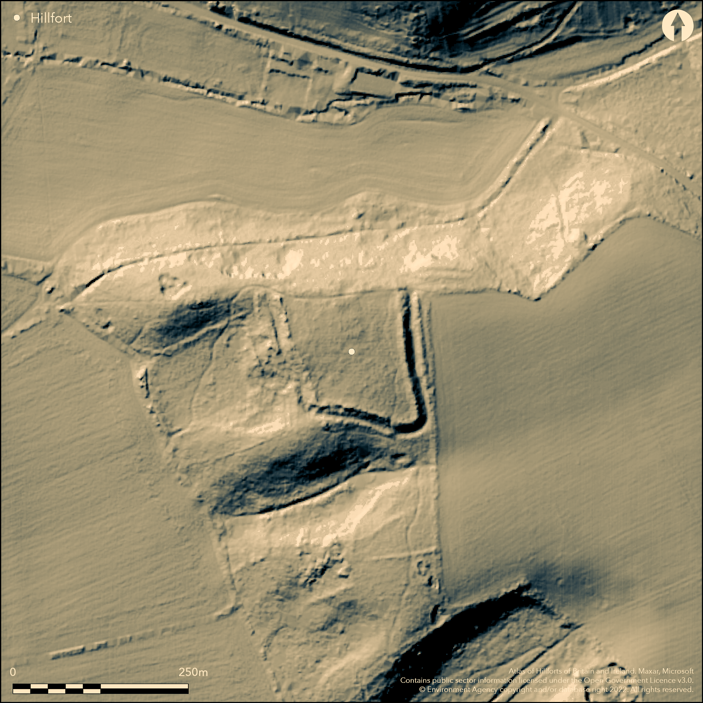
LiDAR 1m DTM Hillshade
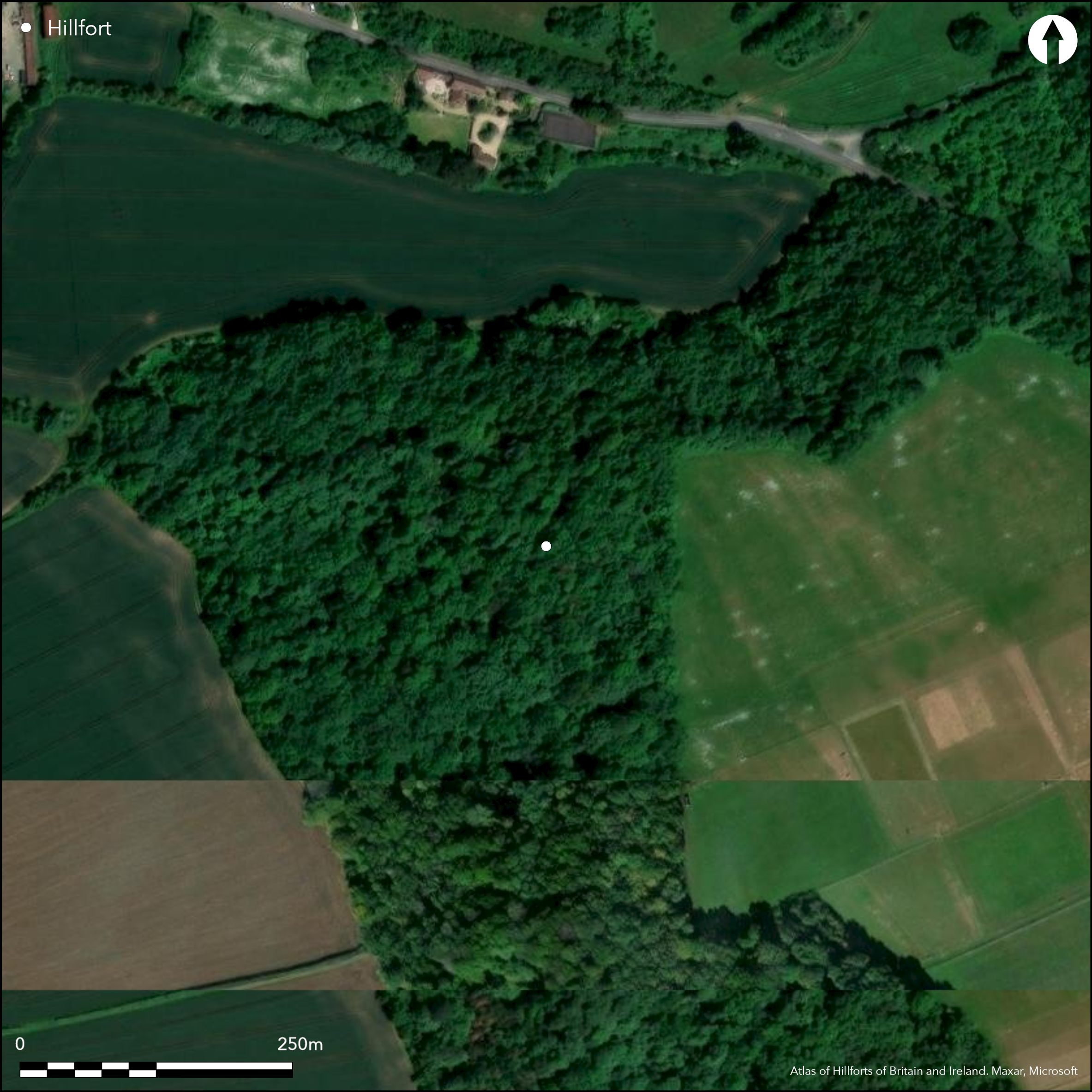
Satellite Imagery
LiDAR 1m DTM Hillshade
Satellite Imagery
Scroll left/right to view further images.
HER: South Gloucestershire 1455 (None)
NMR: ST 68 NW 1 (201491)
SM: 1002478
NGR: ST60808830
X: 360800 Y: 188396 (OSGB36)
Univallate, contour hillfort situated on summit of spur within Vineyards Brake, to E of Elberton village and above Aust cliff, with far reaching views across low-lying flood plain to River Severn estuary on W. Very steep to N, ground rises towards E. Sub-rectangular shaped with interior measuring c. 133m N-S by c. 98m and area 1.6ha. Defined on N by very steep natural slopes, with substantial rampart (possibly of stone rubble), outer ditch and counterscarp bank, surviving differentially around circuit, best on E and S. Inturned entrance on SSE across causeway. Possible at SW end. Another possibility at NW corner where approach from W along spine of ridge. Here gap between N end of W rampart and steep natural slopes to N. This possibly guarded by slightly overlapping outer scarp and shallow ditch. Trackways extend from site to W. Wooded site, very overgrown in part. On 1st Ed. OS map (1881). Undated but chance finds of two sherds of Iron Age pottery from interior.
Citizen Science: ✓
Reliability of Data: Confirmed
Reliability of Interpretation: Confirmed
X: -285790 Y: 6726865 (EPSG: 3857)
Longitude: -2.5672993387180374 Latitude: 51.59299305098245 (EPSG:4326)
Country: England
Current County or Unitary Authority: South Gloucestershire
Historic County: Gloucestershire
Current Parish/Community/Council/Townland: Aust
Best on E and S, W not as good. Information board.
| Extant | ✓ |
| Cropmark | ✗ |
| Likely Destroyed | ✗ |
Wooded site, very overgrown in part.
| Woodland | ✓ |
| Commercial Forestry Plantation | ✗ |
| Parkland | ✗ |
| Pasture (Grazing) | ✗ |
| Arable | ✗ |
| Scrub/Bracken | ✓ |
| Bare Outcrop | ✗ |
| Heather/Moorland | ✗ |
| Heath | ✗ |
| Built-up | ✗ |
| Coastal Grassland | ✗ |
| Other | ✗ |
Univallate, contour hillfort situated on summit of spur within Vineyards Brake, to E of Elberton village and above Aust cliff, with far reaching views across low-lying flood plain to River Severn estuary on W. Very steep to N, ground rises towards E.
| Contour Fort | ✓ |
| Partial Contour Fort | ✗ |
| Promontory Fort | ✗ |
| Hillslope Fort | ✗ |
| Level Terrain Fort | ✗ |
| Marsh Fort | ✗ |
| Multiple Enclosure Fort | ✗ |
| Hilltop | ✗ |
| Coastal Promontory | ✗ |
| Inland Promontory | ✗ |
| Valley Bottom | ✗ |
| Knoll/Hillock/Outcrop | ✗ |
| Ridge | ✗ |
| Cliff/Plateau-edge/Scarp | ✗ |
| Hillslope | ✗ |
| Lowland | ✗ |
| Spur | ✓ |
Dominant Topographic Feature: Spur
| North | ✗ |
| Northeast | ✗ |
| East | ✗ |
| Southeast | ✗ |
| South | ✗ |
| Southwest | ✗ |
| West | ✗ |
| Northwest | ✗ |
| Level | ✓ |
Altitude: 61.0m
N/A
None.
Reliability: D - None
| Pre 1200BC | ✗ |
| 1200BC - 800BC | ✗ |
| 800BC - 400BC | ✗ |
| 400BC - AD50 | ✗ |
| AD50 - AD400 | ✗ |
| AD400 - AD 800 | ✗ |
| Post AD800 | ✗ |
| Unknown | ✓ |
| Pre Hillfort: | None |
| Post Hillfort: | None |
On 1st. Ed. OS map (1881). Field investigation 1962. LiDar Environment Agency 2006. Aerial photograph interpretation Severn Vale National Mapping Project English Heritage 2013-16.
| 1st Identified Map Depiction (1881): | OS map. |
| Other (1962): | Field investigation. |
| LiDAR Survey (2006): | Environment Agency. |
| Other (None): | Aerial photograph interpretation Severn Vale National Mapping Project English Heritage. |
Chance finds of two sherds of Iron Age pottery from interior.
None
| None | ✓ |
| Spring | ✗ |
| Stream | ✗ |
| Pool | ✗ |
| Flush | ✗ |
| Well | ✗ |
| Other | ✗ |
None
| No Known Features | ✓ |
| Round Stone Structures | ✗ |
| Rectangular Stone Structures | ✗ |
| Curvilinear Platforms | ✗ |
| Other Roundhouse Evidence | ✗ |
| Pits | ✗ |
| Quarry Hollows | ✗ |
| Other | ✗ |
None
| No Known Excavation | ✓ |
| Pits | ✗ |
| Postholes | ✗ |
| Roundhouses | ✗ |
| Rectangular Structures | ✗ |
| Roads/Tracks | ✗ |
| Quarry Hollows | ✗ |
| Other | ✗ |
| Nothing Found | ✗ |
None
| No Known Geophysics | ✓ |
| Pits | ✗ |
| Roundhouses | ✗ |
| Rectangular Structures | ✗ |
| Roads/Tracks | ✗ |
| Quarry Hollows | ✗ |
| Other | ✗ |
| Nothing Found | ✗ |
Chance finds of two sherds of Iron Age pottery from interior.
| No Known Finds | ✗ |
| Pottery | ✓ |
| Metal | ✗ |
| Metalworking | ✗ |
| Human Bones | ✗ |
| Animal Bones | ✗ |
| Lithics | ✗ |
| Environmental | ✗ |
| Other | ✗ |
None
| APs Not Checked | ✓ |
| None | ✗ |
| Roundhouses | ✗ |
| Rectangular Structures | ✗ |
| Pits | ✗ |
| Postholes | ✗ |
| Roads/Tracks | ✗ |
| Other | ✗ |
Inturned entrance on SSE across causeway. Possible at SW end. Another possibility at NW corner where approach from W along spine of ridge. Here gap between N end of W rampart and steep natural slopes to N. This possibly guarded by slightly overlapping outer scarp and shallow ditch.
| 3: | None |
| 2: | SW and NW possible. |
Guard Chambers: ✗
Chevaux de Frise: ✗
| 1. In-turned (South east): | On SSE across causeway. |
| 2. Simple Gap (South west): | Across causeway. |
| 3. Simple Gap (North west): | Possible at NW corner. |
| 3. Outworks (North west): | This possibly guarded by slightly overlapping outer scarp and shallow ditch. |
Defined on N by very steep natural slopes, with substantial rampart, outer ditch and counterscarp bank, surviving differentially around circuit, best on E and S.
| Area 1: | 1.6ha. |
| Total: | 1.6ha. |
Total Footprint Area: Noneha.
None
| ✗ | None |
| ✗ | N side defined by very steep slope, but bank included in NE and NW quadrants. |
| NE Quadrant: | 1 |
| SE Quadrant: | 1 |
| SW Quadrant: | 1 |
| NW Quadrant: | 1 |
| Total: | 1 |
| Partial Univallate | ✗ |
| Univallate | ✓ |
| Partial Bivallate | ✗ |
| Bivallate | ✗ |
| Partial Multivallate | ✗ |
| Multivallate | ✗ |
| Unknown | ✗ |
| Partial Univallate | ✗ |
| Univallate | ✗ |
| Partial Bivallate | ✗ |
| Bivallate | ✗ |
| Partial Multivallate | ✗ |
| Multivallate | ✗ |
Bank possibly of stone rubble, seen where trees uprooted.
| None | ✗ |
| Earthen Bank | ✓ |
| Stone Wall | ✗ |
| Rubble | ✓ |
| Wall-walk | ✗ |
| Evidence of Timber | ✗ |
| Vitrification | ✗ |
| Other Burning | ✗ |
| Palisade | ✗ |
| Counter Scarp Bank | ✓ |
| Berm | ✗ |
| Unfinished | ✗ |
| Other | ✗ |
None
| None | ✗ |
| Earthen Bank | ✗ |
| Stone Wall | ✗ |
| Murus Duplex | ✗ |
| Timber-framed | ✗ |
| Timber-laced | ✗ |
| Vitrification | ✗ |
| Other Burning | ✗ |
| Palisade | ✗ |
| Counter Scarp Bank | ✗ |
| Berm | ✗ |
| Unfinished | ✗ |
| No Known Excavation | ✓ |
| Other | ✗ |
| ✗ | None |
| ✓ | None |
Number of Ditches: 1
| ✗ | None |
Burrow, E. 1919. The ancient entrenchments and camps of Gloucestershire, Cheltenham, Ed. J. Burrow and Co, 82.
Solley, T. W. J. 1983. Earthworks at Abbey (Alveston) and Elberton (Aust), Trans Bristol and Gloucs Arch Soc, 101, 179-80.
Witts, G.B. 1883. Archaeological handbook of the County of Gloucester, Cheltenham: G. Norman, 20.
Atlas of Hillforts:
Wikidata:
This work is licensed under CC BY-SA 4.0

 and should be cited as:
Lock, Gary and Ralston, Ian. 2024. Atlas of Hillforts of Britain and Ireland. Available at: https://hillforts.arch.ox.ac.uk
Document Version 1.1