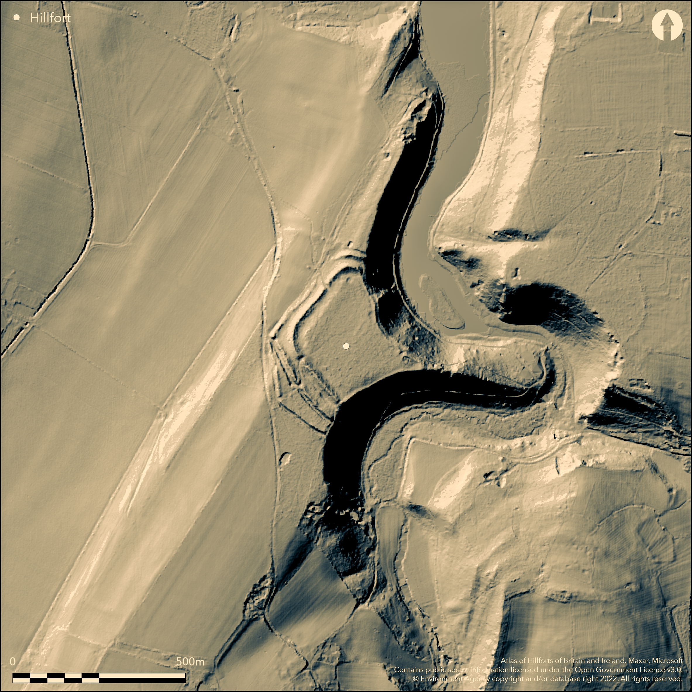
LiDAR 1m DTM Hillshade
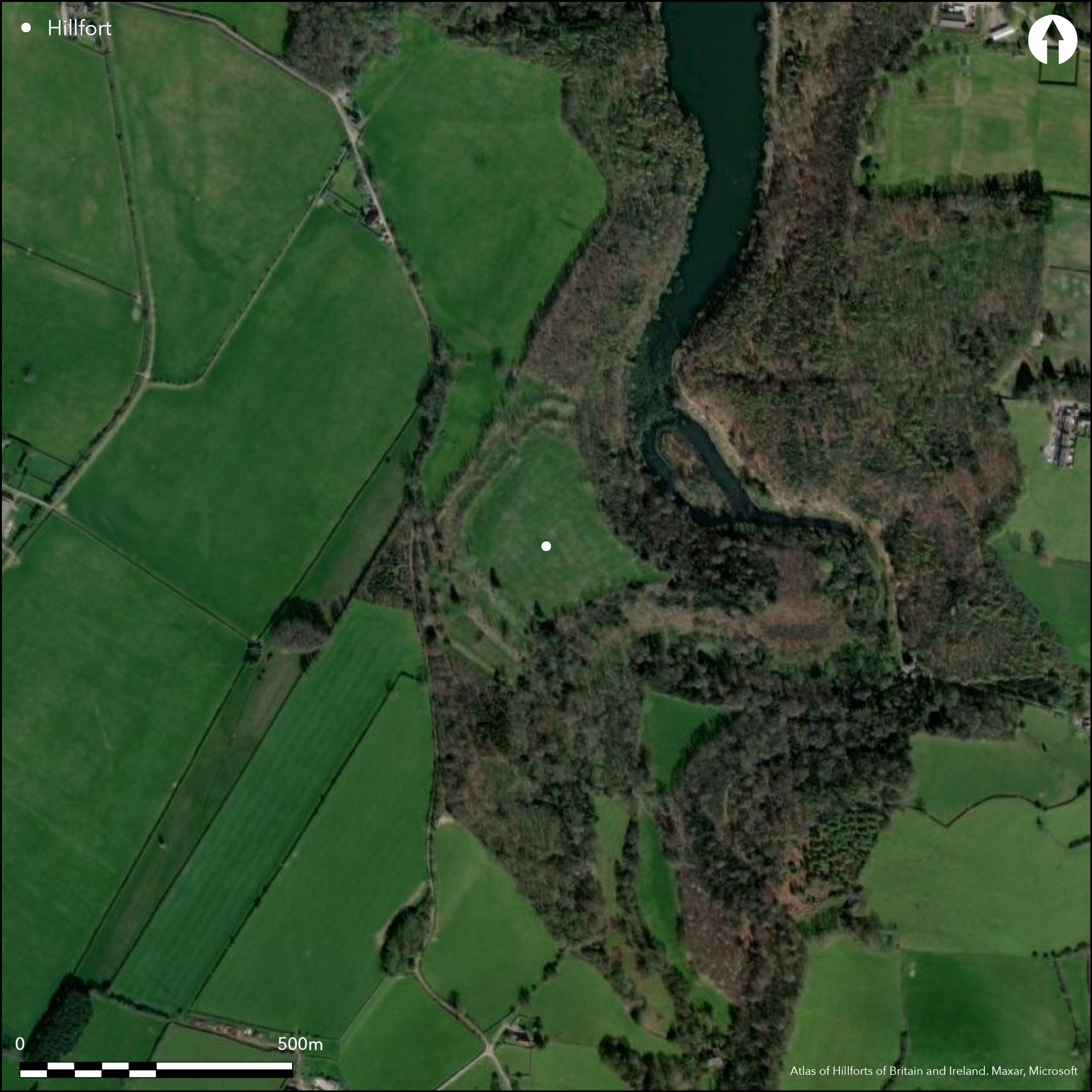
Satellite Imagery
LiDAR 1m DTM Hillshade
Satellite Imagery
Scroll left/right to view further images.
HER: South Gloucestershire 1582 (None)
NMR: ST 69 SE 4 (201653)
SM: 1002483
NGR: ST68959155
X: 368950 Y: 191550 (OSGB36)
Multivallate contour hillfort located on summit of prominent spur overlooking wooded valley of a tributary to Little Avon River and 'The Lake', and within the Grade II* Registered Park of Tortworth Court. Above River Severn estuary to W. Very steep surrounding slopes to stream/lake from NE to S, steep on W and NW, but moderate along ridge to SW. Natural definition to E consisting of the very steep escarpment. Irregular shape measuring c. 225m long NE-SW by 183m, with internal area c. 5.5ha. Defences impressive in part. To N two banks and ditches running across hill top and on SW side three banks and ditches. Inner banks and ditches best, less impressive outwards; eg. height from base of ditch to top of associated bank being to 6m for inner defences, 4.5m for middle and 3m for outer. Two simple causewayed entrances at each end of S side. On SE of hillfort tessellated pavement found 1768 (misprinted on maps as 1868), with, over time, with quantity of Roman pottery. Pavement reputedly 5.4m long by 4.5m wide - location unclear. Interpreted as Romano-British villa or temple site. Wooded site. On 1st Ed.OS map (1880). Minimal investigations, undated.
Citizen Science: ✓
Reliability of Data: Confirmed
Reliability of Interpretation: Confirmed
X: -272725 Y: 6732040 (EPSG: 3857)
Longitude: -2.449931368321336 Latitude: 51.62186092215838 (EPSG:4326)
Country: England
Current County or Unitary Authority: South Gloucestershire
Historic County: Gloucestershire
Current Parish/Community/Council/Townland: Cromhall
Some impressive defences. Within the Grade II* Registered Park (1357) of Tortworth Court.
| Extant | ✓ |
| Cropmark | ✗ |
| Likely Destroyed | ✗ |
Wooded site.
| Woodland | ✓ |
| Commercial Forestry Plantation | ✗ |
| Parkland | ✗ |
| Pasture (Grazing) | ✗ |
| Arable | ✗ |
| Scrub/Bracken | ✗ |
| Bare Outcrop | ✗ |
| Heather/Moorland | ✗ |
| Heath | ✗ |
| Built-up | ✗ |
| Coastal Grassland | ✗ |
| Other | ✗ |
Multivallate contour hillfort located on summit of prominent spur overlooking wooded valley of a tributary to Little Avon River and 'The Lake', and within the Grade II* Registered Park (1357) of Tortworth Court. Above River Severn estuary to W. Very steep surrounding slopes to stream/lake from NE to S, steep on W and NW, but moderate along ridge to SW.
| Contour Fort | ✓ |
| Partial Contour Fort | ✗ |
| Promontory Fort | ✗ |
| Hillslope Fort | ✗ |
| Level Terrain Fort | ✗ |
| Marsh Fort | ✗ |
| Multiple Enclosure Fort | ✗ |
| Hilltop | ✗ |
| Coastal Promontory | ✗ |
| Inland Promontory | ✗ |
| Valley Bottom | ✗ |
| Knoll/Hillock/Outcrop | ✗ |
| Ridge | ✗ |
| Cliff/Plateau-edge/Scarp | ✗ |
| Hillslope | ✗ |
| Lowland | ✗ |
| Spur | ✓ |
Dominant Topographic Feature: Spur
| North | ✗ |
| Northeast | ✗ |
| East | ✗ |
| Southeast | ✗ |
| South | ✗ |
| Southwest | ✗ |
| West | ✗ |
| Northwest | ✗ |
| Level | ✓ |
Altitude: 69.0m
N/A
None.
Reliability: D - None
| Pre 1200BC | ✗ |
| 1200BC - 800BC | ✗ |
| 800BC - 400BC | ✗ |
| 400BC - AD50 | ✗ |
| AD50 - AD400 | ✗ |
| AD400 - AD 800 | ✗ |
| Post AD800 | ✗ |
| Unknown | ✓ |
| Pre Hillfort: | None |
| Post Hillfort: | On SE of hillfort tessellated pavement found 1768 (misprinted on maps as 1868), with, over time, with quantity of Roman pottery. Pavement reputedly 5.4m long by 4.5m wide - location unclear. Interpreted as Romano-British villa or temple site. |
On 1st Ed.OS map (1880). Field investigation 1970 - no details. Aerial photograph interpretation Severn Vale National Mapping Project English Heritage 2013-16.
| Other (1880): | OS map. |
| Other (1970): | Field investigation 1970 - no details. |
| Other (None): | Aerial photograph interpretation Severn Vale National Mapping Project English Heritage. |
On SE of hillfort tessellated pavement found 1768 (misprinted on maps as 1868), with, over time, with quantity of Roman pottery. Pavement reputedly 5.4m long by 4.5m wide - location unclear. Interpreted as Romano-British villa or temple site.
None
| None | ✓ |
| Spring | ✗ |
| Stream | ✗ |
| Pool | ✗ |
| Flush | ✗ |
| Well | ✗ |
| Other | ✗ |
On SE of hillfort tessellated pavement found 1768 (misprinted on maps as 1868), with, over time, with quantity of Roman pottery. Pavement reputedly 5.4m long by 4.5m wide - location unclear. Interpreted as Romano-British villa or temple site.
| No Known Features | ✗ |
| Round Stone Structures | ✗ |
| Rectangular Stone Structures | ✗ |
| Curvilinear Platforms | ✗ |
| Other Roundhouse Evidence | ✗ |
| Pits | ✗ |
| Quarry Hollows | ✗ |
| Other | ✓ |
None
| No Known Excavation | ✓ |
| Pits | ✗ |
| Postholes | ✗ |
| Roundhouses | ✗ |
| Rectangular Structures | ✗ |
| Roads/Tracks | ✗ |
| Quarry Hollows | ✗ |
| Other | ✗ |
| Nothing Found | ✗ |
None
| No Known Geophysics | ✓ |
| Pits | ✗ |
| Roundhouses | ✗ |
| Rectangular Structures | ✗ |
| Roads/Tracks | ✗ |
| Quarry Hollows | ✗ |
| Other | ✗ |
| Nothing Found | ✗ |
Quantity of Roman pottery.
| No Known Finds | ✗ |
| Pottery | ✓ |
| Metal | ✗ |
| Metalworking | ✗ |
| Human Bones | ✗ |
| Animal Bones | ✗ |
| Lithics | ✗ |
| Environmental | ✗ |
| Other | ✗ |
None
| APs Not Checked | ✓ |
| None | ✗ |
| Roundhouses | ✗ |
| Rectangular Structures | ✗ |
| Pits | ✗ |
| Postholes | ✗ |
| Roads/Tracks | ✗ |
| Other | ✗ |
Two simple causewayed entrances at each end of S side. Southernmost staggered, but unclear whether SE or SW so not determined.
| 2: | None |
| 2: | None |
Guard Chambers: ✗
Chevaux de Frise: ✗
| 1. Simple Gap (South east): | Causewayed. |
| 2. Simple Gap (South west): | Causewayed. |
Natural defences to E consisting of the very steep escarpment. Irregular shape measuring c. 225m long NE-SW by 183m, with internal area c. 5.5ha. To N two banks and ditches running across hill top and on SW side three banks and ditches. Inner banks and ditches best, less impressive outwards; eg. height from base of ditch to top of associated bank being to 6m for inner defences, 4.5m for middle and 3m for outer.
| Area 1: | 5.5ha. |
| Total: | 5.5ha. |
Total Footprint Area: Noneha.
None
| ✗ | None |
| ✗ | None |
| NE Quadrant: | 2 |
| SE Quadrant: | 0 |
| SW Quadrant: | 3 |
| NW Quadrant: | 2 |
| Total: | 3 |
| Partial Univallate | ✗ |
| Univallate | ✗ |
| Partial Bivallate | ✓ |
| Bivallate | ✗ |
| Partial Multivallate | ✓ |
| Multivallate | ✗ |
| Unknown | ✗ |
| Partial Univallate | ✗ |
| Univallate | ✗ |
| Partial Bivallate | ✗ |
| Bivallate | ✗ |
| Partial Multivallate | ✗ |
| Multivallate | ✗ |
None
| None | ✗ |
| Earthen Bank | ✓ |
| Stone Wall | ✗ |
| Rubble | ✗ |
| Wall-walk | ✗ |
| Evidence of Timber | ✗ |
| Vitrification | ✗ |
| Other Burning | ✗ |
| Palisade | ✗ |
| Counter Scarp Bank | ✗ |
| Berm | ✗ |
| Unfinished | ✗ |
| Other | ✗ |
None
| None | ✗ |
| Earthen Bank | ✗ |
| Stone Wall | ✗ |
| Murus Duplex | ✗ |
| Timber-framed | ✗ |
| Timber-laced | ✗ |
| Vitrification | ✗ |
| Other Burning | ✗ |
| Palisade | ✗ |
| Counter Scarp Bank | ✗ |
| Berm | ✗ |
| Unfinished | ✗ |
| No Known Excavation | ✓ |
| Other | ✗ |
| ✗ | None |
| ✓ | Up to three ditches. |
Number of Ditches: 3
| ✗ | None |
Witts, G.B. 1883. Archaeological handbook of the County of Gloucester, Cheltenham: G. Norman, 7-8.
Atlas of Hillforts:
Wikidata:
This work is licensed under CC BY-SA 4.0

 and should be cited as:
Lock, Gary and Ralston, Ian. 2024. Atlas of Hillforts of Britain and Ireland. Available at: https://hillforts.arch.ox.ac.uk
Document Version 1.1