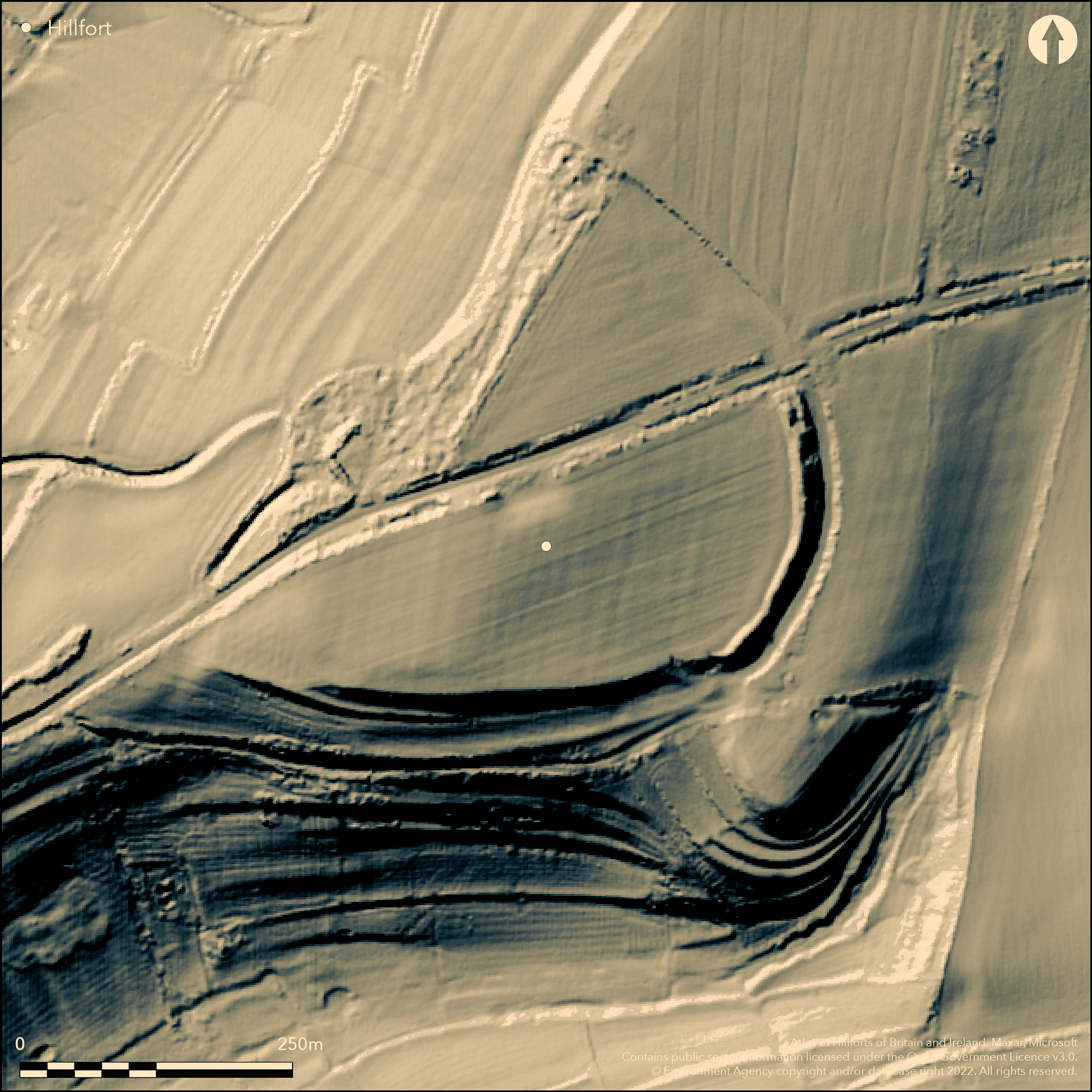
LiDAR 1m DTM Hillshade
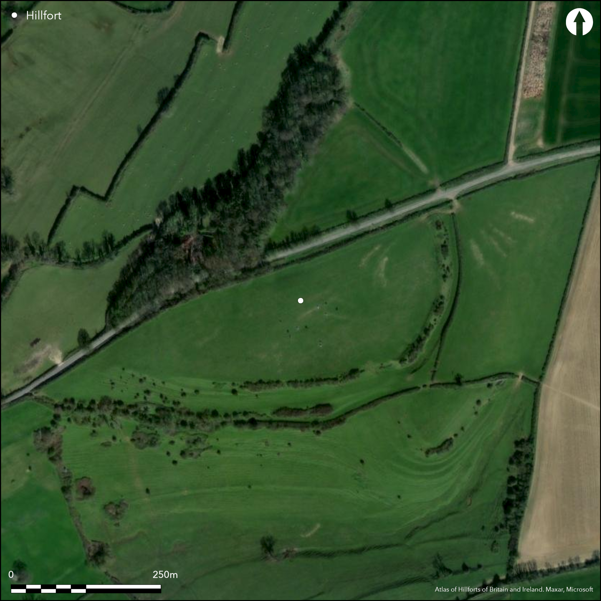
Satellite Imagery
LiDAR 1m DTM Hillshade
Satellite Imagery
Scroll left/right to view further images.
HER: South Gloucestershire 1960 (None)
NMR: ST 77 NW 5 (204859)
SM: 1002484
NGR: ST74157672
X: 374150 Y: 176720 (OSGB36)
Univallate, partial contour hillfort, situated on summit and tip of prominent SW-facing spur of Cotswolds plateau N of Bath called Hinton Hill, overlooking valleys and confluence of two tributaries to the River Boyd. Very steep surrounding slopes to SE and S, steep on W, but moderate/level elsewhere along spur ridge. D-shaped enclosure bisected by local road NE-SW up hillside from Hinton village below. Measures c. 310m long NE-SW by 229m wide internally, with area 4.8ha. Defined by single rampart to 10m wide and 2.4m high, with outer ditch to 6m wide and 1.5m deep, best on E and S where quite impressive. On N past ploughing and tree growth much reduced height of rampart and ditch largely buried feature. Investigation and limited trial excavation 1969 confirmed dimensions of ramparts and ditch and site of entrance in the centre of the east side (Abbot, no date). Field system to SW. S part open pasture, NE pasture, NW mostly woodland. Good condition in parts of E and S, but much reduced on N. Has been rubbish dumping problem. Path runs through S part. On 1st Ed. OS map (1881-70). Undated.
Citizen Science: ✓
Reliability of Data: Confirmed
Reliability of Interpretation: Confirmed
X: -264242 Y: 6708213 (EPSG: 3857)
Longitude: -2.3737246857400014 Latitude: 51.488782673231434 (EPSG:4326)
Country: England
Current County or Unitary Authority: South Gloucestershire
Historic County: Gloucestershire
Current Parish/Community/Council/Townland: Dyfham and Hinton
Good condition in parts of E and S, but much reduced by ploughing and tree growth on NW. Has been rubbish dumping problem. Path runs through S part.
| Extant | ✓ |
| Cropmark | ✗ |
| Likely Destroyed | ✗ |
S part open pasture, NE pasture, NW mostly woodland.
| Woodland | ✓ |
| Commercial Forestry Plantation | ✗ |
| Parkland | ✗ |
| Pasture (Grazing) | ✓ |
| Arable | ✗ |
| Scrub/Bracken | ✗ |
| Bare Outcrop | ✗ |
| Heather/Moorland | ✗ |
| Heath | ✗ |
| Built-up | ✗ |
| Coastal Grassland | ✗ |
| Other | ✗ |
Univallate, partial contour hillfort, situated on summit and tip of prominent SW-facing spur of Cotswolds plateau N of Bath called Hinton Hill, overlooking valleys and confluence of two tributaries to the River Boyd. Very steep surrounding slopes to SE and S, steep on W, but moderate/level elsewhere along spur ridge.
| Contour Fort | ✗ |
| Partial Contour Fort | ✓ |
| Promontory Fort | ✗ |
| Hillslope Fort | ✗ |
| Level Terrain Fort | ✗ |
| Marsh Fort | ✗ |
| Multiple Enclosure Fort | ✗ |
| Hilltop | ✗ |
| Coastal Promontory | ✗ |
| Inland Promontory | ✗ |
| Valley Bottom | ✗ |
| Knoll/Hillock/Outcrop | ✗ |
| Ridge | ✗ |
| Cliff/Plateau-edge/Scarp | ✗ |
| Hillslope | ✗ |
| Lowland | ✗ |
| Spur | ✓ |
Dominant Topographic Feature: Spur
| North | ✗ |
| Northeast | ✗ |
| East | ✗ |
| Southeast | ✗ |
| South | ✗ |
| Southwest | ✓ |
| West | ✗ |
| Northwest | ✗ |
| Level | ✗ |
Altitude: 190.5m
N/A
None.
Reliability: D - None
| Pre 1200BC | ✗ |
| 1200BC - 800BC | ✗ |
| 800BC - 400BC | ✗ |
| 400BC - AD50 | ✗ |
| AD50 - AD400 | ✗ |
| AD400 - AD 800 | ✗ |
| Post AD800 | ✗ |
| Unknown | ✓ |
| Pre Hillfort: | None |
| Post Hillfort: | Possible site of site Battle of Dyrham in AD 577 between Saxons and Britons. |
In Aubrey's Monumenta Britannica (1665-1693). On various maps including Isaac Taylor's map of 1786 as Barhill Camp and Tithe Award map of 1841 as Burrills Camp. On 1st Ed. OS map (1881-87). Field investigations 1962, and 1969 with trial excavation - no details. Trial excavation 1969. Earthwork and geophysical survey for thesis P. Abbot 2006.
| 1st Identified Map Depiction (1786): | Taylor's map. |
| Other (1841): | Tithe Award map. |
| Excavation (1969): | Field investigation and trial excavation - no details. |
| Earthwork Survey (2006): | Thesis P. Abbot. |
| Geophysical Survey (2006): | Thesis P. Abbot. |
| 1st Identified Written Reference (None): | None |
| Other (None): | OS MAP. |
None.
None
| None | ✓ |
| Spring | ✗ |
| Stream | ✗ |
| Pool | ✗ |
| Flush | ✗ |
| Well | ✗ |
| Other | ✗ |
None
| No Known Features | ✓ |
| Round Stone Structures | ✗ |
| Rectangular Stone Structures | ✗ |
| Curvilinear Platforms | ✗ |
| Other Roundhouse Evidence | ✗ |
| Pits | ✗ |
| Quarry Hollows | ✗ |
| Other | ✗ |
None
| No Known Excavation | ✓ |
| Pits | ✗ |
| Postholes | ✗ |
| Roundhouses | ✗ |
| Rectangular Structures | ✗ |
| Roads/Tracks | ✗ |
| Quarry Hollows | ✗ |
| Other | ✗ |
| Nothing Found | ✗ |
None
| No Known Geophysics | ✓ |
| Pits | ✗ |
| Roundhouses | ✗ |
| Rectangular Structures | ✗ |
| Roads/Tracks | ✗ |
| Quarry Hollows | ✗ |
| Other | ✗ |
| Nothing Found | ✗ |
None
| No Known Finds | ✓ |
| Pottery | ✗ |
| Metal | ✗ |
| Metalworking | ✗ |
| Human Bones | ✗ |
| Animal Bones | ✗ |
| Lithics | ✗ |
| Environmental | ✗ |
| Other | ✗ |
None
| APs Not Checked | ✓ |
| None | ✗ |
| Roundhouses | ✗ |
| Rectangular Structures | ✗ |
| Pits | ✗ |
| Postholes | ✗ |
| Roads/Tracks | ✗ |
| Other | ✗ |
Entrance in centre of E side, confirmed by investigation and limiited trial excavation 1969.
| 1: | None |
| 2: | None |
Guard Chambers: ✗
Chevaux de Frise: ✗
| 1. Simple Gap (East): | None |
Defined by single rampart to 10m wide and 2.4m high, with outer ditch to 6m wide and 1.5m deep, best on E and S where quite impressive. On N past ploughing and tree growth much reduced height of rampart and ditch largely buried feature. Investigation and limited trial excavation 1969 confirmed dimensions of ramparts and ditch and site of entrance in the centre of the east side.
| Area 1: | 4.8ha. |
| Total: | 4.8ha. |
Total Footprint Area: Noneha.
None
| ✗ | None |
| ✓ | Bisected by road NE-SW. |
| NE Quadrant: | 1 |
| SE Quadrant: | 1 |
| SW Quadrant: | 1 |
| NW Quadrant: | 1 |
| Total: | 1 |
| Partial Univallate | ✗ |
| Univallate | ✓ |
| Partial Bivallate | ✗ |
| Bivallate | ✗ |
| Partial Multivallate | ✗ |
| Multivallate | ✗ |
| Unknown | ✗ |
| Partial Univallate | ✗ |
| Univallate | ✗ |
| Partial Bivallate | ✗ |
| Bivallate | ✗ |
| Partial Multivallate | ✗ |
| Multivallate | ✗ |
None
| None | ✗ |
| Earthen Bank | ✓ |
| Stone Wall | ✗ |
| Rubble | ✗ |
| Wall-walk | ✗ |
| Evidence of Timber | ✗ |
| Vitrification | ✗ |
| Other Burning | ✗ |
| Palisade | ✗ |
| Counter Scarp Bank | ✗ |
| Berm | ✗ |
| Unfinished | ✗ |
| Other | ✗ |
Investigation and limited trial excavation 1969 confirmed dimensions of ramparts and ditch.
| None | ✗ |
| Earthen Bank | ✗ |
| Stone Wall | ✗ |
| Murus Duplex | ✗ |
| Timber-framed | ✗ |
| Timber-laced | ✗ |
| Vitrification | ✗ |
| Other Burning | ✗ |
| Palisade | ✗ |
| Counter Scarp Bank | ✗ |
| Berm | ✗ |
| Unfinished | ✗ |
| No Known Excavation | ✗ |
| Other | ✓ |
| ✗ | None |
| ✓ | Largely buried feature on N. |
Number of Ditches: 1
| ✗ | None |
Abbot, P. Earthwork and Geophysical Survey of Hinton Hillfort, Hinton, Dyrham and Hinton Parish, South Gloucestershire, no details.
Witts, G.B. 1883. Archaeological handbook of the County of Gloucester, Cheltenham: G. Norman, 19-20.
RCHME 1976. Ancient and Historical Monuments in the County of Gloucester Iron Age and Romano-British Monuments in the Gloucestershire Cotswolds, London: HMSO, 51.
Atlas of Hillforts:
Wikidata:
This work is licensed under CC BY-SA 4.0

 and should be cited as:
Lock, Gary and Ralston, Ian. 2024. Atlas of Hillforts of Britain and Ireland. Available at: https://hillforts.arch.ox.ac.uk
Document Version 1.1