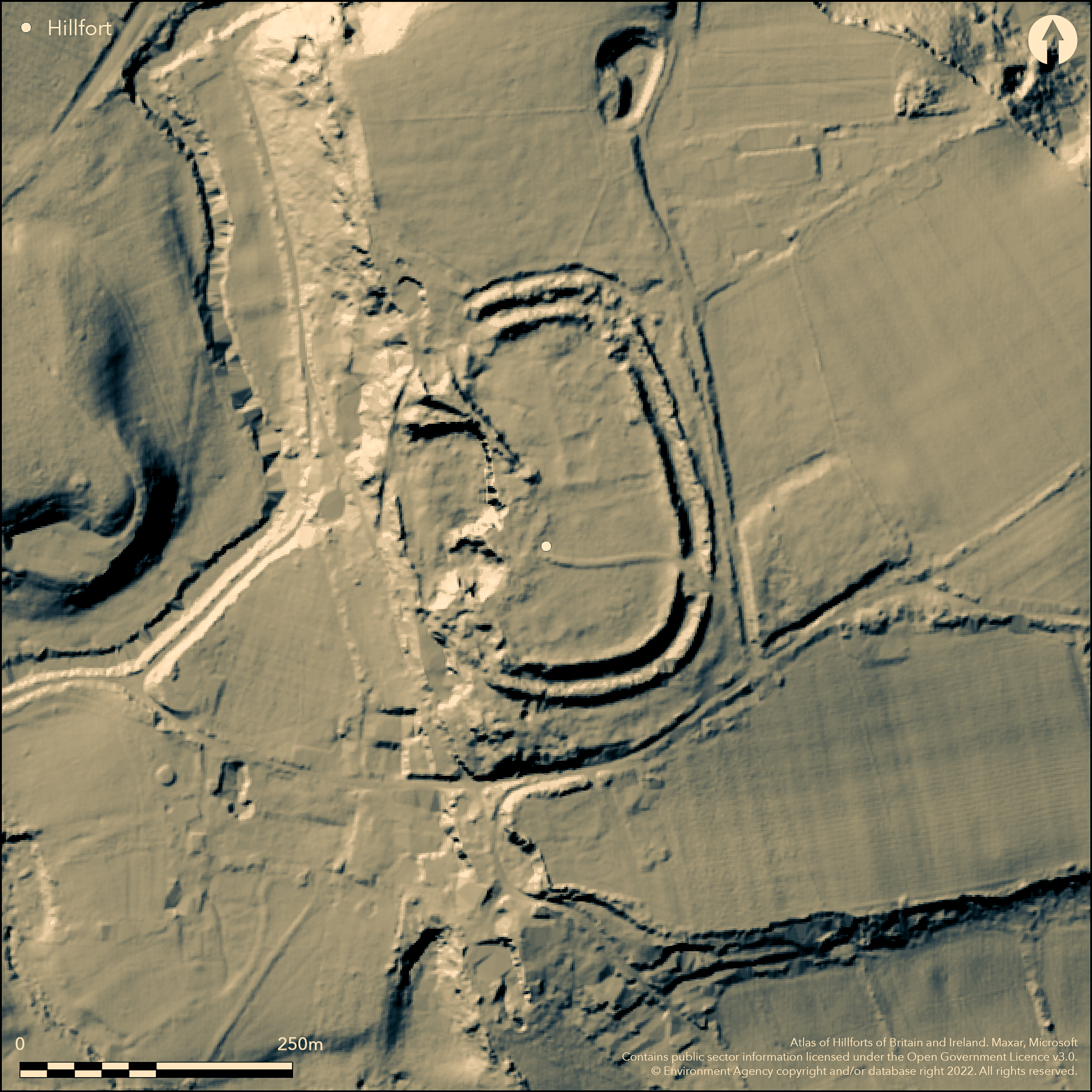
LiDAR 1m DTM Hillshade
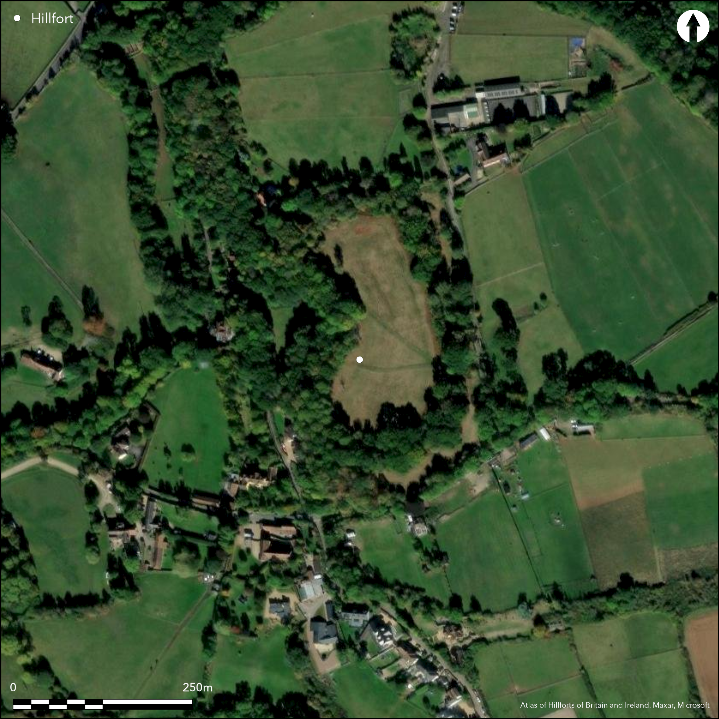
Satellite Imagery
LiDAR 1m DTM Hillshade
Satellite Imagery
Scroll left/right to view further images.
HER: South Gloucestershire 1347 (None)
NMR: ST 67 NE 1 (201258)
SM: 1007023
NGR: ST652791
X: 365200 Y: 179100 (OSGB36)
Small, multivallate, contour hillfort, situated on summit of plateau of Bury Hill, directly overlooking valley of River Frome. Steep to W, moderate elsewhere. Roughly oval in plan measuring c. to 180m long by 102m wide with internal area c. 2ha. Defined by two closely-spaced concentric ramparts with ditches, varying to c. 3m high but W defences quarried away. Elsewhere ditches buried feature or to 3.6m deep. Excavation (Davies and Phillips 1927) of rampart and of possible early Roman longhouse on W side, possibly part of outpost established during conquest period. Second and slightly smaller similar structure identified to E, but not excavated. Large quantities Iron Age /Romano-British pottery and 3rd-4th century pottery from platform and other finds indicative of Iron Age date and reoccupation in late Roman period. Geophysics and LiDAR survey (Adams 2015). Flint implements, including Palaeolithic blade and polished stone macehead found prior to 1926. Pasture and wood to W. On 1st Ed. OS map (1882).
Citizen Science: ✓
Reliability of Data: Confirmed
Reliability of Interpretation: Confirmed
X: -278617 Y: 6711954 (EPSG: 3857)
Longitude: -2.5028617856095607 Latitude: 51.50970041079362 (EPSG:4326)
Country: England; None
Current County or Unitary Authority: South Gloucestershire
Historic County: Gloucestershire
Current Parish/Community/Council/Townland: Winterbourne; Mangotsfield Urban
W ramparts quarried away.
| Extant | ✓ |
| Cropmark | ✗ |
| Likely Destroyed | ✓ |
Pasture interior and wood to W.
| Woodland | ✓ |
| Commercial Forestry Plantation | ✗ |
| Parkland | ✗ |
| Pasture (Grazing) | ✓ |
| Arable | ✗ |
| Scrub/Bracken | ✗ |
| Bare Outcrop | ✗ |
| Heather/Moorland | ✗ |
| Heath | ✗ |
| Built-up | ✗ |
| Coastal Grassland | ✗ |
| Other | ✗ |
Small, multivallate, contour hillfort, situated on summit of plateau of Bury Hill, directly overlooking valley of River Frome. Flat interior. Steep to W, moderate elsewhere.
| Contour Fort | ✓ |
| Partial Contour Fort | ✗ |
| Promontory Fort | ✗ |
| Hillslope Fort | ✗ |
| Level Terrain Fort | ✗ |
| Marsh Fort | ✗ |
| Multiple Enclosure Fort | ✗ |
| Hilltop | ✗ |
| Coastal Promontory | ✗ |
| Inland Promontory | ✗ |
| Valley Bottom | ✗ |
| Knoll/Hillock/Outcrop | ✗ |
| Ridge | ✗ |
| Cliff/Plateau-edge/Scarp | ✓ |
| Hillslope | ✗ |
| Lowland | ✗ |
| Spur | ✗ |
Dominant Topographic Feature: Summit of plateau.
| North | ✗ |
| Northeast | ✗ |
| East | ✗ |
| Southeast | ✗ |
| South | ✗ |
| Southwest | ✗ |
| West | ✗ |
| Northwest | ✗ |
| Level | ✓ |
Altitude: 61.0m
Boundary Type: Parish/Townland
Probably Iron Age, but excavation of early Roman longhouse, possibly part of outpost established during conquest period. Large quantities Iron Age /Romano-British pottery and 3rd-4th century pottery from platform and other finds indicative of Iron Age date and reoccupation in late Roman period.
Reliability: B - Medium
| Pre 1200BC | ✗ |
| 1200BC - 800BC | ✗ |
| 800BC - 400BC | ✗ |
| 400BC - AD50 | ✓ |
| AD50 - AD400 | ✓ |
| AD400 - AD 800 | ✗ |
| Post AD800 | ✗ |
| Unknown | ✗ |
| Pre Hillfort: | None |
| Post Hillfort: | None |
| Artefactual: | Pottery. |
| Other: | Early Roman longhouse. |
Mentioned by Sir Robert Atkyns 1768. On Isaac Taylor's map of 1777. On 1st Ed. OS map (1882). Excavation C.B. Phillips and J.A. Davies 1926; most of archive destroyed in WWII. Aerial photograph interpretation Severn Vale National Mapping Project English Heritage 2013-16. LiDAR and geophysics S. Adams 2015.
| 1st Identified Written Reference (1768): | Mentioned by Sir Robert Atkyns. |
| 1st Identified Map Depiction (1777): | Isaac Taylor. |
| Excavation (1926): | C.B. Phillips and J.A. Davies. |
| Geophysical Survey (2015): | S. Adams |
| LiDAR Survey (2015): | S. Adams. |
Excavation of early Roman longhouse, possibly part of outpost established during conquest period. Large quantities of 3rd-4th century pottery and other finds indicative of reoccupation in late Roman period. Flint implements, including Palaeolithic blade and polished stone macehead. Pits and gullies by geophysics.
Well at NW corner - date not defined.
| None | ✗ |
| Spring | ✗ |
| Stream | ✗ |
| Pool | ✗ |
| Flush | ✗ |
| Well | ✗ |
| Other | ✓ |
None
| No Known Features | ✓ |
| Round Stone Structures | ✗ |
| Rectangular Stone Structures | ✗ |
| Curvilinear Platforms | ✗ |
| Other Roundhouse Evidence | ✗ |
| Pits | ✗ |
| Quarry Hollows | ✗ |
| Other | ✗ |
Excavation of early Roman longhouse, possibly part of outpost established during conquest period.
| No Known Excavation | ✗ |
| Pits | ✗ |
| Postholes | ✗ |
| Roundhouses | ✗ |
| Rectangular Structures | ✓ |
| Roads/Tracks | ✗ |
| Quarry Hollows | ✗ |
| Other | ✗ |
| Nothing Found | ✗ |
None
| No Known Geophysics | ✗ |
| Pits | ✓ |
| Roundhouses | ✗ |
| Rectangular Structures | ✗ |
| Roads/Tracks | ✗ |
| Quarry Hollows | ✗ |
| Other | ✓ |
| Nothing Found | ✗ |
Large quantities of 3rd-4th century pottery and other finds indicative of reoccupation in late Roman period. Flint implements, including Palaeolithic blade and polished stone macehead.
| No Known Finds | ✗ |
| Pottery | ✓ |
| Metal | ✗ |
| Metalworking | ✗ |
| Human Bones | ✗ |
| Animal Bones | ✗ |
| Lithics | ✓ |
| Environmental | ✗ |
| Other | ✗ |
None
| APs Not Checked | ✓ |
| None | ✗ |
| Roundhouses | ✗ |
| Rectangular Structures | ✗ |
| Pits | ✗ |
| Postholes | ✗ |
| Roads/Tracks | ✗ |
| Other | ✗ |
Three entrances, that on NW with protective outer embankment, those to NE and SE simple gaps. .
| 3: | None |
| 2: | None |
Guard Chambers: ✗
Chevaux de Frise: ✗
| 1. Outworks (North west): | Protective outer embankment. |
| 2. Simple Gap (North east): | None |
| 3. Simple Gap (South east): | None |
Defined by two closely-spaced concentric ramparts with ditches, varying to c. 3m high but W defences quarried away. Elsewhere ditches buried feature or to 3.6m deep. Excavation of rampart 1926. Stone wall and revetment found. Also berm
| Area 1: | 2.0ha. |
| Total: | 2.0ha. |
Total Footprint Area: Noneha.
None
| ✗ | None |
| ✗ | W side quarried away. |
| NE Quadrant: | 2 |
| SE Quadrant: | 2 |
| SW Quadrant: | 0 |
| NW Quadrant: | 0 |
| Total: | 2 |
| Partial Univallate | ✗ |
| Univallate | ✗ |
| Partial Bivallate | ✓ |
| Bivallate | ✗ |
| Partial Multivallate | ✗ |
| Multivallate | ✗ |
| Unknown | ✗ |
| Partial Univallate | ✗ |
| Univallate | ✗ |
| Partial Bivallate | ✗ |
| Bivallate | ✗ |
| Partial Multivallate | ✗ |
| Multivallate | ✗ |
None
| None | ✗ |
| Earthen Bank | ✓ |
| Stone Wall | ✗ |
| Rubble | ✗ |
| Wall-walk | ✗ |
| Evidence of Timber | ✗ |
| Vitrification | ✗ |
| Other Burning | ✗ |
| Palisade | ✗ |
| Counter Scarp Bank | ✗ |
| Berm | ✗ |
| Unfinished | ✗ |
| Other | ✗ |
Excavation of rampart 1926. Stone wall and revetment found. Also berm
| None | ✗ |
| Earthen Bank | ✓ |
| Stone Wall | ✓ |
| Murus Duplex | ✗ |
| Timber-framed | ✗ |
| Timber-laced | ✗ |
| Vitrification | ✗ |
| Other Burning | ✗ |
| Palisade | ✗ |
| Counter Scarp Bank | ✗ |
| Berm | ✓ |
| Unfinished | ✗ |
| No Known Excavation | ✗ |
| Other | ✗ |
| ✗ | None |
| ✓ | Buried feature in part. |
Number of Ditches: 2
| ✗ | None |
Adams, S. 2015. Bury Hill. An Iron Age hillfort in the Lower Severn Vale. University of Oxford MSc dissertation, unpublished.
Atkyns, Sir R. 1768. The Ancient and Present State of Glocestershire, 2nd ed, London: T. Spilsbury for W. Herbert.
Burrow, E. 1919. The ancient entrenchments and camps of Gloucestershire, Cheltenham, Ed. J. Burrow and Co, 50.
Davies,J.A. and Phillips,C.W. 1927. Percy Sladen Memorial Fund Excavations at Bury Hill Camp, Winterbourne Down, Gloucestershire, Proc Univ Bristol Speleol Soc, 3(1), 8-24.
Lloyd Baker, T.J.1821. An Account of a Chain of Ancient Fortresses, extending through the South Western part of Gloucestershire, Archaeologia, 19, 164-5.
Witts, G.B. 1883. Archaeological handbook of the County of Gloucester, Cheltenham: G. Norman, 9-10.
Atlas of Hillforts:
Wikidata:
This work is licensed under CC BY-SA 4.0

 and should be cited as:
Lock, Gary and Ralston, Ian. 2024. Atlas of Hillforts of Britain and Ireland. Available at: https://hillforts.arch.ox.ac.uk
Document Version 1.1