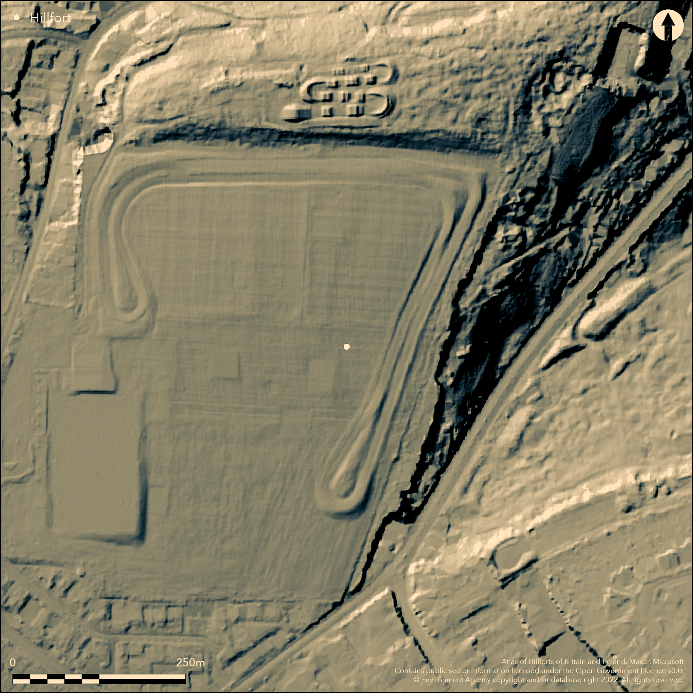
LiDAR 1m DTM Hillshade
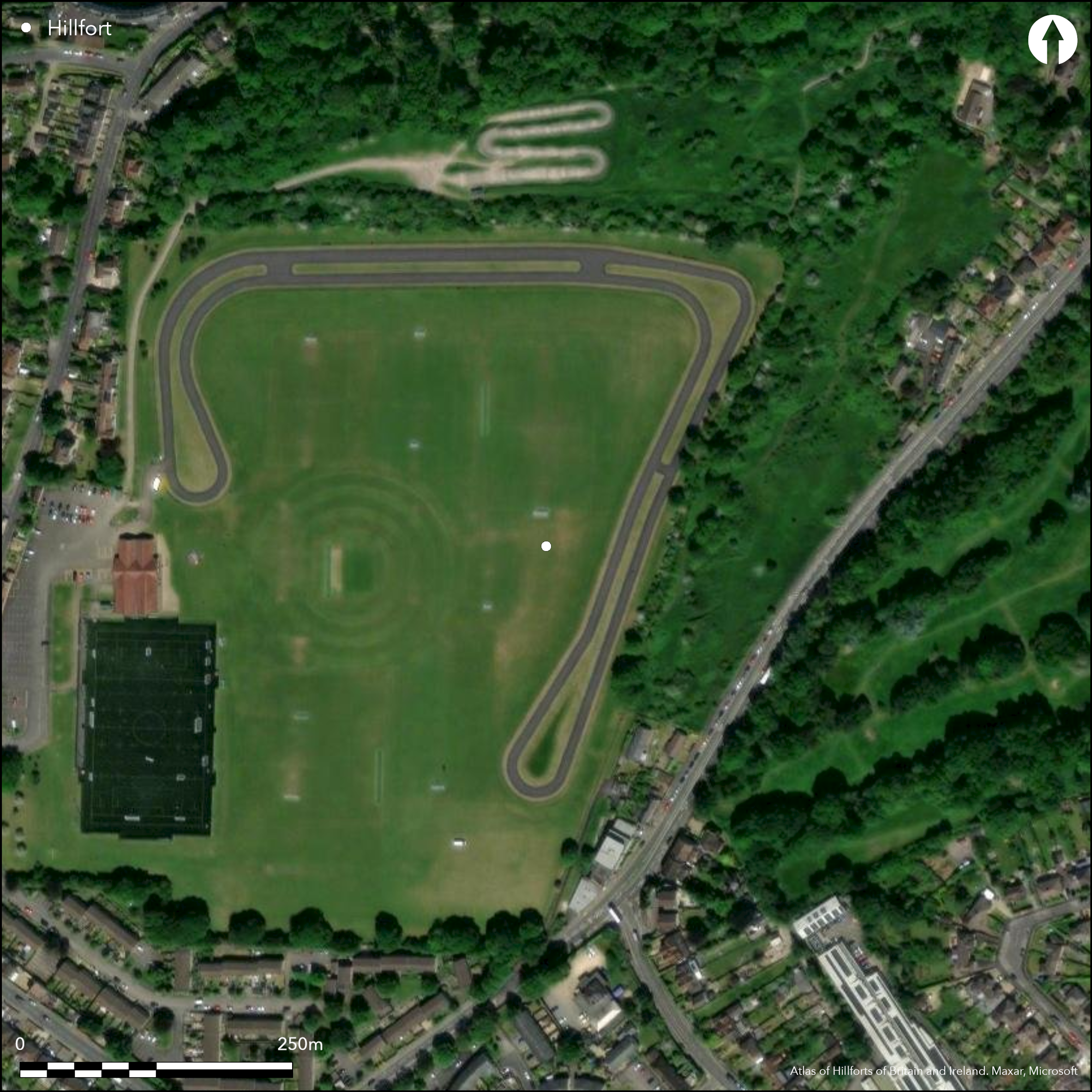
Satellite Imagery
LiDAR 1m DTM Hillshade
Satellite Imagery
Scroll left/right to view further images.
HER: Bath and NE Somerset MBN1797 (None)
NMR: ST 76 SW 23 (204546)
SM: None
NGR: ST74106260
X: 374100 Y: 162600 (OSGB36)
Destroyed, possible, multivallate hillfort located on plateau of Odd Down above River Avon to N and now built over by factory and playing fields and old stone quarries used as a dump, S outskirts of Bath. Steep slopes to N and E, less elsewhere. A 'camp' called Berwick, Berewyke, or Berewyck, adjoining Cottage Crescent and near Barrack Farm, described by antiquarians in early 19th century, and scarping of edge of plateau and other traces by H.M. Scarth in 1855 and 1876. Quote from Pastscape: 'Near the Wansdyke on the western part of Widcombe and Lyncombe parish "... is a lofty eminence, called the Barracks, on which are several tumuli. Underneath the hill stood the ancient village of Berewyke, or Berwick, where according to tradition was a church, the site of which was near the only remaining house, called Barracks Farm. The tithes of this place belonged to the vicar of St Mary de Stall in Bath' (ST 76 SW : 35). Type of hillfort not defined. Minimal investigations, undated.
Citizen Science: ✗
Reliability of Data: Confirmed
Reliability of Interpretation: Unconfirmed
X: -264207 Y: 6685547 (EPSG: 3857)
Longitude: -2.373408638660115 Latitude: 51.36181936014093 (EPSG:4326)
Country: England
Current County or Unitary Authority: Bath and NE Somerset
Historic County: Somerset
Current Parish/Community/Council/Townland: Bath
Destroyed and now built over by factory, playing fields and old stone quarries past used as a dump.
| Extant | ✗ |
| Cropmark | ✗ |
| Likely Destroyed | ✓ |
None
| Woodland | ✗ |
| Commercial Forestry Plantation | ✗ |
| Parkland | ✗ |
| Pasture (Grazing) | ✗ |
| Arable | ✗ |
| Scrub/Bracken | ✗ |
| Bare Outcrop | ✗ |
| Heather/Moorland | ✗ |
| Heath | ✗ |
| Built-up | ✓ |
| Coastal Grassland | ✗ |
| Other | ✗ |
Destroyed, possible, multivallate hillfort located on plateau of Odd Down above River Avon to N and now built over by factory and playing fields and old stone quarries past used as a dump. Steep slopes to N and E, less elsewhere. Type not defined.
| Contour Fort | ✗ |
| Partial Contour Fort | ✗ |
| Promontory Fort | ✗ |
| Hillslope Fort | ✗ |
| Level Terrain Fort | ✓ |
| Marsh Fort | ✗ |
| Multiple Enclosure Fort | ✗ |
| Hilltop | ✗ |
| Coastal Promontory | ✗ |
| Inland Promontory | ✗ |
| Valley Bottom | ✗ |
| Knoll/Hillock/Outcrop | ✗ |
| Ridge | ✗ |
| Cliff/Plateau-edge/Scarp | ✓ |
| Hillslope | ✗ |
| Lowland | ✗ |
| Spur | ✗ |
Dominant Topographic Feature: Details estimated and not definitely defined.
| North | ✗ |
| Northeast | ✗ |
| East | ✗ |
| Southeast | ✗ |
| South | ✗ |
| Southwest | ✗ |
| West | ✗ |
| Northwest | ✗ |
| Level | ✓ |
Altitude: 165.0m
N/A
None.
Reliability: D - None
| Pre 1200BC | ✗ |
| 1200BC - 800BC | ✗ |
| 800BC - 400BC | ✗ |
| 400BC - AD50 | ✗ |
| AD50 - AD400 | ✗ |
| AD400 - AD 800 | ✗ |
| Post AD800 | ✗ |
| Unknown | ✓ |
| Pre Hillfort: | None |
| Post Hillfort: | None |
Mention by Collinson 1791. 'Camp' with strong 'vallum' mentioned by Phelps 1836. Reference by Rev J. Skinner held in British Museum Add manuscripts 33669 f 11. Mention by H.M. Scarth 1855, 1876. Field investigation 1966 - no details.
| 1st Identified Written Reference (1791): | Mention by J. Collinson in 'History and Antiquities of Somerset'. |
| Other (1836): | 'Camp' with strong 'vallum' mentioned by Phelps. |
| Other (1966): | Field investigation - no details. |
| Other (None): | Mention by H.M. Scarth. |
| Other (None): | Reference by Rev J. Skinner held in British Museum Add manuscripts 33669 f 11. |
| LiDAR Survey (None): | Geomatics survey. |
None.
None
| None | ✓ |
| Spring | ✗ |
| Stream | ✗ |
| Pool | ✗ |
| Flush | ✗ |
| Well | ✗ |
| Other | ✗ |
None
| No Known Features | ✓ |
| Round Stone Structures | ✗ |
| Rectangular Stone Structures | ✗ |
| Curvilinear Platforms | ✗ |
| Other Roundhouse Evidence | ✗ |
| Pits | ✗ |
| Quarry Hollows | ✗ |
| Other | ✗ |
None
| No Known Excavation | ✓ |
| Pits | ✗ |
| Postholes | ✗ |
| Roundhouses | ✗ |
| Rectangular Structures | ✗ |
| Roads/Tracks | ✗ |
| Quarry Hollows | ✗ |
| Other | ✗ |
| Nothing Found | ✗ |
None
| No Known Geophysics | ✓ |
| Pits | ✗ |
| Roundhouses | ✗ |
| Rectangular Structures | ✗ |
| Roads/Tracks | ✗ |
| Quarry Hollows | ✗ |
| Other | ✗ |
| Nothing Found | ✗ |
None
| No Known Finds | ✓ |
| Pottery | ✗ |
| Metal | ✗ |
| Metalworking | ✗ |
| Human Bones | ✗ |
| Animal Bones | ✗ |
| Lithics | ✗ |
| Environmental | ✗ |
| Other | ✗ |
None
| APs Not Checked | ✓ |
| None | ✗ |
| Roundhouses | ✗ |
| Rectangular Structures | ✗ |
| Pits | ✗ |
| Postholes | ✗ |
| Roads/Tracks | ✗ |
| Other | ✗ |
None defined.
| 0: | None |
| 2: | None |
Guard Chambers: ✗
Chevaux de Frise: ✗
Destroyed - not defined.
| Area 1: | Noneha. |
| Total: | Noneha. |
Total Footprint Area: Noneha.
None
| ✗ | None |
| ✗ | Destroyed. |
| NE Quadrant: | None |
| SE Quadrant: | None |
| SW Quadrant: | None |
| NW Quadrant: | None |
| Total: | None |
| Partial Univallate | ✗ |
| Univallate | ✗ |
| Partial Bivallate | ✗ |
| Bivallate | ✗ |
| Partial Multivallate | ✗ |
| Multivallate | ✗ |
| Unknown | ✓ |
| Partial Univallate | ✗ |
| Univallate | ✗ |
| Partial Bivallate | ✗ |
| Bivallate | ✗ |
| Partial Multivallate | ✗ |
| Multivallate | ✗ |
Destroyed - not defined.
| None | ✓ |
| Earthen Bank | ✗ |
| Stone Wall | ✗ |
| Rubble | ✗ |
| Wall-walk | ✗ |
| Evidence of Timber | ✗ |
| Vitrification | ✗ |
| Other Burning | ✗ |
| Palisade | ✗ |
| Counter Scarp Bank | ✗ |
| Berm | ✗ |
| Unfinished | ✗ |
| Other | ✗ |
None
| None | ✗ |
| Earthen Bank | ✗ |
| Stone Wall | ✗ |
| Murus Duplex | ✗ |
| Timber-framed | ✗ |
| Timber-laced | ✗ |
| Vitrification | ✗ |
| Other Burning | ✗ |
| Palisade | ✗ |
| Counter Scarp Bank | ✗ |
| Berm | ✗ |
| Unfinished | ✗ |
| No Known Excavation | ✓ |
| Other | ✗ |
| ✗ | None |
| ✗ | Destroyed - not defined. |
Number of Ditches: None
| ✗ | None |
Burrow, I. 1981. Hillfort and hill-top settlement in Somerset in the first to eighth centuries AD, British Archaeological Report (BAR) British Series 1, 91, 264-5.
Collinson, J. 1791. History and Antiquities of Somerset, 1, 171.
Phelps, W. 1836. History and Antiquities of Somersetshire 1, London: J.B. Nichols and Son, 102-3.
Scarth, Rev. H.M. 1855. On the traces of camps and ancient earthworks still existing around Bath and its neighbourhood, Somerset Arch Natur Hist, 6, 98-124.
Scarth, Rev. H.M. 1876. Roman Somerset, with special relation to recent discoveries at Bath. Somerset Arch Natur Hist , 22, 18-30.
Skinner, Rev J. early 19th century. Reference held in British Museum Add manuscripts 33669 f 11.
Atlas of Hillforts:
Wikidata:
This work is licensed under CC BY-SA 4.0

 and should be cited as:
Lock, Gary and Ralston, Ian. 2024. Atlas of Hillforts of Britain and Ireland. Available at: https://hillforts.arch.ox.ac.uk
Document Version 1.1