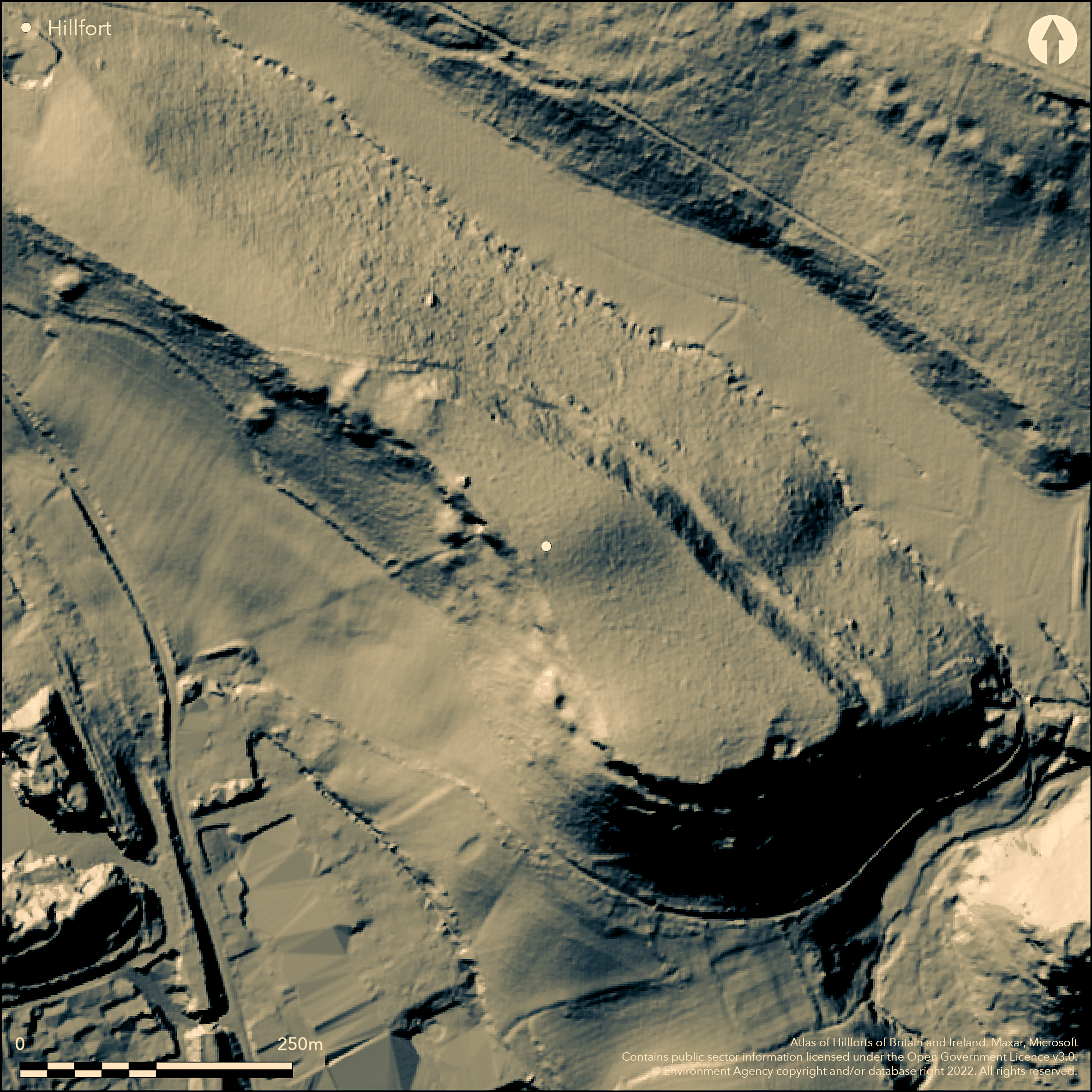
LiDAR 1m DTM Hillshade
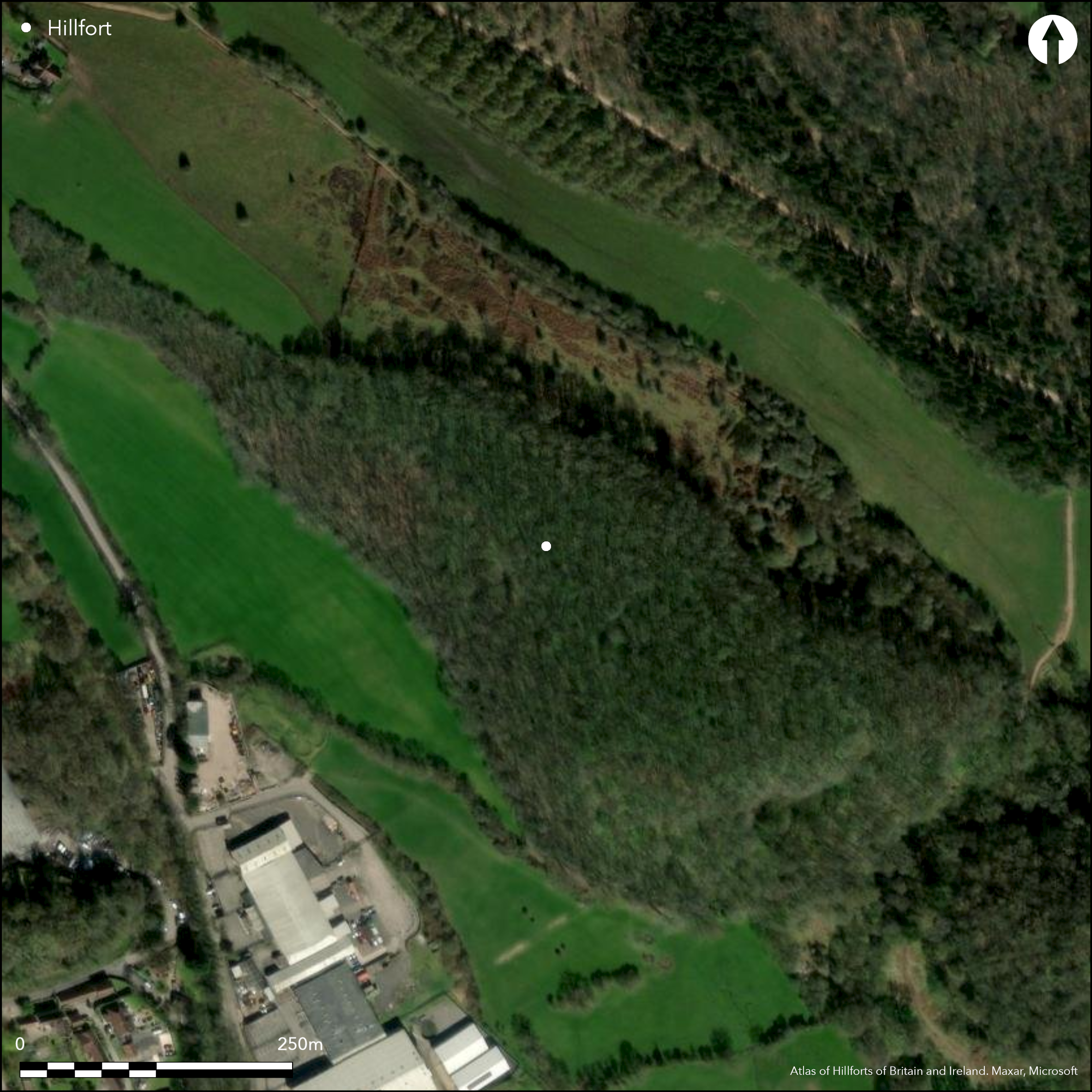
Satellite Imagery
LiDAR 1m DTM Hillshade
Satellite Imagery
Scroll left/right to view further images.
HER: Bath and NE Somerset MBN1104 (None)
NMR: ST 65 NW 2 (200574)
SM: None
NGR: ST63505800
X: 363500 Y: 158000 (OSGB36)
Univallate, partial contour hillfort located at SE end of narrow SE-NW aligned ridge of Highbury Hill, above confluences of streams with Cam Brook on SE, and River Avon on E. Very steep/precipitous slopes to SE and SW, steep on NE, moderate along ridge on NW. Sub-rectangular shape making full use of the topography with internal area c. 3ha. Very dense overgrown woodland makes interpretation difficult, with SE and SW sides seemingly protected by the precipitous slopes. Traces of stony bank and ditch from SE, through E side, to NE and NW. Bank appears to vary from 5m on NE to 8m wide on NW and to only 0.5m high, cutting across the ridge on the NW. Ditch c. 10m wide and to 0.2m deep on NW, but lies c. 10m below bank on NE at c. 8m wide, with possible counterscarp. Infilled and becomes track on N, but defined towards S where stops just short of entrance. Four gaps in bank on SE and NW, with possible original entrance on SE, but now only a vague farm track through. Possible hoard of Roman silver coins found during hedge repairing on Highbury Hill in late 18th century; subsequently sold in Bristol. Unmanaged, overgrown, deciduous woodland (with Sweet Chestnut). Much denuded. Minimal investigations, undated.
Citizen Science: ✓
Reliability of Data: Confirmed
Reliability of Interpretation: Confirmed
X: -281102 Y: 6678072 (EPSG: 3857)
Longitude: -2.5251785459746605 Latitude: 51.31987427302346 (EPSG:4326)
Country: England; None
Current County or Unitary Authority: Bath and NE Somerset
Historic County: Somerset
Current Parish/Community/Council/Townland: Clutton; High Littleton
Possible patchy quarrying on SW slope.
| Extant | ✓ |
| Cropmark | ✗ |
| Likely Destroyed | ✗ |
Unmanaged, overgrown, deciduous woodland (with Sweet Chestnut),
| Woodland | ✓ |
| Commercial Forestry Plantation | ✗ |
| Parkland | ✗ |
| Pasture (Grazing) | ✗ |
| Arable | ✗ |
| Scrub/Bracken | ✓ |
| Bare Outcrop | ✗ |
| Heather/Moorland | ✗ |
| Heath | ✗ |
| Built-up | ✗ |
| Coastal Grassland | ✗ |
| Other | ✗ |
Univallate, partial contour hillfort located at SE end of narrow SE-NW aligned ridge of Highbury Hill, above confluences of streams with Cam Brook on SE, and River Avon on E. Very steep/ precipitous slopes to SE and SW, steep on NE, moderate along ridge on NW.
| Contour Fort | ✗ |
| Partial Contour Fort | ✓ |
| Promontory Fort | ✗ |
| Hillslope Fort | ✗ |
| Level Terrain Fort | ✗ |
| Marsh Fort | ✗ |
| Multiple Enclosure Fort | ✗ |
| Hilltop | ✓ |
| Coastal Promontory | ✗ |
| Inland Promontory | ✗ |
| Valley Bottom | ✗ |
| Knoll/Hillock/Outcrop | ✗ |
| Ridge | ✗ |
| Cliff/Plateau-edge/Scarp | ✗ |
| Hillslope | ✗ |
| Lowland | ✗ |
| Spur | ✗ |
Dominant Topographic Feature: Ridge
| North | ✗ |
| Northeast | ✗ |
| East | ✗ |
| Southeast | ✗ |
| South | ✗ |
| Southwest | ✗ |
| West | ✗ |
| Northwest | ✗ |
| Level | ✓ |
Altitude: 135.0m
Boundary Type: Parish/Townland
None.
Reliability: D - None
| Pre 1200BC | ✗ |
| 1200BC - 800BC | ✗ |
| 800BC - 400BC | ✗ |
| 400BC - AD50 | ✗ |
| AD50 - AD400 | ✗ |
| AD400 - AD 800 | ✗ |
| Post AD800 | ✗ |
| Unknown | ✓ |
| Pre Hillfort: | None |
| Post Hillfort: | Possible hoard of Roman silver coins found during hedge repairing on Highbury Hill in late 18th century; subsequently sold in Bristol. |
Mention Rev. J. Skinner early 19th century. Field investigation 1965 - no details. Re-discovered by P. Fowler (after Rev. J. Skinner) 1972. LiDAR survey Citizen Science information 2014.
| Other (1965): | Field investigation - no details. |
| Other (1972): | Re-discovered by P. Fowler. |
| LiDAR Survey (2014): | Citizen Science information. |
| 1st Identified Written Reference (None): | Rev. J. Skinner. |
None.
Stream below SE corner.
| None | ✓ |
| Spring | ✗ |
| Stream | ✗ |
| Pool | ✗ |
| Flush | ✗ |
| Well | ✗ |
| Other | ✗ |
None
| No Known Features | ✓ |
| Round Stone Structures | ✗ |
| Rectangular Stone Structures | ✗ |
| Curvilinear Platforms | ✗ |
| Other Roundhouse Evidence | ✗ |
| Pits | ✗ |
| Quarry Hollows | ✗ |
| Other | ✗ |
None
| No Known Excavation | ✓ |
| Pits | ✗ |
| Postholes | ✗ |
| Roundhouses | ✗ |
| Rectangular Structures | ✗ |
| Roads/Tracks | ✗ |
| Quarry Hollows | ✗ |
| Other | ✗ |
| Nothing Found | ✗ |
None
| No Known Geophysics | ✓ |
| Pits | ✗ |
| Roundhouses | ✗ |
| Rectangular Structures | ✗ |
| Roads/Tracks | ✗ |
| Quarry Hollows | ✗ |
| Other | ✗ |
| Nothing Found | ✗ |
None
| No Known Finds | ✓ |
| Pottery | ✗ |
| Metal | ✗ |
| Metalworking | ✗ |
| Human Bones | ✗ |
| Animal Bones | ✗ |
| Lithics | ✗ |
| Environmental | ✗ |
| Other | ✗ |
None
| APs Not Checked | ✓ |
| None | ✗ |
| Roundhouses | ✗ |
| Rectangular Structures | ✗ |
| Pits | ✗ |
| Postholes | ✗ |
| Roads/Tracks | ✗ |
| Other | ✗ |
Four gaps in bank on SE and NW, with possible original entrance on SE, but now only a vague farm track through.
| 4: | None |
| 2: | None |
Guard Chambers: ✗
Chevaux de Frise: ✗
| 1. Simple Gap (South east): | Now only vague farm track nthrough. |
SE and SW sides seemingly protected by the precipitous slopes. Traces of stony bank and ditch from SE, through E side, to NE and NW. Bank appears to vary from 5m on NE to 8m wide on NW and to only 0.5m high, cutting across the ridge on the NW. Ditch c. 10m wide and to 0.2m deep on NW, but lies c. 10m below bank on NE at c. 8m wide, with possible counterscarp. Infilled and becomes track on N, but defined towards S where stops just short of entrance.
| Area 1: | 3.0ha. |
| Total: | 3.0ha. |
Total Footprint Area: Noneha.
None
| ✗ | None |
| ✗ | SE and SW seemingly protected by precipitous slopes. |
| NE Quadrant: | 1 |
| SE Quadrant: | 0 |
| SW Quadrant: | 0 |
| NW Quadrant: | 1 |
| Total: | 1 |
| Partial Univallate | ✓ |
| Univallate | ✗ |
| Partial Bivallate | ✗ |
| Bivallate | ✗ |
| Partial Multivallate | ✗ |
| Multivallate | ✗ |
| Unknown | ✗ |
| Partial Univallate | ✗ |
| Univallate | ✗ |
| Partial Bivallate | ✗ |
| Bivallate | ✗ |
| Partial Multivallate | ✗ |
| Multivallate | ✗ |
Possible stone bank. Possible counterscarp on NE side.
| None | ✗ |
| Earthen Bank | ✓ |
| Stone Wall | ✗ |
| Rubble | ✓ |
| Wall-walk | ✗ |
| Evidence of Timber | ✗ |
| Vitrification | ✗ |
| Other Burning | ✗ |
| Palisade | ✗ |
| Counter Scarp Bank | ✓ |
| Berm | ✗ |
| Unfinished | ✗ |
| Other | ✗ |
None
| None | ✗ |
| Earthen Bank | ✗ |
| Stone Wall | ✗ |
| Murus Duplex | ✗ |
| Timber-framed | ✗ |
| Timber-laced | ✗ |
| Vitrification | ✗ |
| Other Burning | ✗ |
| Palisade | ✗ |
| Counter Scarp Bank | ✗ |
| Berm | ✗ |
| Unfinished | ✗ |
| No Known Excavation | ✓ |
| Other | ✗ |
| ✗ | None |
| ✓ | Ditch infilled and becomes track to NE. |
Number of Ditches: 1
| ✗ | None |
Burrow, I. 1981. Hillfort and hill-top settlement in Somerset in the first to eighth centuries AD, British Archaeological Report (BAR) British Series 1, 91, 220-1.
Coombs, H. and Coombs, P. 1971. Journal of a Somerset Rector 1803-1834, 108.
Fowler, P.J. and Fowler, R.L. 1972. Council for British Archaeology : Group 12 (Wessex) and Group 13 (South West) : Archaeological review, 7, 24.
Skinner, Rev. J. MSS 26 (1799-1826), 26B-29.
Atlas of Hillforts:
Wikidata:
This work is licensed under CC BY-SA 4.0

 and should be cited as:
Lock, Gary and Ralston, Ian. 2024. Atlas of Hillforts of Britain and Ireland. Available at: https://hillforts.arch.ox.ac.uk
Document Version 1.1