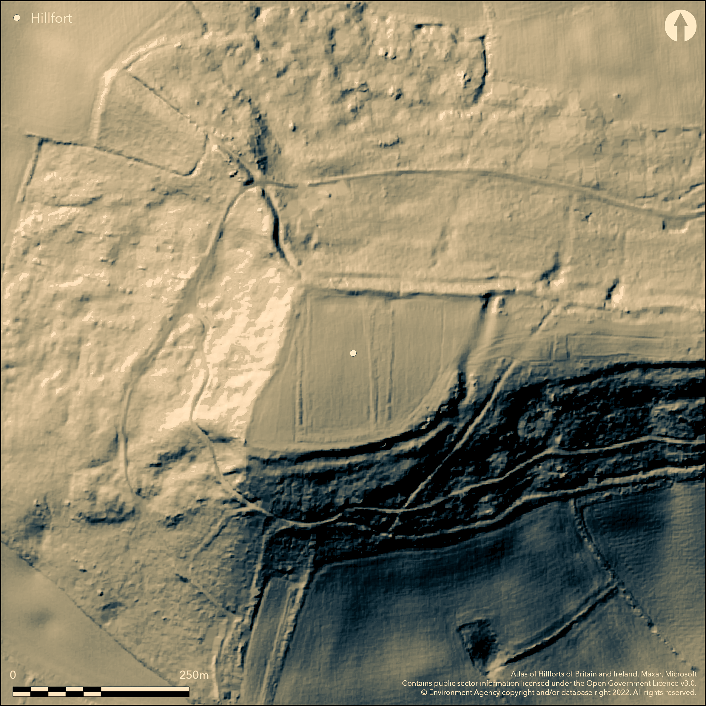
LiDAR 1m DTM Hillshade
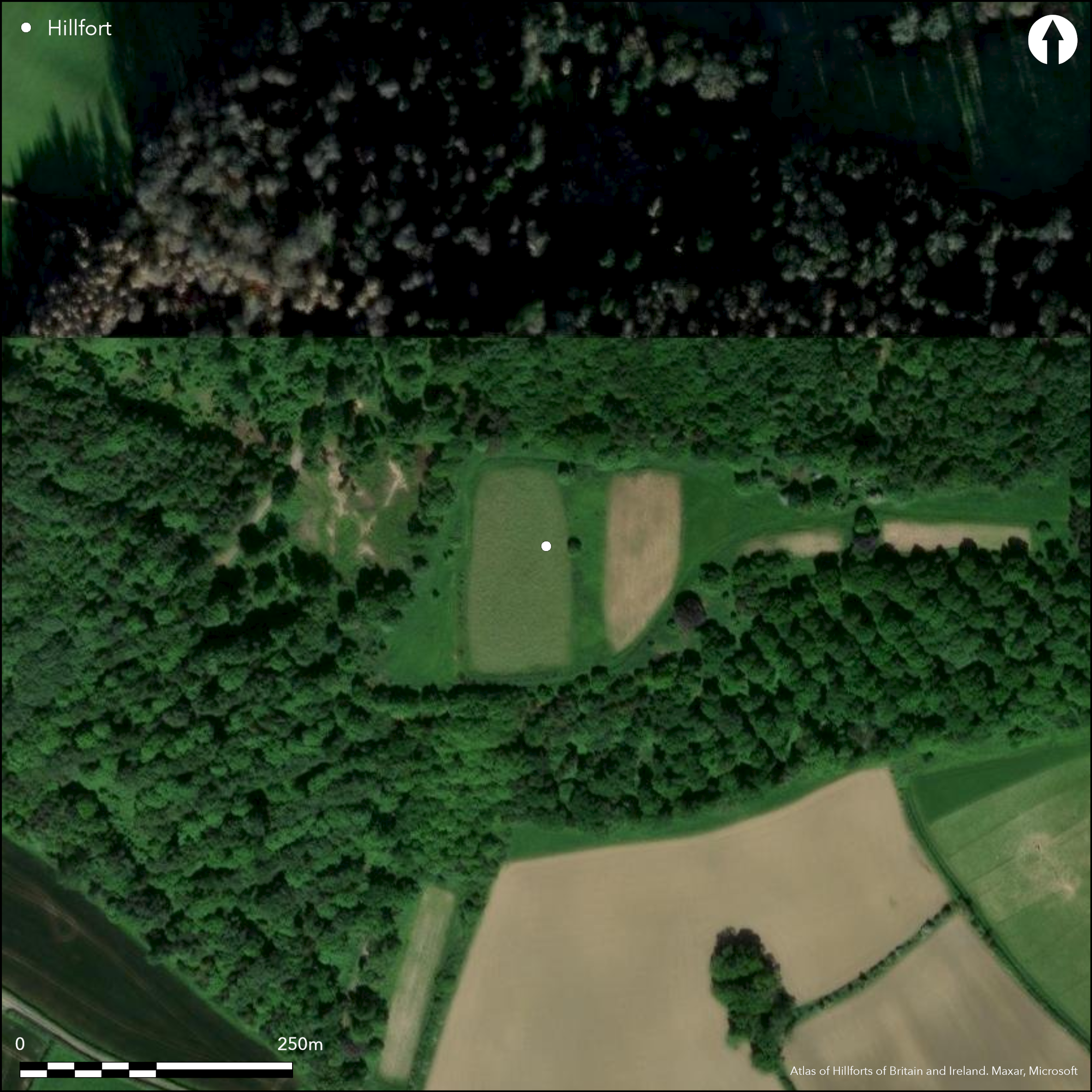
Satellite Imagery
LiDAR 1m DTM Hillshade
Satellite Imagery
Scroll left/right to view further images.
HER: Bath and NE Somerset MBN1306 (None)
NMR: ST 66 SE 11 (201138)
SM: 1002487
NGR: ST67256366
X: 367250 Y: 163660 (OSGB36)
Univallate, contour hillfort located in prominent position on W end of flat-topped hill above streams flowing into River Avon on NE. Surrounding slopes steep, except on E where level along ridge before steep slopes. Hillfort utilises topography well. Sub-rectangular shape, measuring 245m NE-SW by 158m enclosing c. 2.4ha, with footprint measurement 262m by 177m and area c. 5.1ha. The massive Wansdyke masks the original and, probable Iron Age, defences (see Maes Knoll Camp -Atlas No 3970). It uses them on the N side and seems to overlie them at the E end, where the scarp is much better defined than at the W end, where the dyke definitely ends against the corner of the fort. Berm at the foot of the scarp also probably part of the dyke. Early Iron Age pottery found on site. Fieldwork during the 1970's found a ploughed-out crossbank and a 4th to 5th century AD extension against Wansdyke. This possible 'annexe' or addition to the site on the E requires further investigation. No entrance defined, but possibly blocked by Wansdyke on N. Access route will have masked any original feature. Evaluation by R. Iles, Bristol Archaeological Research Group in 1984 produced no features. Ploughed and cultivated interior. Wooded surrounds with grassy lozenge-shaped access from E. On 1st Ed. OS map (1885).
Citizen Science: ✓
Reliability of Data: Confirmed
Reliability of Interpretation: Confirmed
X: -275170 Y: 6687183 (EPSG: 3857)
Longitude: -2.471890494100489 Latitude: 51.37099555094901 (EPSG:4326)
Country: England
Current County or Unitary Authority: Bath and NE Somerset
Historic County: Somerset
Current Parish/Community/Council/Townland: Marksbury
Access to site from E. Site belongs to Duchy of Cornwall and used as a shoot. On Heritage at Risk Register (2015).
| Extant | ✓ |
| Cropmark | ✗ |
| Likely Destroyed | ✗ |
Ploughed and cultivated interior. Wooded surrounds with grassy losenge-shaped access from E.
| Woodland | ✗ |
| Commercial Forestry Plantation | ✗ |
| Parkland | ✗ |
| Pasture (Grazing) | ✗ |
| Arable | ✓ |
| Scrub/Bracken | ✗ |
| Bare Outcrop | ✗ |
| Heather/Moorland | ✗ |
| Heath | ✗ |
| Built-up | ✗ |
| Coastal Grassland | ✗ |
| Other | ✗ |
Univallate, contour hillfort located in prominent position on W end of flat-topped hill above streams flowing into River Avon on NE. Surrounding slopes steep, except on E where level along ridge before steep slopes.
| Contour Fort | ✓ |
| Partial Contour Fort | ✗ |
| Promontory Fort | ✗ |
| Hillslope Fort | ✗ |
| Level Terrain Fort | ✗ |
| Marsh Fort | ✗ |
| Multiple Enclosure Fort | ✗ |
| Hilltop | ✓ |
| Coastal Promontory | ✗ |
| Inland Promontory | ✗ |
| Valley Bottom | ✗ |
| Knoll/Hillock/Outcrop | ✗ |
| Ridge | ✗ |
| Cliff/Plateau-edge/Scarp | ✗ |
| Hillslope | ✗ |
| Lowland | ✗ |
| Spur | ✗ |
Dominant Topographic Feature: Hill top
| North | ✗ |
| Northeast | ✗ |
| East | ✗ |
| Southeast | ✗ |
| South | ✗ |
| Southwest | ✗ |
| West | ✗ |
| Northwest | ✗ |
| Level | ✓ |
Altitude: 177.0m
N/A
Early? Iron Age pottery found on site.
Reliability: C - Low
| Pre 1200BC | ✗ |
| 1200BC - 800BC | ✗ |
| 800BC - 400BC | ✓ |
| 400BC - AD50 | ✗ |
| AD50 - AD400 | ✗ |
| AD400 - AD 800 | ✗ |
| Post AD800 | ✗ |
| Unknown | ✗ |
| Pre Hillfort: | None |
| Post Hillfort: | None |
| Artefactual: | Iron Age pottery. |
In Aubrey's Monumenta Britannica (1665-1693). On 1st Ed. OS map (1885). Field investigations 1961, 1965 - no details. Evaluation R. Iles Bristol Archaeological Research Group 1984.
| 1st Identified Map Depiction (1885): | OS map. |
| Other (1980): | Visit by Hillfort Study Group |
| Other (1984): | Evaluation R. Iles Bristol Archaeological Research Group. |
| 1st Identified Written Reference (None): | None |
| Other (None): | Field investigations - no details. |
Fieldwork during the 1970's found a ploughed out crossbank. Early? Iron Age pottery.
Springs and stream nearby.
| None | ✓ |
| Spring | ✗ |
| Stream | ✗ |
| Pool | ✗ |
| Flush | ✗ |
| Well | ✗ |
| Other | ✗ |
Fieldwork during the 1970's found a ploughed out crossbank.
| No Known Features | ✗ |
| Round Stone Structures | ✗ |
| Rectangular Stone Structures | ✗ |
| Curvilinear Platforms | ✗ |
| Other Roundhouse Evidence | ✗ |
| Pits | ✗ |
| Quarry Hollows | ✗ |
| Other | ✓ |
None
| No Known Excavation | ✓ |
| Pits | ✗ |
| Postholes | ✗ |
| Roundhouses | ✗ |
| Rectangular Structures | ✗ |
| Roads/Tracks | ✗ |
| Quarry Hollows | ✗ |
| Other | ✗ |
| Nothing Found | ✗ |
None
| No Known Geophysics | ✓ |
| Pits | ✗ |
| Roundhouses | ✗ |
| Rectangular Structures | ✗ |
| Roads/Tracks | ✗ |
| Quarry Hollows | ✗ |
| Other | ✗ |
| Nothing Found | ✗ |
Early? Iron Age pottery.
| No Known Finds | ✗ |
| Pottery | ✓ |
| Metal | ✗ |
| Metalworking | ✗ |
| Human Bones | ✗ |
| Animal Bones | ✗ |
| Lithics | ✗ |
| Environmental | ✗ |
| Other | ✗ |
None
| APs Not Checked | ✓ |
| None | ✗ |
| Roundhouses | ✗ |
| Rectangular Structures | ✗ |
| Pits | ✗ |
| Postholes | ✗ |
| Roads/Tracks | ✗ |
| Other | ✗ |
No entrance defined, but possibly blocked by Wansdyke on N. Access route from this will have masked any original feature so not defined.
| 0: | None |
| 2: | None |
Guard Chambers: ✗
Chevaux de Frise: ✗
The massive Wansdyke masks the original and, probable Iron Age, defences. It uses them on the N side and seems to overlie them at the E end, where the scarp is much better defined than at the W end, where the dyke definitely ends against the corner of the fort. Berm at the foot of the scarp also probably part of the dyke. Fieldwork during the 1970's found a ploughed out crossbank and a fourth to fifth century AD extension against the back of Wansdyke.
| Area 1: | 2.4ha. |
| Total: | 2.4ha. |
Total Footprint Area: 5.1ha.
None
| ✗ | None |
| ✓ | Affected by Wansdyke on N quadrants. |
| NE Quadrant: | 1 |
| SE Quadrant: | 1 |
| SW Quadrant: | 1 |
| NW Quadrant: | 1 |
| Total: | 1 |
| Partial Univallate | ✗ |
| Univallate | ✓ |
| Partial Bivallate | ✗ |
| Bivallate | ✗ |
| Partial Multivallate | ✗ |
| Multivallate | ✗ |
| Unknown | ✗ |
| Partial Univallate | ✗ |
| Univallate | ✗ |
| Partial Bivallate | ✗ |
| Bivallate | ✗ |
| Partial Multivallate | ✗ |
| Multivallate | ✗ |
Fieldwork during the 1970's found a ploughed out crossbank and a fourth to fifth century AD extension against the back of Wansdyke. Berm at bottom of scarp possibly part of Wansdyke rather than original fort.
| None | ✗ |
| Earthen Bank | ✓ |
| Stone Wall | ✗ |
| Rubble | ✗ |
| Wall-walk | ✗ |
| Evidence of Timber | ✗ |
| Vitrification | ✗ |
| Other Burning | ✗ |
| Palisade | ✗ |
| Counter Scarp Bank | ✗ |
| Berm | ✓ |
| Unfinished | ✗ |
| Other | ✓ |
None
| None | ✗ |
| Earthen Bank | ✗ |
| Stone Wall | ✗ |
| Murus Duplex | ✗ |
| Timber-framed | ✗ |
| Timber-laced | ✗ |
| Vitrification | ✗ |
| Other Burning | ✗ |
| Palisade | ✗ |
| Counter Scarp Bank | ✗ |
| Berm | ✗ |
| Unfinished | ✗ |
| No Known Excavation | ✓ |
| Other | ✗ |
| ✗ | None |
| ✓ | Ditch slight on SE and not visible on SW and NW. |
Number of Ditches: 1
| ✓ | Possibly later - fourth to fifth century AD extension against the back of Wansdyke. This possible 'annexe' or addition to the site on the E requires further investigation. |
Burrow, E.J. 1924. The ancient earthworks and Camps of Somerset, Cheltenham: E.J. Burrow, 92-3.
Burrow, I. 1981. Hillfort and hill-top settlement in Somerset in the first to eighth centuries AD, British Archaeological Report (BAR) British Series 1, 91, 219-20.
Fox, A. and Fox, C. 1960. Wansdyke reconsidered. Archaeol J, 115, 1-48.
Page, W. ed. 1911. Ancient earthworks, The Victoria History of Somerset, Volume Two, The Victoria History of the Counties of England, London: Constable and Co, 500.
Atlas of Hillforts:
Wikidata:
This work is licensed under CC BY-SA 4.0

 and should be cited as:
Lock, Gary and Ralston, Ian. 2024. Atlas of Hillforts of Britain and Ireland. Available at: https://hillforts.arch.ox.ac.uk
Document Version 1.1