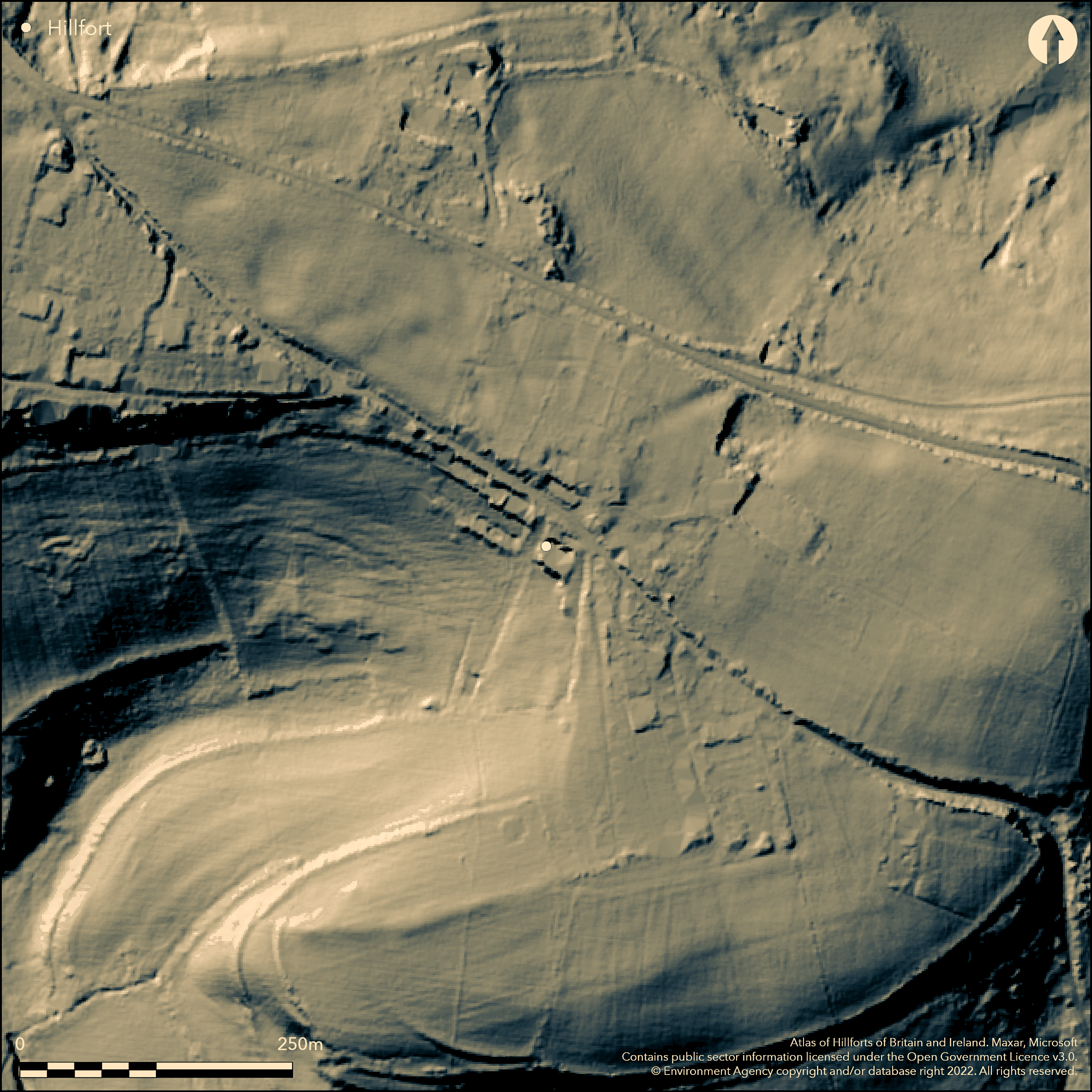
LiDAR 1m DTM Hillshade
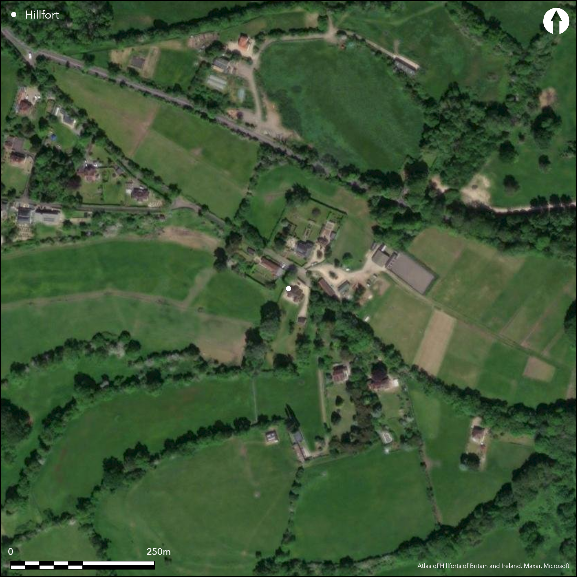
Satellite Imagery
LiDAR 1m DTM Hillshade
Satellite Imagery
Scroll left/right to view further images.
HER: Bath and NE Somerset MBN11846 (None)
NMR: None (None)
SM: None
NGR: ST75506130
X: 375500 Y: 161300 (OSGB36)
Possible, univallate, contour hillfort located on ridge above confluences of Midford Brook, Wellow Brook and Cam Brook on SE, which flow into River Avon on E. S end of site roughly follows and overlooks the River Avon, and N end of the ridge is Bathampton Down. Moderate surrounding slopes. Across the River Avon N of Bathampton Down is Little Solsbury Hill (Atlas No 3963). First investigated by South Stoke History Committee and Bath and Camerton Archaeological Society 2014. Elongated site with footprint c. 407m long by 195m and external area c. 7.9ha. Defined by possible earthen bank and ditch with outwork(s) on SE. Possible sub-circular annexe to be defined. Five breaks in ramparts, with possible complex original entrance on W. Modern gaps for turnpike road on NE and NW. Anecdotal evidence of Iron Age pottery and Roman tiles - unsubstantiated. Possible published source referring to the site as an encampment or gear (gaer, caer), by Rev. John Skinner Diary 1828/9, The British Library. Pasture interior, trees/scrub on possible banks and ditch on S and SW. Affected by farm and road on N. Earthwork survey and geophysics inconclusive (Lambdin 2002). Further investigation required as opinions vary as to whether the site is a hillfort or not. No records and further details. Undated.
Citizen Science: ✓
Reliability of Data: Unconfirmed
Reliability of Interpretation: Unconfirmed
X: -261958 Y: 6683474 (EPSG: 3857)
Longitude: -2.353210843251792 Latitude: 51.35019250689078 (EPSG:4326)
Country: England
Current County or Unitary Authority: Bath and NE Somerset
Historic County: Somerset
Current Parish/Community/Council/Townland: South Stoke
Affected by farm and roads on N. Field boundary crosses site.
| Extant | ✓ |
| Cropmark | ✗ |
| Likely Destroyed | ✗ |
Pasture interior, trees/scrub on possible banks and ditch on S and SW.
| Woodland | ✓ |
| Commercial Forestry Plantation | ✗ |
| Parkland | ✗ |
| Pasture (Grazing) | ✓ |
| Arable | ✗ |
| Scrub/Bracken | ✗ |
| Bare Outcrop | ✗ |
| Heather/Moorland | ✗ |
| Heath | ✗ |
| Built-up | ✗ |
| Coastal Grassland | ✗ |
| Other | ✗ |
Possible, univallate, contour hillfort located on ridge above confluences of Midford Brook, Wellow Brook and Cam Brook on SE, which flow into River Avon on E. S end of site roughly follows and overlooks the River Avon, and N end of the ridge is Bathampton Down. Moderate surrounding slopes.
| Contour Fort | ✓ |
| Partial Contour Fort | ✗ |
| Promontory Fort | ✗ |
| Hillslope Fort | ✗ |
| Level Terrain Fort | ✗ |
| Marsh Fort | ✗ |
| Multiple Enclosure Fort | ✗ |
| Hilltop | ✓ |
| Coastal Promontory | ✗ |
| Inland Promontory | ✗ |
| Valley Bottom | ✗ |
| Knoll/Hillock/Outcrop | ✗ |
| Ridge | ✗ |
| Cliff/Plateau-edge/Scarp | ✗ |
| Hillslope | ✗ |
| Lowland | ✗ |
| Spur | ✗ |
Dominant Topographic Feature: Hill top
| North | ✗ |
| Northeast | ✗ |
| East | ✗ |
| Southeast | ✗ |
| South | ✗ |
| Southwest | ✗ |
| West | ✗ |
| Northwest | ✗ |
| Level | ✓ |
Altitude: 126.0m
N/A
Anecdotal evidence of Iron Age pottery and Roman tiles - unsubstantiated.
Reliability: D - None
| Pre 1200BC | ✗ |
| 1200BC - 800BC | ✗ |
| 800BC - 400BC | ✗ |
| 400BC - AD50 | ✗ |
| AD50 - AD400 | ✗ |
| AD400 - AD 800 | ✗ |
| Post AD800 | ✗ |
| Unknown | ✓ |
| Pre Hillfort: | Possibly. Bronze Age spearhead found in Milford Brook nearby 1908. |
| Post Hillfort: | Possibly. Modern gaps for turnpike road (1753-55) NE and NW. |
Possible published source referring to the site as an encampment or gear (gaer, caer), by Rev. John Skinner Diary 1828/9, The British Library. First investigated as part of Atlas project by South Stoke History Committee and Bath and Camerton Archaeological Society 2014. Earthwork survey and geophysics (Lambdin 2002). LiDAR survey Citizen Science information.
| Earthwork Survey (2002): | None |
| Geophysical Survey (2002): | None |
| Other (2014): | First investigated by South Stoke History Committee and Bath and Camerton Archaeological Society |
| LiDAR Survey (2014): | Citizen Science information. |
| 1st Identified Written Reference (None): | Possible published source referring to the site as an encampment or gear (gaer, caer), by Rev. John Skinner Diary 1828/9, The British Library. |
Modern retaining wall. Possible quarry hollows. Anecdotal evidence of Iron Age pottery and Roman tiles - unsubstantiated.
Spring and steam within fort. Midford Brook, Wellow Brook and Cam Brook nearby and River Avon to E.
| None | ✗ |
| Spring | ✓ |
| Stream | ✓ |
| Pool | ✗ |
| Flush | ✗ |
| Well | ✗ |
| Other | ✗ |
Modern retaining wall. Possible quarry hollows.
| No Known Features | ✗ |
| Round Stone Structures | ✗ |
| Rectangular Stone Structures | ✗ |
| Curvilinear Platforms | ✗ |
| Other Roundhouse Evidence | ✗ |
| Pits | ✗ |
| Quarry Hollows | ✓ |
| Other | ✗ |
None
| No Known Excavation | ✓ |
| Pits | ✗ |
| Postholes | ✗ |
| Roundhouses | ✗ |
| Rectangular Structures | ✗ |
| Roads/Tracks | ✗ |
| Quarry Hollows | ✗ |
| Other | ✗ |
| Nothing Found | ✗ |
None
| No Known Geophysics | ✓ |
| Pits | ✗ |
| Roundhouses | ✗ |
| Rectangular Structures | ✗ |
| Roads/Tracks | ✗ |
| Quarry Hollows | ✗ |
| Other | ✗ |
| Nothing Found | ✗ |
Anecdotal evidence of Iron Age pottery and Roman tiles - unsubstantiated.
| No Known Finds | ✗ |
| Pottery | ✓ |
| Metal | ✗ |
| Metalworking | ✗ |
| Human Bones | ✗ |
| Animal Bones | ✗ |
| Lithics | ✗ |
| Environmental | ✗ |
| Other | ✓ |
None
| APs Not Checked | ✓ |
| None | ✗ |
| Roundhouses | ✗ |
| Rectangular Structures | ✗ |
| Pits | ✗ |
| Postholes | ✗ |
| Roads/Tracks | ✗ |
| Other | ✗ |
Five breaks in ramparts, with possible complex original entrance on W. Modern gaps for turnpike road (1753-55) on NE and NW. Possible complex entrance on W. All yet to be surveyed and confirmed,
| 5: | None |
| 2: | Possible complex entrance on W. |
Guard Chambers: ✗
Chevaux de Frise: ✗
| 1. Other Forms (West): | Complex entrance - to be defined. |
Defined by possible earthen bank and ditch with outwork(s) on SE.
| Area 1: | Noneha. |
| Total: | Noneha. |
Total Footprint Area: 7.9ha.
None
| ✗ | Interior area not defined. |
| ✓ | NW side confused by farm and road activity. |
| NE Quadrant: | 1 |
| SE Quadrant: | 1 |
| SW Quadrant: | 1 |
| NW Quadrant: | 1 |
| Total: | 1 |
| Partial Univallate | ✗ |
| Univallate | ✓ |
| Partial Bivallate | ✗ |
| Bivallate | ✗ |
| Partial Multivallate | ✗ |
| Multivallate | ✗ |
| Unknown | ✗ |
| Partial Univallate | ✗ |
| Univallate | ✗ |
| Partial Bivallate | ✗ |
| Bivallate | ✗ |
| Partial Multivallate | ✗ |
| Multivallate | ✗ |
None
| None | ✗ |
| Earthen Bank | ✓ |
| Stone Wall | ✗ |
| Rubble | ✗ |
| Wall-walk | ✗ |
| Evidence of Timber | ✗ |
| Vitrification | ✗ |
| Other Burning | ✗ |
| Palisade | ✗ |
| Counter Scarp Bank | ✗ |
| Berm | ✗ |
| Unfinished | ✗ |
| Other | ✗ |
None
| None | ✗ |
| Earthen Bank | ✗ |
| Stone Wall | ✗ |
| Murus Duplex | ✗ |
| Timber-framed | ✗ |
| Timber-laced | ✗ |
| Vitrification | ✗ |
| Other Burning | ✗ |
| Palisade | ✗ |
| Counter Scarp Bank | ✗ |
| Berm | ✗ |
| Unfinished | ✗ |
| No Known Excavation | ✓ |
| Other | ✗ |
| ✗ | None |
| ✓ | None |
Number of Ditches: 1
| ✓ | Possible sub-circular annexe - to be defined. |
Lambdin, C. 2002. A Survey of the Roman Remains in the Parish of South Stoke. Unpublished, University of Bristol.
Skinner, Rev J. 1828-9. Possible published source referring to the site as an encampment or gear (gaer, caer) by Rev. John Skinner Diary 1828/9, The British Library.
Atlas of Hillforts:
Wikidata:
This work is licensed under CC BY-SA 4.0

 and should be cited as:
Lock, Gary and Ralston, Ian. 2024. Atlas of Hillforts of Britain and Ireland. Available at: https://hillforts.arch.ox.ac.uk
Document Version 1.1