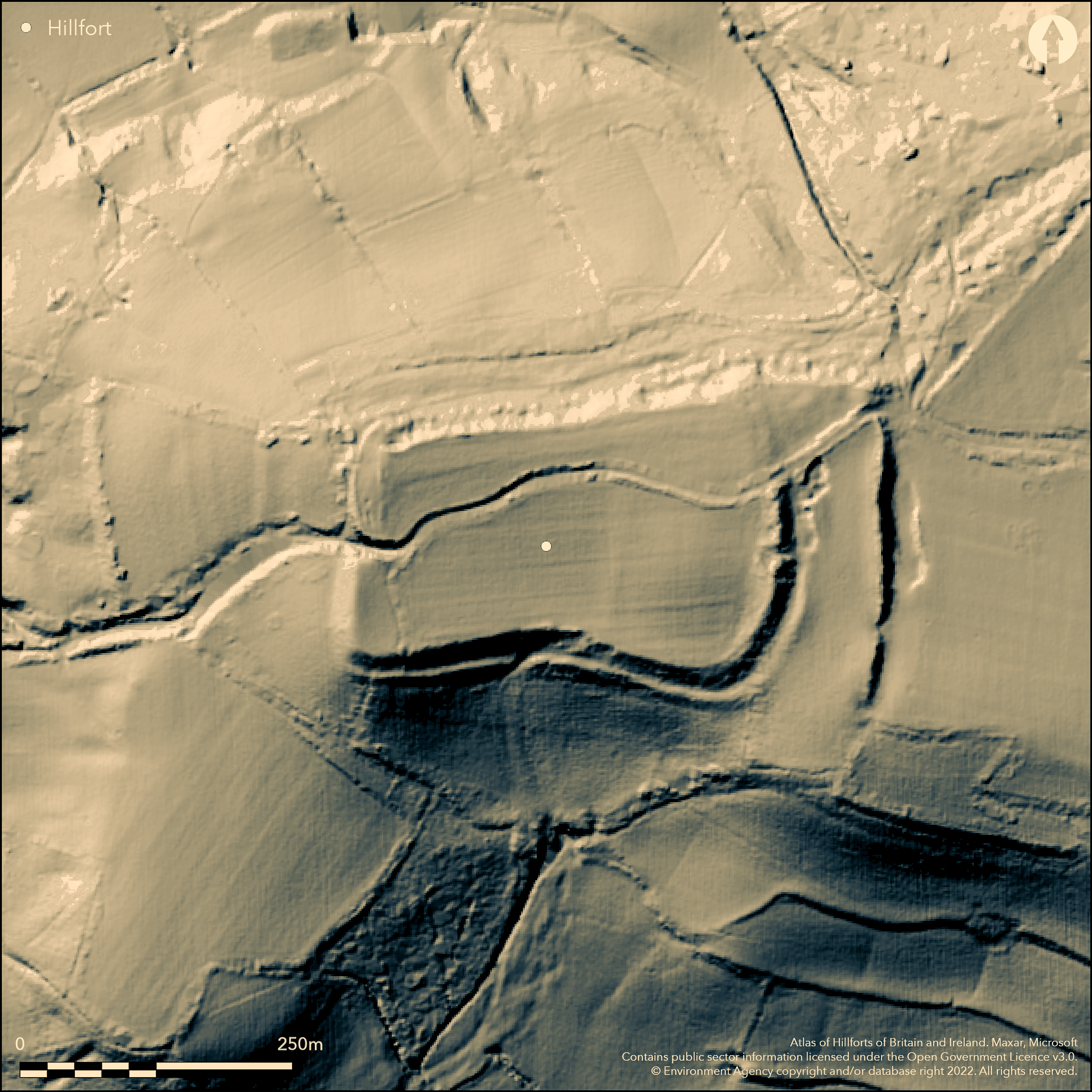
LiDAR 1m DTM Hillshade
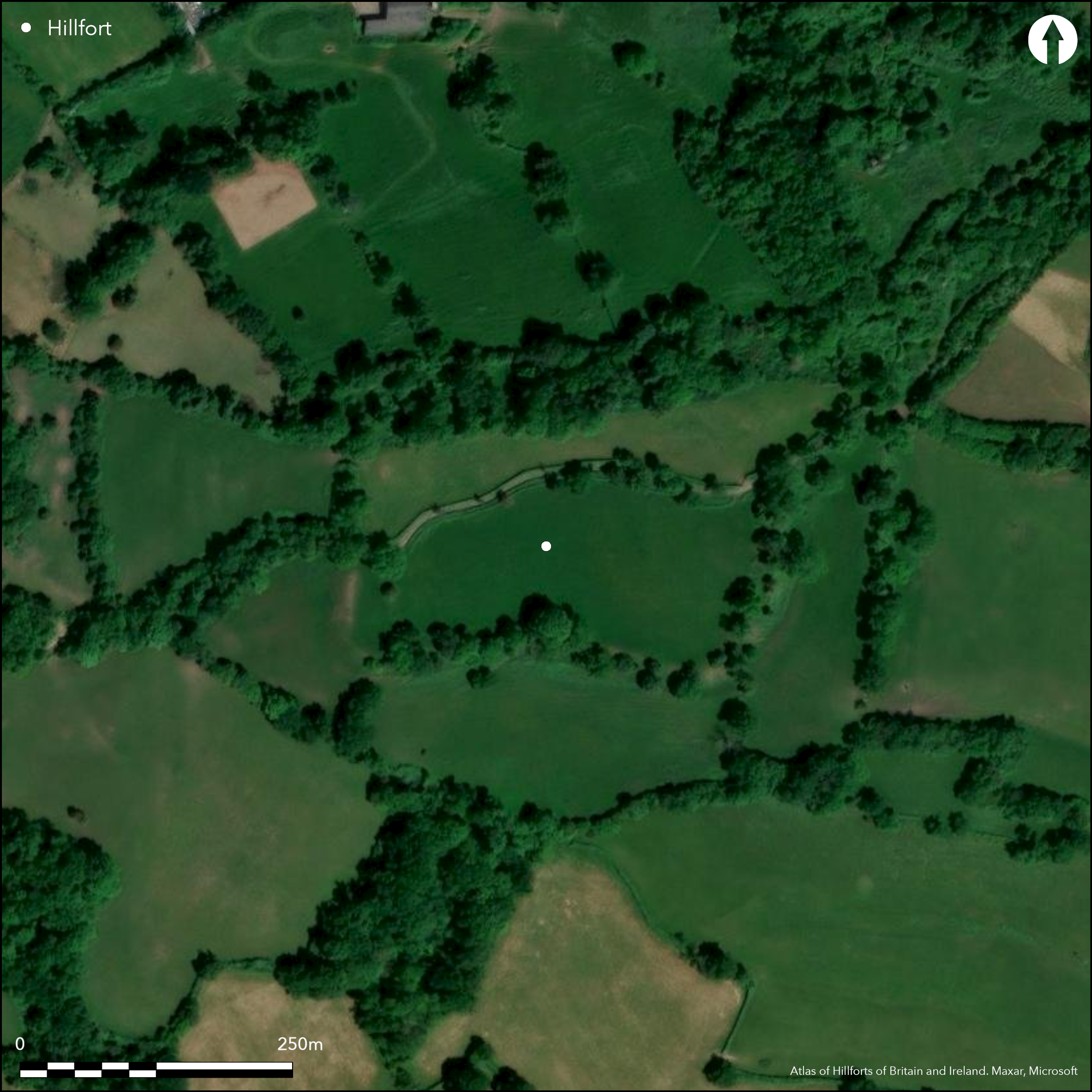
Satellite Imagery
LiDAR 1m DTM Hillshade
Satellite Imagery
Scroll left/right to view further images.
HER: Bath and NE Somerset MBN608 (None)
NMR: ST 55 NE 4 (197270)
SM: 1004526
NGR: ST58205850
X: 358200 Y: 158500 (OSGB36)
Possible univallate contour hillfort located on W-facing spur of summit of prominent Burledge Hill, overlooking the Chew Valley Lake. Extensive views. Steep or very steep surrounding slopes from N and W round to S, level to moderate along ridge on E. Site has suffered from ploughing, quarrying and extensive dense scrub and tree growth, and, as such, present condition and extent of earthworks difficult to assess and can only be estimated. Rectangular form encloses c. 2.2ha and formerly defined by single rampart to c. 4.5m high externally and c. 0.6m high internally, with outer ditch to 7m wide and c. 1.5m deep. Outwork on E possibly giving additional enclosure, but not exactly an annexe. N side now largely quarried away. Mendip Hills AONB NMP Project 2006-09 and investigations by Bath and Camerton Archaeological Society 2014, give most up-to-date assessments, with patches of ramparts still visible on E, S and W. Part excavations 1955 found banks largely stone-built with some walling (ApSimon 1957; 1977). Possible original entrances on NE and W, latter with long hollow way from below, with slight out-turn on N. Modern path leads through this and across site W-NE and through gap on NE, across 'annexe' and through outworks on NE. Another gap through main bank on E, just below that mentioned above, and possibly one on S, probably modern, but not assessed. Interior excavation found postholes, pits, paving, gullies and finds included iron working slag, a saddle quern rubber, Iron Age pottery and animal bone. Interior ploughed and down to pasture. Undated.
Citizen Science: ✓
Reliability of Data: Confirmed
Reliability of Interpretation: Confirmed
X: -289574 Y: 6678808 (EPSG: 3857)
Longitude: -2.6012881188771657 Latitude: 51.32400429616565 (EPSG:4326)
Country: England; None
Current County or Unitary Authority: Bath and NE Somerset
Historic County: Somerset
Current Parish/Community/Council/Townland: West Harptree; Stowey-Sutton
Very overgrown earthworks with quarry damage.
| Extant | ✓ |
| Cropmark | ✗ |
| Likely Destroyed | ✓ |
Interior ploughed and down to pasture. Much scrub and tree growth on earthworks. Quarrying.
| Woodland | ✗ |
| Commercial Forestry Plantation | ✗ |
| Parkland | ✗ |
| Pasture (Grazing) | ✓ |
| Arable | ✗ |
| Scrub/Bracken | ✓ |
| Bare Outcrop | ✗ |
| Heather/Moorland | ✗ |
| Heath | ✗ |
| Built-up | ✗ |
| Coastal Grassland | ✗ |
| Other | ✓ |
Univallate possible contour hillfort located on W-facing spur of summit of prominent Burledge Hill, overlooking the Chew Valley Lake. Extensive views. Steep or very steep surrounding slopes from N and W round to S, level to moderate along ridge on E.
| Contour Fort | ✓ |
| Partial Contour Fort | ✗ |
| Promontory Fort | ✗ |
| Hillslope Fort | ✗ |
| Level Terrain Fort | ✗ |
| Marsh Fort | ✗ |
| Multiple Enclosure Fort | ✗ |
| Hilltop | ✗ |
| Coastal Promontory | ✗ |
| Inland Promontory | ✗ |
| Valley Bottom | ✗ |
| Knoll/Hillock/Outcrop | ✗ |
| Ridge | ✗ |
| Cliff/Plateau-edge/Scarp | ✗ |
| Hillslope | ✗ |
| Lowland | ✗ |
| Spur | ✓ |
Dominant Topographic Feature: Spur
| North | ✗ |
| Northeast | ✗ |
| East | ✗ |
| Southeast | ✗ |
| South | ✗ |
| Southwest | ✗ |
| West | ✗ |
| Northwest | ✗ |
| Level | ✓ |
Altitude: 152.0m
Boundary Type: Parish/Townland
None.
Reliability: D - None
| Pre 1200BC | ✗ |
| 1200BC - 800BC | ✗ |
| 800BC - 400BC | ✗ |
| 400BC - AD50 | ✗ |
| AD50 - AD400 | ✗ |
| AD400 - AD 800 | ✗ |
| Post AD800 | ✗ |
| Unknown | ✓ |
| Pre Hillfort: | None |
| Post Hillfort: | None |
Shown by Strachey on Map of Somerset 1736. Mentioned by Stukeley in 'Itinerarium Curiosum' 1776, 77-9 as 'Bow Ditches'. Part excavation by H.M. Apsimon 1955. Field investigations 1959, 1966 - no details. Mendip Hills AONB NMP 2006-09. LiDAR survey Citizen Science information 2014.
| 1st Identified Map Depiction (1736): | Shown by Strachey on Map of Somerset |
| 1st Identified Written Reference (1776): | Mentioned by Stukeley in 'Itinerarium Curiosum'. |
| Excavation (1955): | A.M. Apsimon. |
| LiDAR Survey (2014): | Citizen Science information. |
| Other (None): | Field investigations - no details. |
| Other (None): | Mendip Hills AONB NMP. |
Excavation produced post holes, pits, paving and gullies and finds included iron working slag, a saddle quern rubber, Iron Age pottery and animal bone.
None
| None | ✓ |
| Spring | ✗ |
| Stream | ✗ |
| Pool | ✗ |
| Flush | ✗ |
| Well | ✗ |
| Other | ✗ |
None
| No Known Features | ✓ |
| Round Stone Structures | ✗ |
| Rectangular Stone Structures | ✗ |
| Curvilinear Platforms | ✗ |
| Other Roundhouse Evidence | ✗ |
| Pits | ✗ |
| Quarry Hollows | ✗ |
| Other | ✗ |
Excavation produced postholes, pits, paving and gullies and finds included iron working slag, a saddle quern rubber, Iron Age pottery and animal bone.
| No Known Excavation | ✗ |
| Pits | ✓ |
| Postholes | ✓ |
| Roundhouses | ✗ |
| Rectangular Structures | ✗ |
| Roads/Tracks | ✗ |
| Quarry Hollows | ✗ |
| Other | ✓ |
| Nothing Found | ✗ |
None
| No Known Geophysics | ✓ |
| Pits | ✗ |
| Roundhouses | ✗ |
| Rectangular Structures | ✗ |
| Roads/Tracks | ✗ |
| Quarry Hollows | ✗ |
| Other | ✗ |
| Nothing Found | ✗ |
Finds from excavation included iron working slag, a saddle quern rubber, Iron Age pottery and animal bone.
| No Known Finds | ✗ |
| Pottery | ✓ |
| Metal | ✗ |
| Metalworking | ✓ |
| Human Bones | ✗ |
| Animal Bones | ✓ |
| Lithics | ✓ |
| Environmental | ✗ |
| Other | ✗ |
None
| APs Not Checked | ✓ |
| None | ✗ |
| Roundhouses | ✗ |
| Rectangular Structures | ✗ |
| Pits | ✗ |
| Postholes | ✗ |
| Roads/Tracks | ✗ |
| Other | ✗ |
Possible original entrances on NE and W, latter with long hollow way from below, with slight out-turn on N. Modern path leads through this and across site W-NE and through gap on NE, across 'annexe' and through outworks on NE. Another gap through main bank on E, just below that mentioned above, and possibly one on S, probably modern, but not assessed.
| 4: | Possible modern gaps on E and S. |
| 2: | Possibly two - on NE and W. |
Guard Chambers: ✗
Chevaux de Frise: ✗
| 1. Out-turned (West): | Slight out-turn on N. |
| 1. Hollow Way (West): | Long hollow way from below. |
| 2. Simple Gap (North east): | None |
Formerly defined by single rampart to c. 4.5m high externally and c. 0.6m high internally, with outer ditch to 7m wide and c. 1.5m deep. Outwork on E possibly giving additional enclosure, but not exactly an annexe. N side now largely quarried away. Patches of defences still visible on E, S and W.
| Area 1: | 2.2ha. |
| Total: | 2.2ha. |
Total Footprint Area: Noneha.
None
| ✓ | Likely two phases of occupation. |
| ✗ | Patches of defences only, but quadrants estimated. |
| NE Quadrant: | 1 |
| SE Quadrant: | 1 |
| SW Quadrant: | 1 |
| NW Quadrant: | 1 |
| Total: | 1 |
| Partial Univallate | ✗ |
| Univallate | ✓ |
| Partial Bivallate | ✗ |
| Bivallate | ✗ |
| Partial Multivallate | ✗ |
| Multivallate | ✗ |
| Unknown | ✗ |
| Partial Univallate | ✗ |
| Univallate | ✗ |
| Partial Bivallate | ✗ |
| Bivallate | ✗ |
| Partial Multivallate | ✗ |
| Multivallate | ✗ |
Undergrowth precludes accurate assessment.
| None | ✗ |
| Earthen Bank | ✓ |
| Stone Wall | ✓ |
| Rubble | ✓ |
| Wall-walk | ✗ |
| Evidence of Timber | ✗ |
| Vitrification | ✗ |
| Other Burning | ✗ |
| Palisade | ✗ |
| Counter Scarp Bank | ✗ |
| Berm | ✗ |
| Unfinished | ✗ |
| Other | ✗ |
Excavations 1955 found banks largely stone-built with some walling.
| None | ✗ |
| Earthen Bank | ✗ |
| Stone Wall | ✓ |
| Murus Duplex | ✗ |
| Timber-framed | ✗ |
| Timber-laced | ✗ |
| Vitrification | ✗ |
| Other Burning | ✗ |
| Palisade | ✗ |
| Counter Scarp Bank | ✗ |
| Berm | ✗ |
| Unfinished | ✗ |
| No Known Excavation | ✗ |
| Other | ✓ |
| ✗ | None |
| ✓ | Patches only. |
Number of Ditches: 1
| ✓ | Outwork on E possibly giving additional enclosure, not exactly an annexe as S side has no bank, but nearly there. |
ApSimon,A.M., 1957. Archaeological Notes - Excavations at Burledge Camp, Somerset, Proc Univ Bristol Spelaeol Soc, 8(1), 40.
ApSimon, A. M. 1977. in eds P.A. Rahtz and E. Greenfield, Excavations at Chew Valley Lake, DoE Arch Rep No 8, 168-70 (HMSO).
Burrow, I. 1981. Hillfort and hill-top settlement in Somerset in the first to eighth centuries AD, British Archaeological Report (BAR) British Series 1, 91, 226.
Crook, K.M. and Tratman, E.K. 1946. Field Work, (Gloucesterhire and Somerset, 1947), Proc Univ Bristol Spelaeol Soc, 6(1), 42-54.
Crook, K.M. and Tratman, E.K. 1954. Burledge Camp, Proc Univ Bristol Spelaeol Soc, 7(1) 39-41.
4 (R Iles)
Atlas of Hillforts:
Wikidata:
This work is licensed under CC BY-SA 4.0

 and should be cited as:
Lock, Gary and Ralston, Ian. 2024. Atlas of Hillforts of Britain and Ireland. Available at: https://hillforts.arch.ox.ac.uk
Document Version 1.1