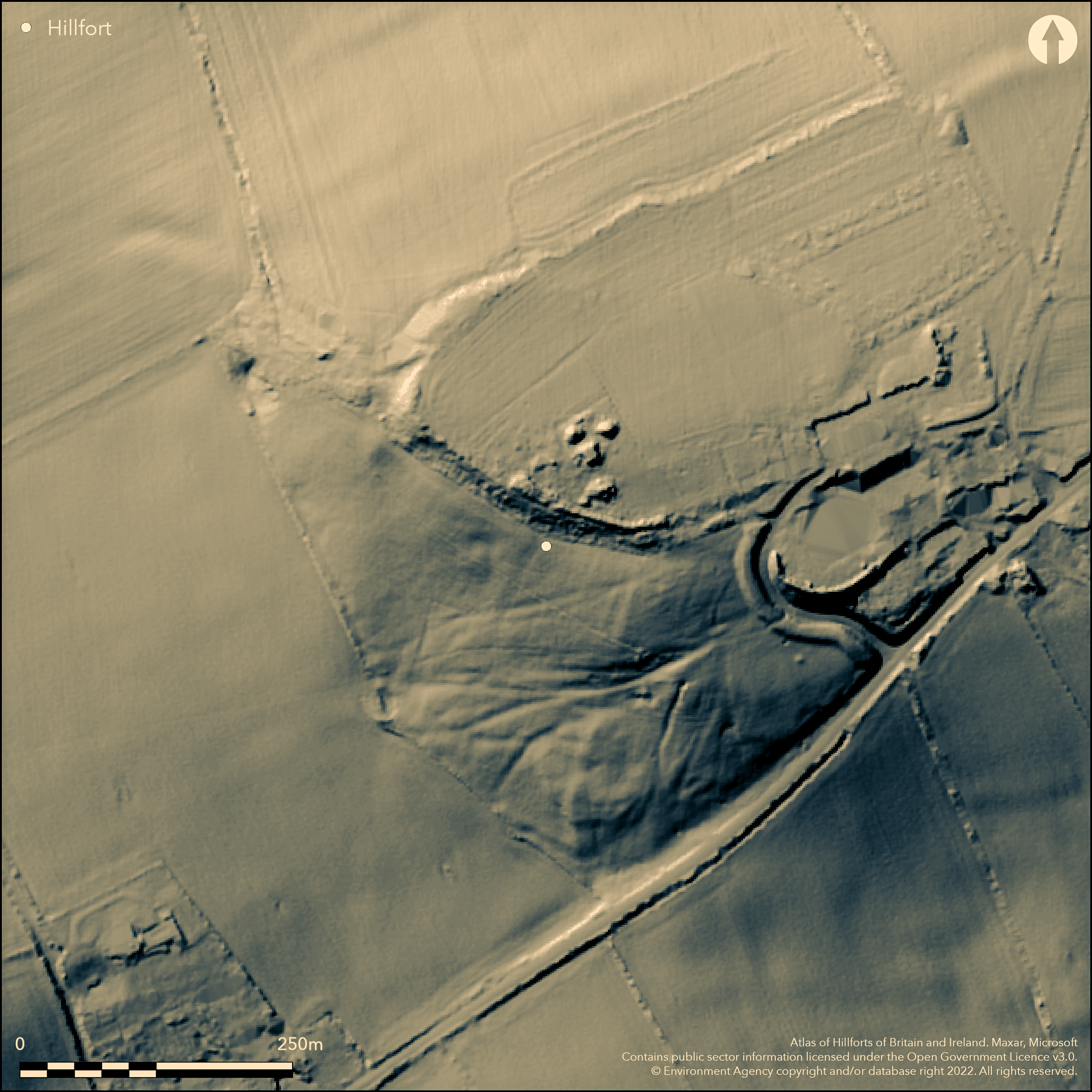
LiDAR 1m DTM Hillshade
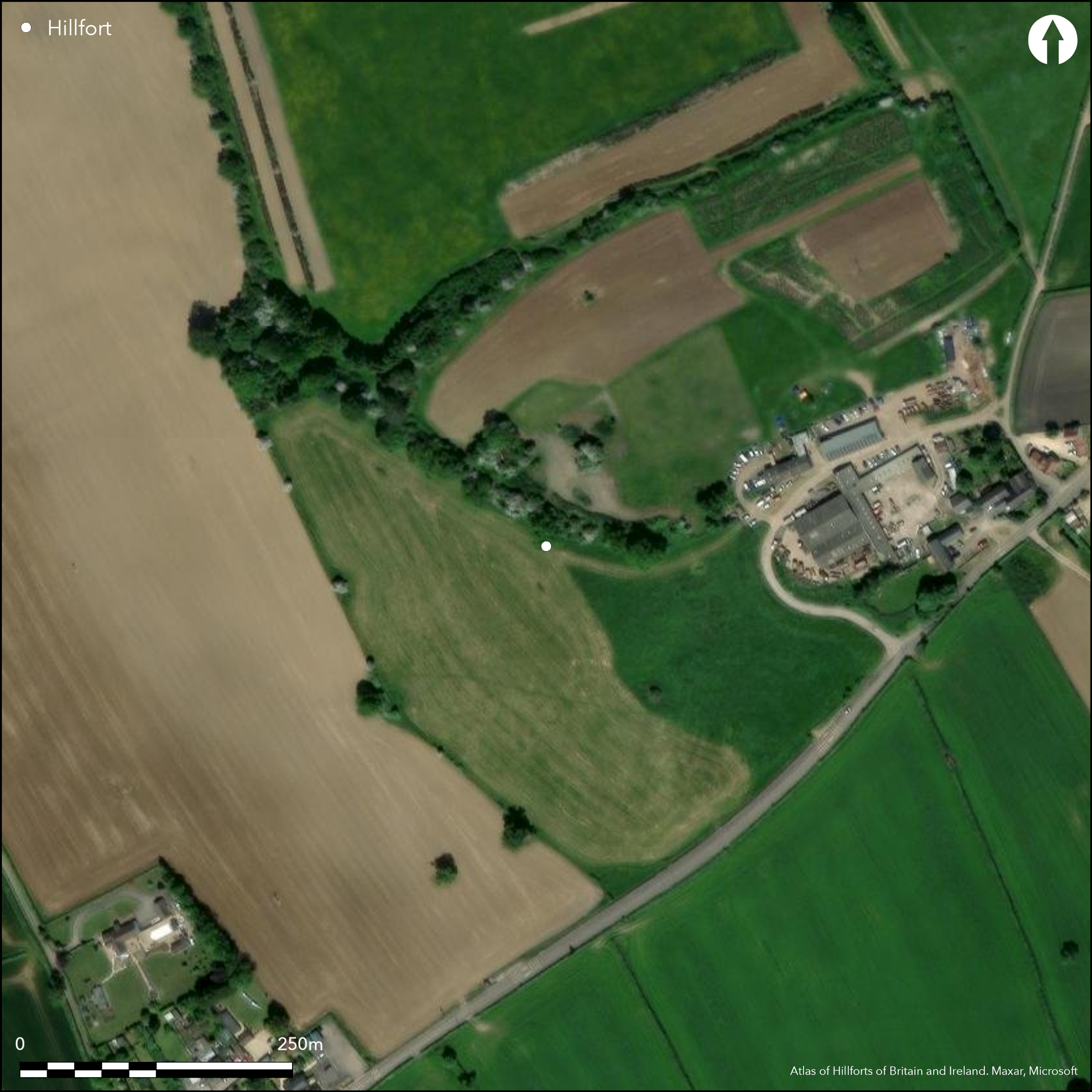
Satellite Imagery
LiDAR 1m DTM Hillshade
Satellite Imagery
Scroll left/right to view further images.
HER: Bath and NE Somerset MBN1140 (None)
NMR: ST 65 NE 7 (200471)
SM: 1004525
NGR: ST68305910
X: 368300 Y: 159100 (OSGB36)
Univallate partial contour hillfort located on ridge of Tunley Hill between two valleys of Cam and Newton Brooks. NW-facing and cutting across 168m contour on E. River Avon on E and Severn Estuary to W. Steep surrounding slopes to N and S, less on SW and NW. Whole site ploughed down, overgrown, part built-on and used as illegal waste dump with successful prosecutions by Environment Agency 2006. As result dimensions difficult to assess. Sub-oval shape, with area estimated at 1.2ha, but probably more. In 1970's N defences flat, but very slight scarp could be traced running across middle of the field and on S and W sides present hedge sat on scarp c. 2m high and on W low wide bank was present immediately W of the hedge. Present (BACAS survey 2014) show vestiges of bank on SW and NW, with possible traces of ditch on SE and NW, but so degraded difficult to assess. Probable earthen construction. Present condition a neglected mess. Tunley Farm just outside on SE. On OS 1:25,000 map (1958). Undated.
Citizen Science: ✓
Reliability of Data: Confirmed
Reliability of Interpretation: Confirmed
X: -273445 Y: 6679885 (EPSG: 3857)
Longitude: -2.4563992266889003 Latitude: 51.330053653853845 (EPSG:4326)
Country: England; None
Current County or Unitary Authority: Bath and NE Somerset
Historic County: Somerset
Current Parish/Community/Council/Townland: Camerton; Priston
Whole site ploughed down, overgrown, part built-on and used as illegal waste dump with successful prosecutions by Environment Agency 2006. As result dimensions difficult to assess. Tunley Farm just outside on SE. Present condition a neglected mess.
| Extant | ✓ |
| Cropmark | ✗ |
| Likely Destroyed | ✗ |
Overgrown scrub and tress and part built-on on SE. Waste dump. Possible WWII pillbox.
| Woodland | ✗ |
| Commercial Forestry Plantation | ✗ |
| Parkland | ✗ |
| Pasture (Grazing) | ✗ |
| Arable | ✗ |
| Scrub/Bracken | ✓ |
| Bare Outcrop | ✗ |
| Heather/Moorland | ✗ |
| Heath | ✗ |
| Built-up | ✓ |
| Coastal Grassland | ✗ |
| Other | ✓ |
Univallate partial contour hillfort located on ridge of Tunley Hill between two valleys of Cam and Newton Brooks. NW-facing and cutting across 168m contour on E. River Avon on E and Severn Estuary to W. Steep surrounding slopes to N and S, less on SW and NW.
| Contour Fort | ✗ |
| Partial Contour Fort | ✓ |
| Promontory Fort | ✗ |
| Hillslope Fort | ✗ |
| Level Terrain Fort | ✗ |
| Marsh Fort | ✗ |
| Multiple Enclosure Fort | ✗ |
| Hilltop | ✓ |
| Coastal Promontory | ✗ |
| Inland Promontory | ✗ |
| Valley Bottom | ✗ |
| Knoll/Hillock/Outcrop | ✗ |
| Ridge | ✗ |
| Cliff/Plateau-edge/Scarp | ✗ |
| Hillslope | ✗ |
| Lowland | ✗ |
| Spur | ✗ |
Dominant Topographic Feature: Hill top
| North | ✗ |
| Northeast | ✗ |
| East | ✗ |
| Southeast | ✗ |
| South | ✗ |
| Southwest | ✗ |
| West | ✗ |
| Northwest | ✓ |
| Level | ✗ |
Altitude: 173.0m
Boundary Type: Parish/Townland
None
Reliability: D - None
| Pre 1200BC | ✗ |
| 1200BC - 800BC | ✗ |
| 800BC - 400BC | ✗ |
| 400BC - AD50 | ✗ |
| AD50 - AD400 | ✗ |
| AD400 - AD 800 | ✗ |
| Post AD800 | ✗ |
| Unknown | ✓ |
| Pre Hillfort: | Possible earlier cromlech on hill to E of hillfort mentioned by Skinner (1772-1839) (Skinner MSS 33668), but no trace. |
| Post Hillfort: | Possible WWII pillbox in interior, but unconfirmed. |
Field investigations 1955, 1965 - no details. On OS 1:25,000 map (1958).
| 1st Identified Map Depiction (1958): | None |
| Other (None): | Field investigations - no details. |
None.
Stream c. 0.5km to N.
| None | ✓ |
| Spring | ✗ |
| Stream | ✗ |
| Pool | ✗ |
| Flush | ✗ |
| Well | ✗ |
| Other | ✗ |
None
| No Known Features | ✓ |
| Round Stone Structures | ✗ |
| Rectangular Stone Structures | ✗ |
| Curvilinear Platforms | ✗ |
| Other Roundhouse Evidence | ✗ |
| Pits | ✗ |
| Quarry Hollows | ✗ |
| Other | ✗ |
None
| No Known Excavation | ✓ |
| Pits | ✗ |
| Postholes | ✗ |
| Roundhouses | ✗ |
| Rectangular Structures | ✗ |
| Roads/Tracks | ✗ |
| Quarry Hollows | ✗ |
| Other | ✗ |
| Nothing Found | ✗ |
None
| No Known Geophysics | ✓ |
| Pits | ✗ |
| Roundhouses | ✗ |
| Rectangular Structures | ✗ |
| Roads/Tracks | ✗ |
| Quarry Hollows | ✗ |
| Other | ✗ |
| Nothing Found | ✗ |
None
| No Known Finds | ✓ |
| Pottery | ✗ |
| Metal | ✗ |
| Metalworking | ✗ |
| Human Bones | ✗ |
| Animal Bones | ✗ |
| Lithics | ✗ |
| Environmental | ✗ |
| Other | ✗ |
None
| APs Not Checked | ✓ |
| None | ✗ |
| Roundhouses | ✗ |
| Rectangular Structures | ✗ |
| Pits | ✗ |
| Postholes | ✗ |
| Roads/Tracks | ✗ |
| Other | ✗ |
Rubbish-filled/overgrown possible entrance on SE, but whether modern or original not assessed and unclear.
| 0: | None |
| 2: | Rubbish-filled/overgrown possible entrance on SE, but whether modern or original not assessed and unclear. |
Guard Chambers: ✗
Chevaux de Frise: ✗
| 1. Simple Gap (South east): | Rubbish-filled/overgrown possible entrance on SE, but whether modern or original not assessed and unclear. |
In 1970's N defences flat, but very slight scarp could be traced running across middle of the field in 1970's and on S and W sides present hedge sat on scarp c. 2m high and on W low wide bank was present immediately W of the hedge. Present (BACAS survey 2014) show vestiges of bank on SW and NW, with possible traces of ditch on SE and NW, but so degraded difficult to assess. Probable earthen construction.
| Area 1: | 1.2ha. |
| Total: | 1.2ha. |
Total Footprint Area: Noneha.
None
| ✗ | Estimate of c. 1.2ha, but probably more. |
| ✗ | None |
| NE Quadrant: | 0 |
| SE Quadrant: | 0 |
| SW Quadrant: | 1 |
| NW Quadrant: | 1 |
| Total: | 1 |
| Partial Univallate | ✓ |
| Univallate | ✗ |
| Partial Bivallate | ✗ |
| Bivallate | ✗ |
| Partial Multivallate | ✗ |
| Multivallate | ✗ |
| Unknown | ✗ |
| Partial Univallate | ✗ |
| Univallate | ✗ |
| Partial Bivallate | ✗ |
| Bivallate | ✗ |
| Partial Multivallate | ✗ |
| Multivallate | ✗ |
None
| None | ✗ |
| Earthen Bank | ✓ |
| Stone Wall | ✗ |
| Rubble | ✗ |
| Wall-walk | ✗ |
| Evidence of Timber | ✗ |
| Vitrification | ✗ |
| Other Burning | ✗ |
| Palisade | ✗ |
| Counter Scarp Bank | ✗ |
| Berm | ✗ |
| Unfinished | ✗ |
| Other | ✗ |
None
| None | ✗ |
| Earthen Bank | ✗ |
| Stone Wall | ✗ |
| Murus Duplex | ✗ |
| Timber-framed | ✗ |
| Timber-laced | ✗ |
| Vitrification | ✗ |
| Other Burning | ✗ |
| Palisade | ✗ |
| Counter Scarp Bank | ✗ |
| Berm | ✗ |
| Unfinished | ✗ |
| No Known Excavation | ✓ |
| Other | ✗ |
| ✗ | None |
| ✓ | Possible vestige on SE and NW. |
Number of Ditches: 1
| ✗ | None |
Burrow, I. 1981. Hillfort and hill-top settlement in Somerset in the first to eighth centuries AD, British Archaeological Report (BAR) British Series 1, 91, 228.
Atlas of Hillforts:
Wikidata:
This work is licensed under CC BY-SA 4.0

 and should be cited as:
Lock, Gary and Ralston, Ian. 2024. Atlas of Hillforts of Britain and Ireland. Available at: https://hillforts.arch.ox.ac.uk
Document Version 1.1