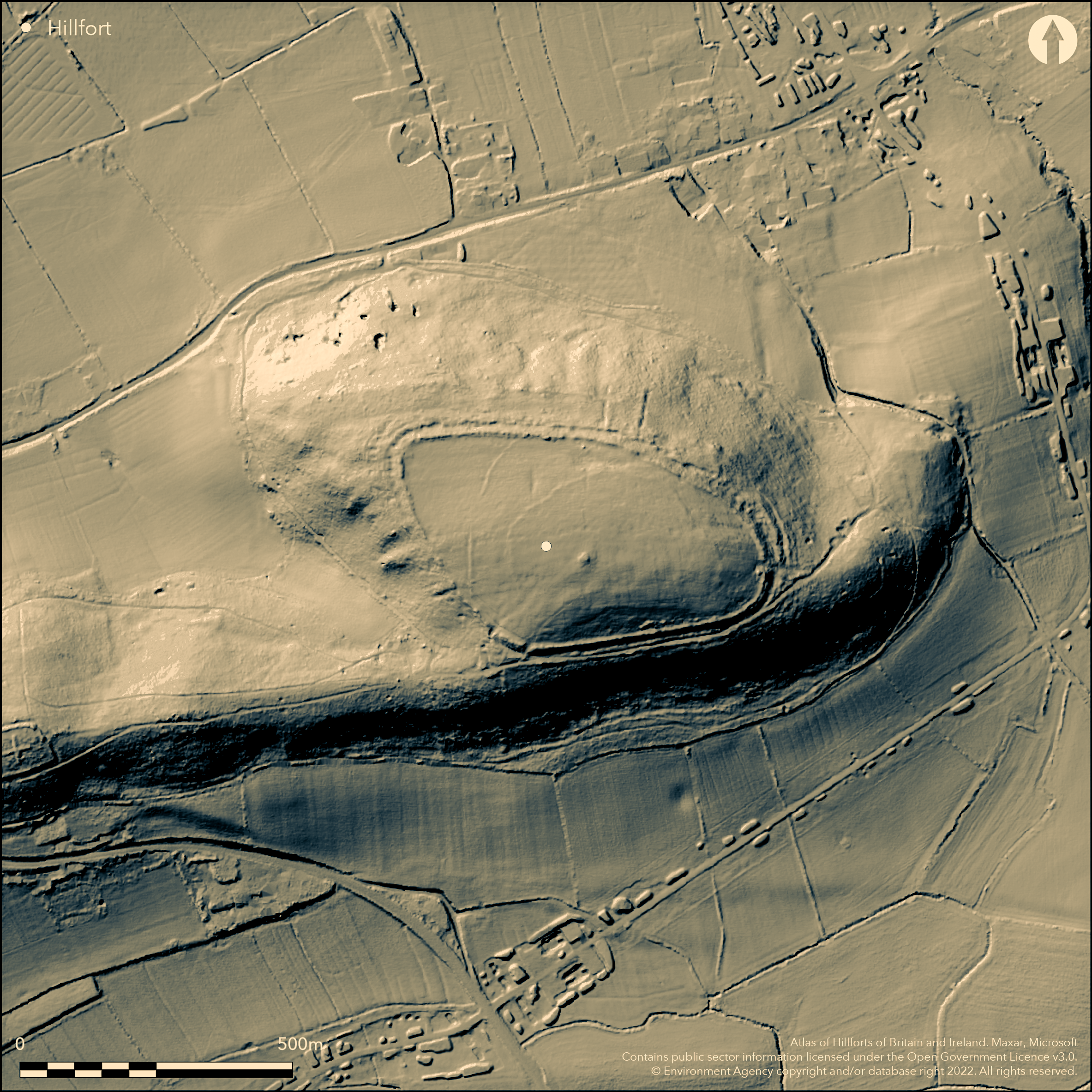
LiDAR 1m DTM Hillshade
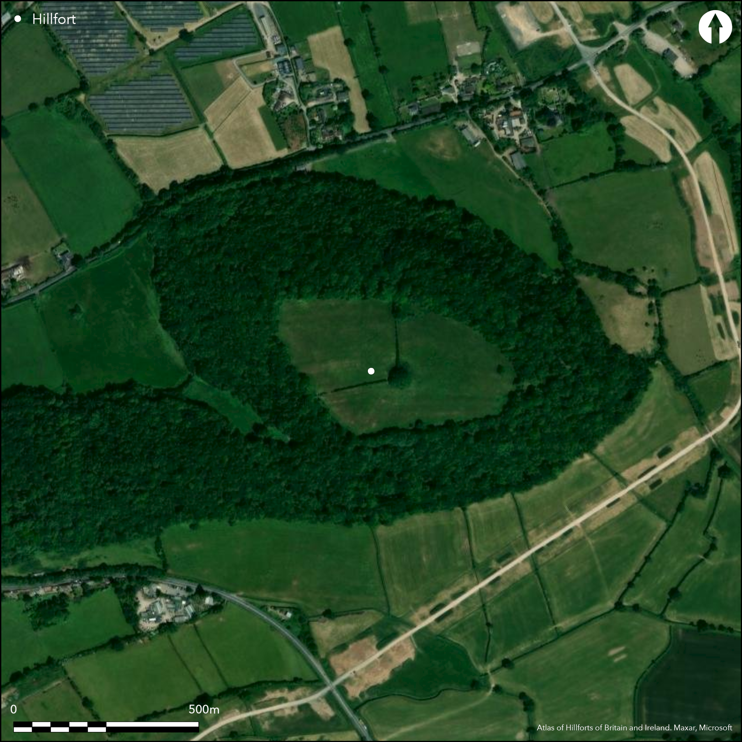
Satellite Imagery
LiDAR 1m DTM Hillshade
Satellite Imagery
Scroll left/right to view further images.
HER: North Somerset MNS219 (None)
NMR: ST 45 NW 6 (194460)
SM: 1008031
NGR: ST409590
X: 340900 Y: 159000 (OSGB36)
Large, univallate contour hillfort located on prominent summit of hill situated at E end of narrow ridge on Banwell Plain, a carboniferous plateau on NW fringe of Mendip Hills overlooking the Somerset Levels and above Towerhead Brook to NE. Very steep surrounding slopes in all directions. Sub-oval gently sloping interior measures c. 250m N-S by 400m, with area c. 8.8ha. Defined by earthen rampart c. 1.5m high and c. 5m wide, surrounded by ditch c. 1m deep from which material was quarried for bank. Ditch flanked by sections of external counterscarp bank c. 0.5m high on N, E and S sides. Possible original out-turned entrance on NE side. Three entrances, at SE and SW corners and N, probably modern. Possibly within interior two smaller enclosures, smallest is c. 2.8ha on E summit of the hill defined by bank c. 0.5m high and c. 1m across flanked by shallow and intermittent external ditch. Second enclosure of c. 6ha defined by earthwork of similar proportions and covers most of the main ramparts of the final hillfort. Although these may possibly represent development of small early Iron Age settlements into the progressively larger site, they may be nothing more than a field boundary. Partial excavations by J.E. Pritchard c. 1900-2 and 1958 by J. Hunt (1955; 1961; 1962) found early Iron Age pottery from rampart. Latter excavated possible hut site. Probable barrow or burial site in interior, surviving to 0.5m high and c. 8m across, with surrounding ditch c.1m wide and 0.5m deep. Partial excavation of barrow 1959 produced Iron Age pottery and associated flintwork suggesting that the barrow may be contemporary with the hillfort or with the two earlier settlement enclosures. Excavation also suggested that the barrow was later re-used as the site of a post-medieval building. Additional finds include Palaeolithic, Neolithic and Bronze Age flintwork and a bronze looped palstave. Pasture interior divided into three fields with wooded surrounds. On 1st Ed. OS map (1885).
Citizen Science: ✗
Reliability of Data: Confirmed
Reliability of Interpretation: Confirmed
X: -317219 Y: 6679335 (EPSG: 3857)
Longitude: -2.8496237077574706 Latitude: 51.32696222990627 (EPSG:4326)
Country: England
Current County or Unitary Authority: North Somerset
Historic County: Somerset
Current Parish/Community/Council/Townland: Banwell
Interior divided into three fields.
| Extant | ✓ |
| Cropmark | ✗ |
| Likely Destroyed | ✗ |
Pasture interior, wooded surrounds.
| Woodland | ✓ |
| Commercial Forestry Plantation | ✗ |
| Parkland | ✗ |
| Pasture (Grazing) | ✓ |
| Arable | ✗ |
| Scrub/Bracken | ✗ |
| Bare Outcrop | ✗ |
| Heather/Moorland | ✗ |
| Heath | ✗ |
| Built-up | ✗ |
| Coastal Grassland | ✗ |
| Other | ✗ |
Large, univallate contour hillfort located on prominent summit of hill situated at E end of narrow ridge on Banwell Plain, a carboniferous plateau on NW fringe of Mendip Hills overlooking the Somerset Levels and above Towerhead Brook to NE. Very steep surrounding slopes in all directions.
| Contour Fort | ✓ |
| Partial Contour Fort | ✗ |
| Promontory Fort | ✗ |
| Hillslope Fort | ✗ |
| Level Terrain Fort | ✗ |
| Marsh Fort | ✗ |
| Multiple Enclosure Fort | ✗ |
| Hilltop | ✓ |
| Coastal Promontory | ✗ |
| Inland Promontory | ✗ |
| Valley Bottom | ✗ |
| Knoll/Hillock/Outcrop | ✗ |
| Ridge | ✗ |
| Cliff/Plateau-edge/Scarp | ✗ |
| Hillslope | ✗ |
| Lowland | ✗ |
| Spur | ✗ |
Dominant Topographic Feature: Hill top
| North | ✗ |
| Northeast | ✗ |
| East | ✗ |
| Southeast | ✗ |
| South | ✗ |
| Southwest | ✗ |
| West | ✗ |
| Northwest | ✗ |
| Level | ✓ |
Altitude: 97.0m
N/A
Partial excavations found early Iron Age pottery from rampart. Probable barrow or burial site in interior, surviving to 0.5m high and c. 8m across, with surrounding ditch c.1m wide and 0.5m deep. Partial excavation of barrow 1959 produced Iron Age pottery and associated flintwork suggesting that the barrow may be contemporary with the hillfort or with the two possible earlier settlement enclosures. Excavation also suggested that the barrow was later re-used as the site of a post-medieval building.
Reliability: B - Medium
| Pre 1200BC | ✗ |
| 1200BC - 800BC | ✗ |
| 800BC - 400BC | ✓ |
| 400BC - AD50 | ✗ |
| AD50 - AD400 | ✗ |
| AD400 - AD 800 | ✗ |
| Post AD800 | ✗ |
| Unknown | ✗ |
| Pre Hillfort: | None |
| Post Hillfort: | None |
| Artefactual: | Early Iron Age pottery. |
On 1st Ed. OS map (1885). Partial excavations by J.E. Pritchard 1900-02 and by J. Hunt 1958.
| Other (1885): | OS map. |
| Excavation (1958): | J. Hunt. |
| Excavation (None): | J.E. Pritchard. |
Hunt excavated possible hut site. Early Iron Age pottery. Palaeolithic, Neolithic and Bronze Age flintwork and a bronze looped palstave.
Possible pond.
| None | ✗ |
| Spring | ✗ |
| Stream | ✗ |
| Pool | ✓ |
| Flush | ✗ |
| Well | ✗ |
| Other | ✗ |
None
| No Known Features | ✓ |
| Round Stone Structures | ✗ |
| Rectangular Stone Structures | ✗ |
| Curvilinear Platforms | ✗ |
| Other Roundhouse Evidence | ✗ |
| Pits | ✗ |
| Quarry Hollows | ✗ |
| Other | ✗ |
Hunt excavated possible hut site.
| No Known Excavation | ✗ |
| Pits | ✗ |
| Postholes | ✗ |
| Roundhouses | ✓ |
| Rectangular Structures | ✗ |
| Roads/Tracks | ✗ |
| Quarry Hollows | ✗ |
| Other | ✗ |
| Nothing Found | ✗ |
None
| No Known Geophysics | ✓ |
| Pits | ✗ |
| Roundhouses | ✗ |
| Rectangular Structures | ✗ |
| Roads/Tracks | ✗ |
| Quarry Hollows | ✗ |
| Other | ✗ |
| Nothing Found | ✗ |
Iron Age pottery. Palaeolithic, Neolithic and Bronze Age flintwork and a bronze looped palstave.
| No Known Finds | ✗ |
| Pottery | ✓ |
| Metal | ✓ |
| Metalworking | ✗ |
| Human Bones | ✗ |
| Animal Bones | ✗ |
| Lithics | ✓ |
| Environmental | ✗ |
| Other | ✗ |
None
| APs Not Checked | ✓ |
| None | ✗ |
| Roundhouses | ✗ |
| Rectangular Structures | ✗ |
| Pits | ✗ |
| Postholes | ✗ |
| Roads/Tracks | ✗ |
| Other | ✗ |
Possible original out-turned entrance on NE side. Three entrances, at SE and SW corners and N, are probably modern.
| 4: | Three entrances, at SE and SW corners and N, probably modern. |
| 2: | Possible out-turned entrance on NE side. |
Guard Chambers: ✗
Chevaux de Frise: ✗
| 1. Out-turned (North east): | Possible. |
Defined by earthen rampart c. 1.5m high and c. 5m wide, surrounded by ditch c. 1m deep from which material was quarried for bank. Ditch flanked by sections of external counterscarp bank c. 0.5m high on N, E and S sides.
| Area 1: | 8.8ha. |
| Total: | 8.8ha. |
Total Footprint Area: Noneha.
None
| ✓ | Possibly within interior two smaller enclosures, smallest is c. 2.8ha on E summit of the hill defined by bank c. 0.5m high and c. 1m across flanked by shallow and intermittent external quarry ditch. Second enclosure of c. 6ha defined by earthwork of similar proportions, covering most of main ramparts of final site. Although possibly representing development of small early Iron Age settlements into the progressively larger and defendable site, may be nothing more than field boundary. |
| ✓ | None |
| NE Quadrant: | 1 |
| SE Quadrant: | 1 |
| SW Quadrant: | 1 |
| NW Quadrant: | 1 |
| Total: | 1 |
| Partial Univallate | ✗ |
| Univallate | ✓ |
| Partial Bivallate | ✗ |
| Bivallate | ✗ |
| Partial Multivallate | ✗ |
| Multivallate | ✗ |
| Unknown | ✗ |
| Partial Univallate | ✗ |
| Univallate | ✗ |
| Partial Bivallate | ✗ |
| Bivallate | ✗ |
| Partial Multivallate | ✗ |
| Multivallate | ✗ |
None
| None | ✗ |
| Earthen Bank | ✓ |
| Stone Wall | ✗ |
| Rubble | ✗ |
| Wall-walk | ✗ |
| Evidence of Timber | ✗ |
| Vitrification | ✗ |
| Other Burning | ✗ |
| Palisade | ✗ |
| Counter Scarp Bank | ✓ |
| Berm | ✗ |
| Unfinished | ✗ |
| Other | ✗ |
Innermost of interior enclosures sectioned.
| None | ✗ |
| Earthen Bank | ✓ |
| Stone Wall | ✗ |
| Murus Duplex | ✗ |
| Timber-framed | ✗ |
| Timber-laced | ✗ |
| Vitrification | ✗ |
| Other Burning | ✗ |
| Palisade | ✗ |
| Counter Scarp Bank | ✗ |
| Berm | ✗ |
| Unfinished | ✗ |
| No Known Excavation | ✗ |
| Other | ✗ |
| ✗ | None |
| ✓ | None |
Number of Ditches: 1
| ✗ | None |
Burrow, E. 1924. Ancient earthworks and camps of Somerset, Cheltenham: E.J. Burrow, 48-9.
Burrow , I. 1981. Hillfort and hill-top settlement in Somerset in the first to eighth centuries AD, British Archaeological Report (BAR) British Series 1, 91, 211.
Hunt, J. 1955. Sketch plan and sections, J Axbridge Caving Group and Arch Soc, 2, No. 3, 1955, 28-34.
Hunt, J. 1961. Excavations at Banwell Camp, Somerset and Dorset Notes Queries, 27, 28-34.
Hunt, J. 1961. Banwell Camp 1960 Excavations, Search, (J Banwell Soc), 1, 9-23.
Hunt, J. 1962. Banwell Camp 1960 Excavations, Search, (J Banwell Soc), 2, 11-19.
Page, W. ed. 1911. Ancient earthworks, The Victoria History of Somerset, Volume Two, The Victoria History of the Counties of England, London: Constable and Co, 471.
Atlas of Hillforts:
Wikidata:
This work is licensed under CC BY-SA 4.0

 and should be cited as:
Lock, Gary and Ralston, Ian. 2024. Atlas of Hillforts of Britain and Ireland. Available at: https://hillforts.arch.ox.ac.uk
Document Version 1.1