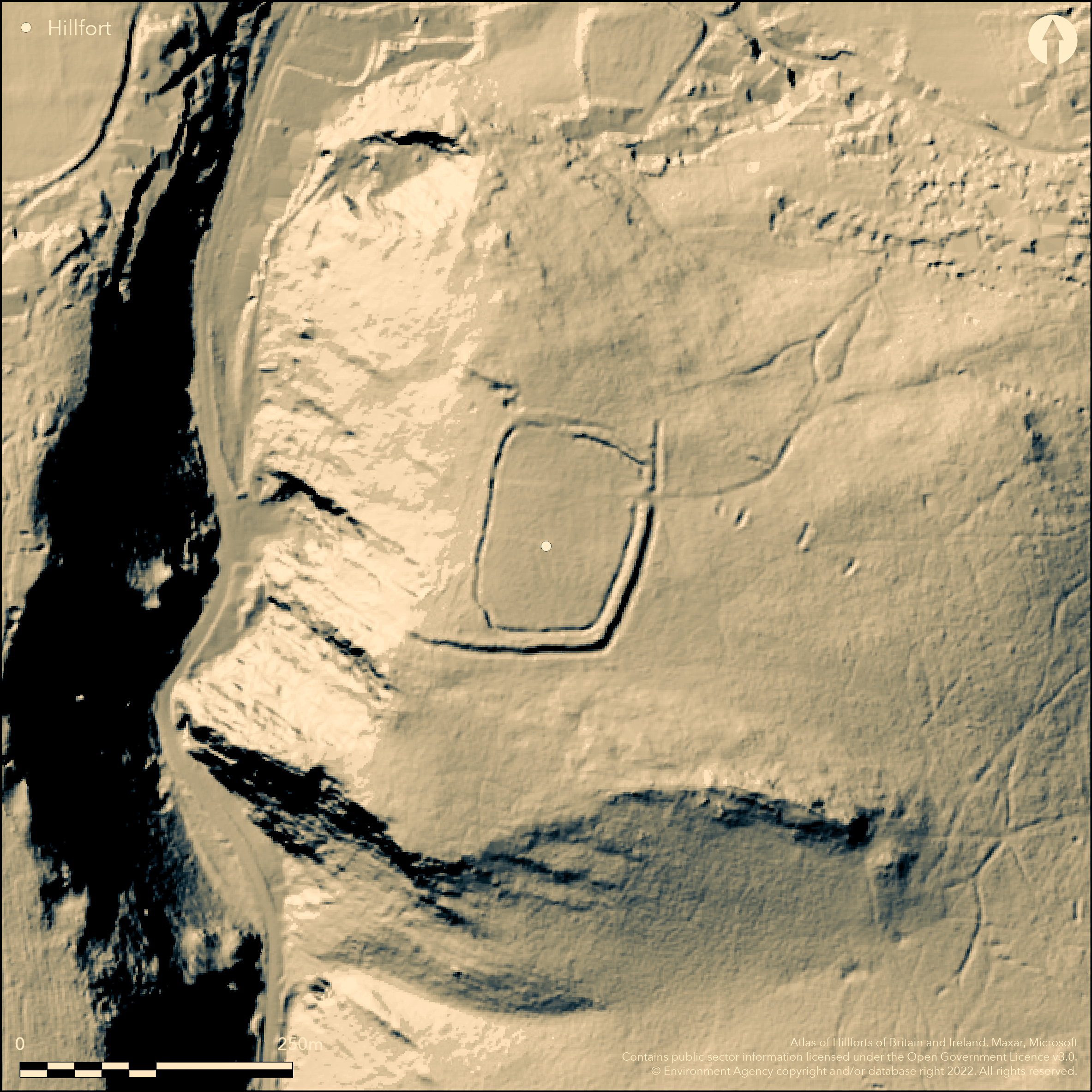
LiDAR 1m DTM Hillshade
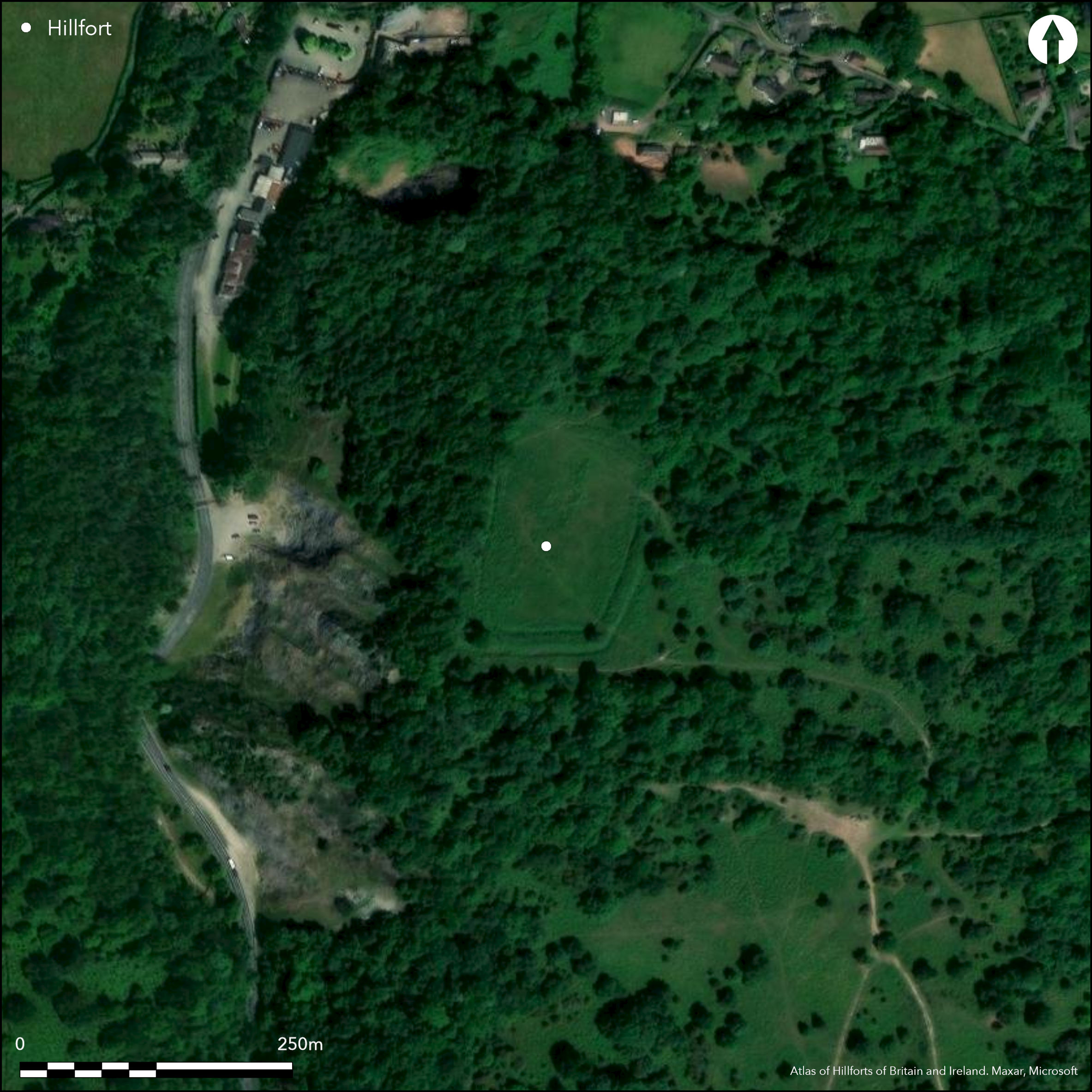
Satellite Imagery
LiDAR 1m DTM Hillshade
Satellite Imagery
Scroll left/right to view further images.
HER: North Somerset MNS265 (None)
NMR: ST 45 NE 43 (194391)
SM: 1011261
NGR: ST47825878
X: 347820 Y: 158780 (OSGB36)
Slight, univallate, hillslope fort located on WNW slopes of plateau edge of Burrington Ham, a carboniferous limestone plateau in Mendip Hills, overlooking gorge of Burrington Combe to S and W, Blagdon Combe to E and area of Levels to N. Very steep to precipitous on SW to NW quadrants above gorge, steep to NE and moderate to E and SE. Sub-oval interior measuring c. 75m E-W by 110m, with area c. 0.8ha. Defined by single rampart, 8m wide and c. 0.5m high, with ditch on either side c. 0.5m deep and 3m wide. Rampart best to E and S areas where slopes less. In more detail, possible two-phased construction at least. Main rampart with outer ditch shows reversed L-shape probable first phase of construction. Second phase comprises N, W and part of S side where bank smaller, less well defined, with an inner ditch instead of outer ditch, former also appearing on the S side abutting the main rampart and continues along E. Excavations by E.K. Tratman (1963) in 1960 showed rampart of dump construction with berm between it and rather flat-bottomed outer ditch, and site possibly unfinished. Two possible original entrances, but NE more definite. On NW comprises two gaps in rampart c. 10m wide separated by ditch c. 12m long. On NE inturned entrance gap 12m wide. The inner ditch suggests a ritual connotation to the site, as suggested by Allcroft (1908, 582-4) and noted by Tratman (1963) and Burrow (1981). Burrington Combe, site of c. seven plus caves, investigated by W. Boyd Dawkins and others, directly below hillfort, and could be possible connection. Here evidence of activity from Mesolithic to Roman, with Aveline's Hole and Read's Cavern producing human remains, latter also with Iron Age chariot gear. But excavations of hillfort in 1960 showed no evidence of occupation. Segment of ditch on NW seems divorced from main enclosure, possibly part of entrance and need to channel stock into the enclosure. Likewise on NE and SW two extensions to external ditch lead away from the enclosure. On SW this linear feature runs for further 50m with slight bank, while on NE extension to external ditch runs away from site by c. 25m. Purpose of these unclear, but may relate to control of stock, as they enclose land between main enclosure and cliffs of gorge to W. The two parallel banks within enclosure may be later. On antiquarian manuscript. Overgrown scrub interior cleared, with surrounding woodland. On 1st Ed. OS map (1885).
Citizen Science: ✓
Reliability of Data: Confirmed
Reliability of Interpretation: Confirmed
X: -306160 Y: 6679103 (EPSG: 3857)
Longitude: -2.750283373722527 Latitude: 51.32566243173054 (EPSG:4326)
Country: England
Current County or Unitary Authority: North Somerset
Historic County: Somerset
Current Parish/Community/Council/Townland: Burrington
Denuded.
| Extant | ✓ |
| Cropmark | ✗ |
| Likely Destroyed | ✗ |
Overgrown scrub interior cleared and planted, with surrounding woodland but clear access on SE.
| Woodland | ✓ |
| Commercial Forestry Plantation | ✗ |
| Parkland | ✗ |
| Pasture (Grazing) | ✓ |
| Arable | ✗ |
| Scrub/Bracken | ✓ |
| Bare Outcrop | ✗ |
| Heather/Moorland | ✗ |
| Heath | ✗ |
| Built-up | ✗ |
| Coastal Grassland | ✗ |
| Other | ✗ |
Slight, univallate, hillslope fort located on WNW plateau edge slopes of Burrington Ham, a carboniferous limestone plateau overlooking Burrington Combe to S and W, Blagdon Combe to E and area of Levels to N. Very steep slopes on W quadrants, steep to NE moderate to E and SE.
| Contour Fort | ✗ |
| Partial Contour Fort | ✗ |
| Promontory Fort | ✗ |
| Hillslope Fort | ✓ |
| Level Terrain Fort | ✗ |
| Marsh Fort | ✗ |
| Multiple Enclosure Fort | ✗ |
| Hilltop | ✗ |
| Coastal Promontory | ✗ |
| Inland Promontory | ✗ |
| Valley Bottom | ✗ |
| Knoll/Hillock/Outcrop | ✗ |
| Ridge | ✗ |
| Cliff/Plateau-edge/Scarp | ✓ |
| Hillslope | ✓ |
| Lowland | ✗ |
| Spur | ✗ |
Dominant Topographic Feature: Plateau edge slopes.
| North | ✗ |
| Northeast | ✗ |
| East | ✗ |
| Southeast | ✗ |
| South | ✗ |
| Southwest | ✗ |
| West | ✗ |
| Northwest | ✓ |
| Level | ✗ |
Altitude: 168.0m
N/A
None.
Reliability: D - None
| Pre 1200BC | ✗ |
| 1200BC - 800BC | ✗ |
| 800BC - 400BC | ✗ |
| 400BC - AD50 | ✗ |
| AD50 - AD400 | ✗ |
| AD400 - AD 800 | ✗ |
| Post AD800 | ✗ |
| Unknown | ✓ |
| Pre Hillfort: | None |
| Post Hillfort: | None |
MSS referring to Dolebury Camp, Burrington Camp and earthworks at Priddy by John Strachey (1671-1743). On 1st Ed. OS map (1885). Excavation University of Bristol Speleological Society 1948. Excavation E.K. Tratman, University of Bristol Speleological Society 1960. Air Photograph Interpretation English Heritage: Mendip Hills AONB NMP 2006-09. Measured survey English Heritage 2007.
| 1st Identified Map Depiction (1885): | OS map. |
| Excavation (1948): | University of Bristol Speleological Society |
| Excavation (1960): | E.K. Tratman, University of Bristol Speleological Society. |
| Other (2007): | Measured survey English Heritage. |
| 1st Identified Written Reference (None): | MSS referring to Dolebury Camp, Burrington Camp and earthworks at Priddy by John Strachey (1671-1743). |
| Other (None): | Air Photograph Interpretation English Heritage: Mendip Hills AONB NMP 2006-09. |
Excavations in 1960 showed no evidence of occupation.
None
| None | ✓ |
| Spring | ✗ |
| Stream | ✗ |
| Pool | ✗ |
| Flush | ✗ |
| Well | ✗ |
| Other | ✗ |
None
| No Known Features | ✓ |
| Round Stone Structures | ✗ |
| Rectangular Stone Structures | ✗ |
| Curvilinear Platforms | ✗ |
| Other Roundhouse Evidence | ✗ |
| Pits | ✗ |
| Quarry Hollows | ✗ |
| Other | ✗ |
Excavations in 1960 showed no evidence of occupation.
| No Known Excavation | ✗ |
| Pits | ✗ |
| Postholes | ✗ |
| Roundhouses | ✗ |
| Rectangular Structures | ✗ |
| Roads/Tracks | ✗ |
| Quarry Hollows | ✗ |
| Other | ✗ |
| Nothing Found | ✓ |
None
| No Known Geophysics | ✓ |
| Pits | ✗ |
| Roundhouses | ✗ |
| Rectangular Structures | ✗ |
| Roads/Tracks | ✗ |
| Quarry Hollows | ✗ |
| Other | ✗ |
| Nothing Found | ✗ |
None
| No Known Finds | ✓ |
| Pottery | ✗ |
| Metal | ✗ |
| Metalworking | ✗ |
| Human Bones | ✗ |
| Animal Bones | ✗ |
| Lithics | ✗ |
| Environmental | ✗ |
| Other | ✗ |
None
| APs Not Checked | ✓ |
| None | ✗ |
| Roundhouses | ✗ |
| Rectangular Structures | ✗ |
| Pits | ✗ |
| Postholes | ✗ |
| Roads/Tracks | ✗ |
| Other | ✗ |
Two possible original entrances. On NW comprises two gaps in rampart c. 10m wide separated by ditch c. 12m long. On NE entrance gap 12m wide. Segment of ditch on NW seems divorced from main enclosure, possibly part of entrance and need to channel stock into the enclosure. Gap on W probably later.
| 3: | Gap on W probably later. |
| 2: | None |
Guard Chambers: ✗
Chevaux de Frise: ✗
| 1. Simple Gap (North west): | Two gaps in rampart c. 10m wide separated by ditch c. 12m long. |
| 2. Simple Gap (North east): | None |
Defined by single rampart, 8m wide and c. 0.5m high, with ditch on either side c. 0.5m deep and 3m wide. Rampart best to E and S areas where slopes less. In more detail, possible two-phased construction at least. Main rampart with outer ditch shows reversed L-shape probable first phase of construction. Second phase comprises N, W and part of S side where bank smaller, less well defined, with an inner ditch instead of outer ditch, former also appearing on the S side abutting the main rampart and continues along E. Excavations by E.K. Tratman 1960 showed rampart of dump construction with berm between it and rather flat-bottomed outer ditch.
| Area 1: | 0.8ha. |
| Total: | 0.8ha. |
Total Footprint Area: Noneha.
None
| ✓ | Possible two phased construction at least. Main rampart with outer ditch shows reversed L-shape probable first phase of construction. Second phase comprises N, W and part of S side where bank smaller, less well defined, with an inner ditch instead of outer ditch, former also appearing on the S side abutting the main rampart and continues along E. |
| ✓ | None |
| NE Quadrant: | 1 |
| SE Quadrant: | 1 |
| SW Quadrant: | 1 |
| NW Quadrant: | 1 |
| Total: | 1 |
| Partial Univallate | ✗ |
| Univallate | ✓ |
| Partial Bivallate | ✗ |
| Bivallate | ✗ |
| Partial Multivallate | ✗ |
| Multivallate | ✗ |
| Unknown | ✗ |
| Partial Univallate | ✗ |
| Univallate | ✗ |
| Partial Bivallate | ✗ |
| Bivallate | ✗ |
| Partial Multivallate | ✗ |
| Multivallate | ✗ |
None
| None | ✗ |
| Earthen Bank | ✓ |
| Stone Wall | ✗ |
| Rubble | ✗ |
| Wall-walk | ✗ |
| Evidence of Timber | ✗ |
| Vitrification | ✗ |
| Other Burning | ✗ |
| Palisade | ✗ |
| Counter Scarp Bank | ✗ |
| Berm | ✓ |
| Unfinished | ✓ |
| Other | ✗ |
Excavations by E.K. Tratman in 1960 (Tratman 1963) showed rampart of dump construction, with berm between it and flat-bottomed outer ditch. Suggested as possibly unfinished.
| None | ✗ |
| Earthen Bank | ✓ |
| Stone Wall | ✗ |
| Murus Duplex | ✗ |
| Timber-framed | ✗ |
| Timber-laced | ✗ |
| Vitrification | ✗ |
| Other Burning | ✗ |
| Palisade | ✗ |
| Counter Scarp Bank | ✗ |
| Berm | ✓ |
| Unfinished | ✗ |
| No Known Excavation | ✗ |
| Other | ✗ |
| ✗ | None |
| ✓ | Inner and outer ditches, latter rather flat-bottomed. |
Number of Ditches: 2
| ✗ | None |
Allcroft, A. 1908. Earthwork of England, prehistoric, Roman, Saxon, Danish, Norman, mediaeval, London: Macmillan, 582-4.
Burrow, E. 1924. Ancient earthworks and camps of Somerset, Cheltenham: E.J. Burrow, 68-9.
Burrow, I. 1981. Hillfort and hill-top settlement in Somerset in the first to eighth centuries AD, British Archaeological Report (BAR) British Series 1, 91, 244-6.
Grinsell, L.V. 1958. Archaeology of Wessex, London: Methuen,165.
Jamieson E. 2007. Burrington Camp, North Somerset: a late-prehistoric enclosure on the Mendip Hills, Centre for Archaeology Archaeological Survey Report No 81-2007.
Page, W. ed. 1911. Ancient earthworks, The Victoria History of Somerset, Volume Two, The Victoria History of the Counties of England, London: Constable and Co, 483-4.
Tratman, E.K. 1963. Archaeological notes - Burrington Camp, Somerset. An unoccupied site, Proc Univ Bristol Spelaeol Soc, 10(1), 16-21.
Williams, R. G. J. 1987. John Strachey on some Mendip caverns and antiquities in the early 18th century, Proc Univ Bristol Spelaeol Soc, 18, 57-64.
Atlas of Hillforts:
Wikidata:
This work is licensed under CC BY-SA 4.0

 and should be cited as:
Lock, Gary and Ralston, Ian. 2024. Atlas of Hillforts of Britain and Ireland. Available at: https://hillforts.arch.ox.ac.uk
Document Version 1.1