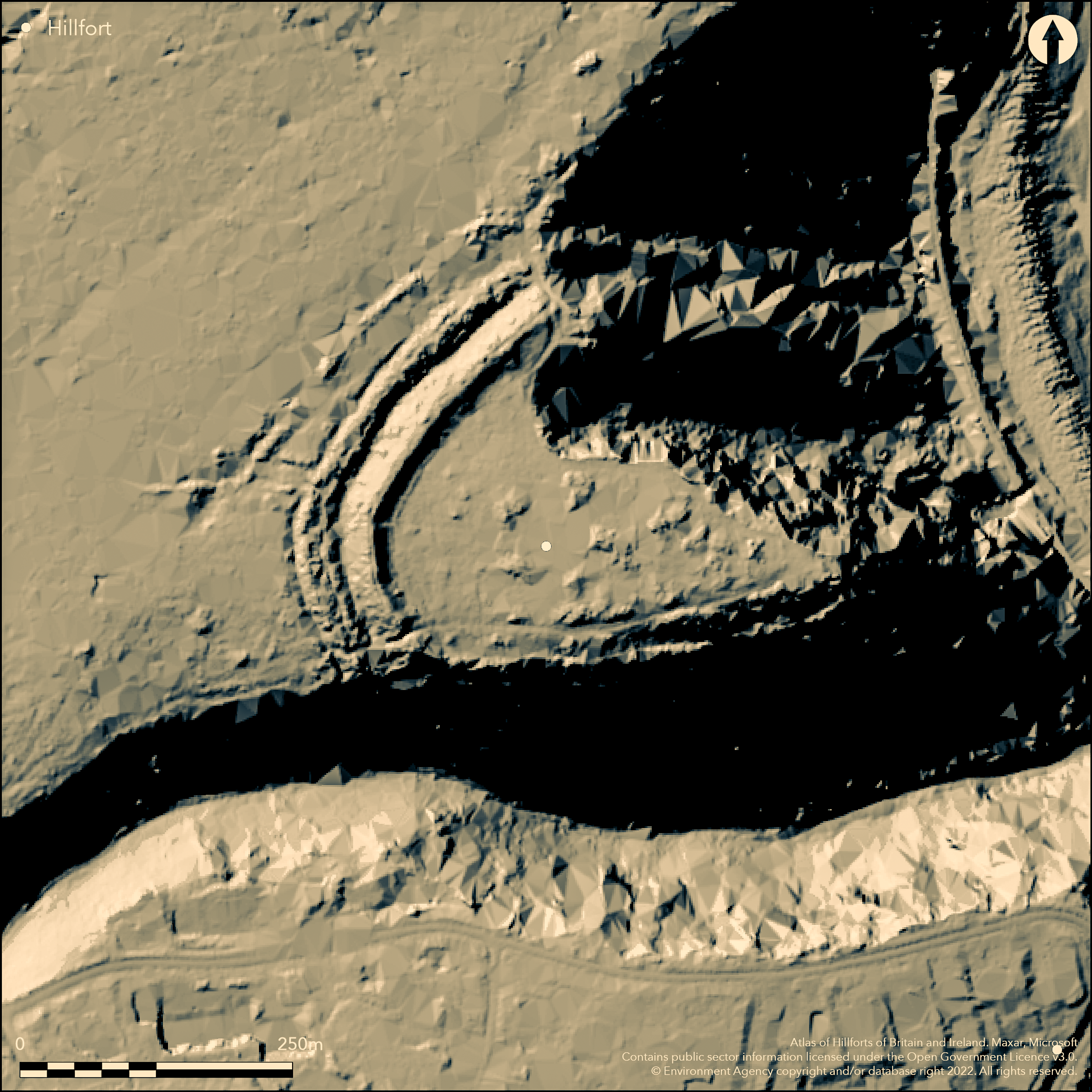
LiDAR 1m DTM Hillshade
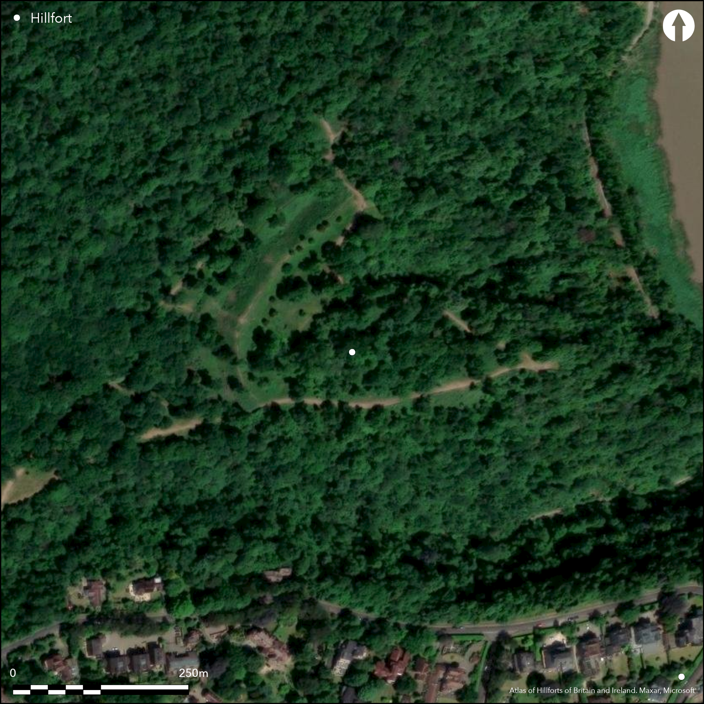
Satellite Imagery
LiDAR 1m DTM Hillshade
Satellite Imagery
Scroll left/right to view further images.
HER: North Somerset MNS859 (None)
NMR: ST 57 SE 35 (198375)
SM: 1008113
NGR: ST55957328
X: 355950 Y: 173280 (OSGB36)
Level terrain fort located in Leigh Woods on carboniferous limestone promontory overlooking Avon Gorge on E and very steep slopes of Nightingale Valley on S. On opposite bank of river, on W, to Clifton Down Camp (Atlas No 4035), on E, just to N of Clifton Suspension Bridge. Fine strategic position above river. One of three hillforts overlooking the Avon Gorge, others being Burgh Walls Camp (Atlas No 3984) and Clifton Down Camp. A level interior measures 150m N-S by 250m, with internal area c. 3ha. Enclosed on all but precipitous gorge on E side by ramparts composed of small stones and surmounted by dry-stone walling. Number of ramparts varies from two on NW to single rampart on S above Nightingale valley. Former is substantial with inner bank 4.5m high and ditch 1m deep, total width 30m. Outer bank 2.5m high and ditch 1m deep, with total width 25m. Entrance uncertain, possibly on N side near cliffs, where modern path enters, and where middle and inner ditches were never cut and access possibly regulated between outer rampart and external bank. Haldane, (1966, 34) also refers to possible access through wide gully on N side leading into interior at foot of which a spring. Modern gap and path on SW. Additional earthwork runs beyond outer rampart along the NW side before turning W; a possible annexe or a covering work for the approach to N entrance. Partial excavation by J.W. Haldane (1975), University of Bristol Speleological Society between 1966 and 1971 showed late Iron Age and Romano-British occupation debris in interior, including pottery, spindle whorls, iron sickle and brooch, mostly from pits. Original settlement during late-pre Roman period when soil cleared and ground levelled and large inner rampart built. Occupation continued without substantial break until middle 1st century AD. After break site appears re-used during middle to late 2nd century AD. On 1st Ed. OS map (1886).
Citizen Science: ✗
Reliability of Data: Confirmed
Reliability of Interpretation: Confirmed
X: -293373 Y: 6702484 (EPSG: 3857)
Longitude: -2.6354145757350804 Latitude: 51.456725020725834 (EPSG:4326)
Country: England; None
Current County or Unitary Authority: North Somerset
Historic County: Somerset
Current Parish/Community/Council/Townland: Long Ashton; Abbots Leigh
Within Leigh Woods National Nature Reserve. Path along perimeter of site from NE-S.
| Extant | ✓ |
| Cropmark | ✗ |
| Likely Destroyed | ✗ |
Within Leigh Wood.
| Woodland | ✓ |
| Commercial Forestry Plantation | ✗ |
| Parkland | ✗ |
| Pasture (Grazing) | ✗ |
| Arable | ✗ |
| Scrub/Bracken | ✗ |
| Bare Outcrop | ✗ |
| Heather/Moorland | ✗ |
| Heath | ✗ |
| Built-up | ✗ |
| Coastal Grassland | ✗ |
| Other | ✗ |
Level terrain fort located in Leigh Woods on carboniferous limestone promontory overlooking Avon Gorge on E and very steep slopes of Nightingale Valley on S.
| Contour Fort | ✗ |
| Partial Contour Fort | ✗ |
| Promontory Fort | ✗ |
| Hillslope Fort | ✗ |
| Level Terrain Fort | ✓ |
| Marsh Fort | ✗ |
| Multiple Enclosure Fort | ✗ |
| Hilltop | ✗ |
| Coastal Promontory | ✗ |
| Inland Promontory | ✓ |
| Valley Bottom | ✗ |
| Knoll/Hillock/Outcrop | ✗ |
| Ridge | ✗ |
| Cliff/Plateau-edge/Scarp | ✗ |
| Hillslope | ✗ |
| Lowland | ✗ |
| Spur | ✗ |
Dominant Topographic Feature: Promontory
| North | ✗ |
| Northeast | ✗ |
| East | ✗ |
| Southeast | ✗ |
| South | ✗ |
| Southwest | ✗ |
| West | ✗ |
| Northwest | ✗ |
| Level | ✓ |
Altitude: 104.0m
Boundary Type: Parish/Townland
Limited excavation indicates occupation between late pre-Roman Iron Age and mid-late 2nd century AD, with late Iron Age and Romano-British occupation finds in interior, including pottery, spindle whorls, iron sickle and bronze brooch, most from pits. Iron-involuted brooch of La Tene II type, usually found in contexts dating from 3rd century to late 1st century BC. Possible coin of Gallenius (AD 253-68). Original settlement during late-pre Roman period when soil cleared and ground levelled and large inner rampart built. Occupation continued without substantial break until middle 1st century AD. After break, site appears re-used during middle to late 2nd century AD.
Reliability: B - Medium
| Pre 1200BC | ✗ |
| 1200BC - 800BC | ✗ |
| 800BC - 400BC | ✗ |
| 400BC - AD50 | ✓ |
| AD50 - AD400 | ✓ |
| AD400 - AD 800 | ✗ |
| Post AD800 | ✗ |
| Unknown | ✗ |
| Pre Hillfort: | None |
| Post Hillfort: | None |
| Artefactual: | Late Iron Age and Romano-British occupation finds in interior. |
Menton W. Barrett 1789 and S. Seyer 1821. Plan G.W. Manby 1802. On 1st Ed. OS map (1886). Filed investigations 1962, 1965 - no details. Excavation J.W. Haldane University of Bristol Speleological Society 1966-71.
| 1st Identified Written Reference (1789): | Mention W. Barrett. |
| Other (1802): | Plan G.W. Manby. |
| Other (1821): | Menton S. Seyer. |
| 1st Identified Map Depiction (1886): | OS map. |
| Other (None): | Field investigations - no details. |
| Excavation (None): | J.W. Haldane University of Bristol Speleological Society. |
Late Iron Age and Romano-British occupation debris in interior, including pottery, spindle whorls, iron sickle mostly from pits. Iron-involuted brooch of La Tene II type, usually found in contexts dating from 3rd century to late 1st century BC. Possible coin of Gallenius (AD 253-68).
None
| None | ✓ |
| Spring | ✗ |
| Stream | ✗ |
| Pool | ✗ |
| Flush | ✗ |
| Well | ✗ |
| Other | ✗ |
None
| No Known Features | ✓ |
| Round Stone Structures | ✗ |
| Rectangular Stone Structures | ✗ |
| Curvilinear Platforms | ✗ |
| Other Roundhouse Evidence | ✗ |
| Pits | ✗ |
| Quarry Hollows | ✗ |
| Other | ✗ |
Excavation found pits.
| No Known Excavation | ✗ |
| Pits | ✓ |
| Postholes | ✗ |
| Roundhouses | ✗ |
| Rectangular Structures | ✗ |
| Roads/Tracks | ✗ |
| Quarry Hollows | ✗ |
| Other | ✗ |
| Nothing Found | ✗ |
None
| No Known Geophysics | ✓ |
| Pits | ✗ |
| Roundhouses | ✗ |
| Rectangular Structures | ✗ |
| Roads/Tracks | ✗ |
| Quarry Hollows | ✗ |
| Other | ✗ |
| Nothing Found | ✗ |
Excavation found late Iron Age and Romano-British occupation debris in interior, including pottery, spindle whorls, iron sickle mostly from pits. Iron-involuted brooch of La Tene II type, Possible coin of Gallenius (AD 253-68),
| No Known Finds | ✗ |
| Pottery | ✓ |
| Metal | ✓ |
| Metalworking | ✗ |
| Human Bones | ✗ |
| Animal Bones | ✗ |
| Lithics | ✗ |
| Environmental | ✗ |
| Other | ✓ |
None
| APs Not Checked | ✓ |
| None | ✗ |
| Roundhouses | ✗ |
| Rectangular Structures | ✗ |
| Pits | ✗ |
| Postholes | ✗ |
| Roads/Tracks | ✗ |
| Other | ✗ |
Entrance uncertain, possibly on N side near cliffs, where modern path enters, and where middle and inner ditches were never cut and access possibly regulated between outer rampart and external bank. Haldane, (1966, 34) also refers to possible access through wide gully on N side leading into interior at foot of which a spring. Modern gap and path on SW.
| 2: | Gap on SW where path cuts through seemingly modern. |
| 2: | Possible. |
Guard Chambers: ✗
Chevaux de Frise: ✗
| 1. Simple Gap (North): | Possibly on N side near cliffs, where modern path enters, and where middle and inner ditches were never cut and access possibly regulated between outer rampart and external bank. Haldane, (1966, 34) also refers to possible access through wide gully on N side leading into interior at foot of which a spring. |
Enclosed on all but precipitous gorge on E side by ramparts composed of small stones and surmounted by dry-stone walling. Number of ramparts varies from two on NW to single rampart on S above Nightingale valley. Former is substantial with inner bank 4.5m high and ditch 1m deep, total width 30m. Outer bank 2.5m high and ditch 1m deep, with total width 25m.
| Area 1: | 3.0ha. |
| Total: | 3.0ha. |
Total Footprint Area: Noneha.
None
| ✗ | None |
| ✗ | None |
| NE Quadrant: | 2 |
| SE Quadrant: | 1 |
| SW Quadrant: | 1 |
| NW Quadrant: | 2 |
| Total: | 2 |
| Partial Univallate | ✓ |
| Univallate | ✗ |
| Partial Bivallate | ✓ |
| Bivallate | ✗ |
| Partial Multivallate | ✗ |
| Multivallate | ✗ |
| Unknown | ✗ |
| Partial Univallate | ✗ |
| Univallate | ✗ |
| Partial Bivallate | ✗ |
| Bivallate | ✗ |
| Partial Multivallate | ✗ |
| Multivallate | ✗ |
Rampart of small stones. Drystone walling in places.
| None | ✗ |
| Earthen Bank | ✓ |
| Stone Wall | ✓ |
| Rubble | ✓ |
| Wall-walk | ✗ |
| Evidence of Timber | ✗ |
| Vitrification | ✗ |
| Other Burning | ✗ |
| Palisade | ✗ |
| Counter Scarp Bank | ✗ |
| Berm | ✗ |
| Unfinished | ✗ |
| Other | ✗ |
Ramparts composed of small stones and surmounted by dry-stone walling.
| None | ✗ |
| Earthen Bank | ✓ |
| Stone Wall | ✓ |
| Murus Duplex | ✗ |
| Timber-framed | ✗ |
| Timber-laced | ✗ |
| Vitrification | ✗ |
| Other Burning | ✗ |
| Palisade | ✗ |
| Counter Scarp Bank | ✗ |
| Berm | ✗ |
| Unfinished | ✗ |
| No Known Excavation | ✗ |
| Other | ✗ |
| ✗ | None |
| ✓ | None |
Number of Ditches: 2
| ✓ | Additional earthwork runs beyond outer rampart along the NW side before turning W; a possible annexe or a covering work for the approach to N entrance. |
Barrett, W. 1789. History and antiquities of the City of Bristol.
Burrow, E. 1924. Ancient earthworks and camps of Somerset, Cheltenham: E.J. Burrow, 46-7.
Burrow, I. 1981. Hillfort and hill-top settlement in Somerset in the first to eighth centuries AD, British Archaeological Report (BAR) British Series 1, 221-2.
Haldane, J.W. 1966. Stokeleigh Camp, Somerset, Proc Univ Bristol Spelaeol Soc, 11(1)31-8.
Haldane, J.W. 1975. The excavations at Stokeleigh Camp, Avon, Proc Univ Bristol Spelaeol Soc, 14(1), 29-63.
Morgan, C. Lloyd 1900. Notes on Clifton, Burwalls and Stokeleigh Camps, Clifton Ant Clb, 5, 8-24.
Manby, G.W. 1802. Fugitive sketches of the history and natural beauties of Clifton, Hotwells and vicinity, Bristol: Norton.
Seyer, S. 1821. Memoirs, historical and topographical, of Bristol and its neighbourhood, 65.
Atlas of Hillforts:
Wikidata:
This work is licensed under CC BY-SA 4.0

 and should be cited as:
Lock, Gary and Ralston, Ian. 2024. Atlas of Hillforts of Britain and Ireland. Available at: https://hillforts.arch.ox.ac.uk
Document Version 1.1