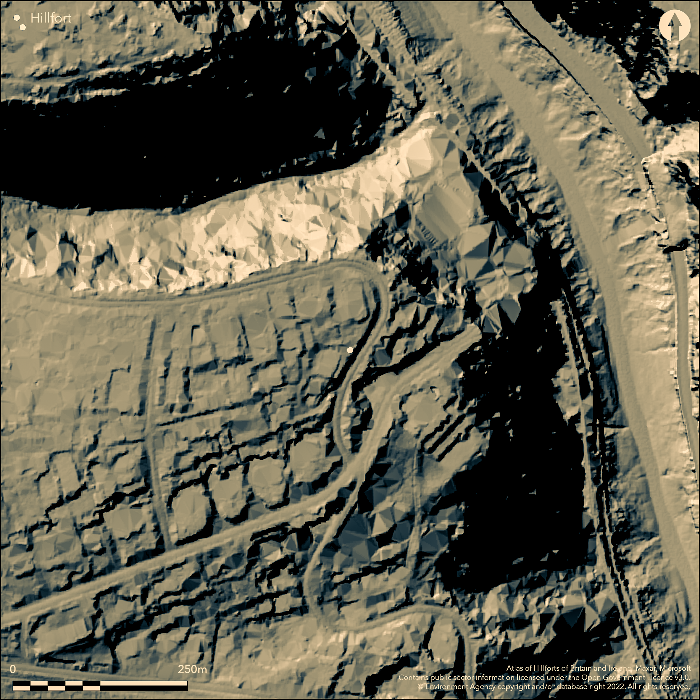
LiDAR 1m DTM Hillshade
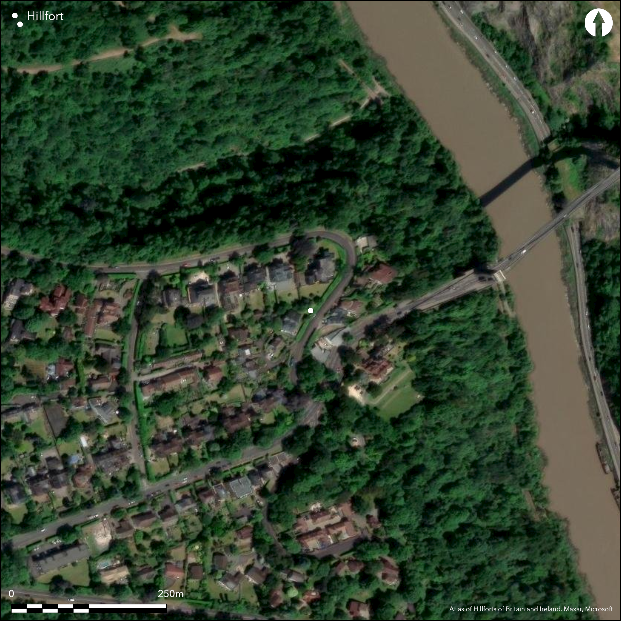
Satellite Imagery
LiDAR 1m DTM Hillshade
Satellite Imagery
Scroll left/right to view further images.
HER: North Somerset MNS860 (None)
NMR: ST 57 SE 37 (198387)
SM: None
NGR: ST56247299
X: 356240 Y: 172990 (OSGB36)
Virtually destroyed, multivallate, inland promontory fort located at point above River Avon on W where now crossed by Clifton Suspension Bridge. Virtually destroyed by villas built 1868 and not on OS 1:500 map of 1884, type of hillfort cannot be accurately defined and inland promontory fort suggested. One of three hillforts overlooking the Avon Gorge, others being Stokeleigh Camp (Atlas No 3983 ) and Clifton Down Camp (Atlas No 4035). Enclosing a roughly triangular area of c. 2.8ha, on E and N sides Avon gorge provided natural defence, but on remaining S and W were three curving ramparts (Burrow 1924) . Entrances destroyed. By 1962 field surveyor found only traces of two banks, each with an outer, or W ditch, traceable for 5m, between modern road and precipitous drop into Nightingale Valley, and two mutilated banks with a strong stone content, separated by berm and ditch in an ornamental garden. Present situation not determined. Undated.
Citizen Science: ✗
Reliability of Data: Unconfirmed
Reliability of Interpretation: Unconfirmed
X: -292904 Y: 6702022 (EPSG: 3857)
Longitude: -2.6312049472445143 Latitude: 51.45414012404379 (EPSG:4326)
Country: England
Current County or Unitary Authority: North Somerset
Historic County: Somerset
Current Parish/Community/Council/Townland: Long Ashton
Virtually destroyed by housing 1868. By 1962 field surveyor found only traces of two banks, each with an outer, or W ditch, traceable for 5.0m, between modern road and precipitous drop into Nightingale Valley, and two mutilated banks with a strong stone content, separated by berm and ditch in an ornamental garden. Present situation not determined.
| Extant | ✓ |
| Cropmark | ✗ |
| Likely Destroyed | ✓ |
Housing.
| Woodland | ✗ |
| Commercial Forestry Plantation | ✗ |
| Parkland | ✗ |
| Pasture (Grazing) | ✗ |
| Arable | ✗ |
| Scrub/Bracken | ✗ |
| Bare Outcrop | ✗ |
| Heather/Moorland | ✗ |
| Heath | ✗ |
| Built-up | ✓ |
| Coastal Grassland | ✗ |
| Other | ✗ |
Vitually destroyed, multivallate, possible inland promontory fort located at point above River Avon on W where now crossed by Clifton Suspension Bridge. Because destroyed by villas built 1868 and not on OS 1:500 map of 1884, type of hillfort cannot be accurately defined and inland promontory fort suggested. Aspect not determined.
| Contour Fort | ✗ |
| Partial Contour Fort | ✗ |
| Promontory Fort | ✓ |
| Hillslope Fort | ✗ |
| Level Terrain Fort | ✗ |
| Marsh Fort | ✗ |
| Multiple Enclosure Fort | ✗ |
| Hilltop | ✗ |
| Coastal Promontory | ✗ |
| Inland Promontory | ✓ |
| Valley Bottom | ✗ |
| Knoll/Hillock/Outcrop | ✗ |
| Ridge | ✗ |
| Cliff/Plateau-edge/Scarp | ✗ |
| Hillslope | ✗ |
| Lowland | ✗ |
| Spur | ✗ |
Dominant Topographic Feature: Built on. Promontory suggested.
| North | ✗ |
| Northeast | ✗ |
| East | ✗ |
| Southeast | ✗ |
| South | ✗ |
| Southwest | ✗ |
| West | ✗ |
| Northwest | ✗ |
| Level | ✗ |
Altitude: 91.0m
N/A
None.
Reliability: D - None
| Pre 1200BC | ✗ |
| 1200BC - 800BC | ✗ |
| 800BC - 400BC | ✗ |
| 400BC - AD50 | ✗ |
| AD50 - AD400 | ✗ |
| AD400 - AD 800 | ✗ |
| Post AD800 | ✗ |
| Unknown | ✓ |
| Pre Hillfort: | None |
| Post Hillfort: | None |
Water colour by S.H. Grimm 1789 in Somerset. Arch. Soc. library. Sketch plan W. Barrett 1789. Antiquarian mentions: S. Seyer 1821; W. Phelps, 1836. Field investigations 1962, 1965 - no details.
| Other (1789): | Water colour by S.H. Grimm. |
| 1st Identified Map Depiction (1789): | Sketch plan W. Barrett. |
| 1st Identified Written Reference (1821): | S. Seyer. |
| Other (1836): | W. Phelps. |
| Other (None): | Field investigations - no details. |
None. Virtually destroyed.
None
| None | ✓ |
| Spring | ✗ |
| Stream | ✗ |
| Pool | ✗ |
| Flush | ✗ |
| Well | ✗ |
| Other | ✗ |
None
| No Known Features | ✓ |
| Round Stone Structures | ✗ |
| Rectangular Stone Structures | ✗ |
| Curvilinear Platforms | ✗ |
| Other Roundhouse Evidence | ✗ |
| Pits | ✗ |
| Quarry Hollows | ✗ |
| Other | ✗ |
None
| No Known Excavation | ✓ |
| Pits | ✗ |
| Postholes | ✗ |
| Roundhouses | ✗ |
| Rectangular Structures | ✗ |
| Roads/Tracks | ✗ |
| Quarry Hollows | ✗ |
| Other | ✗ |
| Nothing Found | ✗ |
None
| No Known Geophysics | ✓ |
| Pits | ✗ |
| Roundhouses | ✗ |
| Rectangular Structures | ✗ |
| Roads/Tracks | ✗ |
| Quarry Hollows | ✗ |
| Other | ✗ |
| Nothing Found | ✗ |
None
| No Known Finds | ✓ |
| Pottery | ✗ |
| Metal | ✗ |
| Metalworking | ✗ |
| Human Bones | ✗ |
| Animal Bones | ✗ |
| Lithics | ✗ |
| Environmental | ✗ |
| Other | ✗ |
None
| APs Not Checked | ✓ |
| None | ✗ |
| Roundhouses | ✗ |
| Rectangular Structures | ✗ |
| Pits | ✗ |
| Postholes | ✗ |
| Roads/Tracks | ✗ |
| Other | ✗ |
Entrances destroyed.
| 0: | None |
| 2: | None |
Guard Chambers: ✗
Chevaux de Frise: ✗
Virtually destroyed by housing 1868. By 1962 field surveyor found only traces of two banks, each with an outer, or W ditch, traceable for 5m, between modern road and precipitous drop into Nightingale Valley, and two mutilated banks with a strong stone content, separated by berm and ditch in an ornamental garden. Present situation not determined.
| Area 1: | 2.8ha. |
| Total: | 2.8ha. |
Total Footprint Area: Noneha.
None
| ✗ | None |
| ✗ | Cannot de determined. Virtually destroyed. |
| NE Quadrant: | None |
| SE Quadrant: | None |
| SW Quadrant: | None |
| NW Quadrant: | None |
| Total: | None |
| Partial Univallate | ✗ |
| Univallate | ✗ |
| Partial Bivallate | ✗ |
| Bivallate | ✗ |
| Partial Multivallate | ✗ |
| Multivallate | ✗ |
| Unknown | ✓ |
| Partial Univallate | ✗ |
| Univallate | ✗ |
| Partial Bivallate | ✗ |
| Bivallate | ✗ |
| Partial Multivallate | ✗ |
| Multivallate | ✗ |
Stony bank. In 1962 field surveyor found two mutilated banks separated by berm and ditch in ornamental garden.
| None | ✗ |
| Earthen Bank | ✓ |
| Stone Wall | ✗ |
| Rubble | ✓ |
| Wall-walk | ✗ |
| Evidence of Timber | ✗ |
| Vitrification | ✗ |
| Other Burning | ✗ |
| Palisade | ✗ |
| Counter Scarp Bank | ✗ |
| Berm | ✓ |
| Unfinished | ✗ |
| Other | ✗ |
None
| None | ✗ |
| Earthen Bank | ✗ |
| Stone Wall | ✗ |
| Murus Duplex | ✗ |
| Timber-framed | ✗ |
| Timber-laced | ✗ |
| Vitrification | ✗ |
| Other Burning | ✗ |
| Palisade | ✗ |
| Counter Scarp Bank | ✗ |
| Berm | ✗ |
| Unfinished | ✗ |
| No Known Excavation | ✓ |
| Other | ✗ |
| ✗ | None |
| ✓ | Traces of two ditches in 1962. |
Number of Ditches: 2
| ✗ | None |
Barrett, W. 1789. History and antiquities of the City of Bristol.
Burrow, E. 1924. Ancient earthworks and camps of Somerset, Cheltenham: E.J. Burrow, 46-7.
Cotton, M.A. 1954. British camps with timber-laces ramparts, Arch J, 111, 26-105.
Manby, G.W. 1802. Fugitive sketches of the history and natural beauties of Clifton, Hotwells and vicinity, Bristol: Norton, 9, 12-13.
Morgan, C. Lloyd 1900. Notes on Clifton, Burwalls and Stokeleigh Camps, Clifton Ant Clb, 5, 8-24.
Phelps, W. 1836. History and Antiquities of Somersetshire 1, London: J.B. Nichols and Son, 96.
Seyer, S. 1821. Memoirs, historical and topographical, of Bristol and its neighbourhood, 62-4.
Atlas of Hillforts:
Wikidata:
This work is licensed under CC BY-SA 4.0

 and should be cited as:
Lock, Gary and Ralston, Ian. 2024. Atlas of Hillforts of Britain and Ireland. Available at: https://hillforts.arch.ox.ac.uk
Document Version 1.1