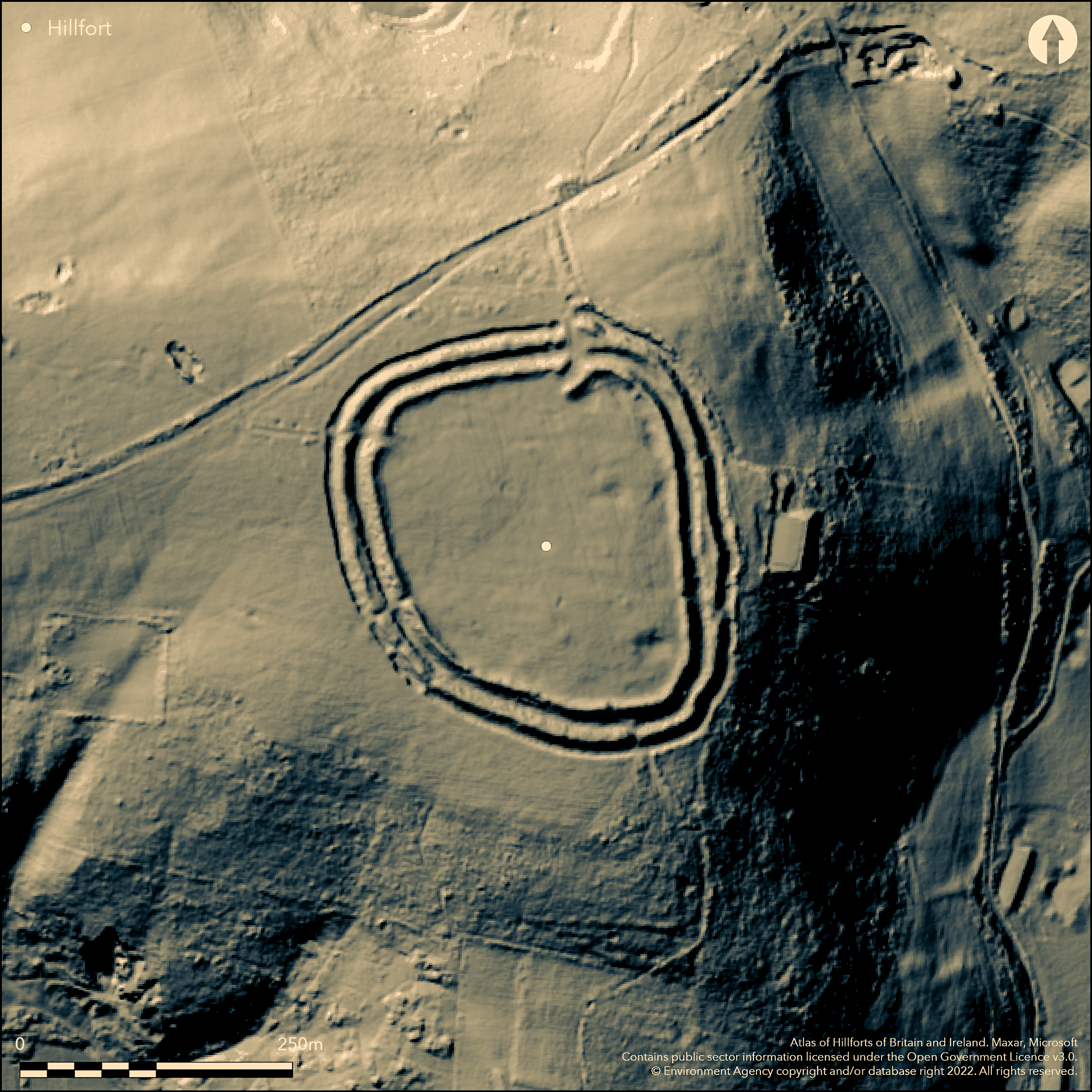
LiDAR 1m DTM Hillshade
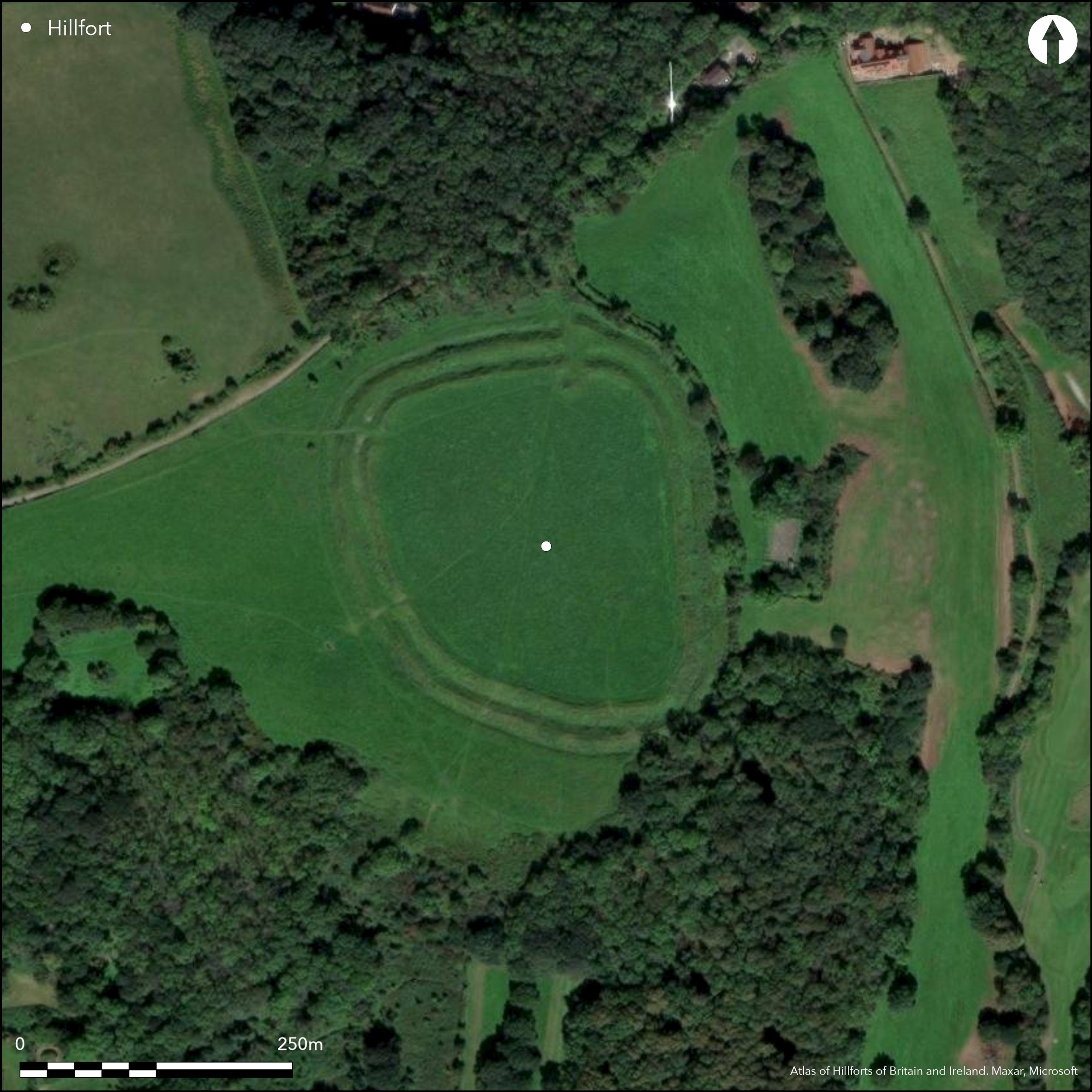
Satellite Imagery
LiDAR 1m DTM Hillshade
Satellite Imagery
Scroll left/right to view further images.
HER: North Somerset MNS531 (None)
NMR: ST 47 SE 25 (195367)
SM: 1008295
NGR: ST45427247
X: 345420 Y: 172470 (OSGB36)
Small, multivallate, partial contour hillfort situated E end of commanding ridge separating Gordano Valley from Somerset Levels. Sloping to E, sub-circular interior 190m N-S by 160m with area 2.7ha. Steep or very steep surrounding slopes, less along ridge on W. Defined by two ramparts of small stones with ditches c. 26.5m. across. Internal bank c. 2m high and medial ditch c. 2m deep, both 18m wide in total. External rampart is c. 1.5m high and ditch c. 2m deep, both 8.5m total. constructed of small stones, quarried from the ditches. Three entrances, only on N thought original, well-preserved and elaborate. Geophysical survey supported by earthwork survey suggest blocked entrance (Papworth 2001). Excavations by H. St George Gray 1922 indicated Iron Age occupation and Romano-British continuation or reuse. With stray finds, artefacts from interior included Iron Age and Romano-British material, including pottery. Also Neolithic flints and Bronze Age axe (found 1856) and substantial Roman activity evidence of late Roman coins of Claudius II (Claudius Gothicus - AD 268-270) and Valentinian II (AD 375-387) and coin of AD 370 (found in 1945). In 1974 part of possible Romano-British altar found in inner ditch. This relief possible local version Roman god Mars or Silvanus. With Roman figurine of Mars suggests possible shrine. One of three Somerset area hillforts named 'Cadbury'; others Cadbury Castle, South Cadbury (Atlas No 3948) and Cadbury Hill Camp, Congresbury (Atlas No 3940). WWII damage. Rough grassland interior with scrub and trees on banks, particularly on N and S. Bracken problem. Path through site N-S through N entrance and S gap. Well-preserved and managed National Trust site. On 1st Ed. OS map (1884).
Citizen Science: ✗
Reliability of Data: Confirmed
Reliability of Interpretation: Confirmed
X: -310229 Y: 6701019 (EPSG: 3857)
Longitude: -2.7868326264275773 Latitude: 51.44852323586533 (EPSG:4326)
Country: England; None
Current County or Unitary Authority: North Somerset
Historic County: Somerset
Current Parish/Community/Council/Townland: Tickenham; Clapton
WWII damage. Path through site N-S through N entrance and S gap. Well-preserved and managed National Trust site.
| Extant | ✓ |
| Cropmark | ✗ |
| Likely Destroyed | ✗ |
Rough grassland interior, with trees and scrub on banks, particularly on N and S. Bracken problem. WWII searchlight battery on site. Site also used for bomb disposal.
| Woodland | ✓ |
| Commercial Forestry Plantation | ✗ |
| Parkland | ✓ |
| Pasture (Grazing) | ✗ |
| Arable | ✗ |
| Scrub/Bracken | ✓ |
| Bare Outcrop | ✗ |
| Heather/Moorland | ✗ |
| Heath | ✗ |
| Built-up | ✗ |
| Coastal Grassland | ✗ |
| Other | ✓ |
Small, multivallate, partial contour hillfort situated E end of commanding ridge separating Gordano Valley from Somerset Levels. Sloping to E, sub-circular interior 190m N-S by 160m with area 2.7ha. Steep or very steep surrounding slopes, less along ridge on W.
| Contour Fort | ✗ |
| Partial Contour Fort | ✓ |
| Promontory Fort | ✗ |
| Hillslope Fort | ✗ |
| Level Terrain Fort | ✗ |
| Marsh Fort | ✗ |
| Multiple Enclosure Fort | ✗ |
| Hilltop | ✗ |
| Coastal Promontory | ✗ |
| Inland Promontory | ✗ |
| Valley Bottom | ✗ |
| Knoll/Hillock/Outcrop | ✗ |
| Ridge | ✓ |
| Cliff/Plateau-edge/Scarp | ✗ |
| Hillslope | ✗ |
| Lowland | ✗ |
| Spur | ✗ |
Dominant Topographic Feature: Ridge.
| North | ✗ |
| Northeast | ✗ |
| East | ✓ |
| Southeast | ✗ |
| South | ✗ |
| Southwest | ✗ |
| West | ✗ |
| Northwest | ✗ |
| Level | ✗ |
Altitude: 110.0m
Boundary Type: Parish/Townland
St.George Gray's excavations 1922 indicated Iron Age occupation and Romano-British continuation or reuse.
Reliability: B - Medium
| Pre 1200BC | ✗ |
| 1200BC - 800BC | ✗ |
| 800BC - 400BC | ✗ |
| 400BC - AD50 | ✓ |
| AD50 - AD400 | ✗ |
| AD400 - AD 800 | ✗ |
| Post AD800 | ✗ |
| Unknown | ✗ |
| Pre Hillfort: | None |
| Post Hillfort: | None |
| Artefactual: | Pottery and other artefacts. |
On 1st Ed. OS map (1884). Excavation H. St George Gray 1922. Field investigations 1962, 1965 - no details. Geophysical survey National Trust 1998-1999.
| 1st Identified Map Depiction (1884): | OS map. |
| Excavation (1922): | H. St George Gray. |
| Other (None): | Field investigations - no details. |
| Geophysical Survey (None): | National Trust. |
From excavation and stray finds, Iron Age and Romano-British artefacts, including pottery, from interior. Also Neolithic flints and Bronze Age axe, latter found in 1856, and substantial Roman activity evidence of late Roman coins of Claudius II (Claudius Gothicus AD 268-270) and Valentinian II (AD 375-387). Also coin of AD 370. Romano-British relief found 1974 lying in inner ditch, apparently eroded out. Shows divine character with spear on the right arm. Possible local version of Roman god, possibly Mars or Silvanus, and possibly part of an altar. With Roman figurine of Mars suggests possible shrine.
None
| None | ✓ |
| Spring | ✗ |
| Stream | ✗ |
| Pool | ✗ |
| Flush | ✗ |
| Well | ✗ |
| Other | ✗ |
None
| No Known Features | ✓ |
| Round Stone Structures | ✗ |
| Rectangular Stone Structures | ✗ |
| Curvilinear Platforms | ✗ |
| Other Roundhouse Evidence | ✗ |
| Pits | ✗ |
| Quarry Hollows | ✗ |
| Other | ✗ |
None
| No Known Excavation | ✗ |
| Pits | ✗ |
| Postholes | ✗ |
| Roundhouses | ✗ |
| Rectangular Structures | ✗ |
| Roads/Tracks | ✗ |
| Quarry Hollows | ✗ |
| Other | ✗ |
| Nothing Found | ✓ |
Geophysics not checked.
| No Known Geophysics | ✗ |
| Pits | ✗ |
| Roundhouses | ✗ |
| Rectangular Structures | ✗ |
| Roads/Tracks | ✗ |
| Quarry Hollows | ✗ |
| Other | ✓ |
| Nothing Found | ✗ |
Iron Age and Romano-British artefacts, including pottery, from interior. Also Neolithic flints and Bronze Age axe, latter found in 1856, and substantial Roman activity evidence of late Roman coins of Claudius II (Claudius Gothicus AD 268-270) and Valentinian II (AD 375-387). Also coin of AD 370. Romano-British relief found 1974 lying in inner ditch, apparently eroded out. Shows divine character with spear on the right arm. Possible local version of Roman god, possibly Mars or Silvanus, and possibly part of an altar. With Roman figurine of Mars suggests possible shrine.
| No Known Finds | ✗ |
| Pottery | ✓ |
| Metal | ✓ |
| Metalworking | ✗ |
| Human Bones | ✗ |
| Animal Bones | ✗ |
| Lithics | ✓ |
| Environmental | ✗ |
| Other | ✓ |
None
| APs Not Checked | ✓ |
| None | ✗ |
| Roundhouses | ✗ |
| Rectangular Structures | ✗ |
| Pits | ✗ |
| Postholes | ✗ |
| Roads/Tracks | ✗ |
| Other | ✗ |
Three entrances, only on N thought original, well-preserved and elaborate with long passageway through ramparts and across ditches, with E inner bank curving obliquely inwards. Path through site N-S through N entrance and S gap. Two phases of geophysical survey supported by earthwork survey suggested blocked entrance. No details of position.
| 3: | Modern gaps on S and SW with paths through. |
| 2: | Only N thought original. |
Guard Chambers: ✗
Chevaux de Frise: ✗
| 1. Passage-way/Corridor (North): | Long passageway through ramparts and across ditches, with E inner bank curving obliquely inwards. |
| 1. In-turned (North): | E inner bank curves obliquely inwards. |
| 2. Blocked (None): | Geophysical survey supported by earthwork survey suggested blocked entrance - no details of position. |
Defined by two ramparts of small stones with ditches c. 26.5m. across. Internal bank c. 2m high and medial ditch c. 2m deep, both 18m wide in total. External rampart is c. 1.5m high and ditch c. 2m deep, both 8.5m total. constructed of small stones, quarried from the ditches.
| Area 1: | 2.7ha. |
| Total: | 2.7ha. |
Total Footprint Area: Noneha.
None
| ✓ | Possibly phased as blocked entrance. |
| ✓ | None |
| NE Quadrant: | 1 |
| SE Quadrant: | 1 |
| SW Quadrant: | 1 |
| NW Quadrant: | 1 |
| Total: | 1 |
| Partial Univallate | ✗ |
| Univallate | ✓ |
| Partial Bivallate | ✗ |
| Bivallate | ✗ |
| Partial Multivallate | ✗ |
| Multivallate | ✗ |
| Unknown | ✗ |
| Partial Univallate | ✗ |
| Univallate | ✗ |
| Partial Bivallate | ✗ |
| Bivallate | ✗ |
| Partial Multivallate | ✗ |
| Multivallate | ✗ |
Banks of small stones.
| None | ✗ |
| Earthen Bank | ✓ |
| Stone Wall | ✗ |
| Rubble | ✓ |
| Wall-walk | ✗ |
| Evidence of Timber | ✗ |
| Vitrification | ✗ |
| Other Burning | ✗ |
| Palisade | ✗ |
| Counter Scarp Bank | ✗ |
| Berm | ✗ |
| Unfinished | ✗ |
| Other | ✗ |
Rampart sectioned by H. St Georgs Gray 1922. Stony banks.
| None | ✗ |
| Earthen Bank | ✓ |
| Stone Wall | ✗ |
| Murus Duplex | ✗ |
| Timber-framed | ✗ |
| Timber-laced | ✗ |
| Vitrification | ✗ |
| Other Burning | ✗ |
| Palisade | ✗ |
| Counter Scarp Bank | ✗ |
| Berm | ✗ |
| Unfinished | ✗ |
| No Known Excavation | ✗ |
| Other | ✓ |
| ✗ | None |
| ✓ | None |
Number of Ditches: 2
| ✗ | None |
Brown, I. 2009. Beacons in the landscape. The hillforts of England and Wales, Oxford: Windgather Press/Oxbow Books.
Burrow, E. 1924. Ancient earthworks and camps of Somerset, Cheltenham: E.J. Burrow, 76-7.
Burrow, I. 1981. Hillfort and hill-top settlement in Somerset in the first to eighth centuries AD, British Archaeological Report (BAR) British Series 1, 91, 227-8.
Page, W. ed. 1911. Ancient earthworks, The Victoria History of Somerset, Volume Two, The Victoria History of the Counties of England, London: Constable and Co, 500-1.
Papworth, M. 1999. Interim report on geophysical survey at Cadbury Camp, Tickenham, North Somerset, Interim report to National Trust.
Papworth, M. 1999. Interim report on geophysical survey II at Cadbury Camp, Tickenham, North Somerset, Interim report to National Trust.
Papworth, M. 2001 CADBURY CAMP, TICKENHAM, NORTH SOMERSET: GEOPHYSICAL SURVEY OF THE HILLFORT INTERIOR, National Trust, unpublished.
St George Gray, H. 1922. Trial-excavations at Cadbury Camp, Tickenham, Somerset, 1922, Somerset Arch Natur Hist , 68, 8-20.
Atlas of Hillforts:
Wikidata:
This work is licensed under CC BY-SA 4.0

 and should be cited as:
Lock, Gary and Ralston, Ian. 2024. Atlas of Hillforts of Britain and Ireland. Available at: https://hillforts.arch.ox.ac.uk
Document Version 1.1