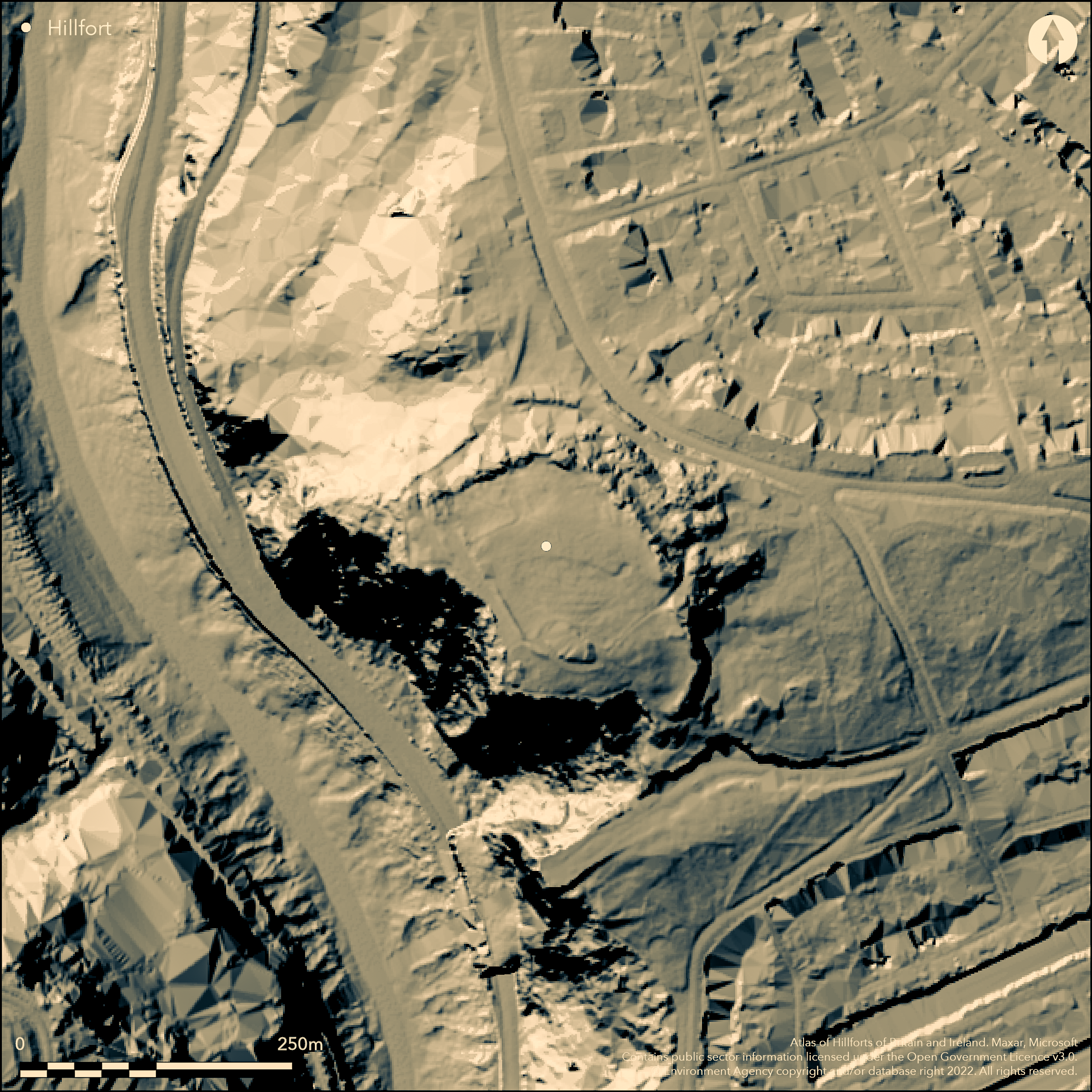
LiDAR 1m DTM Hillshade
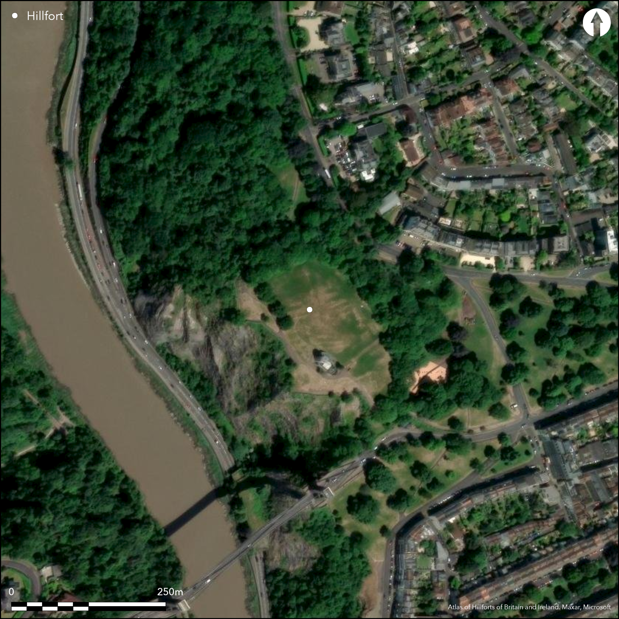
Satellite Imagery
LiDAR 1m DTM Hillshade
Satellite Imagery
Scroll left/right to view further images.
HER: City of Bristol 1780M (None)
NMR: ST 57 SE 21 (198349)
SM: 1005427
NGR: ST56567332
X: 356560 Y: 173320 (OSGB36)
Multivallate, inland promontory fort located in fine possition on Observatory Hill, Clifton Down above River Avon gorge on W. Precipitous, rocky, slopes to river on W, moderate and affected by development elsewhere. On opposite side of river, on E bank, to Stokeleigh Camp (Atlas No 3983), just to N of Clifton Suspension Bridge. One of three hillforts overlooking the Avon Gorge, others being Burgh Walls Camp (Atlas No 3984) and Stokeleigh Camp. Line of, mostly mulivallate, ramparts appear to have cut off the promontory above the gorge in arc running from N-SE, now enclosing c. 3ha. Closely set triple ramparts and ditches on NE, with one or two banks on SE. W and SW sides delineated by the precipitous slopes to gorge. Information on site mostly antiquarian, but plan by C. Lloyd Morgan (1900) useful. In NW corner rectangular earthwork, possibly Roman or medieval in date. Antiquarian digging, 1808, 1810, with sections cut through SE bank of NW earthwork and a low bank running S from this to observatory area on SW by Clifton Antiquarian Club. This latter bank probably later than original hillfort. Possible hut circles in interior. Quarry ditch. Access roads/tracks cut through banks on E and SE. Access gaps for roads/tracks through ramparts on NE and SE. Site of original entrance unclear. Sited on public access Clifton Down with managed grassland interior. Observatory located in SW with access roads/tracks around perimeter on W. Formerly obscured by trees/scrub and old quarrying, now managemed by Bristol City Council to conserve this popular site with scrub and tree removal over 6-year cycle. Significant amount of vegetation cleared from ramparts on N, and triple line of bank now visible. Information boards. On 1st Ed. OS map (1883).
Citizen Science: ✗
Reliability of Data: Confirmed
Reliability of Interpretation: Confirmed
X: -292396 Y: 6702557 (EPSG: 3857)
Longitude: -2.6266404051649426 Latitude: 51.45713191396305 (EPSG:4326)
Country: England
Current County or Unitary Authority: City of Bristol
Historic County: Somerset
Current Parish/Community/Council/Townland: None
Sited on public access Clifton Dow. Observatory located in SW with access roads/tracks from E and SE and around perimeter on W. Formerly obscured by trees/scrub and old quarrying, now management prescriptions by Bristol City Council to conserve this popular site include scrub and tree removal over 6-year cycle. Significant amount of vegetation cleared from ramparts on N, and triple line of bank now visible. Information boards.
| Extant | ✓ |
| Cropmark | ✗ |
| Likely Destroyed | ✗ |
Public access grassland interior, trees and scrub on banks, wooded surrounds. Observatory in SW. Quarrying.
| Woodland | ✓ |
| Commercial Forestry Plantation | ✗ |
| Parkland | ✓ |
| Pasture (Grazing) | ✗ |
| Arable | ✗ |
| Scrub/Bracken | ✗ |
| Bare Outcrop | ✗ |
| Heather/Moorland | ✗ |
| Heath | ✗ |
| Built-up | ✓ |
| Coastal Grassland | ✗ |
| Other | ✓ |
Multivallate, inland promontory fort located in fine possition on Observatory Hill, Clifton Down above River Avon gorge on W. Precipitous, rocky, slopes to river on W, moderate and affected by development elsewhere. On
| Contour Fort | ✗ |
| Partial Contour Fort | ✗ |
| Promontory Fort | ✓ |
| Hillslope Fort | ✗ |
| Level Terrain Fort | ✗ |
| Marsh Fort | ✗ |
| Multiple Enclosure Fort | ✗ |
| Hilltop | ✗ |
| Coastal Promontory | ✗ |
| Inland Promontory | ✓ |
| Valley Bottom | ✗ |
| Knoll/Hillock/Outcrop | ✗ |
| Ridge | ✗ |
| Cliff/Plateau-edge/Scarp | ✗ |
| Hillslope | ✗ |
| Lowland | ✗ |
| Spur | ✗ |
Dominant Topographic Feature: Promontory
| North | ✗ |
| Northeast | ✗ |
| East | ✗ |
| Southeast | ✗ |
| South | ✗ |
| Southwest | ✗ |
| West | ✗ |
| Northwest | ✗ |
| Level | ✓ |
Altitude: 102.0m
N/A
Probably Iron Age, but no dateable finds. Third century Roman coins exhibited to Clifton Antiquarian Club by J.E. Pritchard 1894, said to have been found on the site. Also barbed arrowhead, scraper and flake collected by A. Selley.
Reliability: D - None
| Pre 1200BC | ✗ |
| 1200BC - 800BC | ✗ |
| 800BC - 400BC | ✗ |
| 400BC - AD50 | ✗ |
| AD50 - AD400 | ✗ |
| AD400 - AD 800 | ✗ |
| Post AD800 | ✗ |
| Unknown | ✓ |
| Pre Hillfort: | Flint implements could suggest earlier activity. |
| Post Hillfort: | In NW corner rectangular earthwork, possibly Roman or medieval in date. Roman coins found. Observatory in SW. |
| Morphology/Earthwork/Typology: | Conjecture only. |
Described by William Worcestre (1480) and John Aubrey (17th century). On 1st Ed. OS map (1883). Antiquarian digging, 1808, 1810. Plan 1900 (C. Lloyd Morgan).
| 1st Identified Written Reference (1480): | None |
| 1st Identified Map Depiction (1883): | None |
| Other (1900): | Plan |
| Excavation (None): | None |
Possible hut circles in interior. Quarry ditch. Third century Roman coins exhibited to Clifton Antiquarian Club by J.E. Pritchard 1894, said to have been found on the site. Also barbed arrowhead, scraper and flake collected by A. Selley.
None
| None | ✓ |
| Spring | ✗ |
| Stream | ✗ |
| Pool | ✗ |
| Flush | ✗ |
| Well | ✗ |
| Other | ✗ |
Possible hut circles in interior. Quarry ditch.
| No Known Features | ✗ |
| Round Stone Structures | ✗ |
| Rectangular Stone Structures | ✗ |
| Curvilinear Platforms | ✗ |
| Other Roundhouse Evidence | ✓ |
| Pits | ✗ |
| Quarry Hollows | ✓ |
| Other | ✗ |
None
| No Known Excavation | ✗ |
| Pits | ✗ |
| Postholes | ✗ |
| Roundhouses | ✗ |
| Rectangular Structures | ✗ |
| Roads/Tracks | ✗ |
| Quarry Hollows | ✗ |
| Other | ✗ |
| Nothing Found | ✓ |
None
| No Known Geophysics | ✓ |
| Pits | ✗ |
| Roundhouses | ✗ |
| Rectangular Structures | ✗ |
| Roads/Tracks | ✗ |
| Quarry Hollows | ✗ |
| Other | ✗ |
| Nothing Found | ✗ |
Third century Roman coins exhibited to Clifton Antiquarian Club by J.E. Pritchard 1894, said to have been found on the site. Also barbed arrowhead, scraper and flake collected by A. Selley.
| No Known Finds | ✓ |
| Pottery | ✗ |
| Metal | ✗ |
| Metalworking | ✗ |
| Human Bones | ✗ |
| Animal Bones | ✗ |
| Lithics | ✗ |
| Environmental | ✗ |
| Other | ✗ |
None
| APs Not Checked | ✓ |
| None | ✗ |
| Roundhouses | ✗ |
| Rectangular Structures | ✗ |
| Pits | ✗ |
| Postholes | ✗ |
| Roads/Tracks | ✗ |
| Other | ✗ |
Access gaps from roads/tracks through ramparts on NE and SE. Site of original entrance unclear.
| 2: | Gaps through ramparts on NE and NW. |
| 2: | Site of original entrance unclear. |
Guard Chambers: ✗
Chevaux de Frise: ✗
Line of, mostly mulivallate, ramparts appear to have cut off the promontory above the gorge in arc running from N-SE, now enclosing c. 3ha. Closely-set triple ramparts and ditches on NE, with one or two banks on SE. W and SW side defended by the precipitous slopes to gorge.
| Area 1: | 3.0ha. |
| Total: | 3.0ha. |
Total Footprint Area: Noneha.
None
| ✗ | None |
| ✗ | None |
| NE Quadrant: | 3 |
| SE Quadrant: | 2 |
| SW Quadrant: | 0 |
| NW Quadrant: | 3 |
| Total: | 3 |
| Partial Univallate | ✗ |
| Univallate | ✗ |
| Partial Bivallate | ✓ |
| Bivallate | ✗ |
| Partial Multivallate | ✓ |
| Multivallate | ✗ |
| Unknown | ✗ |
| Partial Univallate | ✗ |
| Univallate | ✗ |
| Partial Bivallate | ✗ |
| Bivallate | ✗ |
| Partial Multivallate | ✗ |
| Multivallate | ✗ |
None
| None | ✗ |
| Earthen Bank | ✓ |
| Stone Wall | ✗ |
| Rubble | ✗ |
| Wall-walk | ✗ |
| Evidence of Timber | ✗ |
| Vitrification | ✗ |
| Other Burning | ✗ |
| Palisade | ✗ |
| Counter Scarp Bank | ✗ |
| Berm | ✗ |
| Unfinished | ✗ |
| Other | ✗ |
None
| None | ✗ |
| Earthen Bank | ✓ |
| Stone Wall | ✗ |
| Murus Duplex | ✗ |
| Timber-framed | ✗ |
| Timber-laced | ✗ |
| Vitrification | ✗ |
| Other Burning | ✗ |
| Palisade | ✗ |
| Counter Scarp Bank | ✗ |
| Berm | ✗ |
| Unfinished | ✗ |
| No Known Excavation | ✗ |
| Other | ✗ |
| ✗ | None |
| ✓ | Possibly three, but total number of ditches unclear. |
Number of Ditches: 3
| ✗ | None |
Burrow, I. 1981. Hillfort and hill-top settlement in Somerset in the first to eighth centuries AD, British Archaeological Report (BAR) British Series 1, 76, 235-6.
Corry, J. 1816. The history of Bristol, civil and ecclesiastical; including biographical notices of eminent and distinguished natives, Bristol: W. Shepherd, 33, 39.
Morgan, C. Lloyd 1900. Notes on Clifton, Burwalls and Stokeleigh Camps, Clifton Ant Clb, 5, 8-24 Plan.
Scarth, H.M. 1873. The camps on the River Avon at Clifton, with remarks on the structure of ancient ramparts, Archaeol, 44, 428-34.
Atlas of Hillforts:
Wikidata:
This work is licensed under CC BY-SA 4.0

 and should be cited as:
Lock, Gary and Ralston, Ian. 2024. Atlas of Hillforts of Britain and Ireland. Available at: https://hillforts.arch.ox.ac.uk
Document Version 1.1