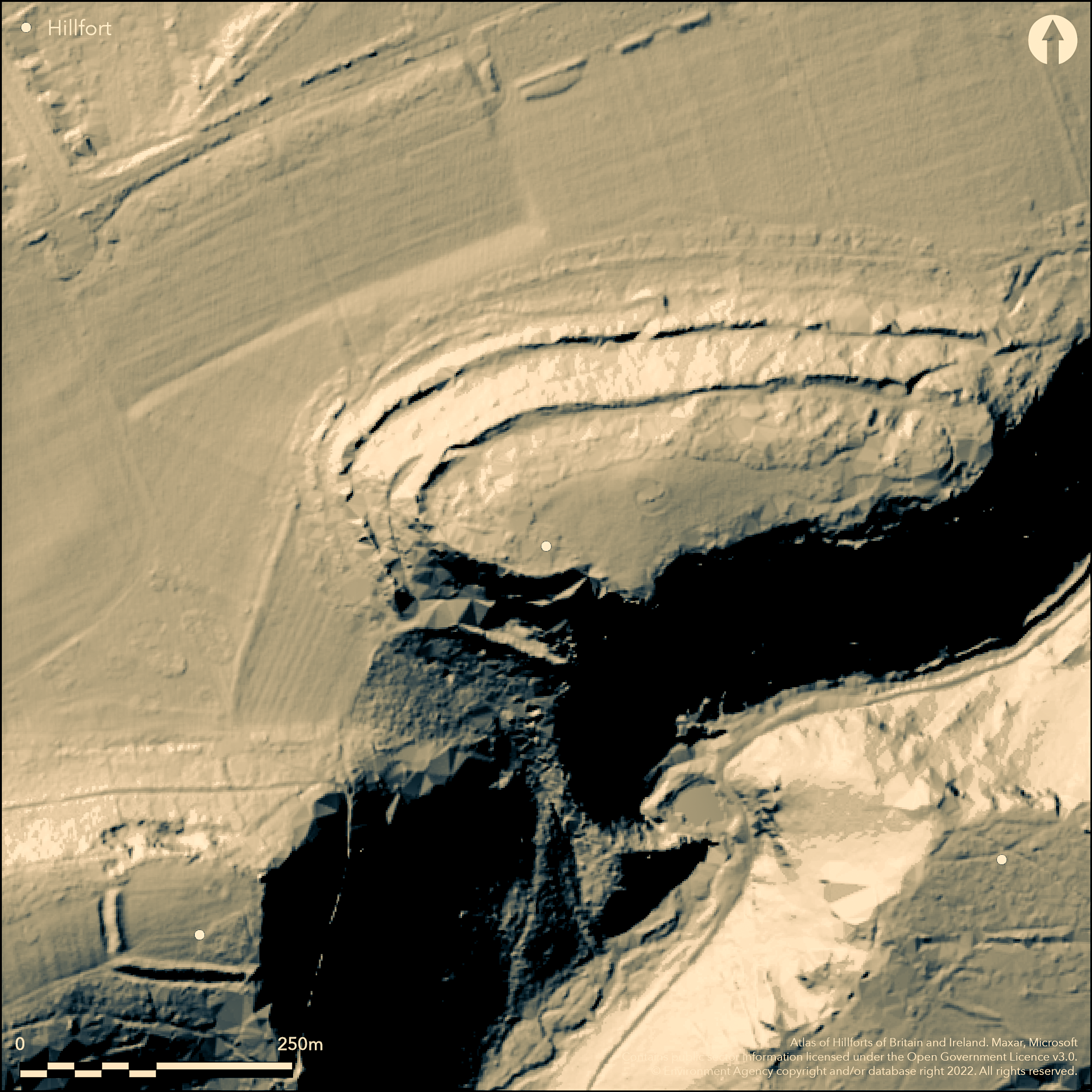
LiDAR 1m DTM Hillshade
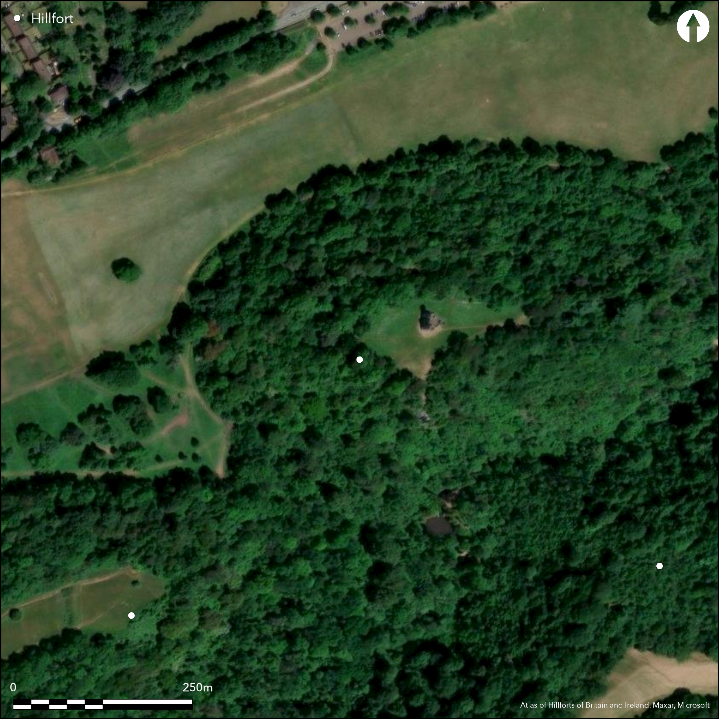
Satellite Imagery
LiDAR 1m DTM Hillshade
Satellite Imagery
Scroll left/right to view further images.
HER: City of Bristol 1753M (None)
NMR: ST 57 NE 2 (198169)
SM: 1004530
NGR: ST55807835
X: 355800 Y: 178350 (OSGB36)
Multivallate, partial contour hillfort located on hill above very steep wooded valley of Hazel Brook, converging with River Trym to SE and thence flowing to River Avon on SW. Steep surrounding slopes, very steep on SE. Just to NE of Kings Weston Down Camp (Atlas No 4044). Encloses c. 2.4ha, Modern 18th century landscaping makes interpretation difficult, but seems, at least, three concentric banks and ditches on N and W sides, now much levelled, but traces of dry-stone walling were visible. On S no signs of ramparts steep slopes possibly enough, but situation in prehistory unclear. On E side low, spread bank runs N-S across summit about 20m W of break of slope, and possible entrance in centre. Second possible entrance gap, with now deeply-cut quarried track, at SW corner. Excavations by J. Clevedon-Brown and P. Rahtz (1959) in 1957 to determine extent of Roman and medieval occupation found intensive late Iron Age B occupation. Two La Tene I brooches and large number of sherds belonging to former 'South-Western Iron Age B culture', recovered from five rubbish-pits. Blaise Castle, a folly, built in interior to enhance the view by Thomas Farr who bought the Blaise estate in 1762. Farr had extensive investments in slave trade and said could view his ships sailing back up the River Avon to Bristol from it. Wooded/parkland interior, wooded surrounds. Now public park and golf course. On 1st Ed OS map (1885-1900).
Citizen Science: ✗
Reliability of Data: Confirmed
Reliability of Interpretation: Confirmed
X: -293684 Y: 6710630 (EPSG: 3857)
Longitude: -2.6382092875845853 Latitude: 51.50229829918697 (EPSG:4326)
Country: England
Current County or Unitary Authority: City of Bristol
Historic County: Gloucestershire
Current Parish/Community/Council/Townland: None
Modern landscaping. Blaise Castle, a folly, built in interior to enhance the view by Thomas Farr who bought the Blaise estate in 1762. Farr had extensive investments in slave trade and said could view his ships sailing back up the River Avon to Bristol from it. Now public park and golf course.
| Extant | ✓ |
| Cropmark | ✗ |
| Likely Destroyed | ✗ |
Wooded/parkland interior, wooded surrounds. Now public park and golf course. Blaise Castle folly in interior.
| Woodland | ✓ |
| Commercial Forestry Plantation | ✗ |
| Parkland | ✓ |
| Pasture (Grazing) | ✓ |
| Arable | ✗ |
| Scrub/Bracken | ✗ |
| Bare Outcrop | ✗ |
| Heather/Moorland | ✗ |
| Heath | ✗ |
| Built-up | ✓ |
| Coastal Grassland | ✗ |
| Other | ✓ |
Multivallate partial contour hillfort located on hill to above very steep wooded valley of Hazel Brook, converging with River Trym to SE and thence flowing to River Avon on SW. Steep surrounding slopes, very steep on SE.
| Contour Fort | ✗ |
| Partial Contour Fort | ✓ |
| Promontory Fort | ✗ |
| Hillslope Fort | ✗ |
| Level Terrain Fort | ✗ |
| Marsh Fort | ✗ |
| Multiple Enclosure Fort | ✗ |
| Hilltop | ✓ |
| Coastal Promontory | ✗ |
| Inland Promontory | ✗ |
| Valley Bottom | ✗ |
| Knoll/Hillock/Outcrop | ✗ |
| Ridge | ✗ |
| Cliff/Plateau-edge/Scarp | ✗ |
| Hillslope | ✗ |
| Lowland | ✗ |
| Spur | ✗ |
Dominant Topographic Feature: Hill top
| North | ✗ |
| Northeast | ✗ |
| East | ✗ |
| Southeast | ✗ |
| South | ✗ |
| Southwest | ✗ |
| West | ✗ |
| Northwest | ✗ |
| Level | ✓ |
Altitude: 91.0m
N/A
Excavations 1957 to determine extent of Roman and medieval occupation found intensive late Iron Age B occupation. Two La Tene I brooches and large number of sherds belonging to 'South-Western Iron Age B culture', recovered from five rubbish-pits.
Reliability: C - Low
| Pre 1200BC | ✗ |
| 1200BC - 800BC | ✗ |
| 800BC - 400BC | ✗ |
| 400BC - AD50 | ✓ |
| AD50 - AD400 | ✗ |
| AD400 - AD 800 | ✗ |
| Post AD800 | ✗ |
| Unknown | ✗ |
| Pre Hillfort: | None |
| Post Hillfort: | None |
| Artefactual: | Iron Age sherds and brooches. |
In Aubrey's Monumenta Britannica (1665-1693). Reference T. J. Lloyd Baker 1821. On 1st Ed OS map (1885-1900). Excavation J. Clevedon-Brown and P. Rahtz 1957. Evaluation BLAISE CASTLE CAR PARK EXTENSION, Cotswold Archaeological Trust 2001.
| Excavation (1957): | J. Clevedon-Brown and P. Rahtz. |
| Other (2001): | Evaluation BLAISE CASTLE CAR PARK EXTENSION, Cotswold Archaeological Trust. |
| 1st Identified Written Reference (None): | None |
| 1st Identified Map Depiction (None): | None |
Excavations 1957 to determine extent of Roman and medieval occupation found intensive late Iron Age B occupation. Two La Tene I brooches and large number of sherds belonging to ' South-Western Iron Age B culture', recovered from five rubbish-pits. Numerous coins found in 1707, 1766-8, and 1819.
None
| None | ✓ |
| Spring | ✗ |
| Stream | ✗ |
| Pool | ✗ |
| Flush | ✗ |
| Well | ✗ |
| Other | ✗ |
None
| No Known Features | ✓ |
| Round Stone Structures | ✗ |
| Rectangular Stone Structures | ✗ |
| Curvilinear Platforms | ✗ |
| Other Roundhouse Evidence | ✗ |
| Pits | ✗ |
| Quarry Hollows | ✗ |
| Other | ✗ |
Rubbish pits investigated.
| No Known Excavation | ✗ |
| Pits | ✓ |
| Postholes | ✗ |
| Roundhouses | ✗ |
| Rectangular Structures | ✗ |
| Roads/Tracks | ✗ |
| Quarry Hollows | ✗ |
| Other | ✗ |
| Nothing Found | ✗ |
None
| No Known Geophysics | ✓ |
| Pits | ✗ |
| Roundhouses | ✗ |
| Rectangular Structures | ✗ |
| Roads/Tracks | ✗ |
| Quarry Hollows | ✗ |
| Other | ✗ |
| Nothing Found | ✗ |
Two La Tene I brooches and large number of sherds belonging to ' South-Western Iron Age B culture', recovered from five rubbish-pits. Numerous coins found in 1707, 1766-8, and 1819.
| No Known Finds | ✗ |
| Pottery | ✓ |
| Metal | ✓ |
| Metalworking | ✗ |
| Human Bones | ✗ |
| Animal Bones | ✗ |
| Lithics | ✗ |
| Environmental | ✗ |
| Other | ✓ |
None
| APs Not Checked | ✓ |
| None | ✗ |
| Roundhouses | ✗ |
| Rectangular Structures | ✗ |
| Pits | ✗ |
| Postholes | ✗ |
| Roads/Tracks | ✗ |
| Other | ✗ |
On E side low, spread bank runs N-S across summit about 20m W of break of slope, and possible entrance in centre. Second possible entrance gap, with now deeply-cut quarried track, at SW corner.
| 2: | None |
| 2: | None |
Guard Chambers: ✗
Chevaux de Frise: ✗
| 1. Simple Gap (South west): | Deeply-cut quarried track |
| 2. Simple Gap (East): | None |
Modern 18th century landscaping makes interpretation difficult, but seems, at least, three concentric banks and ditches on N and W sides, now much levelled, but traces of dry-stone walling were visible. On S no signs of artificial defences, steep slopes possibly enough, but situation in prehistory unclear.
| Area 1: | 2.4ha. |
| Total: | 2.4ha. |
Total Footprint Area: Noneha.
None
| ✗ | None |
| ✗ | None |
| NE Quadrant: | 3 |
| SE Quadrant: | 0 |
| SW Quadrant: | 0 |
| NW Quadrant: | 3 |
| Total: | 3 |
| Partial Univallate | ✗ |
| Univallate | ✗ |
| Partial Bivallate | ✗ |
| Bivallate | ✗ |
| Partial Multivallate | ✓ |
| Multivallate | ✗ |
| Unknown | ✗ |
| Partial Univallate | ✗ |
| Univallate | ✗ |
| Partial Bivallate | ✗ |
| Bivallate | ✗ |
| Partial Multivallate | ✗ |
| Multivallate | ✗ |
Dry-stone walling once visible - present situation unclear.
| None | ✗ |
| Earthen Bank | ✓ |
| Stone Wall | ✓ |
| Rubble | ✗ |
| Wall-walk | ✗ |
| Evidence of Timber | ✗ |
| Vitrification | ✗ |
| Other Burning | ✗ |
| Palisade | ✗ |
| Counter Scarp Bank | ✗ |
| Berm | ✗ |
| Unfinished | ✗ |
| Other | ✗ |
None
| None | ✗ |
| Earthen Bank | ✗ |
| Stone Wall | ✗ |
| Murus Duplex | ✗ |
| Timber-framed | ✗ |
| Timber-laced | ✗ |
| Vitrification | ✗ |
| Other Burning | ✗ |
| Palisade | ✗ |
| Counter Scarp Bank | ✗ |
| Berm | ✗ |
| Unfinished | ✗ |
| No Known Excavation | ✓ |
| Other | ✗ |
| ✗ | None |
| ✓ | Total number of ditches estimated. |
Number of Ditches: 3
| ✗ | None |
Anon, 2001. Blaise Castle Car Park Extension: archaeological evaluation, Cotswold Archaeological Trust.
Burrow, I. 1981. Hillfort and hill-top settlement in Somerset in the first to eighth centuries AD, British Archaeological Report (BAR) British Series 1, 91, 239-40.
Clevedon-Brown,J., and Rahtz, P.A., 1959. Blaise Castle Hill, Bristol. 1957, Proc Univ Bristol Speleol Soc, 8(3), 147-171.
Lloyd Baker, T.J. 1821. An Account of a Chain of Ancient Fortresses, extending through the South Western part of Gloucestershire, Archaeologia, 19, 161-75.
Atlas of Hillforts:
Wikidata:
This work is licensed under CC BY-SA 4.0

 and should be cited as:
Lock, Gary and Ralston, Ian. 2024. Atlas of Hillforts of Britain and Ireland. Available at: https://hillforts.arch.ox.ac.uk
Document Version 1.1