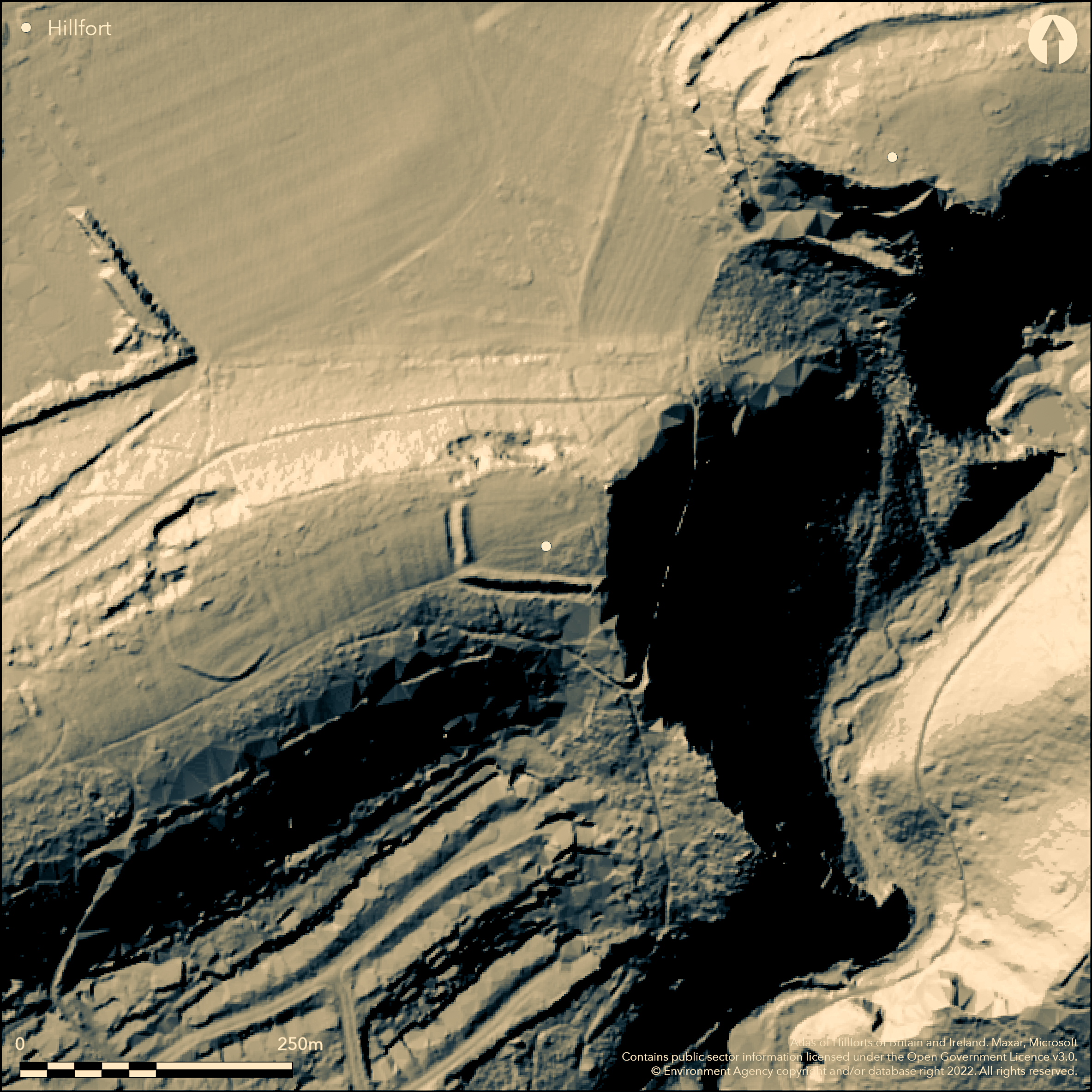
LiDAR 1m DTM Hillshade
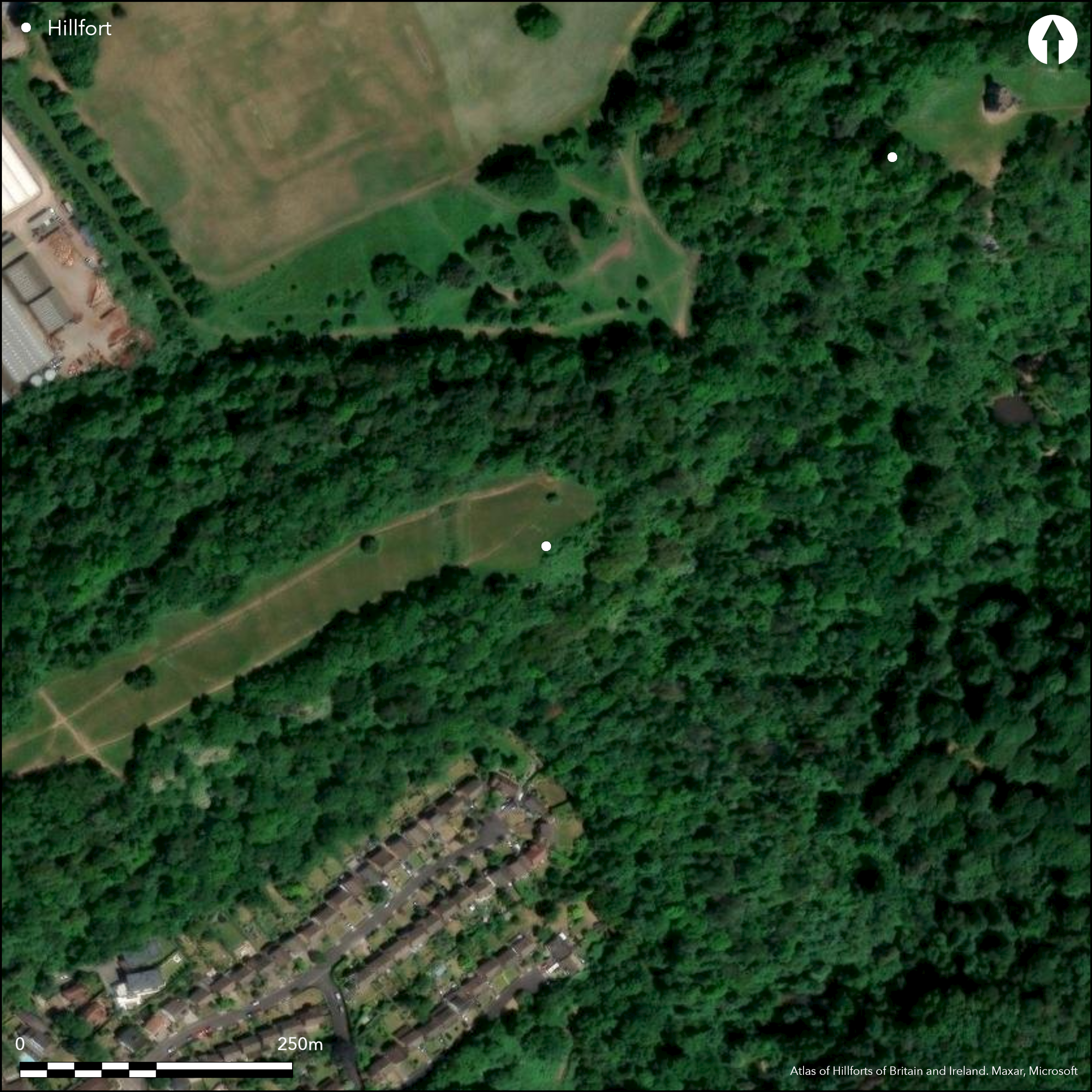
Satellite Imagery
LiDAR 1m DTM Hillshade
Satellite Imagery
Scroll left/right to view further images.
HER: City of Bristol 1757M; 1758M (None)
NMR: ST 57 NE 4 (198171)
SM: 1002479
NGR: ST55607813
X: 355600 Y: 178130 (OSGB36)
Univallate, partial contour hillfort located at NE end of ridge of King's Weston Hill, above Hazel Brook to SE, which converges with River Trym to SE and thence to River Avon. Precipitous or steep slopes, less along ridge to SW. Just to SW of Blaise Castle Camp (Atlas No 4043) and NE, along ridge, of unnamed hillfort (Atlas No 4045). Interior area c. 0.4ha. Defined on E and N by precipitous slope of the hill, on S by low rampart and ditch, and W, where most vulnerable side, by larger bank and ditch. Entrances across levelled ditch through main rampart at SW and NW corners, but where original uncertain. Excavations by P.A. Rahtz (1957) in 1956 found Iron Age occupation layer within S rampart and ditch of W rampart 1.7m deep and over 4.5m wide. Pottery showed first occupation in late phase of early Iron Age. Main destruction of upper rampart of fort in c. mid-2nd century, with some Roman pottery also found. Probable hut site, c. 7m diameter, close to E end of site. Roughly circular earthwork c. 137m W of main rampart, c. 55m diameter, with slight bank more prominent on S side, with shallow rock-cut outer ditch, also investigated (HER 1758M) and pottery found to be of similar and later Iron Age date than that of hillfort. To W cross-ridge dyke, similar in size and character to main rampart of hillfort, possible outwork, but loose rubble infill of ditch dated to c. 2nd century AD. Pasture interior and on ridge to SW, wooded surrounds. In Blaise Castle Estate. On 1st Ed. OS map (1881).
Citizen Science: ✗
Reliability of Data: Confirmed
Reliability of Interpretation: Confirmed
X: -294002 Y: 6710274 (EPSG: 3857)
Longitude: -2.6410627887795357 Latitude: 51.50030454815401 (EPSG:4326)
Country: England
Current County or Unitary Authority: City of Bristol
Historic County: Gloucestershire
Current Parish/Community/Council/Townland: None
In Blaise Castle Estate.
| Extant | ✓ |
| Cropmark | ✗ |
| Likely Destroyed | ✗ |
Pasture interior and on ridge to SW, wooded surrounds.
| Woodland | ✓ |
| Commercial Forestry Plantation | ✗ |
| Parkland | ✗ |
| Pasture (Grazing) | ✓ |
| Arable | ✗ |
| Scrub/Bracken | ✗ |
| Bare Outcrop | ✗ |
| Heather/Moorland | ✗ |
| Heath | ✗ |
| Built-up | ✗ |
| Coastal Grassland | ✗ |
| Other | ✗ |
Univallate, partial contour hillfort located at NE end of ridge of Kings Weston Hill, above Hazel Brook to SE, which converges with River Trym to SE and thence to River Avon. Precipitous or steep slopes surrounding slopes, less along ridge to SW.
| Contour Fort | ✗ |
| Partial Contour Fort | ✓ |
| Promontory Fort | ✗ |
| Hillslope Fort | ✗ |
| Level Terrain Fort | ✗ |
| Marsh Fort | ✗ |
| Multiple Enclosure Fort | ✗ |
| Hilltop | ✗ |
| Coastal Promontory | ✗ |
| Inland Promontory | ✗ |
| Valley Bottom | ✗ |
| Knoll/Hillock/Outcrop | ✗ |
| Ridge | ✓ |
| Cliff/Plateau-edge/Scarp | ✗ |
| Hillslope | ✗ |
| Lowland | ✗ |
| Spur | ✗ |
Dominant Topographic Feature: Ridge
| North | ✗ |
| Northeast | ✓ |
| East | ✗ |
| Southeast | ✗ |
| South | ✗ |
| Southwest | ✗ |
| West | ✗ |
| Northwest | ✗ |
| Level | ✗ |
Altitude: 94.0m
N/A
Pottery showed first occupation in late phase of early Iron Age. Main destruction of upper rampart of fort in c. mid-2nd century, with some Roman pottery also found.
Reliability: B - Medium
| Pre 1200BC | ✗ |
| 1200BC - 800BC | ✗ |
| 800BC - 400BC | ✗ |
| 400BC - AD50 | ✓ |
| AD50 - AD400 | ✓ |
| AD400 - AD 800 | ✗ |
| Post AD800 | ✗ |
| Unknown | ✗ |
| Pre Hillfort: | None |
| Post Hillfort: | None |
| Artefactual: | Pottery. |
On 1st Ed. OS map (1881). Excavation P.A. Rahtz 1956. Pipeline cut through rampart at E end by SW Gas Board 1966. Trench 4m x 4m cut around site of metal detector find of Bronze Age hoard on Kings Weston Down by G. Plowright and M .W. Ponsford 1984 (no report).
| 1st Identified Map Depiction (1881): | None |
| Excavation (1956): | P.A. Rahtz. |
| Excavation (1966): | Pipeline cut through rampart at E end by SW Gas Board. |
| Excavation (1984): | Trench 4m x 4m excavated around site of metal detector find of Bronze Age hoard on Kings Weston Down by G. Plowright and M .W. Ponsford. Exact location unclear. |
Probable hut site, c. 7m diameter, close to E end of site. Iron Age and Roman pottery.
None
| None | ✓ |
| Spring | ✗ |
| Stream | ✗ |
| Pool | ✗ |
| Flush | ✗ |
| Well | ✗ |
| Other | ✗ |
Probable hut site, c. 7m diameter, close to E end of site.
| No Known Features | ✗ |
| Round Stone Structures | ✗ |
| Rectangular Stone Structures | ✗ |
| Curvilinear Platforms | ✗ |
| Other Roundhouse Evidence | ✓ |
| Pits | ✗ |
| Quarry Hollows | ✗ |
| Other | ✗ |
Excavations by P.A. Rahtz 1956 found Iron Age occupation layer within S rampart
| No Known Excavation | ✗ |
| Pits | ✗ |
| Postholes | ✗ |
| Roundhouses | ✗ |
| Rectangular Structures | ✗ |
| Roads/Tracks | ✗ |
| Quarry Hollows | ✗ |
| Other | ✓ |
| Nothing Found | ✗ |
None
| No Known Geophysics | ✓ |
| Pits | ✗ |
| Roundhouses | ✗ |
| Rectangular Structures | ✗ |
| Roads/Tracks | ✗ |
| Quarry Hollows | ✗ |
| Other | ✗ |
| Nothing Found | ✗ |
Iron Age and Roman pottery.
| No Known Finds | ✗ |
| Pottery | ✓ |
| Metal | ✗ |
| Metalworking | ✗ |
| Human Bones | ✗ |
| Animal Bones | ✗ |
| Lithics | ✗ |
| Environmental | ✗ |
| Other | ✗ |
None
| APs Not Checked | ✓ |
| None | ✗ |
| Roundhouses | ✗ |
| Rectangular Structures | ✗ |
| Pits | ✗ |
| Postholes | ✗ |
| Roads/Tracks | ✗ |
| Other | ✗ |
Entrances across levelled ditch through main rampart at SW and NW corners, but where original uncertain.
| 2: | None |
| 2: | Original uncertain. |
Guard Chambers: ✗
Chevaux de Frise: ✗
| 1. Simple Gap (South west): | Possible only. |
| 2. Simple Gap (North west): | Possible only. |
Defined on E and N by precipitous slope of the hill, on S by low rampart and ditch, and W, where most vulnerable side, by larger bank and ditch. Excavations by P.A. Rahtz 1956 found ditch of W rampart 1.7m deep and over 4.5m wide.
| Area 1: | 0.4ha. |
| Total: | 0.4ha. |
Total Footprint Area: Noneha.
None
| ✗ | None |
| ✗ | None |
| NE Quadrant: | 0 |
| SE Quadrant: | 1 |
| SW Quadrant: | 1 |
| NW Quadrant: | 0 |
| Total: | 1 |
| Partial Univallate | ✓ |
| Univallate | ✗ |
| Partial Bivallate | ✗ |
| Bivallate | ✗ |
| Partial Multivallate | ✗ |
| Multivallate | ✗ |
| Unknown | ✗ |
| Partial Univallate | ✗ |
| Univallate | ✗ |
| Partial Bivallate | ✗ |
| Bivallate | ✗ |
| Partial Multivallate | ✗ |
| Multivallate | ✗ |
None
| None | ✗ |
| Earthen Bank | ✓ |
| Stone Wall | ✗ |
| Rubble | ✗ |
| Wall-walk | ✗ |
| Evidence of Timber | ✗ |
| Vitrification | ✗ |
| Other Burning | ✗ |
| Palisade | ✗ |
| Counter Scarp Bank | ✗ |
| Berm | ✗ |
| Unfinished | ✗ |
| Other | ✗ |
Excavations by P.A. Rahtz 1956 found ditch of W rampart 1.7m deep and over 4.5m wide.
| None | ✓ |
| Earthen Bank | ✗ |
| Stone Wall | ✗ |
| Murus Duplex | ✗ |
| Timber-framed | ✗ |
| Timber-laced | ✗ |
| Vitrification | ✗ |
| Other Burning | ✗ |
| Palisade | ✗ |
| Counter Scarp Bank | ✗ |
| Berm | ✗ |
| Unfinished | ✗ |
| No Known Excavation | ✗ |
| Other | ✓ |
| ✗ | None |
| ✓ | Excavations by P.A. Rahtz 1956 found ditch of W rampart 1.7m deep and over 4.5m wide. |
Number of Ditches: 1
| ✗ | None |
Burrow, I. 1981. Hillfort and hill-top settlement in Somerset in the first to eighth centuries AD, British Archaeological Report (BAR) British Series 1, 91, 252.
Godman, C. 1972. King's Weston Hill, Bristol. Its prehistoric camps and inhumation cemetery, Proc Univ Bristol Speleol Soc, 13(1), 41-48.
Rahtz, P.A. 1957. Kings Weston Down Camp, Bristol, 1956. Proc Univ Bristol Speleol Soc, 8(1), 30-38.
Tratman, E.K. 1923. First Report on Kings Weston Hill, Bristol. Proc Univ Bristol Speleol Soc, 2(1), 76-82.
Atlas of Hillforts:
Wikidata:
This work is licensed under CC BY-SA 4.0

 and should be cited as:
Lock, Gary and Ralston, Ian. 2024. Atlas of Hillforts of Britain and Ireland. Available at: https://hillforts.arch.ox.ac.uk
Document Version 1.1