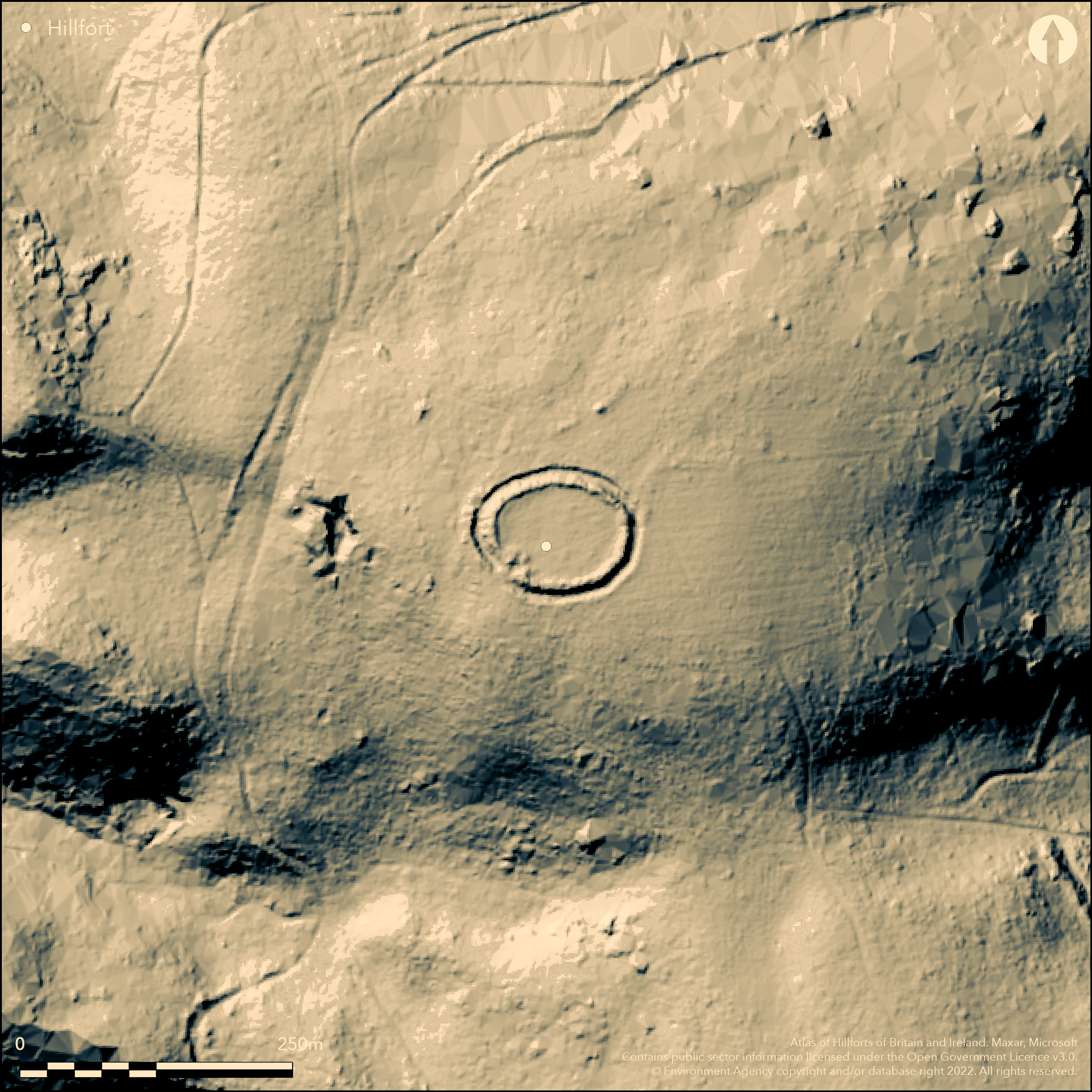
LiDAR 1m DTM Hillshade
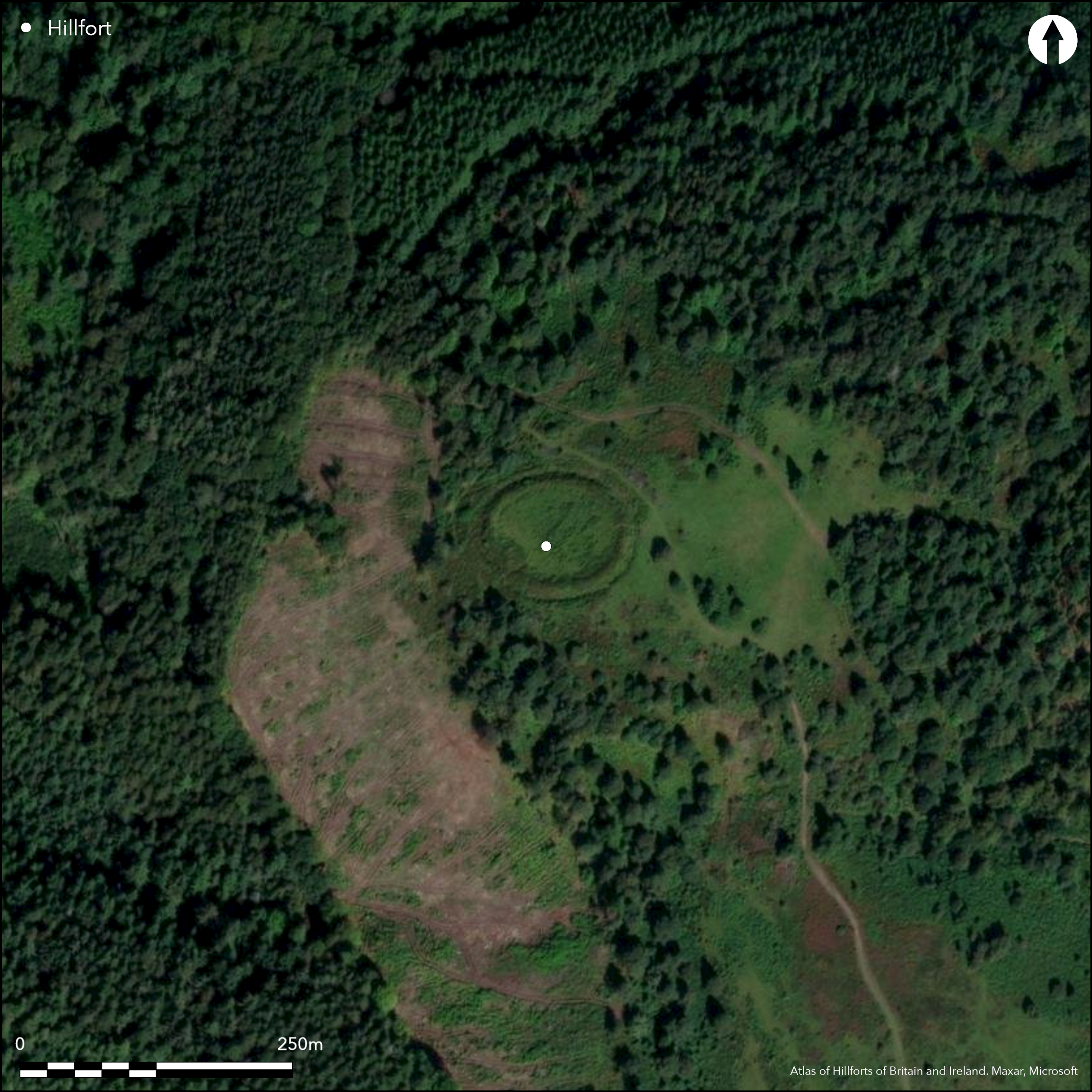
Satellite Imagery
LiDAR 1m DTM Hillshade
Satellite Imagery
Scroll left/right to view further images.
HER: Exmoor National Park MS09410 (None)
NMR: SS 94 SE 4 (36857)
SM: 1007668
NGR: SS98434265
X: 298430 Y: 142650 (OSGB36)
Small univallate hillslope fort located above the NW-facing shoulder of Gallax Hill in Dunster Park, Exmoor National Park, and overlooking valley of River Avill, at its junction with un-named valley running N-S. Slopes very steep or steep becoming very steep on N, E and W, moderate to steep along ridge on SE. Sub-circular shape measuring 100m E-W by 80m and enclosing c. 0.3ha. Despite small size defences impressive with bank to 1.9m-2.5m high, outer ditch to 1.5m deep and counterscarp bank to 1.9m high beyond ditch on N, S and W, that is all but uphill side. Downhill inturned entrance on SW, approached by disturbed causeway 6.7m wide and is slightly askew. It is possible that there is a guard chamber inside the NW inturn, although there has been disturbance by digging and could be just a stone dump. Inside SW inturn is possibly contemporary hut circle site, 5m across and with N entrance. The site has been connected with Bat's Castle hillfort (Atlas No 4060), located just 550m to SE on the hill, and also an open settlement within coaxial fields, but any association with the three monuments at present is conjecture. Well-preserved despite disturbance at entrance. Dense bilberry and heather, moorland with some holly and hawthorn trees obscuring ramparts. Interior has large numbers of ant hills. On 1st Ed. OS map (1889). Few investigations. Undated.
Citizen Science: ✗
Reliability of Data: Confirmed
Reliability of Interpretation: Confirmed
X: -384537 Y: 6652127 (EPSG: 3857)
Longitude: -3.4543533352493134 Latitude: 51.17398391884972 (EPSG:4326)
Country: England
Current County or Unitary Authority: Somerset
Historic County: Somerset
Current Parish/Community/Council/Townland: Dunster
Well-preserved despite disturbance at entrance.
| Extant | ✓ |
| Cropmark | ✗ |
| Likely Destroyed | ✗ |
Dense bilberry and heather, moorland with some holly and hawthorn trees obscuring ramparts. Interior has large numbers of ant hills. Wooded or part wooded surrounds.
| Woodland | ✗ |
| Commercial Forestry Plantation | ✗ |
| Parkland | ✗ |
| Pasture (Grazing) | ✗ |
| Arable | ✗ |
| Scrub/Bracken | ✓ |
| Bare Outcrop | ✗ |
| Heather/Moorland | ✓ |
| Heath | ✗ |
| Built-up | ✗ |
| Coastal Grassland | ✗ |
| Other | ✗ |
Small univallate hillslope fort located above the NW-facing shoulder of Gallax Hill in Dunster Park and overlooking valley of River Avill, at its junction with un-named valley running N-S. Slopes very steep or steep becoming very steep on N, E and W, moderate to steep along ridge on SE.
| Contour Fort | ✗ |
| Partial Contour Fort | ✗ |
| Promontory Fort | ✗ |
| Hillslope Fort | ✓ |
| Level Terrain Fort | ✗ |
| Marsh Fort | ✗ |
| Multiple Enclosure Fort | ✗ |
| Hilltop | ✓ |
| Coastal Promontory | ✗ |
| Inland Promontory | ✗ |
| Valley Bottom | ✗ |
| Knoll/Hillock/Outcrop | ✗ |
| Ridge | ✗ |
| Cliff/Plateau-edge/Scarp | ✗ |
| Hillslope | ✓ |
| Lowland | ✗ |
| Spur | ✗ |
Dominant Topographic Feature: Hillslope
| North | ✗ |
| Northeast | ✗ |
| East | ✗ |
| Southeast | ✗ |
| South | ✗ |
| Southwest | ✗ |
| West | ✗ |
| Northwest | ✓ |
| Level | ✗ |
Altitude: 160.0m
N/A
None.
Reliability: D - None
| Pre 1200BC | ✗ |
| 1200BC - 800BC | ✗ |
| 800BC - 400BC | ✗ |
| 400BC - AD50 | ✗ |
| AD50 - AD400 | ✗ |
| AD400 - AD 800 | ✗ |
| Post AD800 | ✗ |
| Unknown | ✓ |
| Pre Hillfort: | None |
| Post Hillfort: | Possible ancient ploughing in interior. |
On 1st Ed. OS map (1889). Field investigation Ordnance Survey 1965. Field investigation R. Wilson-North RCHME 1998. Measured survey RCHME East Exmoor Project 1999-2000. Aerial photograph Interpretation English Heritage Exmoor National Park NMP 2006-09.
| 1st Identified Map Depiction (1889): | OS map. |
| Other (1965): | Field investigation OS. |
| Other (1989): | Visited by Hillfort Study Group |
| Other (1998): | Field investigation R. Wilson-North RCHME. |
| Earthwork Survey (None): | Measured survey RCHME East Exmoor Project. |
| Other (None): | Aerial photograph Interpretation English Heritage Exmoor National Park NMP. |
None.
None
| None | ✓ |
| Spring | ✗ |
| Stream | ✗ |
| Pool | ✗ |
| Flush | ✗ |
| Well | ✗ |
| Other | ✗ |
None
| No Known Features | ✓ |
| Round Stone Structures | ✗ |
| Rectangular Stone Structures | ✗ |
| Curvilinear Platforms | ✗ |
| Other Roundhouse Evidence | ✗ |
| Pits | ✗ |
| Quarry Hollows | ✗ |
| Other | ✗ |
None
| No Known Excavation | ✓ |
| Pits | ✗ |
| Postholes | ✗ |
| Roundhouses | ✗ |
| Rectangular Structures | ✗ |
| Roads/Tracks | ✗ |
| Quarry Hollows | ✗ |
| Other | ✗ |
| Nothing Found | ✗ |
None
| No Known Geophysics | ✓ |
| Pits | ✗ |
| Roundhouses | ✗ |
| Rectangular Structures | ✗ |
| Roads/Tracks | ✗ |
| Quarry Hollows | ✗ |
| Other | ✗ |
| Nothing Found | ✗ |
None
| No Known Finds | ✓ |
| Pottery | ✗ |
| Metal | ✗ |
| Metalworking | ✗ |
| Human Bones | ✗ |
| Animal Bones | ✗ |
| Lithics | ✗ |
| Environmental | ✗ |
| Other | ✗ |
None
| APs Not Checked | ✓ |
| None | ✗ |
| Roundhouses | ✗ |
| Rectangular Structures | ✗ |
| Pits | ✗ |
| Postholes | ✗ |
| Roads/Tracks | ✗ |
| Other | ✗ |
Downhill inturned entrance on SW, approached by disturbed causeway 6.7m wide and is slightly askew. It is possible that there is a guard chamber inside the NW inturn, although there has been disturbance by digging and could be just a stone dump. Inside SW inturn is possibly contemporary hut circle site, 5m across and with N entrance.
| 1: | None |
| 2: | None |
Guard Chambers: ✓
Chevaux de Frise: ✗
| 1. In-turned (South west): | Approached by disturbed causeway 6.7m wide and is slightly askew. |
| 1. Oblique (South west): | Slightly askew. |
| 1. Recesses/Guard Chambers (South west): | Possible guard chamber inside the NW inturn, although there has been disturbance by digging and could be just a stone dump. |
Despite small size defences impressive with stone and earth bank to 1.9m-2.5m high, outer ditch to 1.5m deep and counterscarp bank to 1.9m high beyond ditch on N, S and W, that is all but uphill side.
| Area 1: | 0.3ha. |
| Total: | 0.3ha. |
Total Footprint Area: Noneha.
None
| ✗ | None |
| ✓ | None |
| NE Quadrant: | 1 |
| SE Quadrant: | 1 |
| SW Quadrant: | 1 |
| NW Quadrant: | 1 |
| Total: | 1 |
| Partial Univallate | ✗ |
| Univallate | ✓ |
| Partial Bivallate | ✗ |
| Bivallate | ✗ |
| Partial Multivallate | ✗ |
| Multivallate | ✗ |
| Unknown | ✗ |
| Partial Univallate | ✗ |
| Univallate | ✗ |
| Partial Bivallate | ✗ |
| Bivallate | ✗ |
| Partial Multivallate | ✗ |
| Multivallate | ✗ |
Stone and earth bank. Counterscarp on all but uphill side.
| None | ✗ |
| Earthen Bank | ✓ |
| Stone Wall | ✗ |
| Rubble | ✓ |
| Wall-walk | ✗ |
| Evidence of Timber | ✗ |
| Vitrification | ✗ |
| Other Burning | ✗ |
| Palisade | ✗ |
| Counter Scarp Bank | ✓ |
| Berm | ✗ |
| Unfinished | ✗ |
| Other | ✗ |
None
| None | ✗ |
| Earthen Bank | ✗ |
| Stone Wall | ✗ |
| Murus Duplex | ✗ |
| Timber-framed | ✗ |
| Timber-laced | ✗ |
| Vitrification | ✗ |
| Other Burning | ✗ |
| Palisade | ✗ |
| Counter Scarp Bank | ✗ |
| Berm | ✗ |
| Unfinished | ✗ |
| No Known Excavation | ✓ |
| Other | ✗ |
| ✗ | None |
| ✓ | None |
Number of Ditches: 1
| ✗ | None |
Allcroft, A.H. 1908. Earthwork of England : prehistoric, Roman, Saxon, Danish, Norman, and mediaeval, London: Macmillan, 137.
Burrow, E.J. 1924. The ancient earthworks and camps of Somerset, Cheltenham: E.J. Burrow, 106-7.
Burrow, I. 1981. Hillfort and hill-top settlement in Somerset in the first to eighth centuries AD, British Archaeological Report (BAR) British Series 1, 91.
Grinsell, L.V. 1970. The archaeology of Exmoor : Bideford Bay to Bridgwater, Newton Abbot: David and Charles., 87, 201
Page, W. ed. 1911. Ancient earthworks, The Victoria History of Somerset, Volume Two, The Victoria History of the Counties of England, London: Constable and Co, 508.
Atlas of Hillforts:
Wikidata:
This work is licensed under CC BY-SA 4.0

 and should be cited as:
Lock, Gary and Ralston, Ian. 2024. Atlas of Hillforts of Britain and Ireland. Available at: https://hillforts.arch.ox.ac.uk
Document Version 1.1