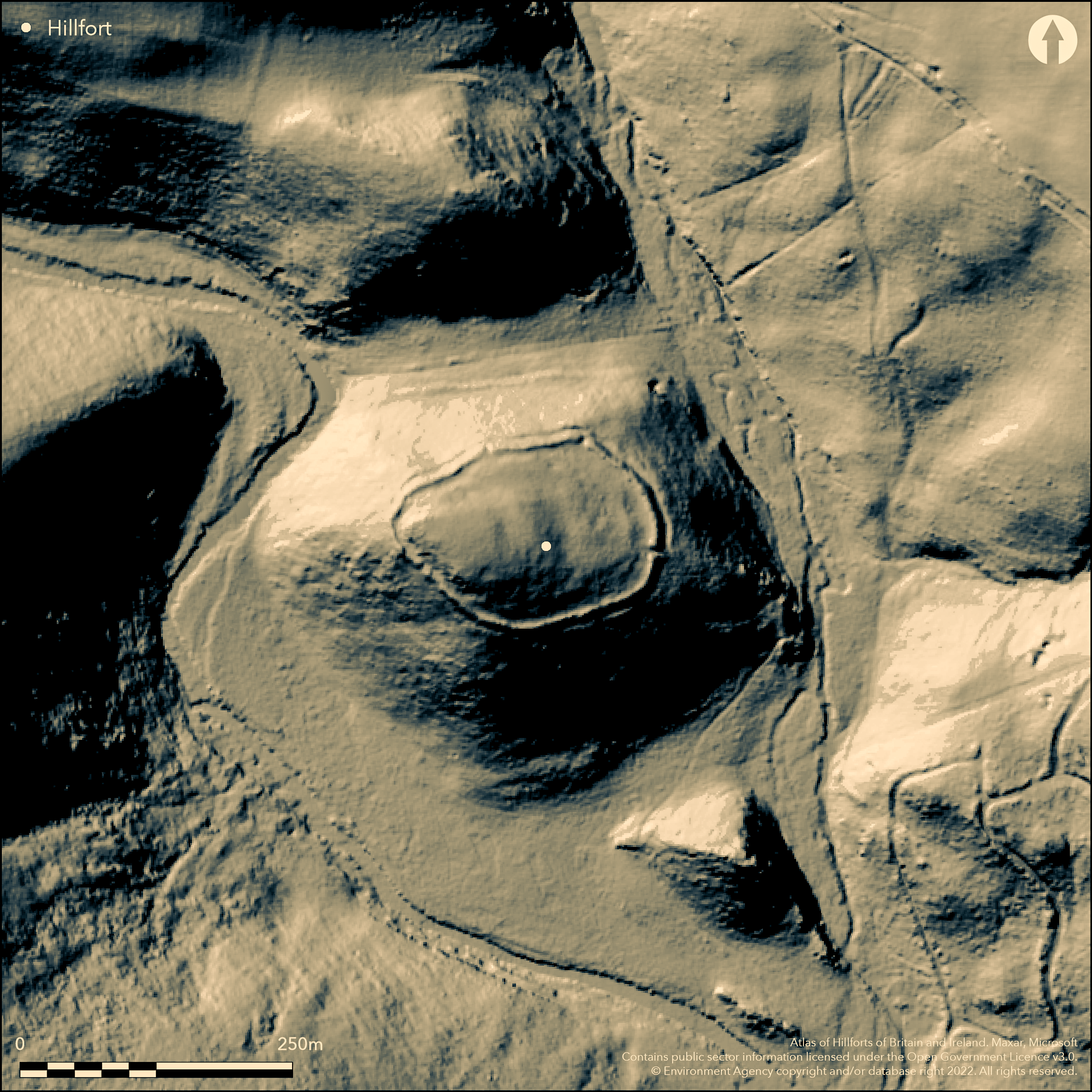
LiDAR 1m DTM Hillshade
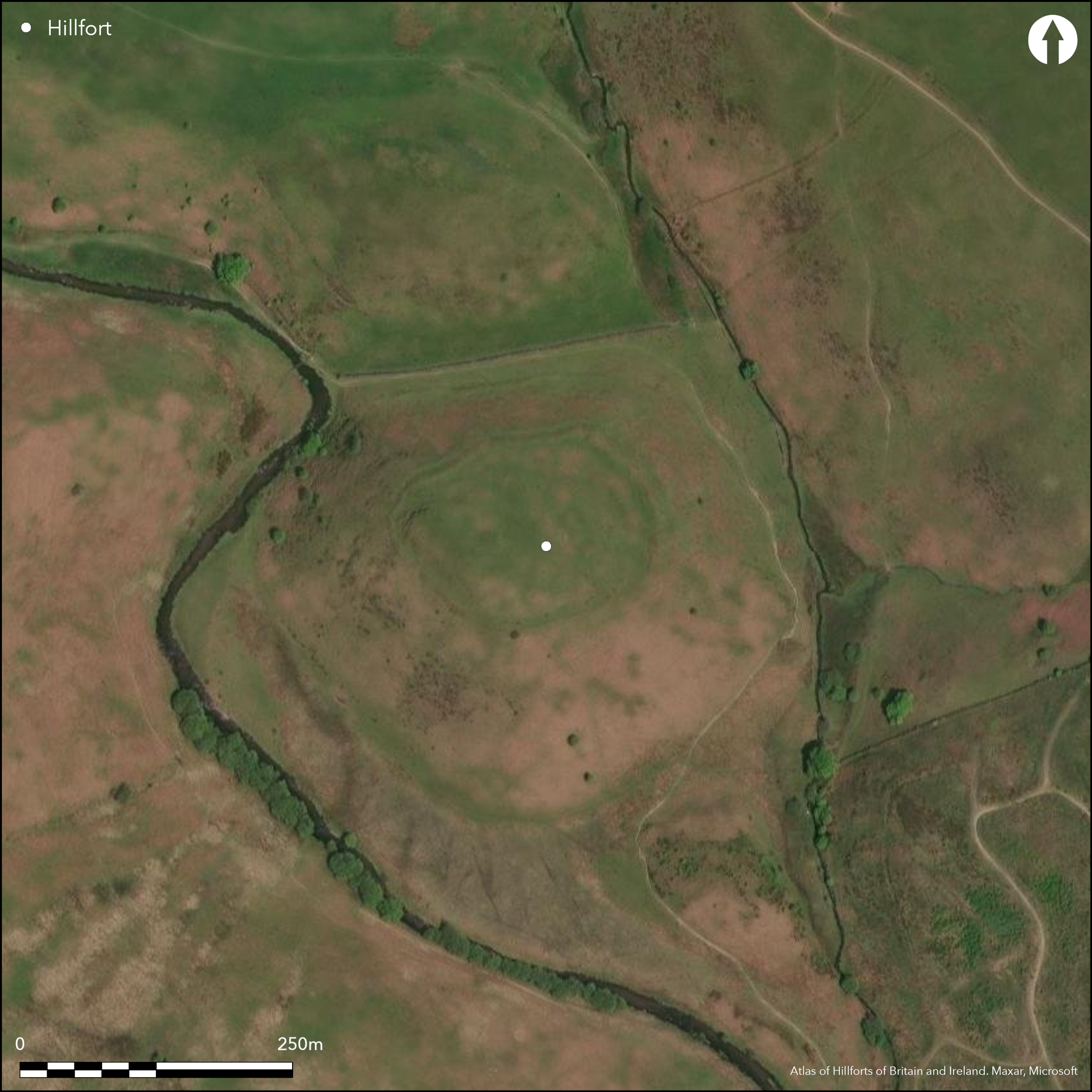
Satellite Imagery
LiDAR 1m DTM Hillshade
Satellite Imagery
Scroll left/right to view further images.
HER: Exmoor National Park MSO6797 (None)
NMR: SS 73 NE 3 (34989)
SM: 1002955
NGR: SS79453735
X: 279450 Y: 137350 (OSGB36)
Fine, univallate, contour hillfort located on conical knoll in broad steep-sided valley of the River Barle, c. 61m above river, where river meets White Water in Exmoor National Park. Very steep surrounding slopes to N and W, steep elsewhere. In common with other hillforts on Exmoor site has small internal area of 0.9ha. Defined by flat-topped rampart to 2m high externally with external silted ditch as a berm 4.5m wide, except where slope makes this unnecessary, and internal quarry ditch to 7m wide for most of circuit. On S rampart has stone-built revetted outer face which is a coursed wall to 0.8m high where best. Original entrance on SE side c. 8m wide; ramparts higher here with raised terminals producing distinct passage. Gap on NE modern, possibly associated with quarrying below hill. On S terminal is upright stone to 0.6m high. At least four building platforms identified in interior. Large scale survey by Exeter Office of RCHME for Exmoor National Park Authority as part of RCHME Exmoor project (Riley 1997). Site surveyed using GPS at 1:1000. The sites of probable prehistoric habitation were recorded, and an earthwork survey, contour plan and digital terrain model produced. Further downstream Oldberry Castle (Atlas No 4118 ) and Mounsey Castle (Atlas No 4119) hillforts at Dulverton have similar locations overlooking the river. Rough upland moorland grazing. Scrub on surrounds to N. Well-preserved. Two Moors Way around site N-S. On 1st Ed. OS map (1889). Undated.
Citizen Science: ✗
Reliability of Data: Confirmed
Reliability of Interpretation: Confirmed
X: -414550 Y: 6643019 (EPSG: 3857)
Longitude: -3.723963689070776 Latitude: 51.12265758327707 (EPSG:4326)
Country: England
Current County or Unitary Authority: Somerset
Historic County: Somerset
Current Parish/Community/Council/Townland: Exmoor
Well-preserved. Two Moors Way around site N-S. On Heritage at Risk Register (2015).
| Extant | ✓ |
| Cropmark | ✗ |
| Likely Destroyed | ✗ |
Rough upland moorland grazing. Scrub on surrounds to N.
| Woodland | ✗ |
| Commercial Forestry Plantation | ✗ |
| Parkland | ✗ |
| Pasture (Grazing) | ✓ |
| Arable | ✗ |
| Scrub/Bracken | ✓ |
| Bare Outcrop | ✗ |
| Heather/Moorland | ✓ |
| Heath | ✗ |
| Built-up | ✗ |
| Coastal Grassland | ✗ |
| Other | ✗ |
Fine, univallate, contour hillfort located on conical knoll in broad steep-sided valley of the River Barle, c. 61m above river, where river meets White Water. Very steep surrounding slopes to N and W, steep elsewhere.
| Contour Fort | ✓ |
| Partial Contour Fort | ✗ |
| Promontory Fort | ✗ |
| Hillslope Fort | ✗ |
| Level Terrain Fort | ✗ |
| Marsh Fort | ✗ |
| Multiple Enclosure Fort | ✗ |
| Hilltop | ✗ |
| Coastal Promontory | ✗ |
| Inland Promontory | ✗ |
| Valley Bottom | ✗ |
| Knoll/Hillock/Outcrop | ✓ |
| Ridge | ✗ |
| Cliff/Plateau-edge/Scarp | ✗ |
| Hillslope | ✗ |
| Lowland | ✗ |
| Spur | ✗ |
Dominant Topographic Feature: Knoll
| North | ✗ |
| Northeast | ✗ |
| East | ✗ |
| Southeast | ✗ |
| South | ✗ |
| Southwest | ✗ |
| West | ✗ |
| Northwest | ✗ |
| Level | ✓ |
Altitude: 305.0m
N/A
None.
Reliability: D - None
| Pre 1200BC | ✗ |
| 1200BC - 800BC | ✗ |
| 800BC - 400BC | ✗ |
| 400BC - AD50 | ✗ |
| AD50 - AD400 | ✗ |
| AD400 - AD 800 | ✗ |
| Post AD800 | ✗ |
| Unknown | ✓ |
| Pre Hillfort: | None |
| Post Hillfort: | None |
Mention by Rev. G. Tugwell in his North-Devon Scenery Book of 1863. On 1st Ed. OS map (1889). Field investigation R. Wilson-North and H. Chapman RCHME 1994. Large scale survey by Exeter Office of RCHME for Exmoor National Park Authority as part of RCHME West Exmoor project 1997 and also part of East Exmoor Project 2000. Site surveyed using GPS at 1:1000. The sites of probable prehistoric habitation were recorded, and an earthwork survey, contour plan and digital terrain model produced. Aerial photograph interpretation English heritage Exmoor National Park NMP 2008.
| 1st Identified Written Reference (1863): | Mention by Rev. G. Tugwell in his North-Devon Scenery Book. |
| 1st Identified Map Depiction (1889): | OS map. |
| Other (1989): | Visited by Hillfort Study Group |
| Other (1994): | Field investigation R. Wilson-North and H. Chapman RCHME. |
| Other (2008): | Aerial photograph interpretation English heritage Exmoor National Park NMP. |
| Earthwork Survey (None): | Large scale survey by Exeter Office of RCHME for Exmoor National Park Authority as part of RCHME Exmoor project 1997. Site surveyed using GPS at 1:1000. The sites of probable prehistoric habitation were recorded, and an earthwork survey, contour plan and digital terrain model produced. Also part of East Exmoor Project 2000. |
At least four building platforms identified in interior. Internal quarry ditch to 7m wide for most of circuit.
None
| None | ✓ |
| Spring | ✗ |
| Stream | ✗ |
| Pool | ✗ |
| Flush | ✗ |
| Well | ✗ |
| Other | ✗ |
At least four building platforms identified in interior. Internal quarry ditch to 7m wide for most of circuit.
| No Known Features | ✗ |
| Round Stone Structures | ✗ |
| Rectangular Stone Structures | ✗ |
| Curvilinear Platforms | ✓ |
| Other Roundhouse Evidence | ✗ |
| Pits | ✗ |
| Quarry Hollows | ✓ |
| Other | ✗ |
None
| No Known Excavation | ✓ |
| Pits | ✗ |
| Postholes | ✗ |
| Roundhouses | ✗ |
| Rectangular Structures | ✗ |
| Roads/Tracks | ✗ |
| Quarry Hollows | ✗ |
| Other | ✗ |
| Nothing Found | ✗ |
None
| No Known Geophysics | ✓ |
| Pits | ✗ |
| Roundhouses | ✗ |
| Rectangular Structures | ✗ |
| Roads/Tracks | ✗ |
| Quarry Hollows | ✗ |
| Other | ✗ |
| Nothing Found | ✗ |
None
| No Known Finds | ✓ |
| Pottery | ✗ |
| Metal | ✗ |
| Metalworking | ✗ |
| Human Bones | ✗ |
| Animal Bones | ✗ |
| Lithics | ✗ |
| Environmental | ✗ |
| Other | ✗ |
None
| APs Not Checked | ✓ |
| None | ✗ |
| Roundhouses | ✗ |
| Rectangular Structures | ✗ |
| Pits | ✗ |
| Postholes | ✗ |
| Roads/Tracks | ✗ |
| Other | ✗ |
Original entrance on SE side c. 8m wide; ramparts higher here with raised terminals producing distinct passage. Gap on NE modern, possibly associated with quarrying below hill.
| 2: | NE gap modern, possibly associated with quarrying at base of hill. |
| 2: | None |
Guard Chambers: ✗
Chevaux de Frise: ✗
| 1. Passage-way/Corridor (South east): | None |
Defined by flat-topped rampart to 2m high externally with external silted ditch as a berm 4.5m wide, except where slope makes this unnecessary, and internal quarry ditch to 7m wide for most of circuit. On S rampart has stone-built revetted outer face which is a coursed wall to 0.8m high where best.
| Area 1: | 0.9ha. |
| Total: | 0.9ha. |
Total Footprint Area: Noneha.
None
| ✗ | Has been suggested that enclosed area 1.1ha or 1.2ha |
| ✓ | None |
| NE Quadrant: | 1 |
| SE Quadrant: | 1 |
| SW Quadrant: | 1 |
| NW Quadrant: | 1 |
| Total: | 1 |
| Partial Univallate | ✗ |
| Univallate | ✓ |
| Partial Bivallate | ✗ |
| Bivallate | ✗ |
| Partial Multivallate | ✗ |
| Multivallate | ✗ |
| Unknown | ✗ |
| Partial Univallate | ✗ |
| Univallate | ✗ |
| Partial Bivallate | ✗ |
| Bivallate | ✗ |
| Partial Multivallate | ✗ |
| Multivallate | ✗ |
None
| None | ✗ |
| Earthen Bank | ✓ |
| Stone Wall | ✓ |
| Rubble | ✗ |
| Wall-walk | ✗ |
| Evidence of Timber | ✗ |
| Vitrification | ✗ |
| Other Burning | ✗ |
| Palisade | ✗ |
| Counter Scarp Bank | ✗ |
| Berm | ✓ |
| Unfinished | ✗ |
| Other | ✗ |
None
| None | ✗ |
| Earthen Bank | ✗ |
| Stone Wall | ✗ |
| Murus Duplex | ✗ |
| Timber-framed | ✗ |
| Timber-laced | ✗ |
| Vitrification | ✗ |
| Other Burning | ✗ |
| Palisade | ✗ |
| Counter Scarp Bank | ✗ |
| Berm | ✗ |
| Unfinished | ✗ |
| No Known Excavation | ✓ |
| Other | ✗ |
| ✗ | None |
| ✓ | Part visible silted ditch for most of circuit. |
Number of Ditches: 1
| ✗ | None |
Allcroft, A.H. 1908. Earthwork of England : prehistoric, Roman, Saxon, Danish, Norman, and mediaeval, London: Macmillan, 174.
Burrow, I. 1981. Hillfort and hill-top settlement in Somerset in the first to eighth centuries AD, British Archaeological Report (BAR) British Series 1, 91, 243.
Grinsell, L.V. 1970. The archaeology of Exmoor : Bideford Bay to Bridgwater, Newton Abbot: David and Charles, 76,85,86,89.
Page, J.L.W. 1890. An Exploration of Exmoor and the Hill Country of West Somerset: With Notes on Its Archaeology, 95-6.
Page, W. ed. 1911. Ancient earthworks, The Victoria History of Somerset, Volume Two, The Victoria History of the Counties of England, London: Constable and Co, 495.
Riley, H. 1997. Cow Castle, Exmoor, Somerset: an archaeological survey by the RCHME, Unpublished report RCHME.
Tugwell, Rev. G. 1863. North-Devon Scenery Book, London: Simpkin Marshall and Co, 51-2.
Atlas of Hillforts:
Wikidata:
This work is licensed under CC BY-SA 4.0

 and should be cited as:
Lock, Gary and Ralston, Ian. 2024. Atlas of Hillforts of Britain and Ireland. Available at: https://hillforts.arch.ox.ac.uk
Document Version 1.1