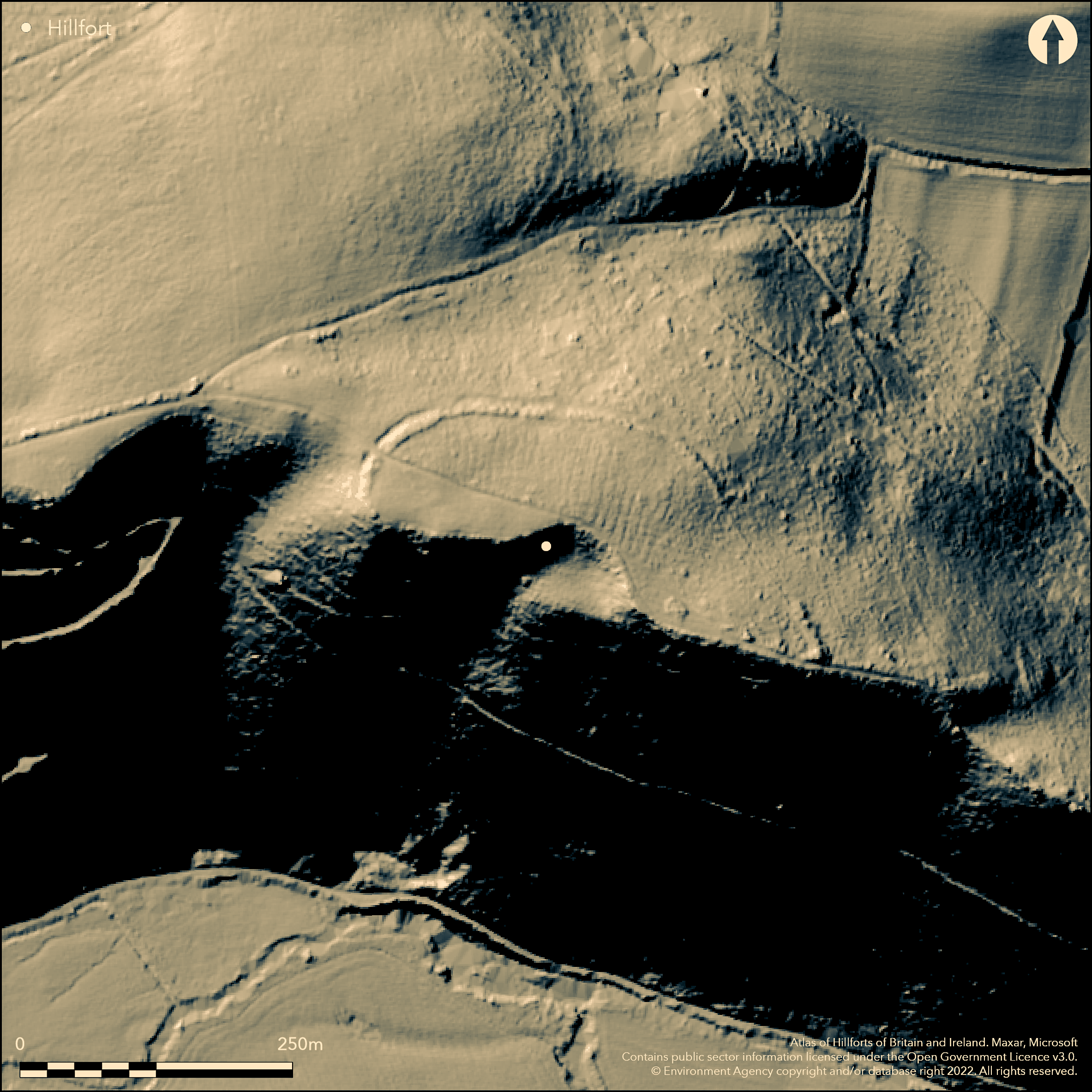
LiDAR 1m DTM Hillshade
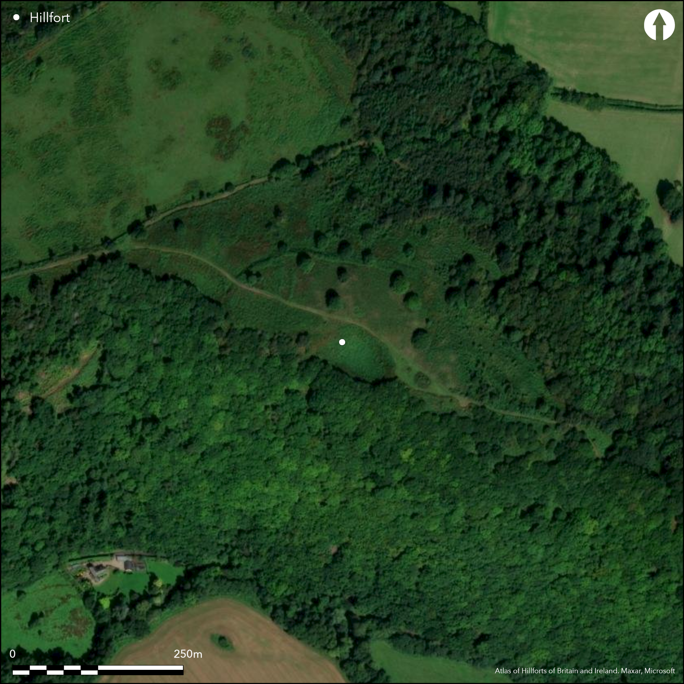
Satellite Imagery
LiDAR 1m DTM Hillshade
Satellite Imagery
Scroll left/right to view further images.
HER: Exmoor National Park MSO9408 (None)
NMR: SS 94 SE 2 (36851)
SM: 1021060
NGR: SS982436
X: 298280 Y: 143660 (OSGB36)
Possible univallate hillfort, aligned SE-NW and following the contours of the steep narrow ridge which forms the SE end of Grabbist Hill on the NE edge of Exmoor National Park and with commanding views overlooking the Avill Valley to S and W to Gallox Hll on S and the hillforts of Black Ball Camp (Atlas No 4110) and Bat's Castle (Atlas No 4060), and to Minehead coast to N and E. Oval in plan measuring c. 200m by 100m, with internal area c. 2ha. Thus there are no ramparts visible on precipitous S side, particularly steep above base of a hollowed area formed by geological landslip known as the 'Giant's Chair'. N side defined by single bank 1.3m to 1.9m high at W end, gradually reducing to 0.5m towards E end. Has been suggested that this low bank is a marker line laid out for unfinished ramparts, but this may be conjecture. W end of the site where defined best has ditch, 2.2m and 3m deep below top of the bank, and counterscarp, overall c. 10m. wide. Possible earthworks to N ploughed out. Possible original entrance gap on W end of the hillfort is believed to be an original entrance, and past scrub and tree clearance across site in winter 2004-05 revealed hollows in rampart either side of the entrance. That on S roughly rectilinear 4m by 3m especially good, all suggesting possible guard chambers. The gate would originally also have had a corresponding causeway. Field boundary around inner part of site obscures features and, as with ridge and furrow in interior and length of bank across, probably indicates medieval or post-medieval cultivation of site. Rough grass, scrub and scattered trees. Wooded surrounds around site from NE to SW. Denuded condition. On OS 1:25,000 map (1950). Few investigations. Undated.
Citizen Science: ✗
Reliability of Data: Confirmed
Reliability of Interpretation: Unconfirmed
X: -384807 Y: 6653735 (EPSG: 3857)
Longitude: -3.4567844989033456 Latitude: 51.18303635978196 (EPSG:4326)
Country: England
Current County or Unitary Authority: Somerset
Historic County: Somerset
Current Parish/Community/Council/Townland: Dunster
Denuded condition. Tree and scrub clearance c. 2005 using contractors who burnt timber - something that will have to be considered in any subsequent geophysical survey. National Trust site.
| Extant | ✓ |
| Cropmark | ✗ |
| Likely Destroyed | ✗ |
Rough grass, scrub and scattered trees. Wooded surrounds around site from NE to SW.
| Woodland | ✗ |
| Commercial Forestry Plantation | ✗ |
| Parkland | ✗ |
| Pasture (Grazing) | ✗ |
| Arable | ✗ |
| Scrub/Bracken | ✓ |
| Bare Outcrop | ✗ |
| Heather/Moorland | ✗ |
| Heath | ✗ |
| Built-up | ✗ |
| Coastal Grassland | ✗ |
| Other | ✗ |
Possible univallate hillfort, aligned SE-NW and following the contours of the steep narrow ridge which forms the SE end of Grabbist Hill on the NE edge of Exmoor and with commanding views. Strategically placed to take full advantage of the precipitous contours of the ridge, and in a commanding position overlooking the Avill Valley to S and W to Gallox Hll on S and the hillforts of Black Ball Camp (Atlas No 4110) and Bat's Castle (Atlas No 4060), and to Minehead coast to N and E.
| Contour Fort | ✓ |
| Partial Contour Fort | ✗ |
| Promontory Fort | ✗ |
| Hillslope Fort | ✗ |
| Level Terrain Fort | ✗ |
| Marsh Fort | ✗ |
| Multiple Enclosure Fort | ✗ |
| Hilltop | ✗ |
| Coastal Promontory | ✗ |
| Inland Promontory | ✗ |
| Valley Bottom | ✗ |
| Knoll/Hillock/Outcrop | ✗ |
| Ridge | ✓ |
| Cliff/Plateau-edge/Scarp | ✗ |
| Hillslope | ✗ |
| Lowland | ✗ |
| Spur | ✗ |
Dominant Topographic Feature: Ridge
| North | ✗ |
| Northeast | ✗ |
| East | ✗ |
| Southeast | ✗ |
| South | ✗ |
| Southwest | ✗ |
| West | ✗ |
| Northwest | ✗ |
| Level | ✓ |
Altitude: 170.0m
N/A
None.
Reliability: D - None
| Pre 1200BC | ✗ |
| 1200BC - 800BC | ✗ |
| 800BC - 400BC | ✗ |
| 400BC - AD50 | ✗ |
| AD50 - AD400 | ✗ |
| AD400 - AD 800 | ✗ |
| Post AD800 | ✗ |
| Unknown | ✓ |
| Pre Hillfort: | None |
| Post Hillfort: | Number of 2m square cuts into N rampart 50m-100m E of entrance; old excavations and possibly WWII fox holes, but no known documentary evidence to support this. |
On OS 1:25,000 map (1950). Field investigation Ordnance Survey 1965. Field investigation H. Riley RCHME 1998. Aerial photograph interpretation English Heritage Exmoor National Park NMP 2007-09.
| 1st Identified Map Depiction (1950): | None |
| Other (1965): | Field investigation OS. |
| Other (1989): | Visited by Hillfort Study Group |
| Other (1998): | Field investigation H. Riley RCHME. |
| Other (None): | Aerial photograph interpretation English Heritage Exmoor National Park NMP. |
Possible quarry ditch.
None
| None | ✓ |
| Spring | ✗ |
| Stream | ✗ |
| Pool | ✗ |
| Flush | ✗ |
| Well | ✗ |
| Other | ✗ |
Possible quarry ditch.
| No Known Features | ✗ |
| Round Stone Structures | ✗ |
| Rectangular Stone Structures | ✗ |
| Curvilinear Platforms | ✗ |
| Other Roundhouse Evidence | ✗ |
| Pits | ✗ |
| Quarry Hollows | ✓ |
| Other | ✗ |
None
| No Known Excavation | ✓ |
| Pits | ✗ |
| Postholes | ✗ |
| Roundhouses | ✗ |
| Rectangular Structures | ✗ |
| Roads/Tracks | ✗ |
| Quarry Hollows | ✗ |
| Other | ✗ |
| Nothing Found | ✗ |
None
| No Known Geophysics | ✓ |
| Pits | ✗ |
| Roundhouses | ✗ |
| Rectangular Structures | ✗ |
| Roads/Tracks | ✗ |
| Quarry Hollows | ✗ |
| Other | ✗ |
| Nothing Found | ✗ |
None
| No Known Finds | ✓ |
| Pottery | ✗ |
| Metal | ✗ |
| Metalworking | ✗ |
| Human Bones | ✗ |
| Animal Bones | ✗ |
| Lithics | ✗ |
| Environmental | ✗ |
| Other | ✗ |
None
| APs Not Checked | ✓ |
| None | ✗ |
| Roundhouses | ✗ |
| Rectangular Structures | ✗ |
| Pits | ✗ |
| Postholes | ✗ |
| Roads/Tracks | ✗ |
| Other | ✗ |
Possible original entrance gap on W end of the hillfort is believed to be an original entrance, and past scrub and tree clearance across site in winter 2004-05 revealed hollows in rampart either side of the entrance. That on S roughly rectilinear 4m by 3m especially good, all suggesting possible guard chambers. The gate would originally also have had a corresponding causeway.
| 1: | None |
| 2: | None |
Guard Chambers: ✓
Chevaux de Frise: ✗
| 1. Simple Gap (West): | The gate would originally also have had a corresponding causeway. |
| 1. Recesses/Guard Chambers (West): | Possible guard chambers. |
No defences visible on precipitous S side, particularly steep above base of a hollowed area formed by geological landslip known as the 'Giant's Chair'. N side defined by single bank 1.3m to 1.9m high at W end, gradually reducing to 0.5m towards E end. Has been suggested that this low bank is a marker line laid out for unfinished defences, but this may be conjecture. W end of the site where defences best has ditch, 2.2m and 3m deep below top of the bank, and counterscarp. Overall the defensive are c. 10m. wide.
| Area 1: | 2.0ha. |
| Total: | 2.0ha. |
Total Footprint Area: Noneha.
None
| ✗ | None |
| ✗ | None |
| NE Quadrant: | 1 |
| SE Quadrant: | 0 |
| SW Quadrant: | 0 |
| NW Quadrant: | 1 |
| Total: | 1 |
| Partial Univallate | ✓ |
| Univallate | ✗ |
| Partial Bivallate | ✗ |
| Bivallate | ✗ |
| Partial Multivallate | ✗ |
| Multivallate | ✗ |
| Unknown | ✗ |
| Partial Univallate | ✗ |
| Univallate | ✗ |
| Partial Bivallate | ✗ |
| Bivallate | ✗ |
| Partial Multivallate | ✗ |
| Multivallate | ✗ |
Counterscarp on W. Has been suggested that this low bank is a marker line laid out for unfinished defences, but this may be conjecture.
| None | ✗ |
| Earthen Bank | ✓ |
| Stone Wall | ✗ |
| Rubble | ✗ |
| Wall-walk | ✗ |
| Evidence of Timber | ✗ |
| Vitrification | ✗ |
| Other Burning | ✗ |
| Palisade | ✗ |
| Counter Scarp Bank | ✓ |
| Berm | ✗ |
| Unfinished | ✓ |
| Other | ✗ |
None
| None | ✗ |
| Earthen Bank | ✗ |
| Stone Wall | ✗ |
| Murus Duplex | ✗ |
| Timber-framed | ✗ |
| Timber-laced | ✗ |
| Vitrification | ✗ |
| Other Burning | ✗ |
| Palisade | ✗ |
| Counter Scarp Bank | ✗ |
| Berm | ✗ |
| Unfinished | ✗ |
| No Known Excavation | ✓ |
| Other | ✗ |
| ✗ | None |
| ✓ | W end of the site where defences best has ditch, 2.2m and 3m deep below top of the bank, and counterscarp. |
Number of Ditches: 1
| ✗ | None |
Dennison, E. 1986. Somerset archaeology 1986, Somerset Archaeol Natur Hist, 130, 1986 141-61.
Atlas of Hillforts:
Wikidata:
This work is licensed under CC BY-SA 4.0

 and should be cited as:
Lock, Gary and Ralston, Ian. 2024. Atlas of Hillforts of Britain and Ireland. Available at: https://hillforts.arch.ox.ac.uk
Document Version 1.1