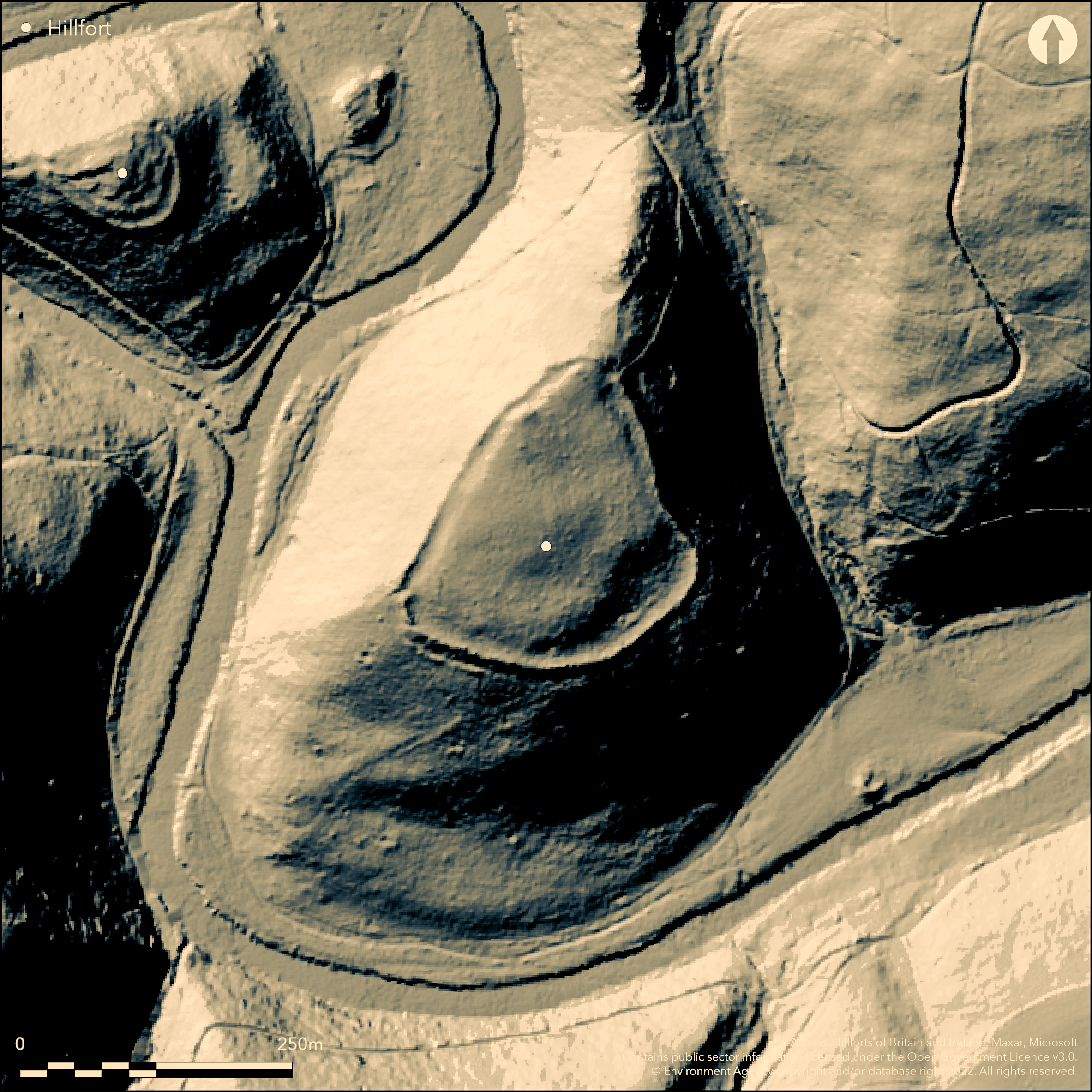
LiDAR 1m DTM Hillshade
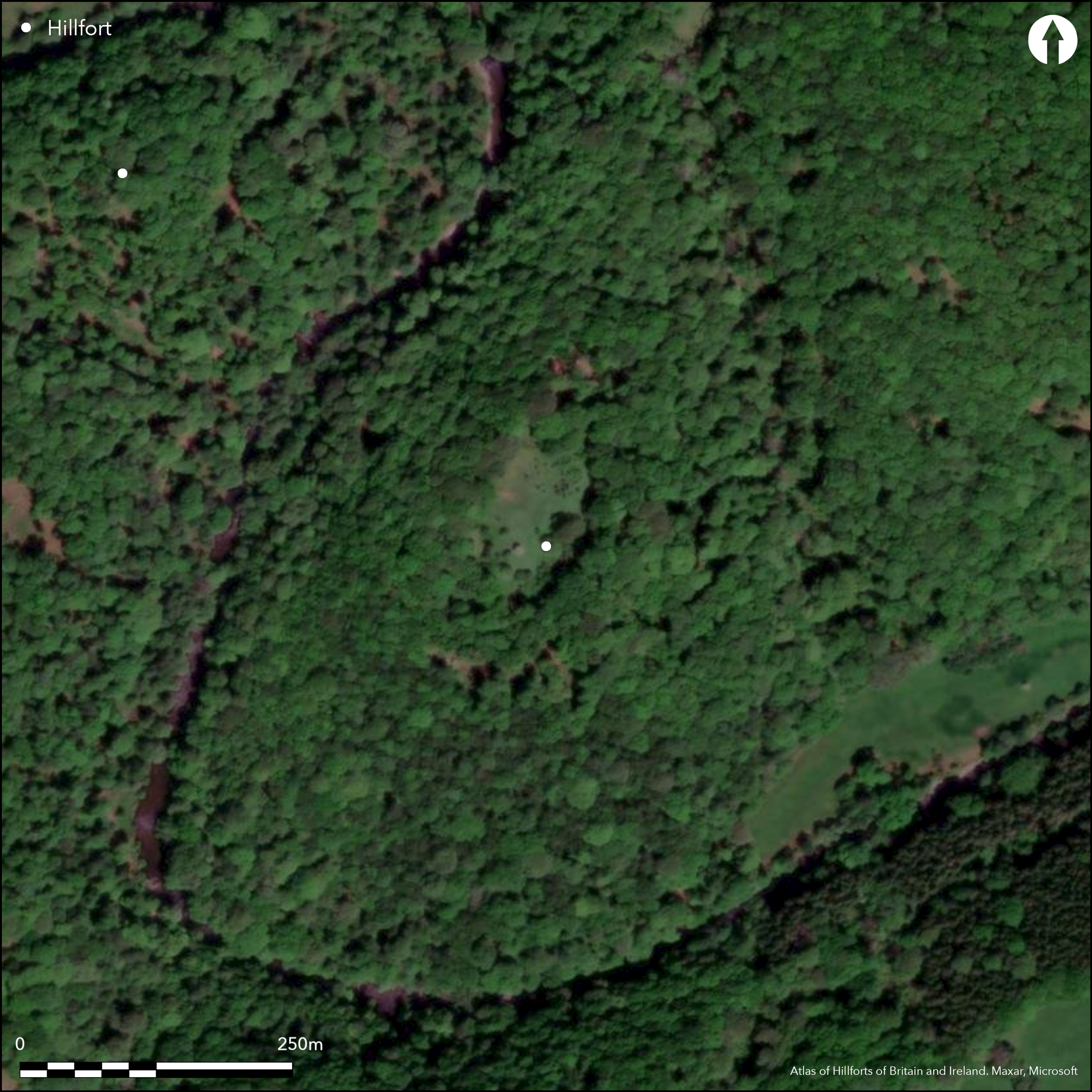
Satellite Imagery
LiDAR 1m DTM Hillshade
Satellite Imagery
Scroll left/right to view further images.
HER: Exmoor National Park MSO9316 (None)
NMR: SS 82 NE 2 (35638)
SM: 1021357
NGR: SS88562955
X: 288560 Y: 129550 (OSGB36)
Univallate, partial contour hillfort, located on high rocky promontory at SW-facing end of steep-sided ridge on N side of lower Barle valley and above a significant meander of the River Barle, just S of its confluence with Danes Brook and its steep valley on W, within Mounsey Wood. Very steep to precipitous slopes to river on W side, steep to river on S and moderate to strong along ridge to NE. Overlooking valley and river, similar to Brewer's Castle opposite and across the river to NW (Atlas No 4127), Cow Castle (Atlas No 4112) upriver and Oldberry Castle at Dulverton (Atlas No 4118). Triangular shape broadly follows the contours, with a wide curved base to S narrowing to N, with interior area c. 1.75ha. Defined by single tumbled stone scarp on E and W and rampart with ditch and counterscarp on S varying between 1.5m and 2m high. On S and W sides escarpment artificially emphasised by internal scarp appearing to have been quarried to provide material for the rampart. Revetment walling visible in rampart face along S side, which is to 0.8m high and constructed of roughly coursed stone. Defences on N provided by substantial outwork, c. 100m away, and straddling the steep ridge which forms the narrow, N rocky spur of the hill. Outwork c. 16m wide and formed by modification of the ridge to form a steep stone-faced scarp with shallow ditch behind and fronted by a level berm with scarped bank below, also stone-faced, extending for c. 30m across the ridge. Strategically placed to defend an entrance on N side. There are two original entrances, to NE and SW. Former has slightly out-turned rampart with berm and short length of bank. SW entrance formed by one in-turned, and one slightly out-turned, rampart end creating an embanked corridor into interior. Remains of charcoal burner's hut in interior, activity supporting local iron working. Mounsey Castle takes its name from Monceaux family, local landowners in medieval period. Legend has it that a stone at Mouncey Castle fell from the Devil's apron as he was on his way to build Tarr Steps. Scrub and bracken interior. On 1st Ed. OS map (1890). Few investigations. Undated.
Citizen Science: ✗
Reliability of Data: Confirmed
Reliability of Interpretation: Confirmed
X: -399797 Y: 6630921 (EPSG: 3857)
Longitude: -3.591436404811144 Latitude: 51.054391099755236 (EPSG:4326)
Country: England; None
Current County or Unitary Authority: Somerset
Historic County: Somerset
Current Parish/Community/Council/Townland: Dulverton; Withypool
Nature conservation site. Beech sapling clearance undertaken. On Heritage at Risk Register (2015).
| Extant | ✓ |
| Cropmark | ✗ |
| Likely Destroyed | ✗ |
Within Mounsey Wood. Scrub and bracken interior. Charcoal burner's hut in interior.
| Woodland | ✓ |
| Commercial Forestry Plantation | ✗ |
| Parkland | ✗ |
| Pasture (Grazing) | ✗ |
| Arable | ✗ |
| Scrub/Bracken | ✓ |
| Bare Outcrop | ✗ |
| Heather/Moorland | ✗ |
| Heath | ✗ |
| Built-up | ✗ |
| Coastal Grassland | ✗ |
| Other | ✓ |
Univallate, partial contour hillfort, located on high rocky promontory at SW-facing end of steep-sided ridge on N side of lower Barle valley and above a significant meander of the River Barle, just S of its confluence with Danes Brook and its steep valley on W, in Exmoor National Park. Within Mounsey Wood. Very steep to precipitous slopes to river on W side, steep to river on S and moderate to strong along ridge to NE.
| Contour Fort | ✗ |
| Partial Contour Fort | ✓ |
| Promontory Fort | ✗ |
| Hillslope Fort | ✗ |
| Level Terrain Fort | ✗ |
| Marsh Fort | ✗ |
| Multiple Enclosure Fort | ✗ |
| Hilltop | ✗ |
| Coastal Promontory | ✗ |
| Inland Promontory | ✓ |
| Valley Bottom | ✗ |
| Knoll/Hillock/Outcrop | ✗ |
| Ridge | ✗ |
| Cliff/Plateau-edge/Scarp | ✗ |
| Hillslope | ✗ |
| Lowland | ✗ |
| Spur | ✗ |
Dominant Topographic Feature: Promontory
| North | ✗ |
| Northeast | ✗ |
| East | ✗ |
| Southeast | ✗ |
| South | ✗ |
| Southwest | ✓ |
| West | ✗ |
| Northwest | ✗ |
| Level | ✗ |
Altitude: 219.0m
Boundary Type: Parish/Townland
None.
Reliability: D - None
| Pre 1200BC | ✗ |
| 1200BC - 800BC | ✗ |
| 800BC - 400BC | ✗ |
| 400BC - AD50 | ✗ |
| AD50 - AD400 | ✗ |
| AD400 - AD 800 | ✗ |
| Post AD800 | ✗ |
| Unknown | ✓ |
| Pre Hillfort: | None |
| Post Hillfort: | Evidence for occupation of site in medieval period, and possibly earlier, in form of charcoal burner's hut in interior, activity carried out to support local iron working sites. |
On 1st Ed. OS map (1890). Field investigation Ordnance Survey 1965. RCHME survey 1998.
| 1st Identified Map Depiction (1890): | OS map. |
| Other (1965): | Field investigation OS. |
| Other (1998): | None |
Quarry ditch visible in most of interior.
None
| None | ✓ |
| Spring | ✗ |
| Stream | ✗ |
| Pool | ✗ |
| Flush | ✗ |
| Well | ✗ |
| Other | ✗ |
Quarry ditch visible in most of interior.
| No Known Features | ✗ |
| Round Stone Structures | ✗ |
| Rectangular Stone Structures | ✗ |
| Curvilinear Platforms | ✗ |
| Other Roundhouse Evidence | ✗ |
| Pits | ✗ |
| Quarry Hollows | ✓ |
| Other | ✗ |
None
| No Known Excavation | ✓ |
| Pits | ✗ |
| Postholes | ✗ |
| Roundhouses | ✗ |
| Rectangular Structures | ✗ |
| Roads/Tracks | ✗ |
| Quarry Hollows | ✗ |
| Other | ✗ |
| Nothing Found | ✗ |
None
| No Known Geophysics | ✓ |
| Pits | ✗ |
| Roundhouses | ✗ |
| Rectangular Structures | ✗ |
| Roads/Tracks | ✗ |
| Quarry Hollows | ✗ |
| Other | ✗ |
| Nothing Found | ✗ |
None
| No Known Finds | ✓ |
| Pottery | ✗ |
| Metal | ✗ |
| Metalworking | ✗ |
| Human Bones | ✗ |
| Animal Bones | ✗ |
| Lithics | ✗ |
| Environmental | ✗ |
| Other | ✗ |
None
| APs Not Checked | ✓ |
| None | ✗ |
| Roundhouses | ✗ |
| Rectangular Structures | ✗ |
| Pits | ✗ |
| Postholes | ✗ |
| Roads/Tracks | ✗ |
| Other | ✗ |
There are two original entrances, to NE and SW. Former has slightly out-turned rampart with berm and short length of bank. SW entrance formed by one in-turned, and one slightly out-turned, rampart end creating an embanked corridor into interior.
| 2: | None |
| 2: | None |
Guard Chambers: ✗
Chevaux de Frise: ✗
| 1. Out-turned (North east): | Slightly out-turned rampart with berm and short length of bank. |
| 1. Other Forms (North east): | Berm and short length of bank. |
| 2. Out-turned (South west): | One in-turned, and one slightly out-turned, rampart end creating an embanked corridor into interior. |
| 2. In-turned (South west): | One in-turned, and one slightly out-turned, rampart end creating an embanked corridor into interior. |
| 2. Passage-way/Corridor (South west): | Embanked corridor into interior. |
Probable stone-walled site. Defined by single scarp on E and W and rampart on S varying between 1.5m and 2m high. On S and W sides escarpment artificially emphasised by internal scarp appearing to have been quarried to provide material for the rampart. Revetment walling visible in rampart face along S side, which is to 0.8m high and constructed of roughly coursed stone. Substantial outwork to defences on N, c. 100m away, and straddling the steep ridge which forms the narrow, N rocky spur of the hill. Outwork c. 16m wide and formed by modification of the ridge to form a steep stone-faced scarp with shallow ditch behind and fronted by a level berm with scarped bank below, also stone-faced, extending for c. 30m across the ridge. Strategically placed to defend an entrance on N side.
| Area 1: | 1.75ha. |
| Total: | 1.75ha. |
Total Footprint Area: Noneha.
None
| ✗ | None |
| ✓ | None |
| NE Quadrant: | 1 |
| SE Quadrant: | 1 |
| SW Quadrant: | 1 |
| NW Quadrant: | 1 |
| Total: | 1 |
| Partial Univallate | ✗ |
| Univallate | ✓ |
| Partial Bivallate | ✗ |
| Bivallate | ✗ |
| Partial Multivallate | ✗ |
| Multivallate | ✗ |
| Unknown | ✗ |
| Partial Univallate | ✗ |
| Univallate | ✗ |
| Partial Bivallate | ✗ |
| Bivallate | ✗ |
| Partial Multivallate | ✗ |
| Multivallate | ✗ |
Probable stone-walled site. Revetment walling visible in rampart face along S side, which is to 0.8m high and constructed of roughly coursed stone. Counterscarp on S.
| None | ✗ |
| Earthen Bank | ✗ |
| Stone Wall | ✓ |
| Rubble | ✓ |
| Wall-walk | ✗ |
| Evidence of Timber | ✗ |
| Vitrification | ✗ |
| Other Burning | ✗ |
| Palisade | ✗ |
| Counter Scarp Bank | ✓ |
| Berm | ✓ |
| Unfinished | ✗ |
| Other | ✗ |
None
| None | ✓ |
| Earthen Bank | ✗ |
| Stone Wall | ✗ |
| Murus Duplex | ✗ |
| Timber-framed | ✗ |
| Timber-laced | ✗ |
| Vitrification | ✗ |
| Other Burning | ✗ |
| Palisade | ✗ |
| Counter Scarp Bank | ✗ |
| Berm | ✗ |
| Unfinished | ✗ |
| No Known Excavation | ✓ |
| Other | ✗ |
| ✗ | None |
| ✓ | Ditch and counterscarp on S, with ditch to outwork to N. |
Number of Ditches: 1
| ✗ | None |
Burrow, E.J. 1924. The ancient earthworks and camps of Somerset, Cheltenham: E.J. Burrow, 88.
Burrow, I. 1981. Hillfort and hill-top settlement in Somerset in the first to eighth centuries AD, British Archaeological Report (BAR) British Series 1, 91, 240-1.
Page, J.L.W. 1890. An Exploration of Exmoor and the Hill Country of West Somerset: With Notes on Its Archaeology, 85-6.
Page, W. ed. 1911. Ancient earthworks, The Victoria History of Somerset, Volume Two, The Victoria History of the Counties of England, London: Constable and Co, 492-3.
Riley, H. 1999. Mounsey Castle and Brewer's Castle : two Iron Age enclosures in the Barle Valley, Somerset : an archaeological survey by the Royal Commission on the Historical Monuments of England, Unpublished report RCHME.
Atlas of Hillforts:
Wikidata:
This work is licensed under CC BY-SA 4.0

 and should be cited as:
Lock, Gary and Ralston, Ian. 2024. Atlas of Hillforts of Britain and Ireland. Available at: https://hillforts.arch.ox.ac.uk
Document Version 1.1