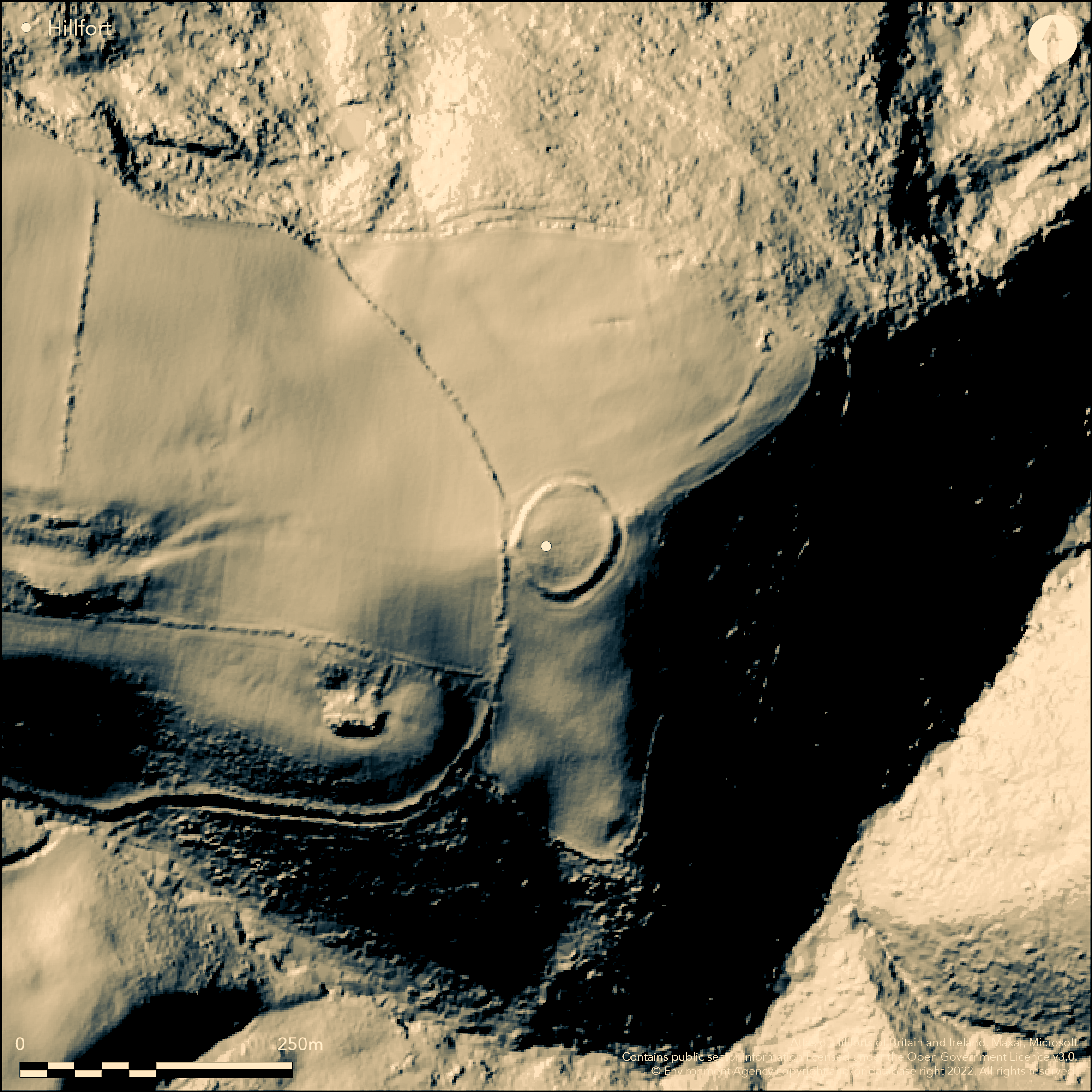
LiDAR 1m DTM Hillshade
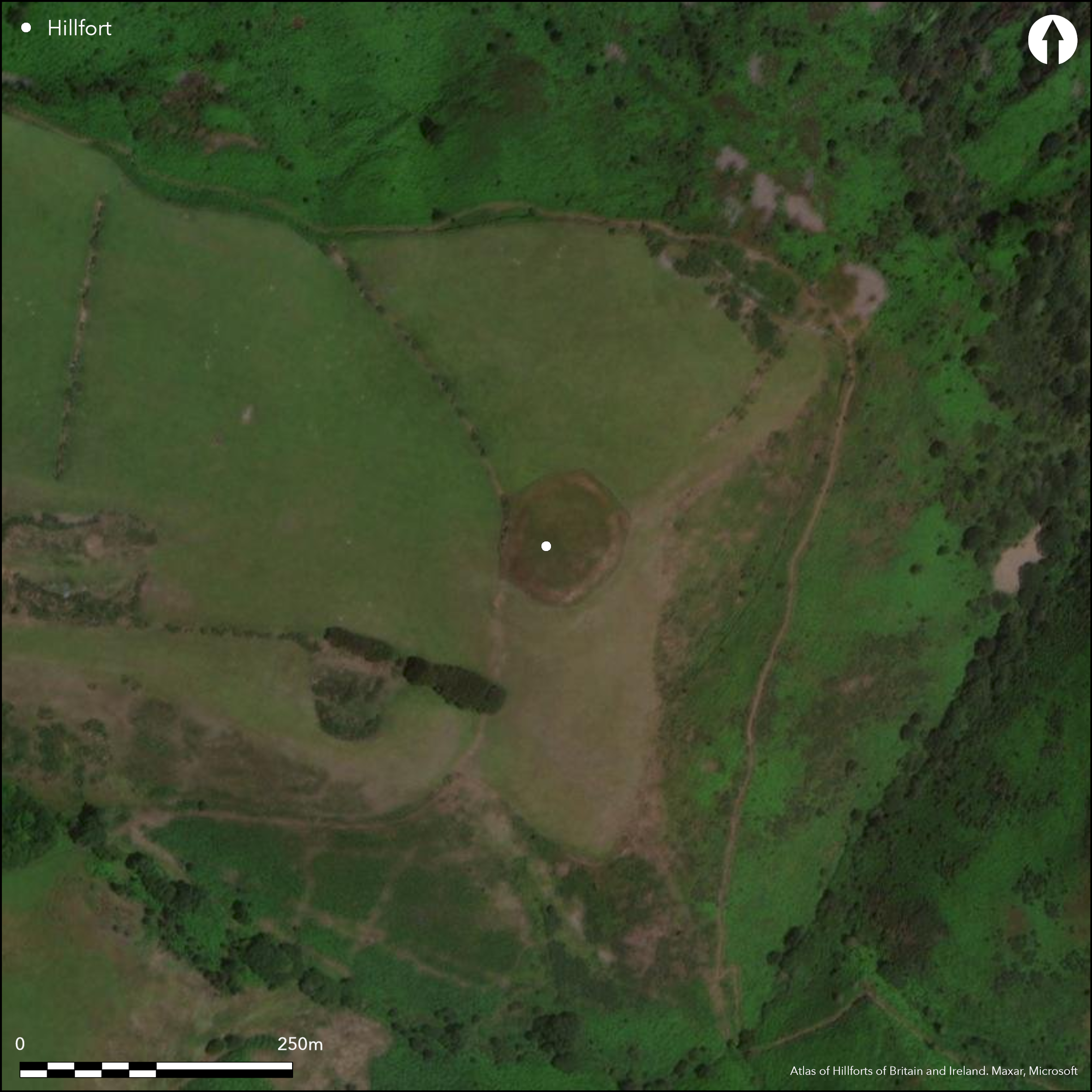
Satellite Imagery
LiDAR 1m DTM Hillshade
Satellite Imagery
Scroll left/right to view further images.
HER: Exmoor National Park MSO7577 (None)
NMR: SS 94 NW 14 (36801)
SM: 1008809
NGR: SS93584830
X: 293580 Y: 148300 (OSGB36)
Small, possible, unvallate hillfort, located on knoll at end of isolated NE-facing spur overlooking Bristol Channel on N and very steep valley of Grexy Combe on E and S in Exmoor National Park. Surrounding slopes steep, then very steep, on N, E to S, moderate to strong along spur on W. Measures 62.5m by 53m, with internal area c. 0.22ha. Defined by bank with slight external ditch, with overall width c. 10.7m, former quite substantial on NE to 0.9m high internally and 2m externally from ditch, but eroded and only a slight earthwork on S. Ditch generally infilled by ploughing, especially on N, NW, S and SW. Three breaks in rampart and which original disputed. Most likely accepted version is that N probably original, those to NE and W probably later and may be the result of tank training activity nearby in WWII. Lynchet scarp from NE side of enclosure and traces of field system outside fort. Improved pasture. On 1st Ed. OS map (1889). Undated. Described elsewhere as a defended enclosure or ringwork, here considered to be a hillfort.
Citizen Science: ✗
Reliability of Data: Confirmed
Reliability of Interpretation: Confirmed
X: -392444 Y: 6660993 (EPSG: 3857)
Longitude: -3.5253832882580154 Latitude: 51.223888493964246 (EPSG:4326)
Country: England
Current County or Unitary Authority: Somerset
Historic County: Somerset
Current Parish/Community/Council/Townland: Minehead Without
Bank much eroded on S. Ditch reduced by ploughing. Surrounding management fence impinges slightly. Field boundary close on W. National Trust site.
| Extant | ✓ |
| Cropmark | ✗ |
| Likely Destroyed | ✗ |
Improved pasture.
| Woodland | ✗ |
| Commercial Forestry Plantation | ✗ |
| Parkland | ✗ |
| Pasture (Grazing) | ✓ |
| Arable | ✗ |
| Scrub/Bracken | ✗ |
| Bare Outcrop | ✗ |
| Heather/Moorland | ✗ |
| Heath | ✗ |
| Built-up | ✗ |
| Coastal Grassland | ✗ |
| Other | ✗ |
Small, possible, unvallate hillfort, ringwork or defended enclosure located on knoll at end of isolated NE-facing spur overlooking Bristol Channel on N and very steep valley of Grexy Combe on E and S. Surrounding slopes steep, then very steep, on N, E to S, moderate to strong along spur on W.
| Contour Fort | ✓ |
| Partial Contour Fort | ✗ |
| Promontory Fort | ✗ |
| Hillslope Fort | ✗ |
| Level Terrain Fort | ✗ |
| Marsh Fort | ✗ |
| Multiple Enclosure Fort | ✗ |
| Hilltop | ✗ |
| Coastal Promontory | ✗ |
| Inland Promontory | ✗ |
| Valley Bottom | ✗ |
| Knoll/Hillock/Outcrop | ✓ |
| Ridge | ✗ |
| Cliff/Plateau-edge/Scarp | ✗ |
| Hillslope | ✗ |
| Lowland | ✗ |
| Spur | ✗ |
Dominant Topographic Feature: Knoll.
| North | ✗ |
| Northeast | ✓ |
| East | ✗ |
| Southeast | ✗ |
| South | ✗ |
| Southwest | ✗ |
| West | ✗ |
| Northwest | ✗ |
| Level | ✗ |
Altitude: 243.0m
N/A
None.
Reliability: D - None
| Pre 1200BC | ✗ |
| 1200BC - 800BC | ✗ |
| 800BC - 400BC | ✗ |
| 400BC - AD50 | ✗ |
| AD50 - AD400 | ✗ |
| AD400 - AD 800 | ✗ |
| Post AD800 | ✗ |
| Unknown | ✓ |
| Pre Hillfort: | None |
| Post Hillfort: | None |
On 1st Ed. OS map (1889). Field investigations Ordnance Survey 1962, 1965. Field investigation R. Wilson-North RCHME 1998. Measured survey RCHME: East Exmoor Project 2000. Aerial photograph interpretation Gloucestershire CC Severn Estuary NMP, Rapid Coastal Zone Assessment Survey 2006-2008.
| 1st Identified Map Depiction (1889): | OS map. |
| Other (1998): | Field investigation R. Wilson-North RCHME. |
| Earthwork Survey (2000): | Measured survey RCHME: East Exmoor Project. |
| Other (None): | Field investigations Ordnance Survey. |
| Other (None): | Aerial photograph interpretation Gloucestershire CC Severn Estuary NMP, Rapid Coastal Zone Assessment Survey. |
None.
None
| None | ✓ |
| Spring | ✗ |
| Stream | ✗ |
| Pool | ✗ |
| Flush | ✗ |
| Well | ✗ |
| Other | ✗ |
None
| No Known Features | ✓ |
| Round Stone Structures | ✗ |
| Rectangular Stone Structures | ✗ |
| Curvilinear Platforms | ✗ |
| Other Roundhouse Evidence | ✗ |
| Pits | ✗ |
| Quarry Hollows | ✗ |
| Other | ✗ |
None
| No Known Excavation | ✓ |
| Pits | ✗ |
| Postholes | ✗ |
| Roundhouses | ✗ |
| Rectangular Structures | ✗ |
| Roads/Tracks | ✗ |
| Quarry Hollows | ✗ |
| Other | ✗ |
| Nothing Found | ✗ |
None
| No Known Geophysics | ✓ |
| Pits | ✗ |
| Roundhouses | ✗ |
| Rectangular Structures | ✗ |
| Roads/Tracks | ✗ |
| Quarry Hollows | ✗ |
| Other | ✗ |
| Nothing Found | ✗ |
None
| No Known Finds | ✓ |
| Pottery | ✗ |
| Metal | ✗ |
| Metalworking | ✗ |
| Human Bones | ✗ |
| Animal Bones | ✗ |
| Lithics | ✗ |
| Environmental | ✗ |
| Other | ✗ |
None
| APs Not Checked | ✓ |
| None | ✗ |
| Roundhouses | ✗ |
| Rectangular Structures | ✗ |
| Pits | ✗ |
| Postholes | ✗ |
| Roads/Tracks | ✗ |
| Other | ✗ |
Three breaks in rampart: to N probably original, to NE and W probably later, latter used as farm access.
| 3: | NE and W gaps probably later, latter used as farm access. |
| 2: | None |
Guard Chambers: ✗
Chevaux de Frise: ✗
| 1. Simple Gap (North): | None |
Defined by bank with slight external ditch, with overall width c. 10.7m, former quite substantial on NE to 0.9m high internally and 2m externally from ditch, but eroded and only a slight earthwork on S. Ditch generally infilled by ploughing, especially on N, NW, S and SW.
| Area 1: | 0.22ha. |
| Total: | 0.22ha. |
Total Footprint Area: Noneha.
None
| ✗ | None |
| ✓ | None |
| NE Quadrant: | 1 |
| SE Quadrant: | 1 |
| SW Quadrant: | 1 |
| NW Quadrant: | 1 |
| Total: | 1 |
| Partial Univallate | ✗ |
| Univallate | ✓ |
| Partial Bivallate | ✗ |
| Bivallate | ✗ |
| Partial Multivallate | ✗ |
| Multivallate | ✗ |
| Unknown | ✗ |
| Partial Univallate | ✗ |
| Univallate | ✗ |
| Partial Bivallate | ✗ |
| Bivallate | ✗ |
| Partial Multivallate | ✗ |
| Multivallate | ✗ |
None
| None | ✗ |
| Earthen Bank | ✓ |
| Stone Wall | ✗ |
| Rubble | ✗ |
| Wall-walk | ✗ |
| Evidence of Timber | ✗ |
| Vitrification | ✗ |
| Other Burning | ✗ |
| Palisade | ✗ |
| Counter Scarp Bank | ✗ |
| Berm | ✗ |
| Unfinished | ✗ |
| Other | ✗ |
None
| None | ✗ |
| Earthen Bank | ✗ |
| Stone Wall | ✗ |
| Murus Duplex | ✗ |
| Timber-framed | ✗ |
| Timber-laced | ✗ |
| Vitrification | ✗ |
| Other Burning | ✗ |
| Palisade | ✗ |
| Counter Scarp Bank | ✗ |
| Berm | ✗ |
| Unfinished | ✗ |
| No Known Excavation | ✓ |
| Other | ✗ |
| ✗ | None |
| ✓ | Ditch generally infilled by ploughing, especially on N, NW, S and SW. |
Number of Ditches: 1
| ✗ | None |
Burrow, E.J. 1924. The ancient earthworks and camps of Somerset, Cheltenham: E.J. Burrow, 86-7.
Burrow, I. 1981. Hillfort and hill-top settlement in Somerset in the first to eighth centuries AD, British Archaeological Report (BAR) British Series 1, 91, 259.
Dobson, D.P. 1931, The Archaeology of Somerset, 239.
Grinsell, L.V. 1970. The archaeology of Exmoor : Bideford Bay to Bridgwater, Newton Abbot: David and Charles, 78,79,85,201.
Page, W. ed. 1911. Ancient earthworks, The Victoria History of Somerset, Volume Two, The Victoria History of the Counties of England, London: Constable and Co, 496.
Atlas of Hillforts:
Wikidata:
This work is licensed under CC BY-SA 4.0

 and should be cited as:
Lock, Gary and Ralston, Ian. 2024. Atlas of Hillforts of Britain and Ireland. Available at: https://hillforts.arch.ox.ac.uk
Document Version 1.1