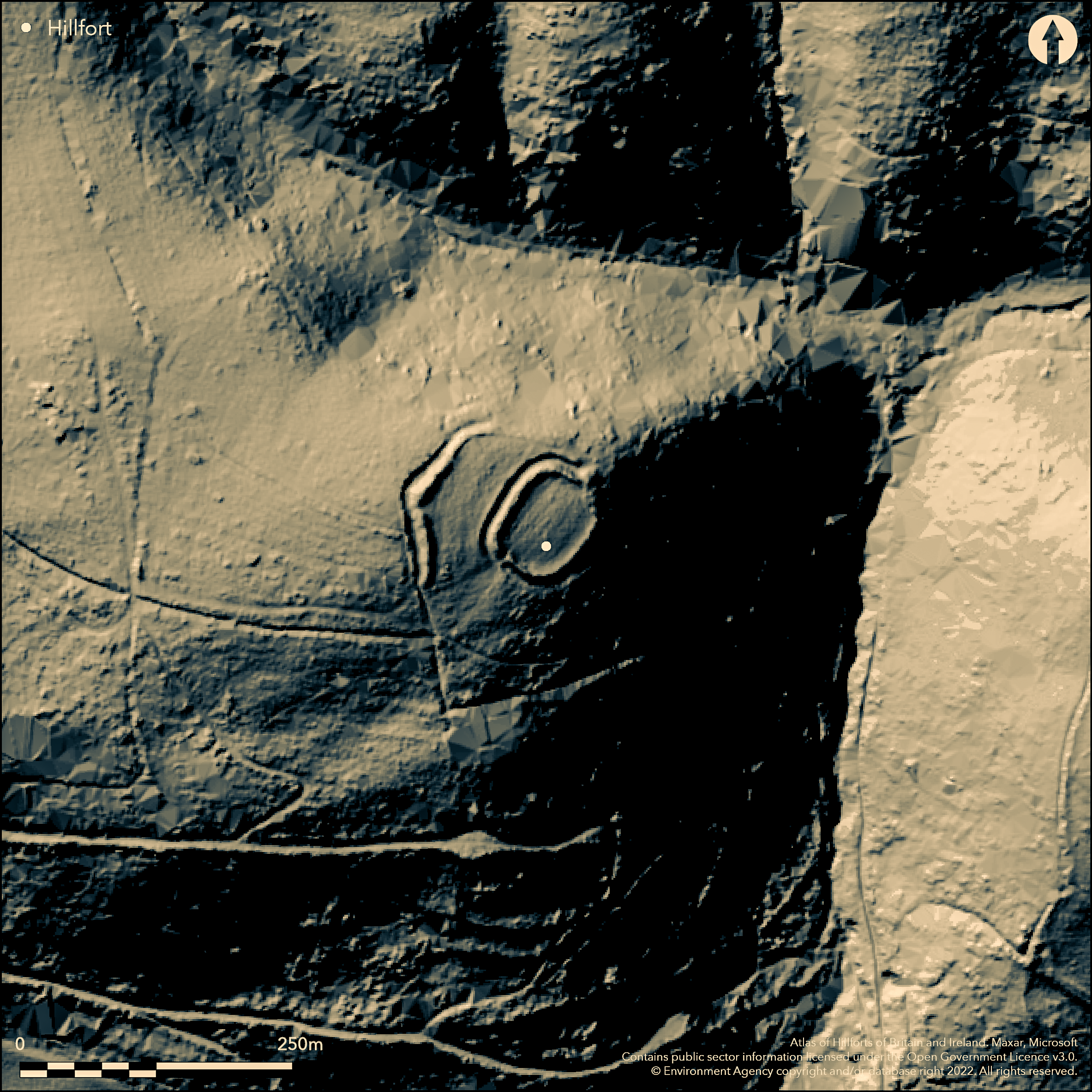
LiDAR 1m DTM Hillshade
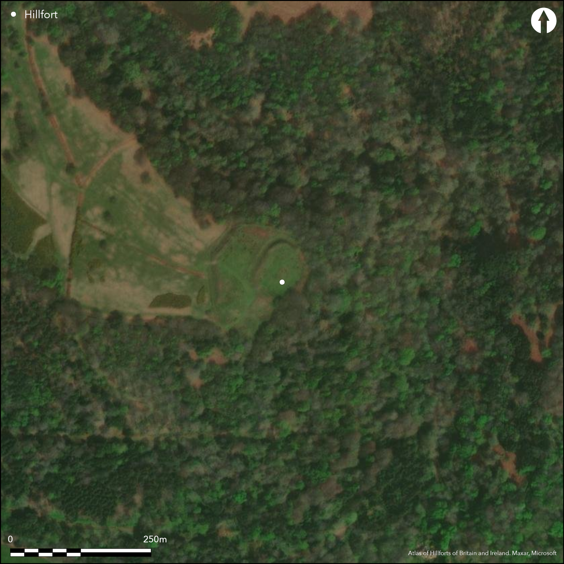
Satellite Imagery
LiDAR 1m DTM Hillshade
Satellite Imagery
Scroll left/right to view further images.
HER: Exmoor National Park MSO8008 (None)
NMR: SS 94 NW 2 (36765)
SM: 1008808
NGR: SS91774716
X: 291770 Y: 147160 (OSGB36)
Small, possible, univallate, partial contour hillfort located on tip of prominent, curving, SE-facing spur below Selworthy Beacon and Bristol Channel to N and immediately NW of Selworthy village in Exmoor National Park. Surrounding slopes generally very steep, slightly less on WNW and moderate to strong along spur to NW. Site does not occupy all of width of spur, resulting in gentler approach on SW before steep and very steep slopes below. Sub-rectangular with slightly curving sides and rounded corners measuring c. 80m by 60m, with long axis NE-SW and internal area c. 0.21ha. Ramparts best on upper side to N with bank up 2m high and outer ditch to 2m deep, forming external face 1.7m high. Counterscarp in part. On lower sides use made of natural slope scarped to form bank 0.2m high above drop of 1.8m, with slight outer terrace. Possible that original rampart stone revetted. Possible original entrance in centre of NE side, where gap in rampart and mound of stone extends out from interior, truncating ditch which turns out along it; possibly remains of out-turn in entrance or collapsed gatehouse. Uphill is a counterscarp bank outside the ditch. Present entrance on SW possibly modern trackway over ramparts. Associated cross-ridge bank c. 32m on uphill W side, with two arms meeting on shallow point on crest of ridge. NE arm, 45m long, runs parallel to top side of site, and second arm runs S from this for 45m, has bank c. 2m high and external ditch c. 2m deep forming external face 2.5m high. On NE runs to edge of the hill and turns briefly towards enclosure as scarp and terrace, but on S ends well short of edge of the hill. Shallow gap through apex probably modern. Possibly defined outer enclosure, or, more likely used as part of the architecture of the site on the uphill approach. Affected by later field enclosure bank where faced with dry-stone walling, and post-medieval or early modern field banks around site. Rough pasture on NW part, scrub/wooded on SE. Wooded slopes from NE to SW. Well-preserved National Trust site. On 1st Ed. OS map (1889). Undated. Described elsewhere as a defended enclosure, here considered to be a hillfort.
Citizen Science: ✗
Reliability of Data: Confirmed
Reliability of Interpretation: Confirmed
X: -395290 Y: 6659111 (EPSG: 3857)
Longitude: -3.550948771712164 Latitude: 51.2133006472056 (EPSG:4326)
Country: England
Current County or Unitary Authority: Somerset
Historic County: Somerset
Current Parish/Community/Council/Townland: Selworthy
Well-preserved National Trust site.
| Extant | ✓ |
| Cropmark | ✗ |
| Likely Destroyed | ✗ |
Rough upland pasture on SW part, scrub/wooded on SE. Wooded slopes from NE to SW.
| Woodland | ✗ |
| Commercial Forestry Plantation | ✗ |
| Parkland | ✗ |
| Pasture (Grazing) | ✓ |
| Arable | ✗ |
| Scrub/Bracken | ✓ |
| Bare Outcrop | ✗ |
| Heather/Moorland | ✗ |
| Heath | ✗ |
| Built-up | ✗ |
| Coastal Grassland | ✗ |
| Other | ✗ |
Small, possible, univallate, partial contour hillfort or defended enclosure located on tip of prominent, curving, SE-facing spur below Selworthy Beacon and Bristol Channel to N and immediately NW of Selworthy village. Surrounding slopes generally very steep, slightly less on WNW and moderate to strong along spur to NW. Site does not occupy all of width of spur, resulting in gentler approach on SW before steep and very steep slopes below.
| Contour Fort | ✗ |
| Partial Contour Fort | ✓ |
| Promontory Fort | ✗ |
| Hillslope Fort | ✗ |
| Level Terrain Fort | ✗ |
| Marsh Fort | ✗ |
| Multiple Enclosure Fort | ✗ |
| Hilltop | ✗ |
| Coastal Promontory | ✗ |
| Inland Promontory | ✗ |
| Valley Bottom | ✗ |
| Knoll/Hillock/Outcrop | ✗ |
| Ridge | ✗ |
| Cliff/Plateau-edge/Scarp | ✗ |
| Hillslope | ✗ |
| Lowland | ✗ |
| Spur | ✓ |
Dominant Topographic Feature: Spur
| North | ✗ |
| Northeast | ✗ |
| East | ✗ |
| Southeast | ✓ |
| South | ✗ |
| Southwest | ✗ |
| West | ✗ |
| Northwest | ✗ |
| Level | ✗ |
Altitude: 240.0m
N/A
None.
Reliability: D - None
| Pre 1200BC | ✗ |
| 1200BC - 800BC | ✗ |
| 800BC - 400BC | ✗ |
| 400BC - AD50 | ✗ |
| AD50 - AD400 | ✗ |
| AD400 - AD 800 | ✗ |
| Post AD800 | ✗ |
| Unknown | ✓ |
| Pre Hillfort: | None |
| Post Hillfort: | None |
Mentioned by Rev. J. Phelps in his History and Antiquities of Somersetshire 1836. On 1st Ed. OS map (1889). Field investigation Ordnance Survey 1965. Field investigation H,Riley, R. Wilson-North and P. Wild RCHME 1998. Measured survey RCHME: East Exmoor Project 2000. Aerial photograph interpretation Gloucestershire CC Severn Estuary NMP, Rapid Coastal Zone Assessment Survey 2006-2008.
| 1st Identified Written Reference (1836): | Mentioned by Rev. J. Phelps in his History and Antiquities of Somersetshire. |
| 1st Identified Map Depiction (1889): | OS map. |
| Other (1965): | Field investigation OS. |
| Other (1998): | Field investigation H,Riley, R. Wilson-North and P. Wild RCHME. |
| Earthwork Survey (2000): | Measured survey RCHME: East Exmoor Project 2000. |
| Other (None): | Aerial photograph interpretation Gloucestershire CC Severn Estuary NMP, Rapid Coastal Zone Assessment Survey. |
None.
None
| None | ✓ |
| Spring | ✗ |
| Stream | ✗ |
| Pool | ✗ |
| Flush | ✗ |
| Well | ✗ |
| Other | ✗ |
None
| No Known Features | ✓ |
| Round Stone Structures | ✗ |
| Rectangular Stone Structures | ✗ |
| Curvilinear Platforms | ✗ |
| Other Roundhouse Evidence | ✗ |
| Pits | ✗ |
| Quarry Hollows | ✗ |
| Other | ✗ |
None
| No Known Excavation | ✓ |
| Pits | ✗ |
| Postholes | ✗ |
| Roundhouses | ✗ |
| Rectangular Structures | ✗ |
| Roads/Tracks | ✗ |
| Quarry Hollows | ✗ |
| Other | ✗ |
| Nothing Found | ✗ |
None
| No Known Geophysics | ✓ |
| Pits | ✗ |
| Roundhouses | ✗ |
| Rectangular Structures | ✗ |
| Roads/Tracks | ✗ |
| Quarry Hollows | ✗ |
| Other | ✗ |
| Nothing Found | ✗ |
None
| No Known Finds | ✓ |
| Pottery | ✗ |
| Metal | ✗ |
| Metalworking | ✗ |
| Human Bones | ✗ |
| Animal Bones | ✗ |
| Lithics | ✗ |
| Environmental | ✗ |
| Other | ✗ |
None
| APs Not Checked | ✓ |
| None | ✗ |
| Roundhouses | ✗ |
| Rectangular Structures | ✗ |
| Pits | ✗ |
| Postholes | ✗ |
| Roads/Tracks | ✗ |
| Other | ✗ |
Possible original entrance in centre of NE side, where gap in rampart and mound of stone extends out from interior, truncating ditch which turns out along it; possibly remains of out-turn in entrance or collapsed gatehouse. Uphill is a counterscarp bank outside the ditch. Present entrance on SW possibly modern trackway over ramparts.
| 2: | SW gap possibly modern. |
| 2: | None |
Guard Chambers: ✓
Chevaux de Frise: ✗
| 1. Out-turned (North east): | Possibly out-turned. |
| 1. Recesses/Guard Chambers (North east): | Possible collapsed gatehouse. |
Defences best on upper side to N with bank up 2m high and outer ditch to 2m deep, forming external face 1.7m high. Counterscarp in part. On lower sides use made of natural slope scarped to form bank 0.2m high above drop of 1.8m, with slight outer terrace. Possible that original rampart stone revetted.
| Area 1: | 0.21ha. |
| Total: | 0.21ha. |
Total Footprint Area: Noneha.
None
| ✗ | Estimates of area vary from c. 0.18ha to 0.22ha. |
| ✓ | None |
| NE Quadrant: | 1 |
| SE Quadrant: | 1 |
| SW Quadrant: | 1 |
| NW Quadrant: | 1 |
| Total: | 1 |
| Partial Univallate | ✗ |
| Univallate | ✓ |
| Partial Bivallate | ✗ |
| Bivallate | ✗ |
| Partial Multivallate | ✗ |
| Multivallate | ✗ |
| Unknown | ✗ |
| Partial Univallate | ✗ |
| Univallate | ✗ |
| Partial Bivallate | ✗ |
| Bivallate | ✗ |
| Partial Multivallate | ✗ |
| Multivallate | ✗ |
Possible that original rampart stone-revettted.
| None | ✗ |
| Earthen Bank | ✓ |
| Stone Wall | ✓ |
| Rubble | ✗ |
| Wall-walk | ✗ |
| Evidence of Timber | ✗ |
| Vitrification | ✗ |
| Other Burning | ✗ |
| Palisade | ✗ |
| Counter Scarp Bank | ✓ |
| Berm | ✗ |
| Unfinished | ✗ |
| Other | ✗ |
None
| None | ✗ |
| Earthen Bank | ✗ |
| Stone Wall | ✗ |
| Murus Duplex | ✗ |
| Timber-framed | ✗ |
| Timber-laced | ✗ |
| Vitrification | ✗ |
| Other Burning | ✗ |
| Palisade | ✗ |
| Counter Scarp Bank | ✗ |
| Berm | ✗ |
| Unfinished | ✗ |
| No Known Excavation | ✓ |
| Other | ✗ |
| ✗ | None |
| ✓ | None |
Number of Ditches: 1
| ✓ | Possibly. Associated cross-ridge bank c. 32m on uphill W side, with two arms meeting on shallow point on crest of ridge. NE arm, 45m long, runs parallel to top side of site, and second arm runs S from this for 45m, has bank c. 2m high and external ditch c. 2m deep forming external face 2.5m high. On NE runs to edge of the hill and turns briefly towards enclosure as scarp and terrace, but on S ends well short of edge of the hill. Shallow gap through apex probably modern. Possibly defined outer enclosure, or, more likely used as part of the architecture of the site on the uphill approach. Affected by later field enclosure bank where faced with dry-stone walling, and post-medieval or early modern field banks around site. |
Allcroft, A.H. 1908. Earthwork of England : prehistoric, Roman, Saxon, Danish, Norman, and mediaeval, London: Macmillan, 112-13.
Burrow, E.J. 1924. The ancient earthworks and camps of Somerset, Cheltenham: E.J. Burrow, 72-3.
Burrow, I. 1981. Hillfort and hill-top settlement in Somerset in the first to eighth centuries AD, British Archaeological Report (BAR) British Series 1, 91.
Grinsell, L.V. 1970. The archaeology of Exmoor : Bideford Bay to Bridgwater, Newton Abbot: David and Charles, 79,84-5,201
Page, W. ed. 1911. Ancient earthworks, The Victoria History of Somerset, Volume Two, The Victoria History of the Counties of England, London: Constable and Co, 499-500.
Phelps, Rev. J. 1936. The History and Antiquities of Somersetshire. Being a general and parochial survey of that interesting county, London: J.B. Nichols and Son, 117.
Whybrow, C. 1967. Some multivallate hillforts on Exmoor and in North Devon, Proc Devon Archaeol Soc, 11-12.
Wild, P. 1998. Bury Castle, Selworthy Somerset, Unpublished RCHME report.
Atlas of Hillforts:
Wikidata:
This work is licensed under CC BY-SA 4.0

 and should be cited as:
Lock, Gary and Ralston, Ian. 2024. Atlas of Hillforts of Britain and Ireland. Available at: https://hillforts.arch.ox.ac.uk
Document Version 1.1