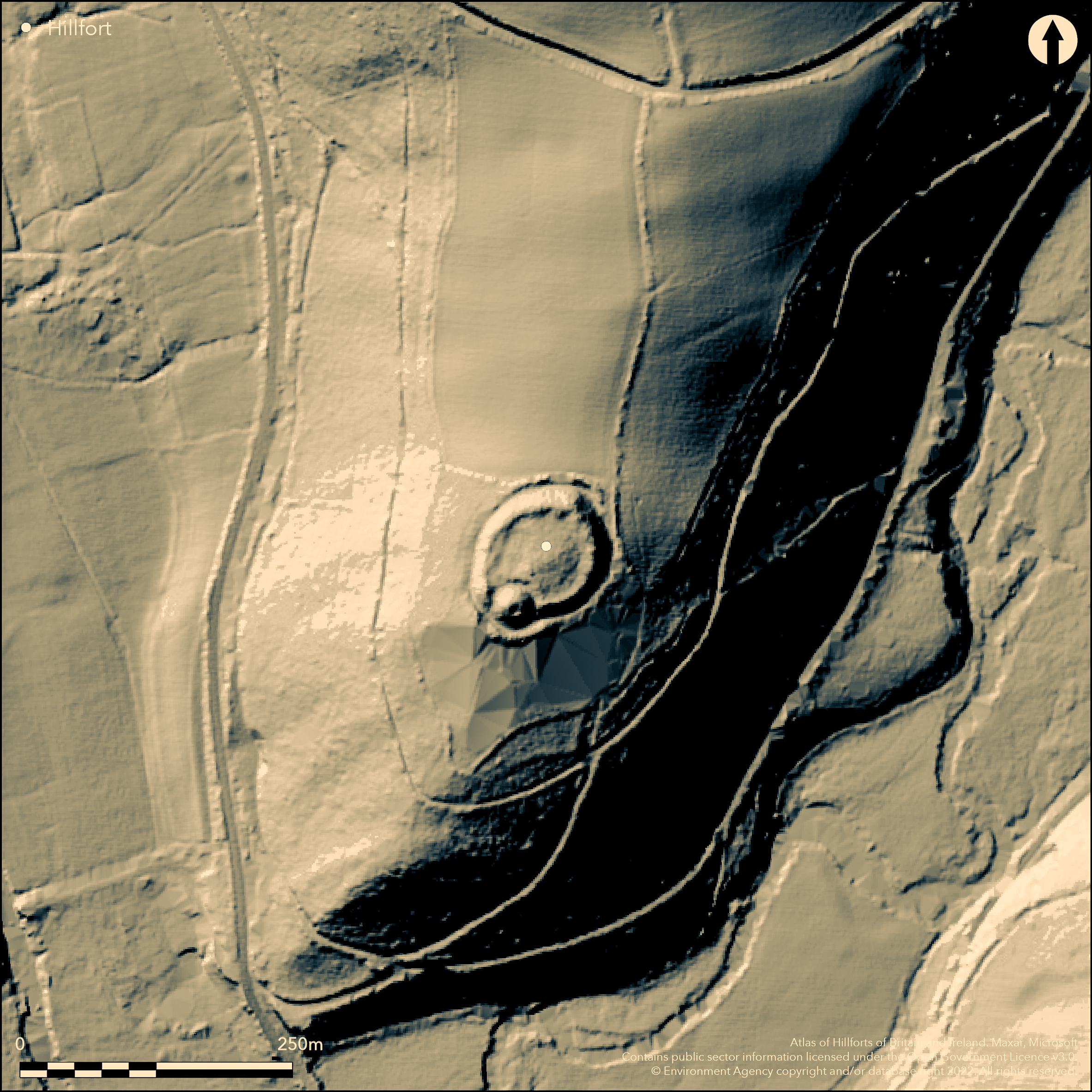
LiDAR 1m DTM Hillshade
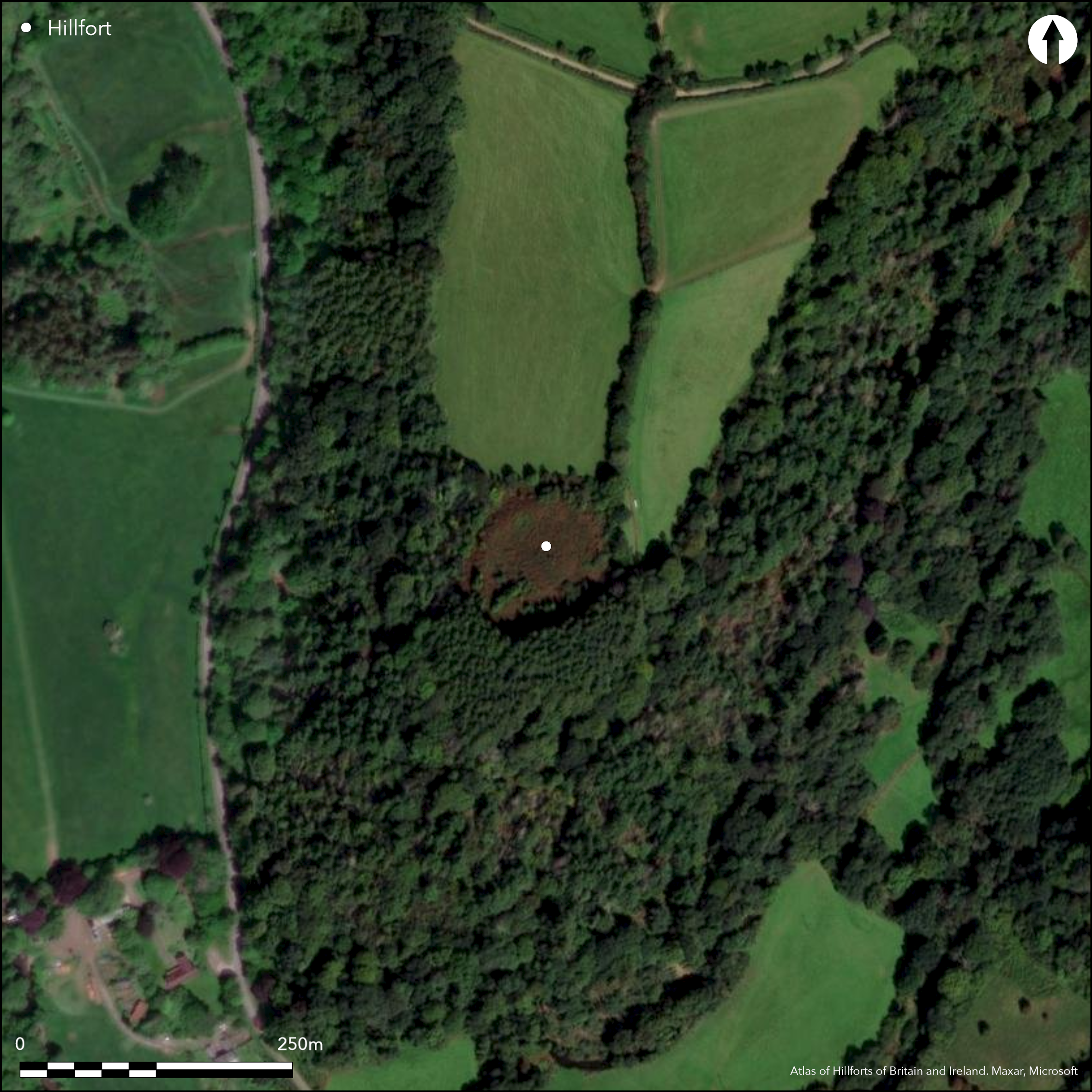
Satellite Imagery
LiDAR 1m DTM Hillshade
Satellite Imagery
Scroll left/right to view further images.
HER: Exmoor National Park MSO8841 (None)
NMR: SS 92 NW 7 (36540)
SM: 1006170
NGR: SS93852698
X: 293850 Y: 126980 (OSGB36)
Small, univallate, partial contour hillfort located on SW-facing spur at the end of a high ridge running N-S above confluence of River Exe and its tributary the River Haddeo to SW in Exmoor National Park. Steep surrounding slopes, very steep on SW and moderate to strong along ridge to NE. Small, possible 12th century, motte and bailey castle, to 5m high and 23m diameter, with enclosing ditch (Bury Castle), at S end of site. Oval in shape NE-SW with maximum length and breadth only 110m by 73m, with footprint c. 0.8ha, interior c. 85m N-S by 58m, with area c. 0.5ha. Defined by rampart and part-buried ditch with counterscarp to N and S. Rampart to c. 8m high on N, but generally 1.8 to 5m high on SW. Possible entrance on SE, but unclear and possible that entrance blocked in medieval period. Site obscured by scrub. Wooded surrounding slopes from NE round to W. Generally good condition. On 1st Ed. OS map (1890). Undated. Described elsewhere as a defended enclosure, here considered to be a hillfort.
Citizen Science: ✗
Reliability of Data: Confirmed
Reliability of Interpretation: Confirmed
X: -391314 Y: 6627008 (EPSG: 3857)
Longitude: -3.5152329606563795 Latitude: 51.032291975938435 (EPSG:4326)
Country: England
Current County or Unitary Authority: Somerset
Historic County: Somerset
Current Parish/Community/Council/Townland: Brompton Regis
Generally good condition. Bracken control measures undertaken. Possible motte and bailey castle.
| Extant | ✓ |
| Cropmark | ✗ |
| Likely Destroyed | ✗ |
Site obscured by scrub and bracken. Wooded surrounding slopes from NE round to W. Possible motte and bailey castle.
| Woodland | ✗ |
| Commercial Forestry Plantation | ✗ |
| Parkland | ✗ |
| Pasture (Grazing) | ✗ |
| Arable | ✗ |
| Scrub/Bracken | ✓ |
| Bare Outcrop | ✗ |
| Heather/Moorland | ✗ |
| Heath | ✗ |
| Built-up | ✗ |
| Coastal Grassland | ✗ |
| Other | ✓ |
Small, univallate, partial contour hillfort located on SW-facing spur at the end of a high ridge running N-S above confluence of River Exe and its tributary River Haddeo to SW. Steep surrounding slopes, very steep on SW and moderate to strong along ridge to NE.
| Contour Fort | ✓ |
| Partial Contour Fort | ✗ |
| Promontory Fort | ✗ |
| Hillslope Fort | ✗ |
| Level Terrain Fort | ✗ |
| Marsh Fort | ✗ |
| Multiple Enclosure Fort | ✗ |
| Hilltop | ✗ |
| Coastal Promontory | ✗ |
| Inland Promontory | ✗ |
| Valley Bottom | ✗ |
| Knoll/Hillock/Outcrop | ✗ |
| Ridge | ✓ |
| Cliff/Plateau-edge/Scarp | ✗ |
| Hillslope | ✗ |
| Lowland | ✗ |
| Spur | ✓ |
Dominant Topographic Feature: Spur
| North | ✗ |
| Northeast | ✗ |
| East | ✗ |
| Southeast | ✗ |
| South | ✗ |
| Southwest | ✓ |
| West | ✗ |
| Northwest | ✗ |
| Level | ✗ |
Altitude: 183.0m
N/A
None.
Reliability: D - None
| Pre 1200BC | ✗ |
| 1200BC - 800BC | ✗ |
| 800BC - 400BC | ✗ |
| 400BC - AD50 | ✗ |
| AD50 - AD400 | ✗ |
| AD400 - AD 800 | ✗ |
| Post AD800 | ✗ |
| Unknown | ✓ |
| Pre Hillfort: | None |
| Post Hillfort: | Small, possible 12th century, motte and bailey castle, to 5m high and 23m diameter, with enclosing ditch (Bury Castle), at S end of site. Probably built by William de Say before 1144, the year of his death. |
On 1st Ed. OS map (1890). Field investigation Ordnance Survey 1965. Surveyed by RCHME as part of East Exmoor Project 1996. Aerial photograph interpretation RCHME: Brendon Hills Mapping Project, NMP 1998. Surveyed as part of Exmoor Scheduled Monument Condition Assessment 2015.
| 1st Identified Map Depiction (1890): | OS map. |
| Other (1965): | Field investigation OS. |
| Earthwork Survey (1996): | Surveyed by RCHME as part of East Exmoor Project. |
| Other (1998): | Aerial photograph interpretation RCHME: Brendon Hills Mapping Project, NMP. |
| Other (2015): | Surveyed as part of Exmoor Scheduled Monument Condition Assessment. |
None.
None
| None | ✓ |
| Spring | ✗ |
| Stream | ✗ |
| Pool | ✗ |
| Flush | ✗ |
| Well | ✗ |
| Other | ✗ |
None
| No Known Features | ✓ |
| Round Stone Structures | ✗ |
| Rectangular Stone Structures | ✗ |
| Curvilinear Platforms | ✗ |
| Other Roundhouse Evidence | ✗ |
| Pits | ✗ |
| Quarry Hollows | ✗ |
| Other | ✗ |
None
| No Known Excavation | ✓ |
| Pits | ✗ |
| Postholes | ✗ |
| Roundhouses | ✗ |
| Rectangular Structures | ✗ |
| Roads/Tracks | ✗ |
| Quarry Hollows | ✗ |
| Other | ✗ |
| Nothing Found | ✗ |
None
| No Known Geophysics | ✓ |
| Pits | ✗ |
| Roundhouses | ✗ |
| Rectangular Structures | ✗ |
| Roads/Tracks | ✗ |
| Quarry Hollows | ✗ |
| Other | ✗ |
| Nothing Found | ✗ |
None
| No Known Finds | ✓ |
| Pottery | ✗ |
| Metal | ✗ |
| Metalworking | ✗ |
| Human Bones | ✗ |
| Animal Bones | ✗ |
| Lithics | ✗ |
| Environmental | ✗ |
| Other | ✗ |
None
| APs Not Checked | ✓ |
| None | ✗ |
| Roundhouses | ✗ |
| Rectangular Structures | ✗ |
| Pits | ✗ |
| Postholes | ✗ |
| Roads/Tracks | ✗ |
| Other | ✗ |
Possible entrance on SE, but unclear and possible that entrance blocked in medieval period.
| 1: | None |
| 2: | None |
Guard Chambers: ✗
Chevaux de Frise: ✗
| 1. Simple Gap (South east): | Possible entrance only. |
| 1. Blocked (South east): | Possibly blocked in medieval period. |
Defined by rampart and part-buried ditch with counterscarp to N and S. Rampart to c. 8m high on N, but generally 1.8 to 5m high on SW. Possible
| Area 1: | 0.5ha. |
| Total: | 0.5ha. |
Total Footprint Area: 0.8ha.
None
| ✗ | None |
| ✓ | None |
| NE Quadrant: | 1 |
| SE Quadrant: | 1 |
| SW Quadrant: | 1 |
| NW Quadrant: | 1 |
| Total: | 1 |
| Partial Univallate | ✗ |
| Univallate | ✓ |
| Partial Bivallate | ✗ |
| Bivallate | ✗ |
| Partial Multivallate | ✗ |
| Multivallate | ✗ |
| Unknown | ✗ |
| Partial Univallate | ✗ |
| Univallate | ✗ |
| Partial Bivallate | ✗ |
| Bivallate | ✗ |
| Partial Multivallate | ✗ |
| Multivallate | ✗ |
Counterscarp to N and S.
| None | ✗ |
| Earthen Bank | ✓ |
| Stone Wall | ✗ |
| Rubble | ✗ |
| Wall-walk | ✗ |
| Evidence of Timber | ✗ |
| Vitrification | ✗ |
| Other Burning | ✗ |
| Palisade | ✗ |
| Counter Scarp Bank | ✓ |
| Berm | ✗ |
| Unfinished | ✗ |
| Other | ✗ |
None
| None | ✗ |
| Earthen Bank | ✗ |
| Stone Wall | ✗ |
| Murus Duplex | ✗ |
| Timber-framed | ✗ |
| Timber-laced | ✗ |
| Vitrification | ✗ |
| Other Burning | ✗ |
| Palisade | ✗ |
| Counter Scarp Bank | ✗ |
| Berm | ✗ |
| Unfinished | ✗ |
| No Known Excavation | ✓ |
| Other | ✗ |
| ✗ | None |
| ✓ | Part-buried ditch. |
Number of Ditches: 1
| ✗ | None |
Allcroft, A.H. 1908. Earthwork of England : prehistoric, Roman, Saxon, Danish, Norman, and mediaeval, London: Macmillan, 136.
Anon 1996. Bury Castle, Brompton Regis, Unpublished client report RCHME.
Page, W. ed. 1911. Ancient earthworks, The Victoria History of Somerset, Volume Two, The Victoria History of the Counties of England, London: Constable and Co, 482-3.
Atlas of Hillforts:
Wikidata:
This work is licensed under CC BY-SA 4.0

 and should be cited as:
Lock, Gary and Ralston, Ian. 2024. Atlas of Hillforts of Britain and Ireland. Available at: https://hillforts.arch.ox.ac.uk
Document Version 1.1