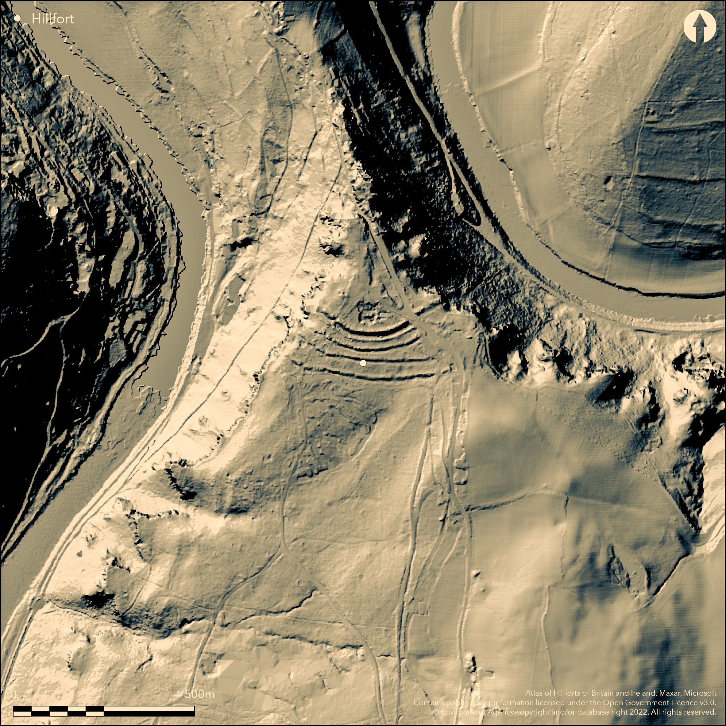
LiDAR 1m DTM Hillshade
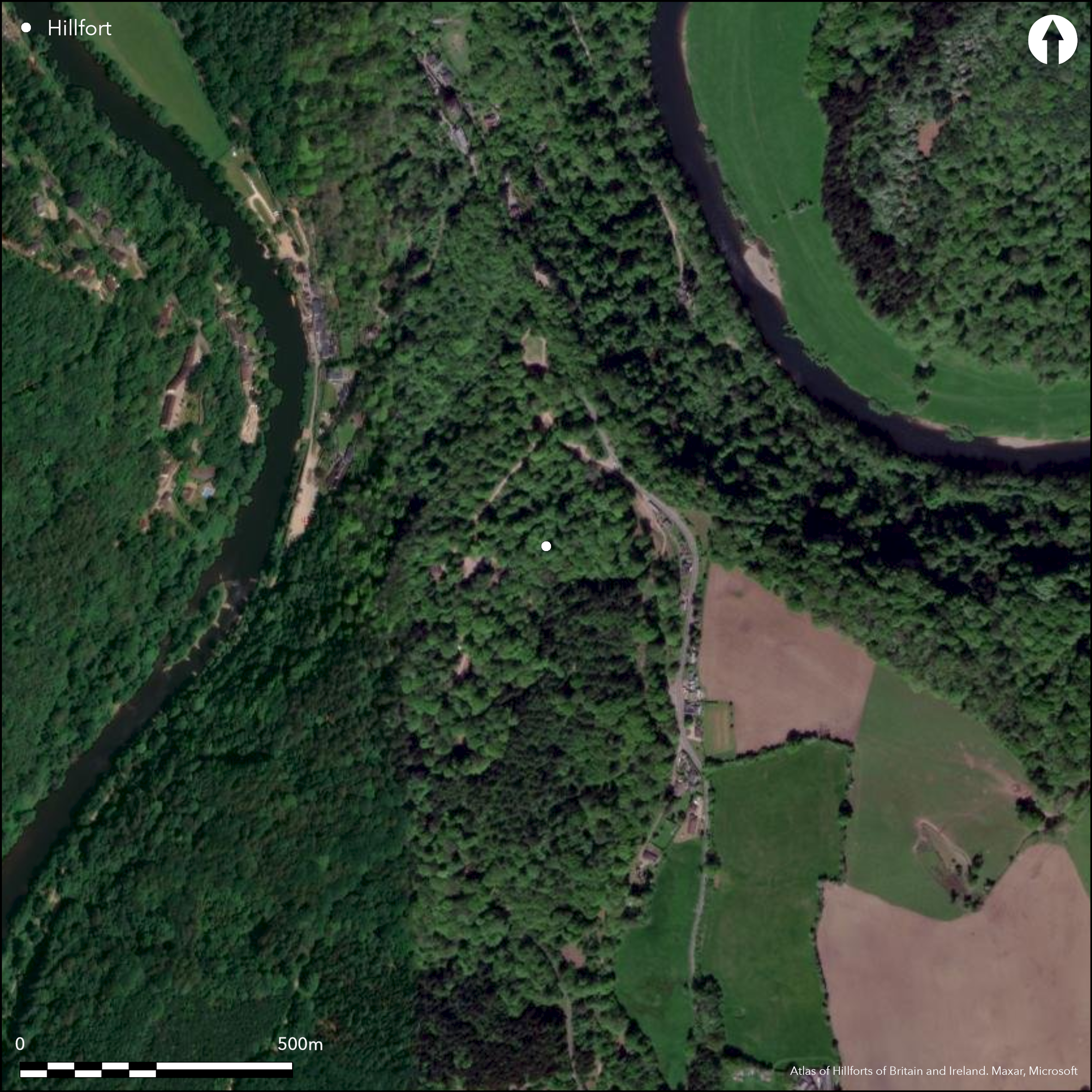
Satellite Imagery
LiDAR 1m DTM Hillshade
Satellite Imagery
Scroll left/right to view further images.
HER: Gloucestershire 19 (None)
NMR: SO 51 NE 3 (109563)
SM: 1016760
NGR: SO56371569
X: 356370 Y: 215690 (OSGB36)
Fine and large inland promontory fort located high above a marked NW-facing loop of the River Wye within the Forest of Dean. Precipitous cliffs to river to 122m high around site to N, E and W, moderate to strong then steep along spur S-SSE. Triangular in shape, with base to SSE and apex to NNW at c. 148m A.S.L. and c. 6ha overall. On S side a series of five banks and four ditches, which take up a great deal of 6ha total, with interior estimated at around 4.4ha. Although initially attributed to Offa, who reigned between 784-796 AD, the nature of the ramparts and pottery finds give late Iron Age/ Romano-British date. The promontory is cut off on the S by the impressive series of banks and ditches, controlling access to the N interior. The outermost three comprise banks rising to c. 1.2m-2m high fronted by V-shaped ditches from 4m-5m wide at top to 2m-3m wide at bottom and 0.5m-1m deep. To N of these the inner configuration comprises two banks with intervening ditch. The outer bank of these c. 0.8m high, the large ditch 8m wide at top, 5m wide at bottom, and 1.5m deep. The innermost bank rises to 4m high from bottom of ditch and c. 8m wide. Bank more complex than first appears, the W banks variable to edge of promontory; the two outer banks for example run into NE-SW lateral bank, whilst the end of third bank disappears into decline called 'Hoillow Rock' and two inner banks continue to promontory edge. On E side the two outer banks built on by road, car park and houses, the second reappearing across the road to 1.5m high and curving N to meet third bank. the two innermost banks run through to the promontory edge on E. No obvious entrance, but possibly on line of the road on E side of fort. To N interior rises, then flattens, then rises again to edge of promontory giving an unusual SE aspect to the site. Although ramparts recorded as early as 1297, antiquarian interest only in latter part of 19th century by Nichols 1858, Playne 1877 and MacClean 1880. Abraded sherds of 1st century AD pottery were found in 1990-91 and monitoring of groundworks in 2005 for five postholes within hillfort recovered fragment of tap-slag, suggesting bloomery smelting on the site, two of numerous small assessments and watching briefs on the site. Although the site has had suggested associations with King Offa since 19th century, there are no recognised sections of the dyke associated with the hillfort. Generally good condition, but overgrown with woodland, brambles and scrub, with rough greass. Spectacular popular visitor attraction and important educational resource. On 1st Ed. OS map (1881).
Citizen Science: ✓
Reliability of Data: Confirmed
Reliability of Interpretation: Confirmed
X: -293290 Y: 6770898 (EPSG: 3857)
Longitude: -2.6346722052893212 Latitude: 51.8380606279457 (EPSG:4326)
Country: England; None
Current County or Unitary Authority: Gloucestershire
Historic County: Gloucestershire
Current Parish/Community/Council/Townland: English Bicknor; Whitchurch
Generally good condition, but overgrown. Spectacular popular visitor attraction and important educational resource.
| Extant | ✓ |
| Cropmark | ✗ |
| Likely Destroyed | ✗ |
Woodland, brambles and scrub with rough grass.
| Woodland | ✓ |
| Commercial Forestry Plantation | ✗ |
| Parkland | ✗ |
| Pasture (Grazing) | ✓ |
| Arable | ✗ |
| Scrub/Bracken | ✓ |
| Bare Outcrop | ✗ |
| Heather/Moorland | ✗ |
| Heath | ✗ |
| Built-up | ✗ |
| Coastal Grassland | ✗ |
| Other | ✗ |
Large inland promontory fort located high above a marked NW-facing loop of the River Wye within the Forest of Dean. Precipitous cliffs to river to 122m high around site to N, E and W, moderate to strong then steep along spur S-SSE.
| Contour Fort | ✗ |
| Partial Contour Fort | ✗ |
| Promontory Fort | ✓ |
| Hillslope Fort | ✗ |
| Level Terrain Fort | ✗ |
| Marsh Fort | ✗ |
| Multiple Enclosure Fort | ✗ |
| Hilltop | ✗ |
| Coastal Promontory | ✗ |
| Inland Promontory | ✓ |
| Valley Bottom | ✗ |
| Knoll/Hillock/Outcrop | ✗ |
| Ridge | ✗ |
| Cliff/Plateau-edge/Scarp | ✗ |
| Hillslope | ✗ |
| Lowland | ✗ |
| Spur | ✗ |
Dominant Topographic Feature: Spur promontory
| North | ✗ |
| Northeast | ✗ |
| East | ✗ |
| Southeast | ✓ |
| South | ✗ |
| Southwest | ✗ |
| West | ✗ |
| Northwest | ✗ |
| Level | ✗ |
Altitude: 148.0m
Boundary Type: Parish/Townland
Nature of defences and 1st century AD pottery found on site suggest a late Iron Age/Romano-British date.
Reliability: C - Low
| Pre 1200BC | ✗ |
| 1200BC - 800BC | ✗ |
| 800BC - 400BC | ✗ |
| 400BC - AD50 | ✓ |
| AD50 - AD400 | ✗ |
| AD400 - AD 800 | ✗ |
| Post AD800 | ✗ |
| Unknown | ✗ |
| Pre Hillfort: | None |
| Post Hillfort: | None |
| Artefactual: | 1st century AD pottery. |
| Morphology/Earthwork/Typology: | Nature of defences Iron Age. |
Ramparts recorded 1297. On 1st Ed. OS map (1881). Field investigation 1958 - no details. Evaluation with seven trial trenches C. Parry 1990-1. Watching Brief C. Parry 1994. Management survey J. Hoyle 1996. Air Photograph Interpretation English Heritage: Gloucestershire NMP (North Cotswolds and Forest of Dean) 2002-06. Watching Brief J. Hoyle 2005. Watching Brief B. Williams 2009. Geophysical survey Gloucestershire County Council Archaeology Service 2009.
| 1st Identified Written Reference (1297): | Ramparts recorded. |
| 1st Identified Map Depiction (1881): | OS map. |
| Other (1958): | Field investigation - no details. |
| Other (1994): | Watching Brief C. Parry. |
| Other (1996): | Management survey J. Hoyle. |
| Other (2005): | Watching Brief J. Hoyle. |
| Other (2009): | Watching Brief B. Williams. |
| Geophysical Survey (2009): | Geophysical survey Gloucestershire County Council Archaeology Service. |
| Excavation (None): | Evaluation with seven trial trenches C. Parry. |
| Other (None): | Air Photograph Interpretation English Heritage: Gloucestershire NMP (North Cotswolds and Forest of Dean) . |
Abraded sherds of 1st century AD pottery were found in one of numerous small assessments and watching briefs in 1990-91 and monitoring of groundworks for five postholes within hillfort recovered fragment of tap-slag, suggesting bloomery smelting on the site.
None
| None | ✓ |
| Spring | ✗ |
| Stream | ✗ |
| Pool | ✗ |
| Flush | ✗ |
| Well | ✗ |
| Other | ✗ |
None
| No Known Features | ✓ |
| Round Stone Structures | ✗ |
| Rectangular Stone Structures | ✗ |
| Curvilinear Platforms | ✗ |
| Other Roundhouse Evidence | ✗ |
| Pits | ✗ |
| Quarry Hollows | ✗ |
| Other | ✗ |
Trial trenches and small assessments generally found nothing.
| No Known Excavation | ✗ |
| Pits | ✗ |
| Postholes | ✗ |
| Roundhouses | ✗ |
| Rectangular Structures | ✗ |
| Roads/Tracks | ✗ |
| Quarry Hollows | ✗ |
| Other | ✗ |
| Nothing Found | ✓ |
None
| No Known Geophysics | ✗ |
| Pits | ✗ |
| Roundhouses | ✗ |
| Rectangular Structures | ✗ |
| Roads/Tracks | ✗ |
| Quarry Hollows | ✗ |
| Other | ✗ |
| Nothing Found | ✓ |
Abraded sherds of 1st century AD pottery were found in one of numerous small assessments and watching briefs in 1990-91 and monitoring of groundworks for five postholes within hillfort recovered fragment of tap-slag, suggesting bloomery smelting on the site.
| No Known Finds | ✗ |
| Pottery | ✓ |
| Metal | ✗ |
| Metalworking | ✓ |
| Human Bones | ✗ |
| Animal Bones | ✗ |
| Lithics | ✗ |
| Environmental | ✗ |
| Other | ✗ |
None
| APs Not Checked | ✓ |
| None | ✗ |
| Roundhouses | ✗ |
| Rectangular Structures | ✗ |
| Pits | ✗ |
| Postholes | ✗ |
| Roads/Tracks | ✗ |
| Other | ✗ |
No obvious entrance, but possibly on line of the road on E side of fort.
| 0: | No obvious entrance. |
| 2: | Possibly on line of the road on E side of fort. |
Guard Chambers: ✗
Chevaux de Frise: ✗
| 1. Simple Gap (East): | Type estimated only. |
Promontory is cut off on the S by the impressive series of banks and ditches, controlling access to the N interior. The outermost three comprise banks rising to c. 1.2m-2m high fronted by V-shaped ditches from 4m-5m wide at top to 2m-3m wide at bottom and 0.5m-1m deep. To N of these the inner defence comprises two banks with intervening ditch. The outer bank of these c. 0.8m high, the large ditch 8m wide at top, 5m wide at bottom, and 1.5m deep. The innermost bank rises to 4m high from bottom of ditch and c. 8m wide. Bank more complex than first appears, the W banks variable to edge of promontory; the two outer banks for example run into NE-SW lateral bank, whilst the end of third bank disappears into decline called 'Hoillow Rock' and two inner banks continue to promontory edge. On E side the two outer banks built on by road, car park and houses, the second reappearing across the road to 1.5m high and curving N to meet third bank. the two innermost banks run through to the promontory edge on E.
| Area 1: | 6.0ha. |
| Total: | 6.0ha. |
Total Footprint Area: 4.4ha.
None
| ✗ | Defended on S side by series of five banks and four ditches, which take up a great deal of the 6ha total, interior therefore estimated at c. 4.4ha, but a definitive earthwork survey is required. |
| ✗ | None |
| NE Quadrant: | 0 |
| SE Quadrant: | 5 |
| SW Quadrant: | 5 |
| NW Quadrant: | 0 |
| Total: | 5 |
| Partial Univallate | ✗ |
| Univallate | ✗ |
| Partial Bivallate | ✗ |
| Bivallate | ✗ |
| Partial Multivallate | ✓ |
| Multivallate | ✗ |
| Unknown | ✗ |
| Partial Univallate | ✗ |
| Univallate | ✗ |
| Partial Bivallate | ✗ |
| Bivallate | ✗ |
| Partial Multivallate | ✗ |
| Multivallate | ✗ |
None
| None | ✗ |
| Earthen Bank | ✓ |
| Stone Wall | ✗ |
| Rubble | ✗ |
| Wall-walk | ✗ |
| Evidence of Timber | ✗ |
| Vitrification | ✗ |
| Other Burning | ✗ |
| Palisade | ✗ |
| Counter Scarp Bank | ✗ |
| Berm | ✗ |
| Unfinished | ✗ |
| Other | ✗ |
Nothing found in small assessments.
| None | ✓ |
| Earthen Bank | ✗ |
| Stone Wall | ✗ |
| Murus Duplex | ✗ |
| Timber-framed | ✗ |
| Timber-laced | ✗ |
| Vitrification | ✗ |
| Other Burning | ✗ |
| Palisade | ✗ |
| Counter Scarp Bank | ✗ |
| Berm | ✗ |
| Unfinished | ✗ |
| No Known Excavation | ✗ |
| Other | ✗ |
| ✗ | None |
| ✓ | V-shaped ditches/ |
Number of Ditches: 4
| ✗ | None |
Darvill, T. 2011. Prehistoric Gloucestershire. Forests and vales and high blue hills, 2nd Edition, Stroud: Amberley Publishing.
Hoyle, J. 1997. Symonds Yat Promontory Fort, Management Plan, Gloucestershire Archaeology Service Archaeology Service.
Hoyle J. 2005. A report on a watching brief at Symonds Yat Promontory Fort, Gloucestershire, Gloucestershire County Council.
Parry, c. 1994. Symonds Yat promontory fort, English Bicknor, Gloucestershire: Excavations 1990-91, Trans Bristol Gloucestershire Archaeol Soc, 112, 59-72.
Parry, C. 1994. Symonds Yat Promontory Fort, English Bicknor, Gloucestershire: report on a watching brief undertaken February 1994, Gloucestershire County Council Arcahology Service unpublished report.
Roberts, T. 2009. A geophysical survey report at Symonds Yat Promontory Fort, English Bicknor, Gloucestershire, Gloucestershire County Council Archaeological service unpublished report.
Williams, B. 2009. Archaeological monitoring during resurfacing and drainage along the main pedestrian access at Symonds Yat, English Bicknor, Gloucestershire, Gloucestershire County Council Archaeological service unpublished report.
Atlas of Hillforts:
Wikidata:
This work is licensed under CC BY-SA 4.0

 and should be cited as:
Lock, Gary and Ralston, Ian. 2024. Atlas of Hillforts of Britain and Ireland. Available at: https://hillforts.arch.ox.ac.uk
Document Version 1.1