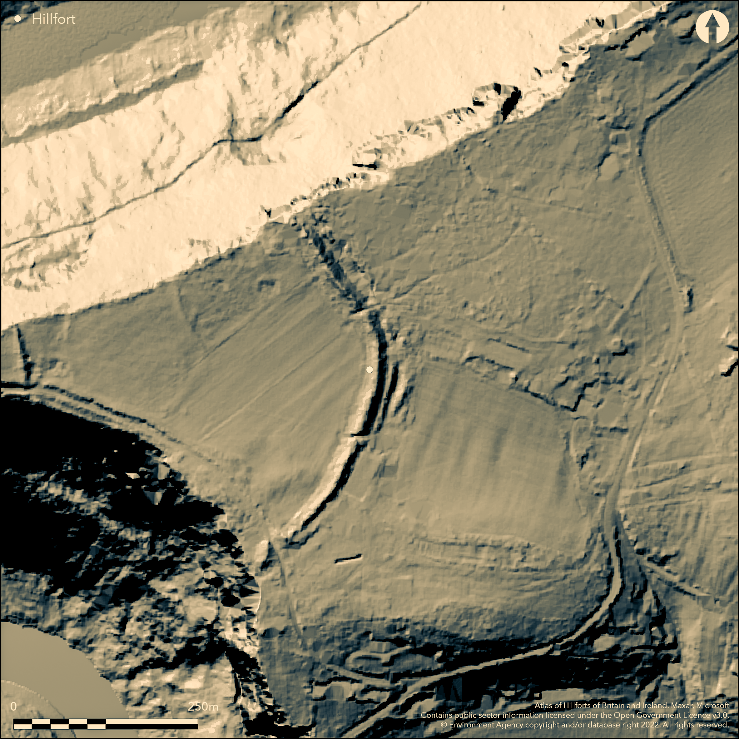
LiDAR 1m DTM Hillshade
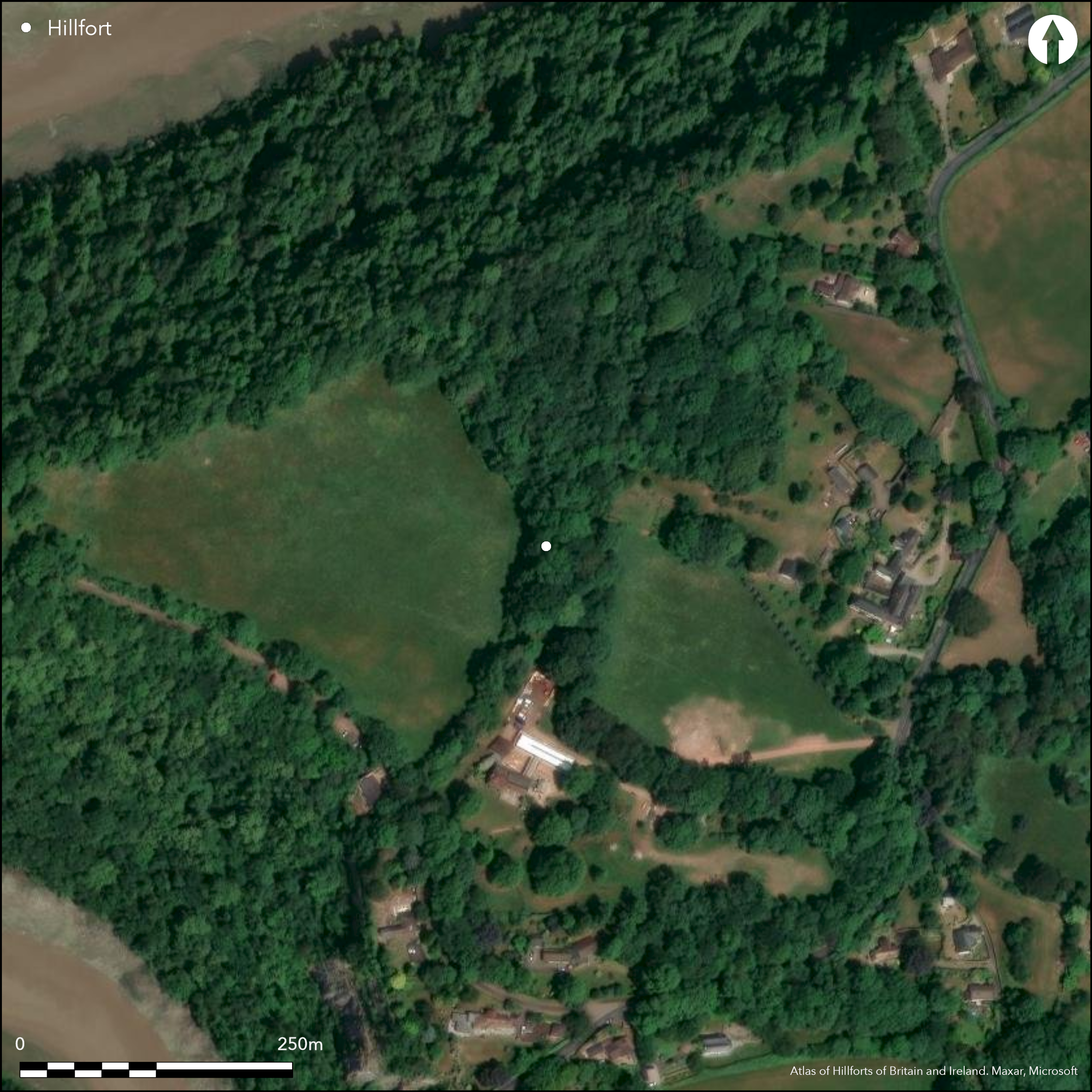
Satellite Imagery
LiDAR 1m DTM Hillshade
Satellite Imagery
Scroll left/right to view further images.
HER: Gloucestershire 23 (None)
NMR: ST 59 NW 3 (198723)
SM: 1004858
NGR: ST54269671
X: 354260 Y: 196710 (OSGB36)
Inland promontory fort on W-facing spur above very prominent bend and peninsula in the River Wye, to N of Wintour's Leap and Bang-y-gor rocks and above Priors Reach to N. Precipitous slopes to river on N and SW, steep to W and moderate along spur to E. Part of ramparts seemingly incorporated into Offa's Dyke earthwork. Triangular shape, defined by two banks cutting off the promontory on E, to c. 2m high and ditches to c. 2.5m deep, with slight counterscarp in places, cut off promontory, all measuring c. 37m overall. 300m to W possible earlier phase of to fort, or additional line, c. 50m long, defined by bank to c. 1.4m high with possible ditch on E side. This inner bank, together with other banks of uncertain date (may be medieval or post-medieval boundaries or prehistoric) visible on aerial photographs, but main earthworks in trees. Three trial trenches 2003 for development proposal found line of outer ditch. Original entrance unclear, possibly where modern track to Lancaut cuts through banks on SE edge. Similar, though not as elaborate, as Symonds' Yat (Atlas No 4147) another Forest of Dean site. Pasture interior and wood, wooded slopes to river. On 1:2500 OS map (1902).
Citizen Science: ✓
Reliability of Data: Confirmed
Reliability of Interpretation: Confirmed
X: -296421 Y: 6740182 (EPSG: 3857)
Longitude: -2.6627923213417275 Latitude: 51.66724876375758 (EPSG:4326)
Country: England; None
Current County or Unitary Authority: Gloucestershire
Historic County: Gloucestershire
Current Parish/Community/Council/Townland: Tidenham; St Arvans
Well-preserved.
| Extant | ✓ |
| Cropmark | ✗ |
| Likely Destroyed | ✗ |
Pasture interior and wood, wooded slopes to river.
| Woodland | ✓ |
| Commercial Forestry Plantation | ✗ |
| Parkland | ✗ |
| Pasture (Grazing) | ✓ |
| Arable | ✗ |
| Scrub/Bracken | ✓ |
| Bare Outcrop | ✗ |
| Heather/Moorland | ✗ |
| Heath | ✗ |
| Built-up | ✗ |
| Coastal Grassland | ✗ |
| Other | ✗ |
Inland promontory fort on W-facing spur above very prominent bend and peninsula in the River Wye, to W of Wintour's leap and Bang-y-gor rocks and above Priors Reach to N. Precipitous slopes to river on N and SW, steep to W and moderate along spur to E.
| Contour Fort | ✗ |
| Partial Contour Fort | ✗ |
| Promontory Fort | ✓ |
| Hillslope Fort | ✗ |
| Level Terrain Fort | ✗ |
| Marsh Fort | ✗ |
| Multiple Enclosure Fort | ✗ |
| Hilltop | ✗ |
| Coastal Promontory | ✗ |
| Inland Promontory | ✓ |
| Valley Bottom | ✗ |
| Knoll/Hillock/Outcrop | ✗ |
| Ridge | ✗ |
| Cliff/Plateau-edge/Scarp | ✗ |
| Hillslope | ✗ |
| Lowland | ✗ |
| Spur | ✓ |
Dominant Topographic Feature: Spur promontory
| North | ✗ |
| Northeast | ✗ |
| East | ✗ |
| Southeast | ✗ |
| South | ✗ |
| Southwest | ✗ |
| West | ✓ |
| Northwest | ✗ |
| Level | ✗ |
Altitude: 107.0m
Boundary Type: Parish/Townland
None.
Reliability: D - None
| Pre 1200BC | ✗ |
| 1200BC - 800BC | ✗ |
| 800BC - 400BC | ✗ |
| 400BC - AD50 | ✗ |
| AD50 - AD400 | ✗ |
| AD400 - AD 800 | ✗ |
| Post AD800 | ✗ |
| Unknown | ✓ |
| Pre Hillfort: | None |
| Post Hillfort: | None |
In Aubrey's Monumenta Britannica (1665-1693). On 1:2500 OS map (1902). Field investigation 1970 - no details. Geophysical survey for development proposal Stratascan 2000. Three trial trenches 2003 for development N Kennedy, Bristol and Rehion Archaeological Services. Aerial photograph interpretation English Heritage/Gloucestershire CC (North Cotswolds and Forest of Dean) NMP.
| Other (1902): | OS map. |
| Other (1970): | Field investigation. |
| Geophysical Survey (2000): | Geophysical survey for development proposal Stratascan. |
| Excavation (2003): | Three trial trenches 2003 for development N Kennedy, Bristol and Rehion Archaeological Services. |
| 1st Identified Written Reference (None): | In Aubrey's Monumenta Britannica. |
| Other (None): | Aerial photograph interpretation English Heritage/Gloucestershire CC (North Cotswolds and Forest of Dean) NMP. |
None.
None
| None | ✓ |
| Spring | ✗ |
| Stream | ✗ |
| Pool | ✗ |
| Flush | ✗ |
| Well | ✗ |
| Other | ✗ |
None
| No Known Features | ✓ |
| Round Stone Structures | ✗ |
| Rectangular Stone Structures | ✗ |
| Curvilinear Platforms | ✗ |
| Other Roundhouse Evidence | ✗ |
| Pits | ✗ |
| Quarry Hollows | ✗ |
| Other | ✗ |
None
| No Known Excavation | ✓ |
| Pits | ✗ |
| Postholes | ✗ |
| Roundhouses | ✗ |
| Rectangular Structures | ✗ |
| Roads/Tracks | ✗ |
| Quarry Hollows | ✗ |
| Other | ✗ |
| Nothing Found | ✗ |
None
| No Known Geophysics | ✗ |
| Pits | ✗ |
| Roundhouses | ✗ |
| Rectangular Structures | ✗ |
| Roads/Tracks | ✗ |
| Quarry Hollows | ✗ |
| Other | ✗ |
| Nothing Found | ✓ |
None
| No Known Finds | ✓ |
| Pottery | ✗ |
| Metal | ✗ |
| Metalworking | ✗ |
| Human Bones | ✗ |
| Animal Bones | ✗ |
| Lithics | ✗ |
| Environmental | ✗ |
| Other | ✗ |
None
| APs Not Checked | ✓ |
| None | ✗ |
| Roundhouses | ✗ |
| Rectangular Structures | ✗ |
| Pits | ✗ |
| Postholes | ✗ |
| Roads/Tracks | ✗ |
| Other | ✗ |
Original entrance unclear, but possibly where modern track to Lancaut through defences on SE edge. Possible modern gaps on E.
| 3: | Possible modern gaps on E. |
| 2: | None |
Guard Chambers: ✗
Chevaux de Frise: ✗
| 1. Simple Gap (East): | Possibly where modern track to Lancaut through defences on SE edge. |
Defined by two banks cutting off the promontory on E, to c. 2m high and ditches to c. 2.5m deep, with slight counterscarp in places, cut off promontory, all measuring c. 37m overall. 300m to W, possible earlier phase of defences to fort, or additional line, c. 50m long, defined by bank to c. 1.4m high with possible ditch on E side. This inner defence, together with other banks of uncertain date (may be medieval or post-medieval boundaries or prehistoric) visible on aerial photographs, but main earthworks in trees. Three trial trenches 2003 for development proposal found line of outer ditch.
| Area 1: | 4.8ha. |
| Total: | 4.8ha. |
Total Footprint Area: Noneha.
None
| ✓ | Area defined from map/satellite. 300m to W possible earlier phase to fort, or second line, defined by bank to c. 1.4m high with possible ditch on E side, but phasing not proven. Smaller area not calculated. |
| ✗ | Possible additional line of defence to E. |
| NE Quadrant: | 2 |
| SE Quadrant: | 2 |
| SW Quadrant: | 0 |
| NW Quadrant: | 0 |
| Total: | 2 |
| Partial Univallate | ✗ |
| Univallate | ✗ |
| Partial Bivallate | ✓ |
| Bivallate | ✗ |
| Partial Multivallate | ✗ |
| Multivallate | ✗ |
| Unknown | ✗ |
| Partial Univallate | ✗ |
| Univallate | ✗ |
| Partial Bivallate | ✗ |
| Bivallate | ✗ |
| Partial Multivallate | ✗ |
| Multivallate | ✗ |
Slight counterscarp in places.
| None | ✗ |
| Earthen Bank | ✓ |
| Stone Wall | ✗ |
| Rubble | ✗ |
| Wall-walk | ✗ |
| Evidence of Timber | ✗ |
| Vitrification | ✗ |
| Other Burning | ✗ |
| Palisade | ✗ |
| Counter Scarp Bank | ✓ |
| Berm | ✗ |
| Unfinished | ✗ |
| Other | ✗ |
Three trial trenches 2003 found line of outer ditch.
| None | ✗ |
| Earthen Bank | ✗ |
| Stone Wall | ✗ |
| Murus Duplex | ✗ |
| Timber-framed | ✗ |
| Timber-laced | ✗ |
| Vitrification | ✗ |
| Other Burning | ✗ |
| Palisade | ✗ |
| Counter Scarp Bank | ✗ |
| Berm | ✗ |
| Unfinished | ✗ |
| No Known Excavation | ✗ |
| Other | ✓ |
| ✗ | None |
| ✓ | Intermediate and external ditches to banks. |
Number of Ditches: 2
| ✗ | None |
Barker P, Mercer E and Brookes C. 2000 GEOPHYSICAL SURVEY CARRIED OUT AT LANCAUT, GLOUCESTERSHIRE. STRATASCAN, unpublished report No. 1458
Fox ,C. 1955 Offa's Dyke: a field survey of the western frontier - works of Mercia in the seventh and eighth centuries.
Hoyle, J.P. and Vallender, J. 1995-1996. Offa's Dyke in Glos. Management Survey 1995-6, Gloucestershire County Council archive.
Atlas of Hillforts:
Wikidata:
This work is licensed under CC BY-SA 4.0

 and should be cited as:
Lock, Gary and Ralston, Ian. 2024. Atlas of Hillforts of Britain and Ireland. Available at: https://hillforts.arch.ox.ac.uk
Document Version 1.1