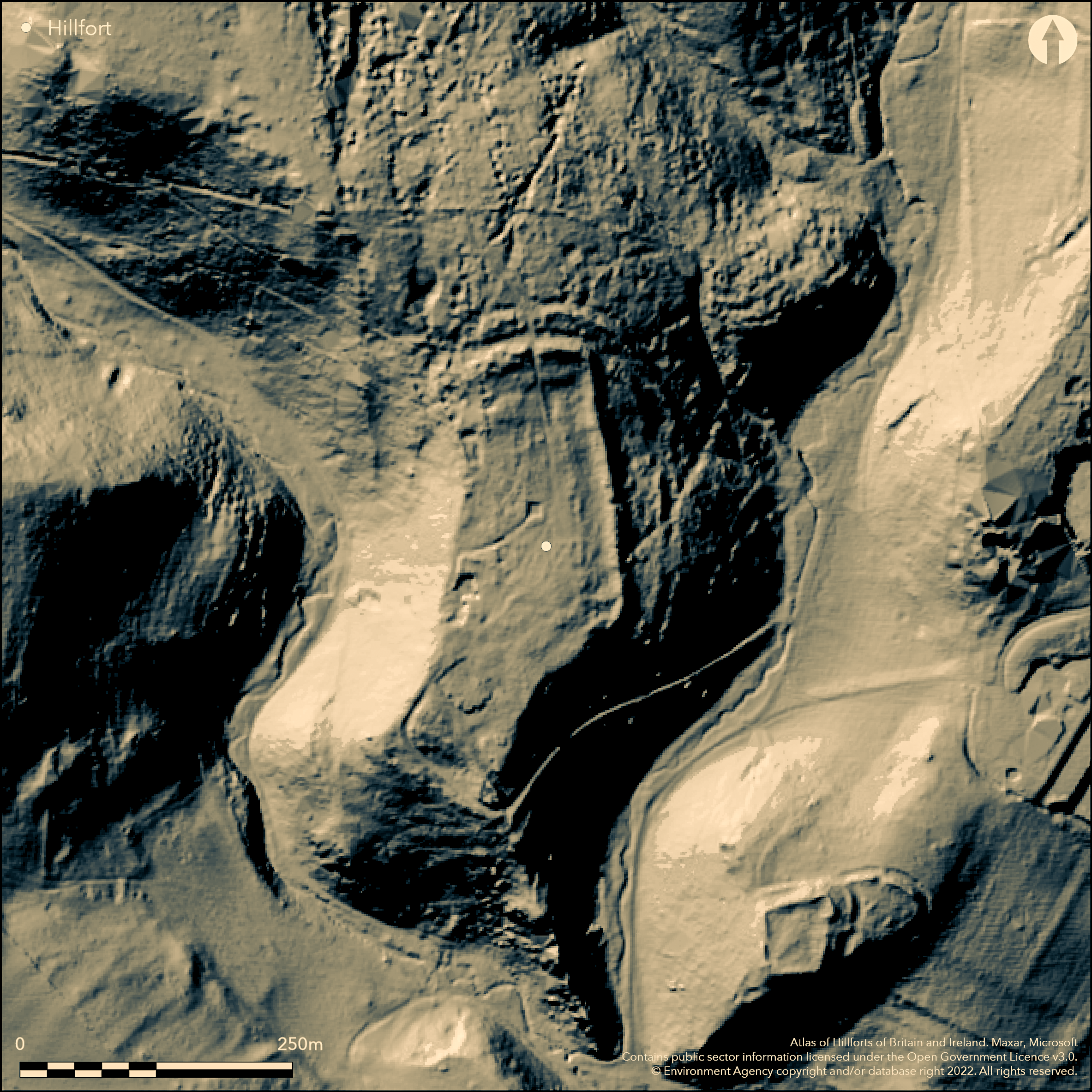
LiDAR 1m DTM Hillshade
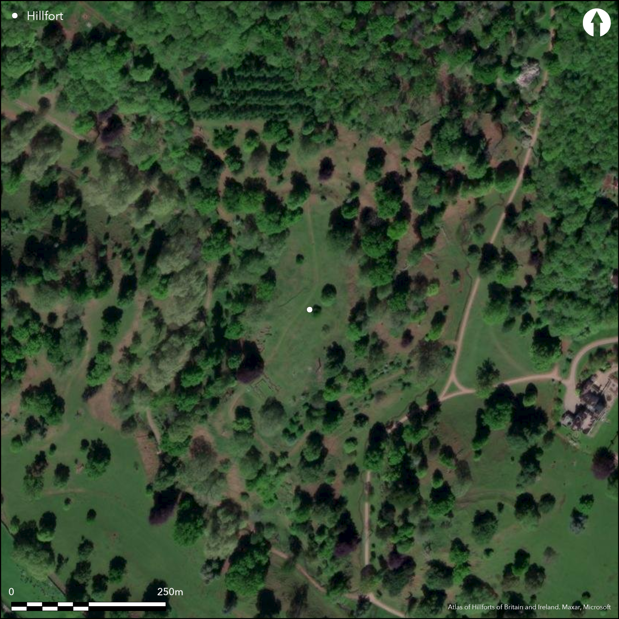
Satellite Imagery
LiDAR 1m DTM Hillshade
Satellite Imagery
Scroll left/right to view further images.
HER: Gloucestershire 25 (None)
NMR: SO 60 SW 1 (111668)
SM: 1017373
NGR: SO61600270
X: 361600 Y: 202700 (OSGB36)
A partial contour hillfort located on SW-facing spur above streams on E and S flowing into River Severn estuary, and above its floodplain on SE, in Forest of Dean. Steep slopes NE to SE, very steep S to W, moderate along spur to NNW. Substantial investigations and excavations from early nineteenth century found promontory fort established in or around 1st century BC with later Romano-British settlement, centred on ironstone mining. Later still, partially restored Romano-Celtic temple of basilican type, dedicated to god Nodens, with baths, healing centre and accommodation (mansio) complex, within the fort. Fort aligned N-S, with internal area 1.8ha. The steep natural slopes on E, S and W seemingly provide adequate natural definition, but the actual extent of artificial construct is unclear. At N end of fort a system of two banks and ditches cuts off the neck of the promontory from rising ground to give a characteristic promontory fort; inner bank being to c. 2m high, with ditch to its N 3m wide, and from bottom of this ditch outer bank to 2m high, with further ditch to N 1.5m deep and 2m wide. However, the two ramparts continue along the E side, internal bank standing to c. 2m high running in a straight N-S line, the outer bank also to 2m, but following the contours of the hill. On the W side is a low bank, c. 0.2m-0.5m high, with protruding stone suggesting possible wall footings within the bank. Any Iron Age ramparts at S end of fort appear to have been disturbed by Romano-British construction of entrance to temple complex. Some suggestion from geophysical survey 1998 that geophysical features associated with inner face of E rampart curve W across site c. 40m S of main N rampart, leaving E rampart where there significant kink - possible suggestion that original pre-Roman main rampart possibly turned to cross promontory here, and two extant ramparts on N may have been outer ramparts with simple cross-ridge form. This would suggest a possible partial contour hillfort, but whether there is a single, or phased, construction to the hillfort has not been determined, as neither has the dating of any rampart sequence. NW corner of N defences disturbed by iron extraction pits, and further pits in E interior, one a shaft 1m square and unknown depth, ranging from 3m to 16m diameter and 1m deep. Dating sequence suggested by Sir Mortimer Wheeler in his summary of 1928-9 excavations (Wheeler and Wheeler 1932). Promontory fort established shortly before first century BC, during second and third centuries AD occupied by Romano-British population engaged, at least partly, in iron mining. Soon after AD 364-7 temple and associated structure complex built, with modifications after, and c. end of 4th century buildings surrounded by precinct wall. Final occupation phase of occupation c. 5th and 6th centuries, with reinforcement of the prehistoric earthwork. Above questioned and selective re-excavation of coin-dated features (Casey and Hoffmann 1999) found the religious buildings dated from second half of 3rd century rather than middle of 4th, and features attributed to post-Roman period fell within Roman chronology. Original hillfort entrance not defined and little known of occupation in interior, although areas of paving and postholes found beneath Roman layers. Many small objects were found both during Wheeler's temple excavations and from earlier diggings, including pottery, many bracelets, pins, spoons, coins and votive inscriptions and representations of dogs in stone and bronze associated with Nodens. Bronze working of brooches in 1st century AD. Iron spear head typical of 1st century BC. Sparse woodland and parkland in Lydney Park Estate. Well-preserved. On 1st Ed. OS map (1880-1).
Citizen Science: ✓
Reliability of Data: Confirmed
Reliability of Interpretation: Confirmed
X: -284680 Y: 6749953 (EPSG: 3857)
Longitude: -2.5573265263013654 Latitude: 51.72165530719667 (EPSG:4326)
Country: England; None
Current County or Unitary Authority: Gloucestershire
Historic County: Gloucestershire
Current Parish/Community/Council/Townland: Lydney; Aylburton
Well-preserved in Lydney Park Estate. Museum and interpretation and temple complex footings exposed.
| Extant | ✓ |
| Cropmark | ✗ |
| Likely Destroyed | ✗ |
Sparse woodland and parkland.
| Woodland | ✓ |
| Commercial Forestry Plantation | ✗ |
| Parkland | ✓ |
| Pasture (Grazing) | ✗ |
| Arable | ✗ |
| Scrub/Bracken | ✗ |
| Bare Outcrop | ✗ |
| Heather/Moorland | ✗ |
| Heath | ✗ |
| Built-up | ✗ |
| Coastal Grassland | ✗ |
| Other | ✗ |
Probable partial contour hillfort located on SW-facing spur above streams on E and S flowing into River Severn estuary, and above its floodplain on SE, in Forest of Dean. Steep slopes NE to SE, very steep S to W, moderate along spur to NNW.
| Contour Fort | ✗ |
| Partial Contour Fort | ✓ |
| Promontory Fort | ✗ |
| Hillslope Fort | ✗ |
| Level Terrain Fort | ✗ |
| Marsh Fort | ✗ |
| Multiple Enclosure Fort | ✗ |
| Hilltop | ✗ |
| Coastal Promontory | ✗ |
| Inland Promontory | ✓ |
| Valley Bottom | ✗ |
| Knoll/Hillock/Outcrop | ✗ |
| Ridge | ✗ |
| Cliff/Plateau-edge/Scarp | ✗ |
| Hillslope | ✗ |
| Lowland | ✗ |
| Spur | ✓ |
Dominant Topographic Feature: Spur promontory.
| North | ✗ |
| Northeast | ✗ |
| East | ✗ |
| Southeast | ✗ |
| South | ✗ |
| Southwest | ✓ |
| West | ✗ |
| Northwest | ✗ |
| Level | ✗ |
Altitude: 76.0m
Boundary Type: Parish/Townland
Dating sequence suggested by Sir Mortimer Wheeler in his summary of 1928-9 excavations. Promontory fort established shortly before first century BC, during second and third centuries AD occupied by Romano-British population engaged, at least partly, in iron mining. Soon after AD 364-7 temple and associated structure complex built, with modifications after, and c. end of fourth century buildings surrounded by precinct wall. Final occupation phase of occupation c. fifth and sixth centuries, with reinforcement of the prehistoric earthwork. Above questioned and selective re-excavation of coin-dated features by P.J. Casey, Durham University, 1980-1 found the religious buildings dated from second half of 3rd century rather than middle of 4th, and features attributed to post-Roman period fell within Roman chronology.
Reliability: B - Medium
| Pre 1200BC | ✗ |
| 1200BC - 800BC | ✗ |
| 800BC - 400BC | ✗ |
| 400BC - AD50 | ✓ |
| AD50 - AD400 | ✓ |
| AD400 - AD 800 | ✓ |
| Post AD800 | ✗ |
| Unknown | ✗ |
| Pre Hillfort: | None |
| Post Hillfort: | None |
| Artefactual: | Many small dateable finds including coins, and stone and bronze dogs associated with Nodens. Middle Iron Age saucepan pot ceramics. |
Excavation of Roman temple by C. Bathhurst 1805. On 1st Ed. OS map (1880-1). Field investigation 1963 - no details. Excavation of Roman temple R.E. and T.V. Wheeler 1928-9. Excavation Roman temple C. Scott-Grant 1958-9. Excavation Roman temple P.J. Casey 1980-1. Geophysical survey P. Macdonald and T. Young 1998. English Heritage: Gloucestershire NMP project 2003. Temple survey 2003.
| Excavation (1805): | Excavation of Roman temple C. Bathhurst. |
| Other (1963): | Field investigation - no details. |
| Geophysical Survey (1998): | P. Macdonald and T. Young to investigate mining in interior. |
| Other (2003): | English Heritage: Gloucestershire NMP project. |
| Other (2003): | Temple survey. |
| 1st Identified Map Depiction (None): | OS map. |
| Excavation (None): | Excavation of Roman temple R.E. and T.V. Wheeler |
| Excavation (None): | Excavation Roman temple C. Scott-Grant 1958-9. |
| Excavation (None): | Excavation Roman temple P.J. Casey |
Geophysical survey 1998 to investigate mining in interior - found unlikely to be further late Roman masonry buildings to N of excavated temple complex and no indications of earlier mining structures. Some suggestion geophysical features associated with inner face of E rampart curve W across site c. 40m S of main N rampart, leaving E rampart where there significant kink - possible suggestion that original pre-Roman main rampart possibly turned to cross promontory here, and two extant ramparts on N may have been outer ramparts with simple cross-ridge form. NW corner of N defences disturbed by iron extraction pits, and further pits in E interior, one a shaft 1m square and unknown depth, ranging from 3m to 16m diameter and 1m deep. Very many small objects were found both during Wheeler's temple excavations 1928-9 and from earlier diggings, including bead rimmed jars, some stamped and incised wares, flagons, many bracelets, pins, spoons, coins and votive inscriptions and representations of dogs in stone and bronze associated with Nodens. Bronze working of brooches in 1st century AD. Iron spear head typical of 1st century BC.
None
| None | ✓ |
| Spring | ✗ |
| Stream | ✗ |
| Pool | ✗ |
| Flush | ✗ |
| Well | ✗ |
| Other | ✗ |
NW corner of N defences disturbed by iron extraction pits, and further pits in E interior, one a shaft 1m square and unknown depth, ranging from 3m to 16m diameter and 1m deep.
| No Known Features | ✗ |
| Round Stone Structures | ✗ |
| Rectangular Stone Structures | ✗ |
| Curvilinear Platforms | ✗ |
| Other Roundhouse Evidence | ✗ |
| Pits | ✓ |
| Quarry Hollows | ✗ |
| Other | ✗ |
Excavations were generally devoted to Roman temple complex rather than hillfort, and little known of occupation in interior, although areas of paving and postholes located beneath Roman layers.
| No Known Excavation | ✗ |
| Pits | ✗ |
| Postholes | ✓ |
| Roundhouses | ✗ |
| Rectangular Structures | ✗ |
| Roads/Tracks | ✗ |
| Quarry Hollows | ✗ |
| Other | ✓ |
| Nothing Found | ✗ |
Geophysical survey 1998 to investigate mining in interior - found unlikely to be further late Roman masonry buildings to N of excavated temple complex and no indications of earlier mining structures.
| No Known Geophysics | ✗ |
| Pits | ✗ |
| Roundhouses | ✗ |
| Rectangular Structures | ✗ |
| Roads/Tracks | ✗ |
| Quarry Hollows | ✗ |
| Other | ✗ |
| Nothing Found | ✓ |
Very many small objects were found both during Wheeler's temple excavations 1928-9 and from earlier diggings, including bead rimmed jars, some stamped and incised wares, flagons, many bracelets, pins, spoons, coins and votive inscriptions and representations of dogs in stone and bronze associated with Nodens. Bronze working of brooches in 1st century AD. Iron spear head typical of 1st century BC.
| No Known Finds | ✗ |
| Pottery | ✓ |
| Metal | ✓ |
| Metalworking | ✓ |
| Human Bones | ✗ |
| Animal Bones | ✗ |
| Lithics | ✓ |
| Environmental | ✗ |
| Other | ✓ |
None
| APs Not Checked | ✓ |
| None | ✗ |
| Roundhouses | ✗ |
| Rectangular Structures | ✗ |
| Pits | ✗ |
| Postholes | ✗ |
| Roads/Tracks | ✗ |
| Other | ✗ |
Original entrance not defined, but conjecture that may have been destroyed by temple complex on S.
| 0: | None |
| 2: | None |
Guard Chambers: ✗
Chevaux de Frise: ✗
Steep natural slopes on E, S and W seemingly provide adequate natural defence, but the actual extent of artificial construct is unclear. At N end of fort a system of two glacis banks and ditches cuts off the neck of the promontory from rising ground to give a characteristic promontory fort; inner bank being to c. 2m high, with ditch to its N 3m wide, and from bottom of this ditch outer bank to 2m high, with further ditch to N 1.5m deep and 2m wide. However, the two ramparts continue along the E side, internal bank standing to c. 2m high running in a straight N-S line, the outer bank also to 2m, but following the contours of the hill. On the W side is a low bank, c. 0.2m-0.5m high, with protruding stone suggesting possible wall footings within the bank. Any Iron Age defences at S end of fort appear to have been disturbed by Romano-British construction of entrance to temple complex. Some suggestion from 1998 geophysical survey that geophysical features associated with inner face of E rampart curve W across site c. 40m S of main N rampart, leaving E rampart where there significant kink - possible suggestion that original pre-Roman main rampart possibly turned to cross promontory here, and two extant ramparts on N may have been outer ramparts with simple cross-ridge form.
| Area 1: | 1.8ha. |
| Total: | 1.8ha. |
Total Footprint Area: Noneha.
None
| ✓ | Possibly phased, but unclear and whether there is a single, or phased, construction to the hillfort has not been determined, as neither has the dating of any rampart sequence. Some suggestion from geophysical survey 1998 that geophysical features associated with inner face of E rampart curve W across site c. 40m S of main N rampart, leaving E rampart where there significant kink - possible suggestion that original pre-Roman main rampart possibly turned to cross promontory here, and two extant ramparts on N may have been outer ramparts with simple cross-ridge form. |
| ✗ | Any Iron Age defences at S end of fort appear to have been disturbed by Romano-British construction of entrance to temple complex. |
| NE Quadrant: | 2 |
| SE Quadrant: | 0 |
| SW Quadrant: | 0 |
| NW Quadrant: | 2 |
| Total: | 2 |
| Partial Univallate | ✗ |
| Univallate | ✗ |
| Partial Bivallate | ✓ |
| Bivallate | ✗ |
| Partial Multivallate | ✗ |
| Multivallate | ✗ |
| Unknown | ✗ |
| Partial Univallate | ✗ |
| Univallate | ✗ |
| Partial Bivallate | ✗ |
| Bivallate | ✗ |
| Partial Multivallate | ✗ |
| Multivallate | ✗ |
Glacis banks. On the W side is a low bank, c. 0.2m-0.5m high, with protruding stone suggesting possible wall footings within the bank.
| None | ✗ |
| Earthen Bank | ✓ |
| Stone Wall | ✓ |
| Rubble | ✗ |
| Wall-walk | ✗ |
| Evidence of Timber | ✗ |
| Vitrification | ✗ |
| Other Burning | ✗ |
| Palisade | ✗ |
| Counter Scarp Bank | ✗ |
| Berm | ✗ |
| Unfinished | ✗ |
| Other | ✗ |
Excavations generally devoted to temple complex, but extent of ramparts determined.
| None | ✗ |
| Earthen Bank | ✓ |
| Stone Wall | ✗ |
| Murus Duplex | ✗ |
| Timber-framed | ✗ |
| Timber-laced | ✗ |
| Vitrification | ✗ |
| Other Burning | ✗ |
| Palisade | ✗ |
| Counter Scarp Bank | ✗ |
| Berm | ✗ |
| Unfinished | ✗ |
| No Known Excavation | ✗ |
| Other | ✗ |
| ✗ | None |
| ✓ | None |
Number of Ditches: 2
| ✗ | None |
Brown, I. 2009. Beacons in the landscape. The hillforts of England and Wales, Oxford: Windgather Press/Oxbow Books.
Casey, P.J. and Hoffmann, B.1999. Excavations at the Roman temple in Lydney Park, Gloucestershire 1980 and 1981, Antiq J, 79, 81-143.79, 81-143;
Darvill, T. 2011. Prehistoric Gloucestershire. Forests and vales and high blue hills, 2nd Edition, Stroud: Amberley Publishing.
Lewis, M.J.T. 1966 Temples in Roman Britain, Cambridge classical studies, 88-92.
McWhirr, A, , 1981. Roman Gloucestershire, 106-7, 153-5.
Scott-Garrett, C. 1959. Roman Iron Mine in Lydney Park, Trans Bristol Gloucestershire Archaeol Soc, 78, 86-91.
Wheeler, R.E.M. and Wheeler, T.V. 1932. Report on the excavation of the prehistoric, Roman and post-Roman site in Lydney Park, Gloucestershire. Oxford.
Atlas of Hillforts:
Wikidata:
This work is licensed under CC BY-SA 4.0

 and should be cited as:
Lock, Gary and Ralston, Ian. 2024. Atlas of Hillforts of Britain and Ireland. Available at: https://hillforts.arch.ox.ac.uk
Document Version 1.1