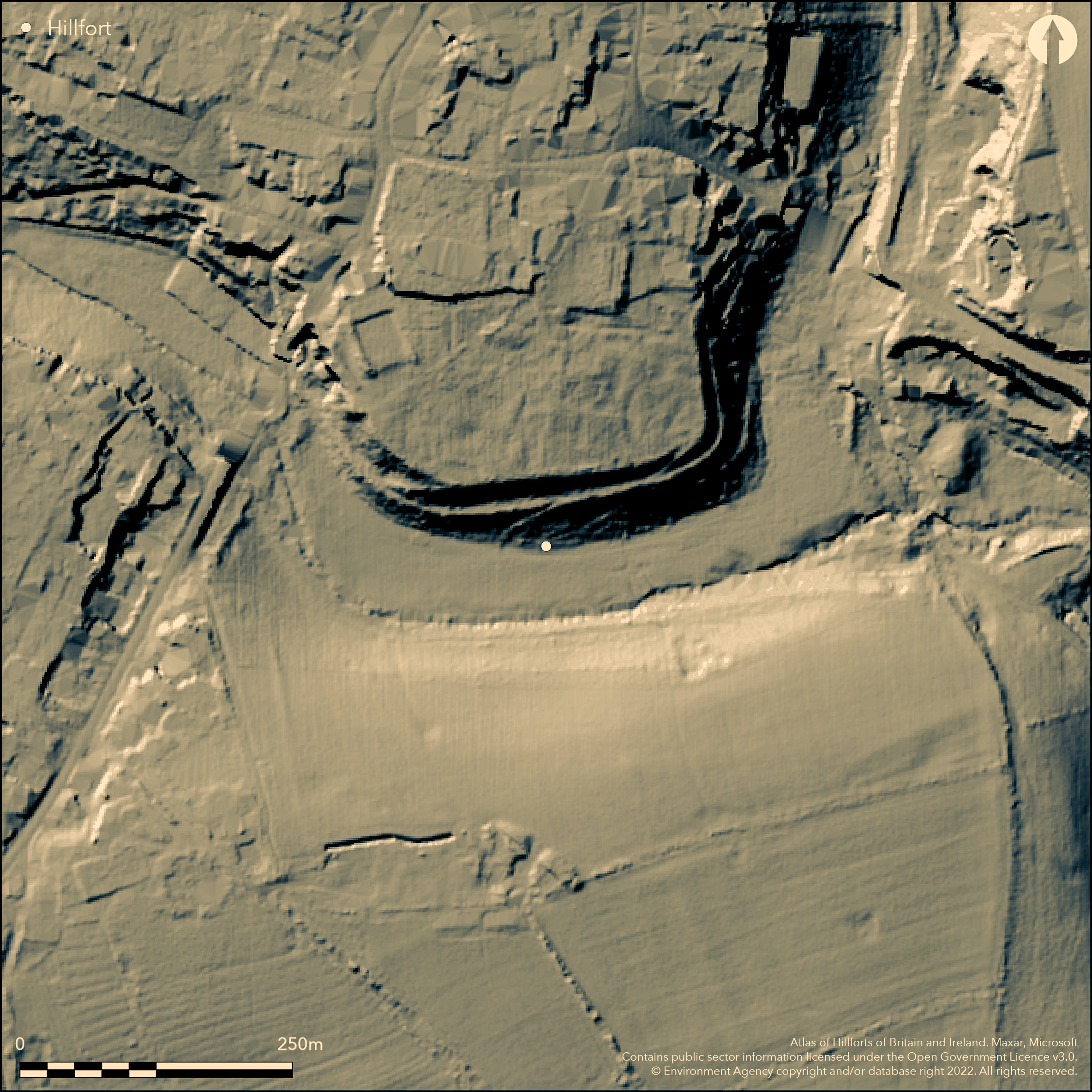
LiDAR 1m DTM Hillshade
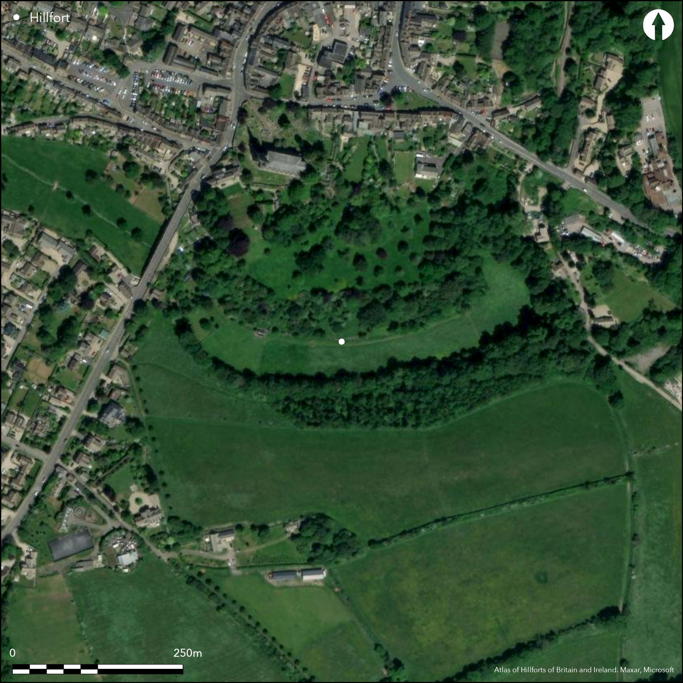
Satellite Imagery
LiDAR 1m DTM Hillshade
Satellite Imagery
Scroll left/right to view further images.
HER: Gloucestershire 109 (None)
NMR: ST 89 SE 8 (209123)
SM: 1003421
NGR: ST891928
X: 389100 Y: 192800 (OSGB36)
Possible site of contour hillfort or medieval castle or manor house located on prominent knoll on S side of Tetbury adjacent to the church. Earlier castle thought built by Robert of Gloucester and taken by King Stephen in 1144, but no accurate documentary evidence for castle here and past mis-interpretation of medieval documents by antiquarians, site more likely a medieval manor house or associated with a pre-conquest monasterium (Leech 1981). Whatever, no direct evidence of an Iron Age hillfort here, either as cropmarks or on the ground, but possible. Under pasture with some trees on the slopes. Site of 'camp' on 1st Ed OS map (1882).
Citizen Science: ✗
Reliability of Data: Unconfirmed
Reliability of Interpretation: Unconfirmed
X: -240328 Y: 6734191 (EPSG: 3857)
Longitude: -2.158905340721538 Latitude: 51.63385476775653 (EPSG:4326)
Country: England; None
Current County or Unitary Authority: Gloucestershire
Historic County: Gloucestershire
Current Parish/Community/Council/Townland: Tetbury Upton; Long Newnton
Nothing visible of any hillfort.
| Extant | ✗ |
| Cropmark | ✗ |
| Likely Destroyed | ✓ |
Under pasture with some trees on the slopes.
| Woodland | ✗ |
| Commercial Forestry Plantation | ✗ |
| Parkland | ✗ |
| Pasture (Grazing) | ✓ |
| Arable | ✗ |
| Scrub/Bracken | ✗ |
| Bare Outcrop | ✗ |
| Heather/Moorland | ✗ |
| Heath | ✗ |
| Built-up | ✗ |
| Coastal Grassland | ✗ |
| Other | ✗ |
Possible site of contour hillfort (type estimated) or medieval castle or manor house located on prominent knoll on S side of Tetbury adjacent to the church.
| Contour Fort | ✓ |
| Partial Contour Fort | ✗ |
| Promontory Fort | ✗ |
| Hillslope Fort | ✗ |
| Level Terrain Fort | ✗ |
| Marsh Fort | ✗ |
| Multiple Enclosure Fort | ✗ |
| Hilltop | ✗ |
| Coastal Promontory | ✗ |
| Inland Promontory | ✗ |
| Valley Bottom | ✗ |
| Knoll/Hillock/Outcrop | ✓ |
| Ridge | ✗ |
| Cliff/Plateau-edge/Scarp | ✗ |
| Hillslope | ✗ |
| Lowland | ✗ |
| Spur | ✗ |
Dominant Topographic Feature: Knoll
| North | ✗ |
| Northeast | ✗ |
| East | ✗ |
| Southeast | ✗ |
| South | ✗ |
| Southwest | ✗ |
| West | ✗ |
| Northwest | ✗ |
| Level | ✓ |
Altitude: 107.0m
Boundary Type: Parish/Townland
None.
Reliability: D - None
| Pre 1200BC | ✗ |
| 1200BC - 800BC | ✗ |
| 800BC - 400BC | ✗ |
| 400BC - AD50 | ✗ |
| AD50 - AD400 | ✗ |
| AD400 - AD 800 | ✗ |
| Post AD800 | ✗ |
| Unknown | ✓ |
| Pre Hillfort: | None |
| Post Hillfort: | Site of later medieval castle, manor house or associated with pre-conquest monasterium. Medieval artefacts found 18th century. |
On 1st Ed OS map (1882). Field investigations 1972, 1973 - no details. Aerial photograph interpretation English Heritage/Gloucestershire County Council The Cotswold Hills (South Cotswolds) NMP 2007-10.
| Other (1882): | OS map. |
| Other (None): | Field investigations - no details. |
| Other (None): | Aerial photograph interpretation English Heritage/Gloucestershire County Council The Cotswiold Hills (South Cotswolds) NMP 2007-10. |
None.
None
| None | ✓ |
| Spring | ✗ |
| Stream | ✗ |
| Pool | ✗ |
| Flush | ✗ |
| Well | ✗ |
| Other | ✗ |
None
| No Known Features | ✓ |
| Round Stone Structures | ✗ |
| Rectangular Stone Structures | ✗ |
| Curvilinear Platforms | ✗ |
| Other Roundhouse Evidence | ✗ |
| Pits | ✗ |
| Quarry Hollows | ✗ |
| Other | ✗ |
None
| No Known Excavation | ✓ |
| Pits | ✗ |
| Postholes | ✗ |
| Roundhouses | ✗ |
| Rectangular Structures | ✗ |
| Roads/Tracks | ✗ |
| Quarry Hollows | ✗ |
| Other | ✗ |
| Nothing Found | ✗ |
None
| No Known Geophysics | ✓ |
| Pits | ✗ |
| Roundhouses | ✗ |
| Rectangular Structures | ✗ |
| Roads/Tracks | ✗ |
| Quarry Hollows | ✗ |
| Other | ✗ |
| Nothing Found | ✗ |
None
| No Known Finds | ✓ |
| Pottery | ✗ |
| Metal | ✗ |
| Metalworking | ✗ |
| Human Bones | ✗ |
| Animal Bones | ✗ |
| Lithics | ✗ |
| Environmental | ✗ |
| Other | ✗ |
None
| APs Not Checked | ✓ |
| None | ✗ |
| Roundhouses | ✗ |
| Rectangular Structures | ✗ |
| Pits | ✗ |
| Postholes | ✗ |
| Roads/Tracks | ✗ |
| Other | ✗ |
None defined.
| 0: | None |
| 2: | None |
Guard Chambers: ✗
Chevaux de Frise: ✗
None visible.
| Area 1: | Noneha. |
| Total: | Noneha. |
Total Footprint Area: Noneha.
None
| ✗ | Area not defined. |
| ✗ | Nothing visible. |
| NE Quadrant: | None |
| SE Quadrant: | None |
| SW Quadrant: | None |
| NW Quadrant: | None |
| Total: | None |
| Partial Univallate | ✗ |
| Univallate | ✗ |
| Partial Bivallate | ✗ |
| Bivallate | ✗ |
| Partial Multivallate | ✗ |
| Multivallate | ✗ |
| Unknown | ✓ |
| Partial Univallate | ✗ |
| Univallate | ✗ |
| Partial Bivallate | ✗ |
| Bivallate | ✗ |
| Partial Multivallate | ✗ |
| Multivallate | ✗ |
None
| None | ✓ |
| Earthen Bank | ✗ |
| Stone Wall | ✗ |
| Rubble | ✗ |
| Wall-walk | ✗ |
| Evidence of Timber | ✗ |
| Vitrification | ✗ |
| Other Burning | ✗ |
| Palisade | ✗ |
| Counter Scarp Bank | ✗ |
| Berm | ✗ |
| Unfinished | ✗ |
| Other | ✗ |
None
| None | ✗ |
| Earthen Bank | ✗ |
| Stone Wall | ✗ |
| Murus Duplex | ✗ |
| Timber-framed | ✗ |
| Timber-laced | ✗ |
| Vitrification | ✗ |
| Other Burning | ✗ |
| Palisade | ✗ |
| Counter Scarp Bank | ✗ |
| Berm | ✗ |
| Unfinished | ✗ |
| No Known Excavation | ✓ |
| Other | ✗ |
| ✗ | None |
| ✗ | None defined. |
Number of Ditches: None
| ✗ | None |
Burrow, E.J. 1919. The ancient entrenchments and camps of Gloucestershire, Cheltenham: Ed. J. Burrow, 144.
Camden, W. 1610, Britannia, 242.
Herbert, N.M. (ed) 1976. A history of the county of Gloucester, 11, The Victoria History of the Counties of England, 260-1.
Leech, R. 1981, Historic Towns in Gloucestershire, Bristol: CRAAGS.
Playne, G.F. 1877. On the ancient camps of Gloucestershire, Cotteswold Field Club, 6. 219.
Rudder, S. 1779. A new history of Gloucestershire, Cirencester: Samuel Rudder, 727-8.
Atlas of Hillforts:
Wikidata:
This work is licensed under CC BY-SA 4.0

 and should be cited as:
Lock, Gary and Ralston, Ian. 2024. Atlas of Hillforts of Britain and Ireland. Available at: https://hillforts.arch.ox.ac.uk
Document Version 1.1