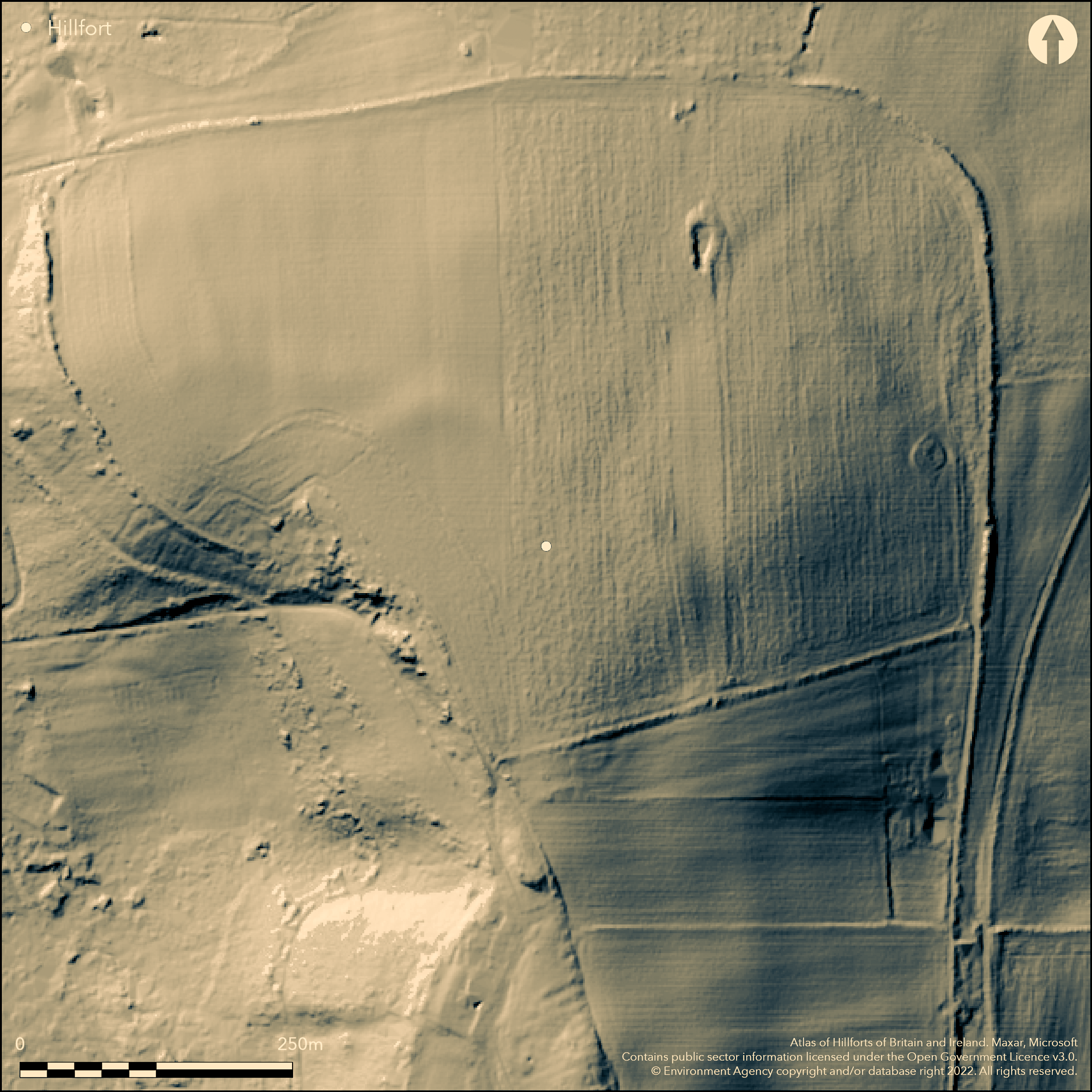
LiDAR 1m DTM Hillshade
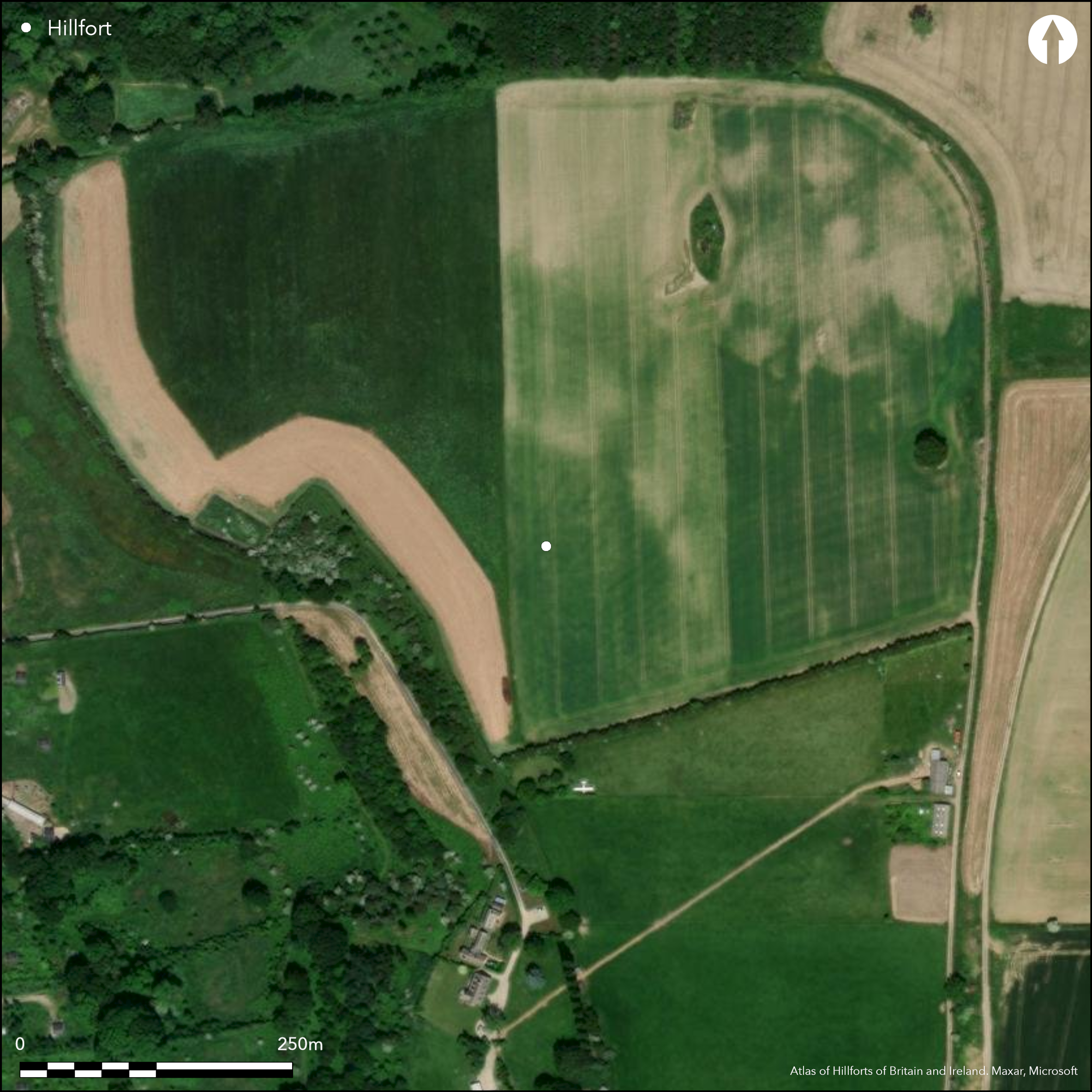
Satellite Imagery
LiDAR 1m DTM Hillshade
Satellite Imagery
Scroll left/right to view further images.
HER: Gloucestershire 2290 (None)
NMR: SP 03 SW 2 (328203)
SM: None
NGR: SP02403180
X: 402400 Y: 231800 (OSGB36)
Much damaged contour hillfort located on flat topped ridge of hill called 'The Warren' in Toddington Deer Park above headwater streams of River Isbourne to E and streams eventually flowing into River Severn on W. Steep slopes, slightly less on E and S. Site investigated in field in 1973 and mapped from aerial photographs as part of English Heritage/Gloucestershire CC NMP 2002-06. Highest part of hill appeared artificially scarped following contours with oval shape c. 230m, SE-NW by 170m NW-SE, by 170.0m transversely, with area estimated at c. 3.9ha. In 1970's some still visible, with W side upper slopes steepened by scarping c. 10m long to 5m high, but a once substantial bank seemingly ploughed-out at N and S ends and E side also reduced to small bank c. 5m long and to 1.5m high. Possible original entrance cut very obliquely up through scarped slopes near NW corner. By 1990 all seemed reduced to cropmark. The above mapping also found further enclosures, possibly annexes or outworks, adjacent to N and S ends of fort. Site cultivated. No further details.
Citizen Science: ✗
Reliability of Data: Confirmed
Reliability of Interpretation: Confirmed
X: -218907 Y: 6797344 (EPSG: 3857)
Longitude: -1.966476814976849 Latitude: 51.984613267922946 (EPSG:4326)
Country: England; None
Current County or Unitary Authority: Gloucestershire
Historic County: Gloucestershire
Current Parish/Community/Council/Townland: Toddington; Winchcombe
Ploughed-out and by 1990 all seemed reduced to cropmark.
| Extant | ✗ |
| Cropmark | ✓ |
| Likely Destroyed | ✗ |
Cultivated.
| Woodland | ✗ |
| Commercial Forestry Plantation | ✗ |
| Parkland | ✗ |
| Pasture (Grazing) | ✗ |
| Arable | ✓ |
| Scrub/Bracken | ✗ |
| Bare Outcrop | ✗ |
| Heather/Moorland | ✗ |
| Heath | ✗ |
| Built-up | ✗ |
| Coastal Grassland | ✗ |
| Other | ✗ |
Possible contour hillfort located on flat topped ridge of hill called 'The Warren' in Toddington Deer Park above headwater streams of River Isbourne to E and streams eventually flowing into River Severn on W. Steep slopes, slightly less on E and S.
| Contour Fort | ✓ |
| Partial Contour Fort | ✗ |
| Promontory Fort | ✗ |
| Hillslope Fort | ✗ |
| Level Terrain Fort | ✗ |
| Marsh Fort | ✗ |
| Multiple Enclosure Fort | ✗ |
| Hilltop | ✓ |
| Coastal Promontory | ✗ |
| Inland Promontory | ✗ |
| Valley Bottom | ✗ |
| Knoll/Hillock/Outcrop | ✗ |
| Ridge | ✗ |
| Cliff/Plateau-edge/Scarp | ✗ |
| Hillslope | ✗ |
| Lowland | ✗ |
| Spur | ✗ |
Dominant Topographic Feature: Hill top
| North | ✗ |
| Northeast | ✗ |
| East | ✗ |
| Southeast | ✗ |
| South | ✗ |
| Southwest | ✗ |
| West | ✗ |
| Northwest | ✗ |
| Level | ✓ |
Altitude: 135.0m
Boundary Type: Parish/Townland
None.
Reliability: D - None
| Pre 1200BC | ✗ |
| 1200BC - 800BC | ✗ |
| 800BC - 400BC | ✗ |
| 400BC - AD50 | ✗ |
| AD50 - AD400 | ✗ |
| AD400 - AD 800 | ✗ |
| Post AD800 | ✗ |
| Unknown | ✓ |
| Pre Hillfort: | None |
| Post Hillfort: | None |
Field investigation 1973 - no details.Aerial photograph investigation English Heritager/Gloucestershire CC (North Cotswolds Forest of Dean) NMP 2002-06.
| Other (1973): | Field investigation - no details. |
| Other (None): | Aerial photograph investigation English Heritager/Gloucestershire CC (North Cotswolds Forest of Dean) NMP. |
None.
None
| None | ✓ |
| Spring | ✗ |
| Stream | ✗ |
| Pool | ✗ |
| Flush | ✗ |
| Well | ✗ |
| Other | ✗ |
None
| No Known Features | ✓ |
| Round Stone Structures | ✗ |
| Rectangular Stone Structures | ✗ |
| Curvilinear Platforms | ✗ |
| Other Roundhouse Evidence | ✗ |
| Pits | ✗ |
| Quarry Hollows | ✗ |
| Other | ✗ |
None
| No Known Excavation | ✓ |
| Pits | ✗ |
| Postholes | ✗ |
| Roundhouses | ✗ |
| Rectangular Structures | ✗ |
| Roads/Tracks | ✗ |
| Quarry Hollows | ✗ |
| Other | ✗ |
| Nothing Found | ✗ |
None
| No Known Geophysics | ✓ |
| Pits | ✗ |
| Roundhouses | ✗ |
| Rectangular Structures | ✗ |
| Roads/Tracks | ✗ |
| Quarry Hollows | ✗ |
| Other | ✗ |
| Nothing Found | ✗ |
None
| No Known Finds | ✓ |
| Pottery | ✗ |
| Metal | ✗ |
| Metalworking | ✗ |
| Human Bones | ✗ |
| Animal Bones | ✗ |
| Lithics | ✗ |
| Environmental | ✗ |
| Other | ✗ |
None
| APs Not Checked | ✓ |
| None | ✗ |
| Roundhouses | ✗ |
| Rectangular Structures | ✗ |
| Pits | ✗ |
| Postholes | ✗ |
| Roads/Tracks | ✗ |
| Other | ✗ |
Possible original entrance cuts very obliquely up through scarped slopes near NW corner.
| None: | Breaks cannot be estimated. |
| 2: | None |
Guard Chambers: ✗
Chevaux de Frise: ✗
| 1. Oblique (North west): | Very oblique possible entrance. |
Highest part of hill appeared artificially scarped following contours with oval shape c. 230m, SE-NW by 170m NW-SE, by 170.0m transversely, with area estimated at 3.9ha footprint. In 1970's some still visible, with W side upper slopes steepened by scarping c. 10m long to 5m high, but a once substantial bank seemingly ploughed-out at N and S ends and E side also reduced to small bank c. 5m long and to 1.5m high.
| Area 1: | 3.3ha. |
| Total: | 3.3ha. |
Total Footprint Area: 3.9ha.
None
| ✗ | Whole footprint is 3.9ha |
| ✗ | Quadrants estimated and once would have probably completed circuit. |
| NE Quadrant: | 1 |
| SE Quadrant: | 1 |
| SW Quadrant: | 1 |
| NW Quadrant: | 1 |
| Total: | 1 |
| Partial Univallate | ✗ |
| Univallate | ✓ |
| Partial Bivallate | ✗ |
| Bivallate | ✗ |
| Partial Multivallate | ✗ |
| Multivallate | ✗ |
| Unknown | ✗ |
| Partial Univallate | ✗ |
| Univallate | ✗ |
| Partial Bivallate | ✗ |
| Bivallate | ✗ |
| Partial Multivallate | ✗ |
| Multivallate | ✗ |
None
| None | ✗ |
| Earthen Bank | ✓ |
| Stone Wall | ✗ |
| Rubble | ✗ |
| Wall-walk | ✗ |
| Evidence of Timber | ✗ |
| Vitrification | ✗ |
| Other Burning | ✗ |
| Palisade | ✗ |
| Counter Scarp Bank | ✗ |
| Berm | ✗ |
| Unfinished | ✗ |
| Other | ✗ |
None
| None | ✗ |
| Earthen Bank | ✗ |
| Stone Wall | ✗ |
| Murus Duplex | ✗ |
| Timber-framed | ✗ |
| Timber-laced | ✗ |
| Vitrification | ✗ |
| Other Burning | ✗ |
| Palisade | ✗ |
| Counter Scarp Bank | ✗ |
| Berm | ✗ |
| Unfinished | ✗ |
| No Known Excavation | ✓ |
| Other | ✗ |
| ✗ | None |
| ✗ | No ditch defined. |
Number of Ditches: 0
| ✓ | Possible. Mapping also found further enclosures, possibly annexes or outworks, adjacent to N and S ends of fort. |
Burrow, E.J. 1919. The ancient entrenchments and camps of Gloucestershire, Cheltenham: Ed. J. Burrow, 146.
Witts, G.B. 1883. Archaeological handbook of the County of Gloucestershire, Cheltenham: Norman Brothers, 48.
Atlas of Hillforts:
Wikidata:
This work is licensed under CC BY-SA 4.0

 and should be cited as:
Lock, Gary and Ralston, Ian. 2024. Atlas of Hillforts of Britain and Ireland. Available at: https://hillforts.arch.ox.ac.uk
Document Version 1.1