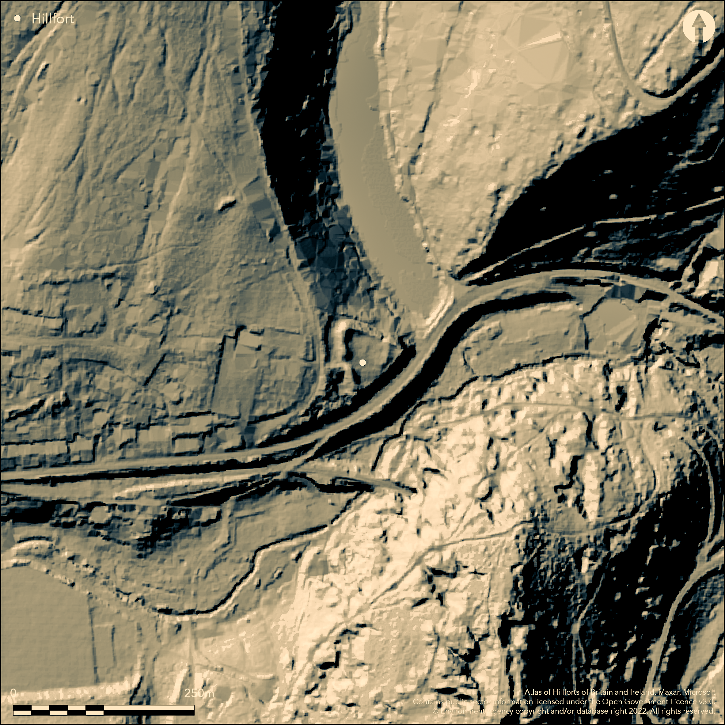
LiDAR 1m DTM Hillshade
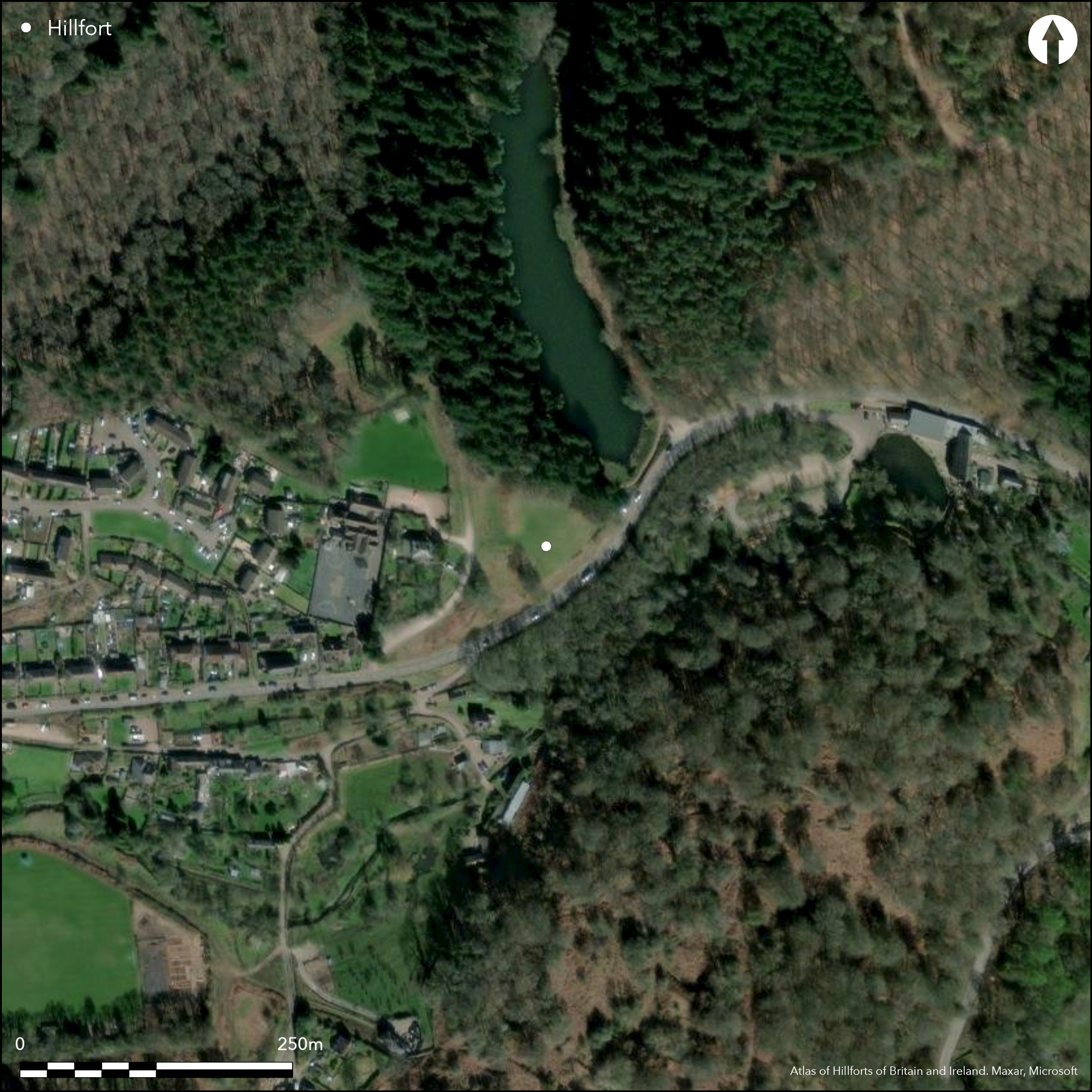
Satellite Imagery
LiDAR 1m DTM Hillshade
Satellite Imagery
Scroll left/right to view further images.
HER: Gloucestershire 444 (None)
NMR: SO 61 SE 4 (111775)
SM: 1005564
NGR: SO66161058
X: 366160 Y: 210580 (OSGB36)
Possible inland promontory fort located on end of steeply sloping ENE-facing spur overlooking junction of three valleys and forming the valley side of meander in Soudley Brook and also overlooking confluence of major tributary. Very steep to precipitous slopes, moderate along spur to WSW. Roughly triangular enclosure of 0.36ha total. Defined on WSW by single rampart to 2m high with 9.1m wide and 1m deep outer ditch cutting across spur. NE and SE sides are formed by the precipitous natural scarp slopes. Single, damaged, central entrance in rampart probably original. Chance finds on molehills of five Romano-British Severn Valley Ware pottery, several pieces of haematite and bloomery slag, charcoal and flint flake. Hillfort site unproven but likely, although catalogued by King (1983) as medieval castle site. On 1st Ed. OS map (1878-81).
Citizen Science: ✗
Reliability of Data: Confirmed
Reliability of Interpretation: Unconfirmed
X: -277418 Y: 6762747 (EPSG: 3857)
Longitude: -2.492084417769921 Latitude: 51.79279829927264 (EPSG:4326)
Country: England; None
Current County or Unitary Authority: Gloucestershire
Historic County: Gloucestershire
Current Parish/Community/Council/Townland: Ruspidge; Newnham
Visitor pressure and erosion. On Heritage at Risk Register (2015).
| Extant | ✓ |
| Cropmark | ✗ |
| Likely Destroyed | ✗ |
Bracken growth.
| Woodland | ✗ |
| Commercial Forestry Plantation | ✗ |
| Parkland | ✗ |
| Pasture (Grazing) | ✗ |
| Arable | ✗ |
| Scrub/Bracken | ✓ |
| Bare Outcrop | ✗ |
| Heather/Moorland | ✗ |
| Heath | ✗ |
| Built-up | ✗ |
| Coastal Grassland | ✗ |
| Other | ✗ |
Possible inland promontory fort located on end of steeply sloping E-facing spur overlooking junction of three valleys and forming the valley side of meander in Soudley Brook and also overlooking confluence of major tributary. Very steep to precipitous slopes, moderate along spur to W.
| Contour Fort | ✗ |
| Partial Contour Fort | ✗ |
| Promontory Fort | ✓ |
| Hillslope Fort | ✗ |
| Level Terrain Fort | ✗ |
| Marsh Fort | ✗ |
| Multiple Enclosure Fort | ✗ |
| Hilltop | ✗ |
| Coastal Promontory | ✗ |
| Inland Promontory | ✓ |
| Valley Bottom | ✗ |
| Knoll/Hillock/Outcrop | ✗ |
| Ridge | ✗ |
| Cliff/Plateau-edge/Scarp | ✗ |
| Hillslope | ✗ |
| Lowland | ✗ |
| Spur | ✓ |
Dominant Topographic Feature: Spur promontory
| North | ✗ |
| Northeast | ✗ |
| East | ✓ |
| Southeast | ✗ |
| South | ✗ |
| Southwest | ✗ |
| West | ✗ |
| Northwest | ✗ |
| Level | ✗ |
Altitude: 80.0m
Boundary Type: Parish/Townland
None.
Reliability: D - None
| Pre 1200BC | ✗ |
| 1200BC - 800BC | ✗ |
| 800BC - 400BC | ✗ |
| 400BC - AD50 | ✗ |
| AD50 - AD400 | ✗ |
| AD400 - AD 800 | ✗ |
| Post AD800 | ✗ |
| Unknown | ✓ |
| Pre Hillfort: | None |
| Post Hillfort: | None |
On 1st Ed. OS map (1878-81). Field investigation 1970 - no details. Measured survey Forest of Dean Gloucestershire CC 1999. Management survey Gloucestershire CC 2000. Aerial photograph interpretation Englsih Heritage/Gloucestershire CC (North Cotswolds Forest of Dean) NMP 2002-06.
| Other (1970): | Field investigation - no details. |
| Other (1999): | Measured survey Forest of Dean Gloucestershire CC. |
| Other (2000): | Management survey Gloucestershire CC. |
| 1st Identified Map Depiction (None): | OS map. |
| Other (None): | Aerial photograph interpretation Englsih Heritage/Gloucestershire CC (North Cotswolds Forest of Dean) NMP. |
Chance finds on molehills of five of Romano-British Severn Valley Ware pottery, several pieces of haematite and bloomery slag, charcoal and flint flake.
None
| None | ✓ |
| Spring | ✗ |
| Stream | ✗ |
| Pool | ✗ |
| Flush | ✗ |
| Well | ✗ |
| Other | ✗ |
None
| No Known Features | ✓ |
| Round Stone Structures | ✗ |
| Rectangular Stone Structures | ✗ |
| Curvilinear Platforms | ✗ |
| Other Roundhouse Evidence | ✗ |
| Pits | ✗ |
| Quarry Hollows | ✗ |
| Other | ✗ |
None
| No Known Excavation | ✓ |
| Pits | ✗ |
| Postholes | ✗ |
| Roundhouses | ✗ |
| Rectangular Structures | ✗ |
| Roads/Tracks | ✗ |
| Quarry Hollows | ✗ |
| Other | ✗ |
| Nothing Found | ✗ |
None
| No Known Geophysics | ✓ |
| Pits | ✗ |
| Roundhouses | ✗ |
| Rectangular Structures | ✗ |
| Roads/Tracks | ✗ |
| Quarry Hollows | ✗ |
| Other | ✗ |
| Nothing Found | ✗ |
Chance finds on molehills of five of Romano-British Severn Valley Ware pottery, several pieces of haematite and bloomery slag, charcoal and flint flake.
| No Known Finds | ✗ |
| Pottery | ✓ |
| Metal | ✗ |
| Metalworking | ✓ |
| Human Bones | ✗ |
| Animal Bones | ✗ |
| Lithics | ✓ |
| Environmental | ✗ |
| Other | ✓ |
None
| APs Not Checked | ✓ |
| None | ✗ |
| Roundhouses | ✗ |
| Rectangular Structures | ✗ |
| Pits | ✗ |
| Postholes | ✗ |
| Roads/Tracks | ✗ |
| Other | ✗ |
Single, damaged, central entrance in rampart on WSW probably original.
| 1: | None |
| 2: | None |
Guard Chambers: ✗
Chevaux de Frise: ✗
| 1. Simple Gap (West): | Damaged. |
Defined on WSW by single rampart to 2m high with 9.1m wide and 1m deep outer ditch cutting across spur. NE and SE sides are formed by the precipitous natural scarp slopes. Single
| Area 1: | Noneha. |
| Total: | Noneha. |
Total Footprint Area: 3.6ha.
None
| ✗ | None |
| ✗ | None |
| NE Quadrant: | 0 |
| SE Quadrant: | 0 |
| SW Quadrant: | 1 |
| NW Quadrant: | 1 |
| Total: | 1 |
| Partial Univallate | ✓ |
| Univallate | ✗ |
| Partial Bivallate | ✗ |
| Bivallate | ✗ |
| Partial Multivallate | ✗ |
| Multivallate | ✗ |
| Unknown | ✗ |
| Partial Univallate | ✗ |
| Univallate | ✗ |
| Partial Bivallate | ✗ |
| Bivallate | ✗ |
| Partial Multivallate | ✗ |
| Multivallate | ✗ |
None
| None | ✗ |
| Earthen Bank | ✓ |
| Stone Wall | ✗ |
| Rubble | ✗ |
| Wall-walk | ✗ |
| Evidence of Timber | ✗ |
| Vitrification | ✗ |
| Other Burning | ✗ |
| Palisade | ✗ |
| Counter Scarp Bank | ✗ |
| Berm | ✗ |
| Unfinished | ✗ |
| Other | ✗ |
None
| None | ✗ |
| Earthen Bank | ✗ |
| Stone Wall | ✗ |
| Murus Duplex | ✗ |
| Timber-framed | ✗ |
| Timber-laced | ✗ |
| Vitrification | ✗ |
| Other Burning | ✗ |
| Palisade | ✗ |
| Counter Scarp Bank | ✗ |
| Berm | ✗ |
| Unfinished | ✗ |
| No Known Excavation | ✓ |
| Other | ✗ |
| ✗ | None |
| ✓ | None |
Number of Ditches: 1
| ✗ | None |
King, D.J.C. 1983. Castellarium anglicanum : an index and bibliography of the castles in England, Wales and the islands.
Playne, G.F. 1877. On the ancient camps of Gloucestershire, Cotteswold Field Club, 6. 235.
Witts, G.B. 1883. Archaeological handbook of the County of Gloucestershire, Cheltenham: Norman Brothers, 46-7.
Atlas of Hillforts:
Wikidata:
This work is licensed under CC BY-SA 4.0

 and should be cited as:
Lock, Gary and Ralston, Ian. 2024. Atlas of Hillforts of Britain and Ireland. Available at: https://hillforts.arch.ox.ac.uk
Document Version 1.1