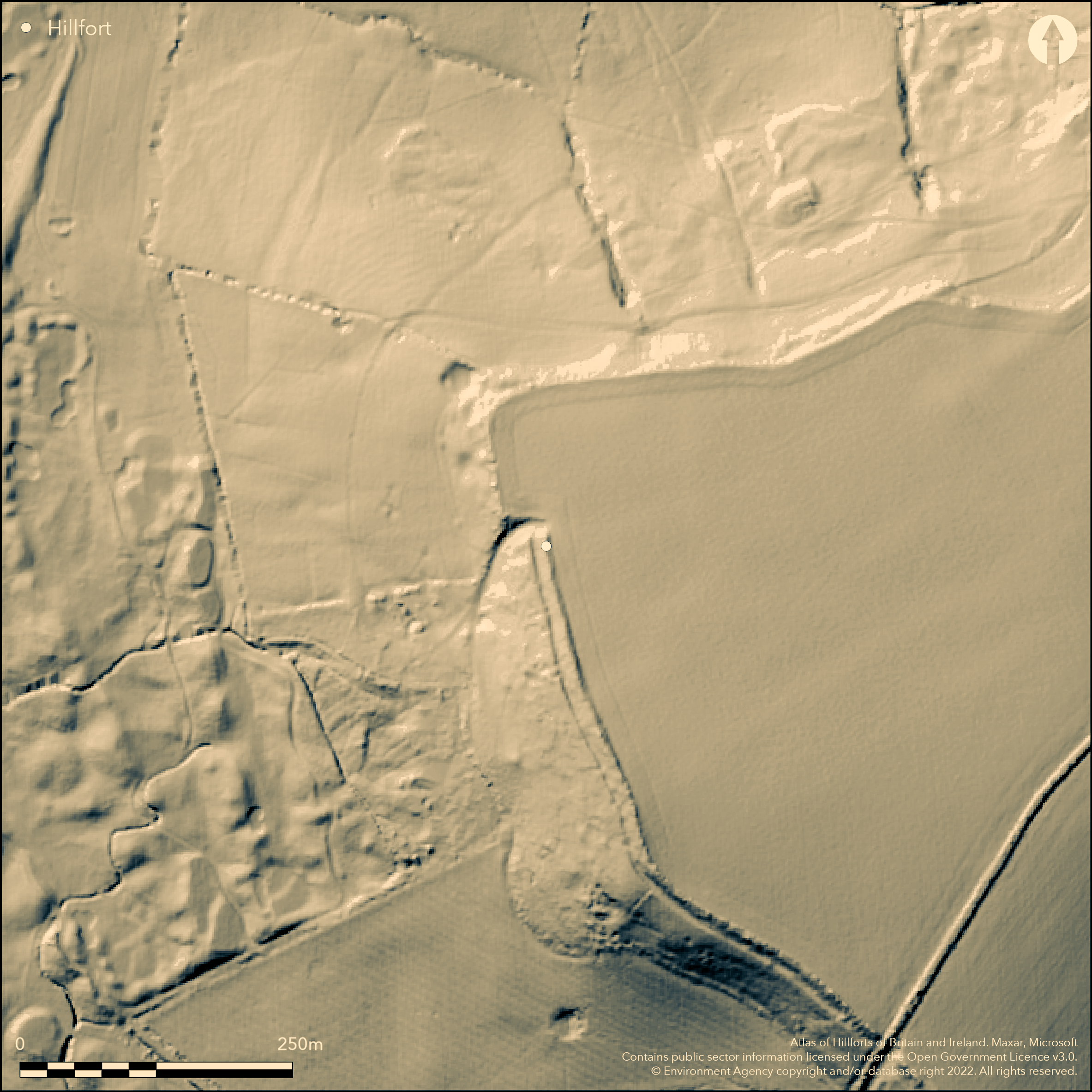
LiDAR 1m DTM Hillshade
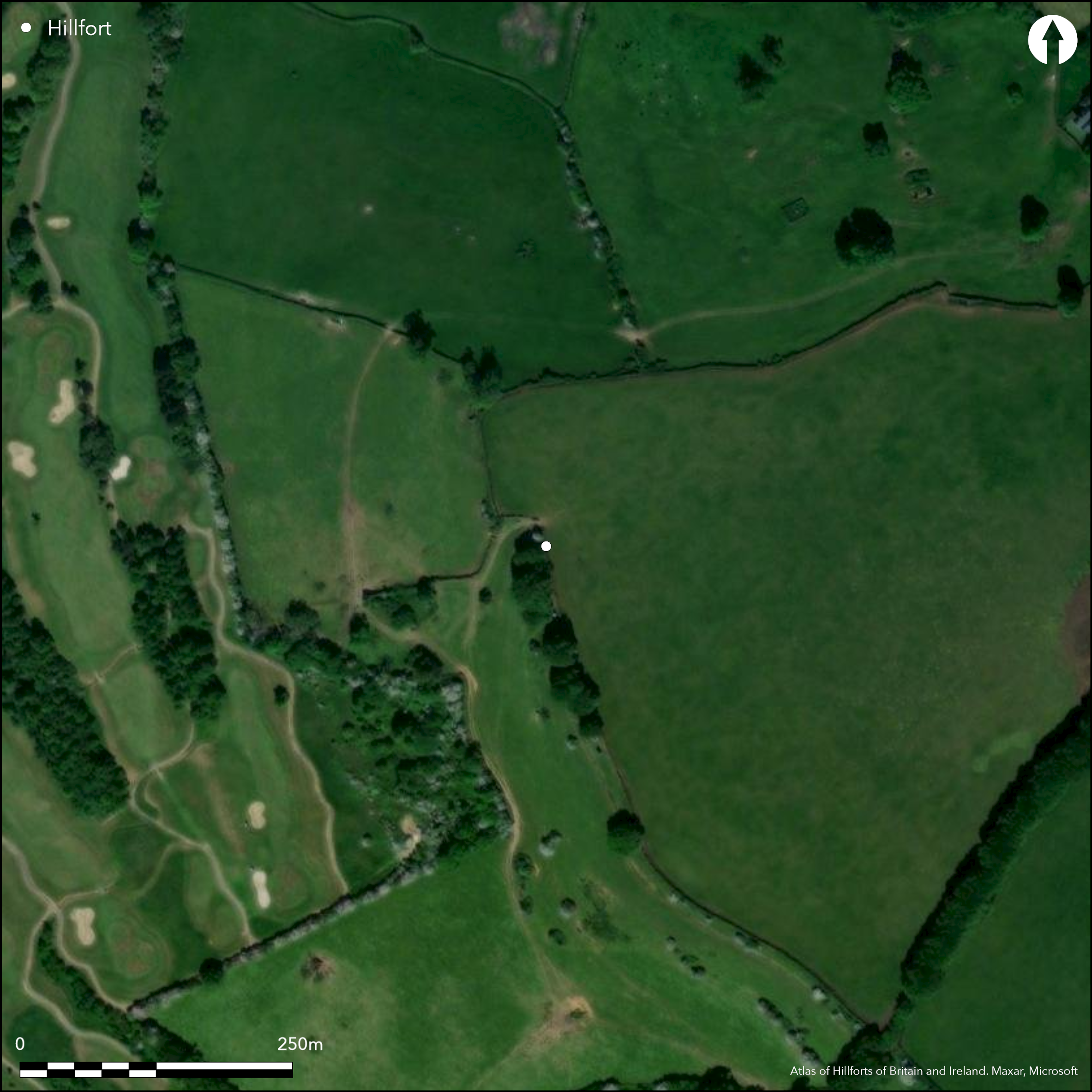
Satellite Imagery
LiDAR 1m DTM Hillshade
Satellite Imagery
Scroll left/right to view further images.
HER: South Gloucestershire 2001 (None)
NMR: ST 77 SW 8 (204958)
SM: 1004668
NGR: ST72007148
X: 372000 Y: 171480 (OSGB36)
Possible, unfinished, contour hillfort located in high position on distinctive, slightly domed, Freezing Hill, the S end of long ridge, the N end, Tog Hill, falling away to River Severn. Wide-reaching views across Bristol Channel. To SE Swainswick Valley and W side drops steeply down to Severn Vale. Steep surrounding slopes, less along ridge to NE. Site defined by linear earthwork on S end of SE to SW side of hill, also called 'Royal Camp' on Isaac Taylor's map of 1777 and 'Old Dyke' in Saxon charters. Site considered in past as c. 0.5m high bank standing on edge of escarpment with ditch c. 2.7m below, with hollow way at either end downslope. Cut through by parish boundary where bank and ditch cut by deep hollow way and over-ridden by an associated boundary bank. Extensions to bank to NE shown on Witt's map of 1880's cannot be traced. Field survey by John Oswin of Bath and Camerton Archaeological Society (Citizen Science 2015) confirmed vestiges of not one but two possible ramparts and ditches on SE and SW, with potential entrance via hollow way through SE. to virtually level interior. Most noticeable feature in SE portion is (probably lower) rampart, more a steepening of hillside, with slight ditch and then bank forming more of a lip before steep down slope continues. At SE end, this disrupted by quarry pit, beyond blank hillside, suggesting site possibly unfinished. Field boundary right on break of slope follows a tight curve around end of the hill, but on short E portion, slope below possibly artificially steepened before fading but suggesting continuing marked-out area. The double rampart possibly continues NW along edge of hill, but barbed wire fence makes investigation not possible at present. No bank visible on NE-E side. Substantial questions remain about the site, hampered by its present inaccessibility, as W part cut off by barbed wire and half under crop summer 2015. Possible that the earthworks at Freezing Hill are purely linear dykes and not part of any hillfort. This is a feature of other sites in the Cotswolds, as at Cleeve Common, the bank and ditch running across the landscape and so dividing it into blocks as boundaries (Darvill, 2011, 172; RCHME 1976, 66). Site part pasture, part arable. On 1st Ed. OS map (1885-1900). Undated.
Citizen Science: ✓
Reliability of Data: Unconfirmed
Reliability of Interpretation: Unconfirmed
X: -267643 Y: 6699776 (EPSG: 3857)
Longitude: -2.404273663064346 Latitude: 51.441564566219014 (EPSG:4326)
Country: England; None
Current County or Unitary Authority: South Gloucestershire
Historic County: Gloucestershire
Current Parish/Community/Council/Townland: Cold Ashton; Doynton
Footpath goes through middle of site. Only SE portion accessible, W part cut off by barbed wire. Hilltop cut of by fence and half under corn 2015. Earthworks in poor, uncared-for condition.
| Extant | ✓ |
| Cropmark | ✗ |
| Likely Destroyed | ✗ |
Part pasture, part arable.
| Woodland | ✗ |
| Commercial Forestry Plantation | ✗ |
| Parkland | ✗ |
| Pasture (Grazing) | ✓ |
| Arable | ✓ |
| Scrub/Bracken | ✗ |
| Bare Outcrop | ✗ |
| Heather/Moorland | ✗ |
| Heath | ✗ |
| Built-up | ✗ |
| Coastal Grassland | ✗ |
| Other | ✗ |
Possible, unfinished contour hillfort located in good strategic position on distinctive, slightly domed, Freezing Hill, the S end of long ridge, the N end, Tog Hill, falling away to River Severn. Wide-reaching views across Bristol Channel. To SE Swainswick Valley and W side drops steeply down to Severn Vale. Steep surrounding slopes, less along ridge to NE.
| Contour Fort | ✓ |
| Partial Contour Fort | ✗ |
| Promontory Fort | ✗ |
| Hillslope Fort | ✗ |
| Level Terrain Fort | ✗ |
| Marsh Fort | ✗ |
| Multiple Enclosure Fort | ✗ |
| Hilltop | ✓ |
| Coastal Promontory | ✗ |
| Inland Promontory | ✗ |
| Valley Bottom | ✗ |
| Knoll/Hillock/Outcrop | ✗ |
| Ridge | ✗ |
| Cliff/Plateau-edge/Scarp | ✗ |
| Hillslope | ✗ |
| Lowland | ✗ |
| Spur | ✗ |
Dominant Topographic Feature: Hill top
| North | ✗ |
| Northeast | ✗ |
| East | ✗ |
| Southeast | ✗ |
| South | ✗ |
| Southwest | ✓ |
| West | ✗ |
| Northwest | ✗ |
| Level | ✗ |
Altitude: 205.0m
Boundary Type: Parish/Townland
Reliability: D - None
| Pre 1200BC | ✗ |
| 1200BC - 800BC | ✗ |
| 800BC - 400BC | ✗ |
| 400BC - AD50 | ✗ |
| AD50 - AD400 | ✗ |
| AD400 - AD 800 | ✗ |
| Post AD800 | ✗ |
| Unknown | ✓ |
| Pre Hillfort: | None |
| Post Hillfort: | None |
On Saxon charters. On Isaac Taylor's map 1777. Field investigation 1971 - no details. On 1st Ed OS map (1882). Field survey John Osiwn, Bath and Camerton Archaeological Society 2015. LiDAR survey Citizen SCience information 2015.
| 1st Identified Map Depiction (1777): | On map by Isaac Taylor as Royal Camp. |
| Other (1882): | OS Map. |
| Other (1971): | Field investigation - no details. |
| Other (2015): | Field survey John Osiwn, Bath and Camerton Archaeological Society. |
| LiDAR Survey (2015): | Citizen Science information. |
| 1st Identified Written Reference (None): | On Saxon charters as Old Dyke. . |
None.
None
| None | ✓ |
| Spring | ✗ |
| Stream | ✗ |
| Pool | ✗ |
| Flush | ✗ |
| Well | ✗ |
| Other | ✗ |
None
| No Known Features | ✓ |
| Round Stone Structures | ✗ |
| Rectangular Stone Structures | ✗ |
| Curvilinear Platforms | ✗ |
| Other Roundhouse Evidence | ✗ |
| Pits | ✗ |
| Quarry Hollows | ✗ |
| Other | ✗ |
None
| No Known Excavation | ✓ |
| Pits | ✗ |
| Postholes | ✗ |
| Roundhouses | ✗ |
| Rectangular Structures | ✗ |
| Roads/Tracks | ✗ |
| Quarry Hollows | ✗ |
| Other | ✗ |
| Nothing Found | ✗ |
None
| No Known Geophysics | ✓ |
| Pits | ✗ |
| Roundhouses | ✗ |
| Rectangular Structures | ✗ |
| Roads/Tracks | ✗ |
| Quarry Hollows | ✗ |
| Other | ✗ |
| Nothing Found | ✗ |
None
| No Known Finds | ✓ |
| Pottery | ✗ |
| Metal | ✗ |
| Metalworking | ✗ |
| Human Bones | ✗ |
| Animal Bones | ✗ |
| Lithics | ✗ |
| Environmental | ✗ |
| Other | ✗ |
None
| APs Not Checked | ✓ |
| None | ✗ |
| Roundhouses | ✗ |
| Rectangular Structures | ✗ |
| Pits | ✗ |
| Postholes | ✗ |
| Roads/Tracks | ✗ |
| Other | ✗ |
Potential entrance via hollow way through SE. to virtually level interior, also cut through by parish boundary.
| 1: | None |
| 2: | None |
Guard Chambers: ✗
Chevaux de Frise: ✗
| 1. Hollow Way (South east): | Possible entrance where parish boundary cuts through earthworks. |
Site considered in past as c. 0.5m high bank standing on edge of escarpment with ditch c. 2.7m below, with hollow way at either end downslope. Field survey by John Oswin of Bath and Camerton Archaeological Society 2015 confirmed vestiges of not one but two possible ramparts and ditches on SE and SW. Earthen bank with possible stone core. Morphology suggests site unfinished.
| Area 1: | Noneha. |
| Total: | Noneha. |
Total Footprint Area: Noneha.
None
| ✗ | Area not defined. |
| ✗ | None |
| NE Quadrant: | None |
| SE Quadrant: | None |
| SW Quadrant: | None |
| NW Quadrant: | None |
| Total: | None |
| Partial Univallate | ✗ |
| Univallate | ✗ |
| Partial Bivallate | ✗ |
| Bivallate | ✗ |
| Partial Multivallate | ✗ |
| Multivallate | ✗ |
| Unknown | ✓ |
| Partial Univallate | ✗ |
| Univallate | ✗ |
| Partial Bivallate | ✗ |
| Bivallate | ✗ |
| Partial Multivallate | ✗ |
| Multivallate | ✗ |
Earthen bank with possible stone core. Morphology suggests site unfinished.
| None | ✗ |
| Earthen Bank | ✓ |
| Stone Wall | ✗ |
| Rubble | ✗ |
| Wall-walk | ✗ |
| Evidence of Timber | ✗ |
| Vitrification | ✗ |
| Other Burning | ✗ |
| Palisade | ✗ |
| Counter Scarp Bank | ✗ |
| Berm | ✗ |
| Unfinished | ✓ |
| Other | ✗ |
None
| None | ✗ |
| Earthen Bank | ✗ |
| Stone Wall | ✗ |
| Murus Duplex | ✗ |
| Timber-framed | ✗ |
| Timber-laced | ✗ |
| Vitrification | ✗ |
| Other Burning | ✗ |
| Palisade | ✗ |
| Counter Scarp Bank | ✗ |
| Berm | ✗ |
| Unfinished | ✗ |
| No Known Excavation | ✓ |
| Other | ✗ |
| ✗ | None |
| ✓ | Possibly two. |
Number of Ditches: 2
| ✗ | None |
Darvill, T. 2011. Prehistoric Gloucestershire. Forests and vales and high blue hills, 2nd Edition, Stroud: Amberley Publishing.
Grundy, G.B. 1935. Saxon Charters of Gloucestershire, 9.
Playne, G.F. 1877. On the ancient camps of Gloucestershire, Cotteswold Field Club, 6. 220.
RCHME 1976. Ancient and historical monuments in the County of Gloucestershire, Vol I: Iron Age and Romano-British monuments in the Gloucestershire Cotswolds, London: HMSO.
Witts, G.B. 1883. Archaeological handbook of the County of Gloucestershire, Cheltenham: Norman Brothers, 22.
Atlas of Hillforts:
Wikidata:
This work is licensed under CC BY-SA 4.0

 and should be cited as:
Lock, Gary and Ralston, Ian. 2024. Atlas of Hillforts of Britain and Ireland. Available at: https://hillforts.arch.ox.ac.uk
Document Version 1.1