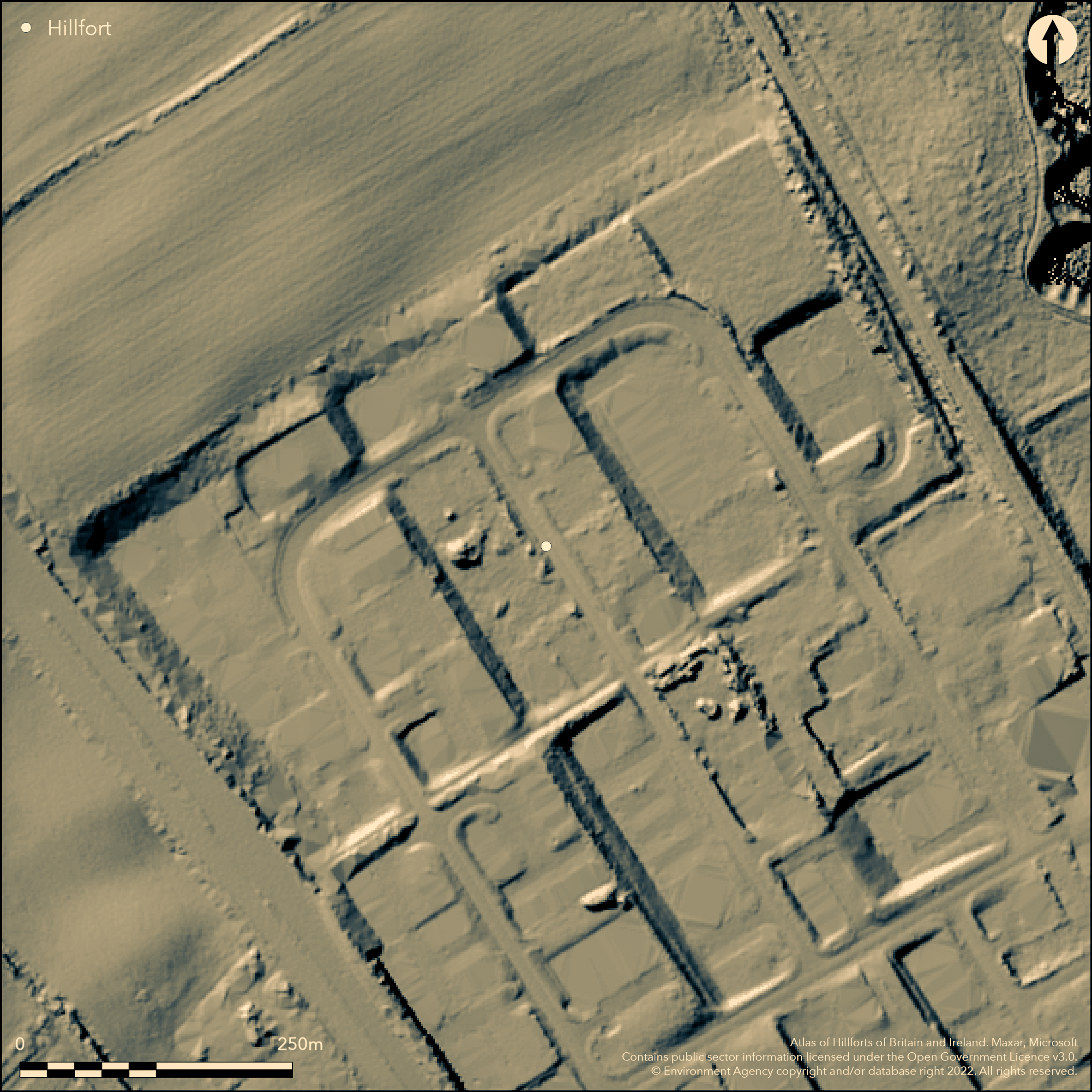
LiDAR 1m DTM Hillshade
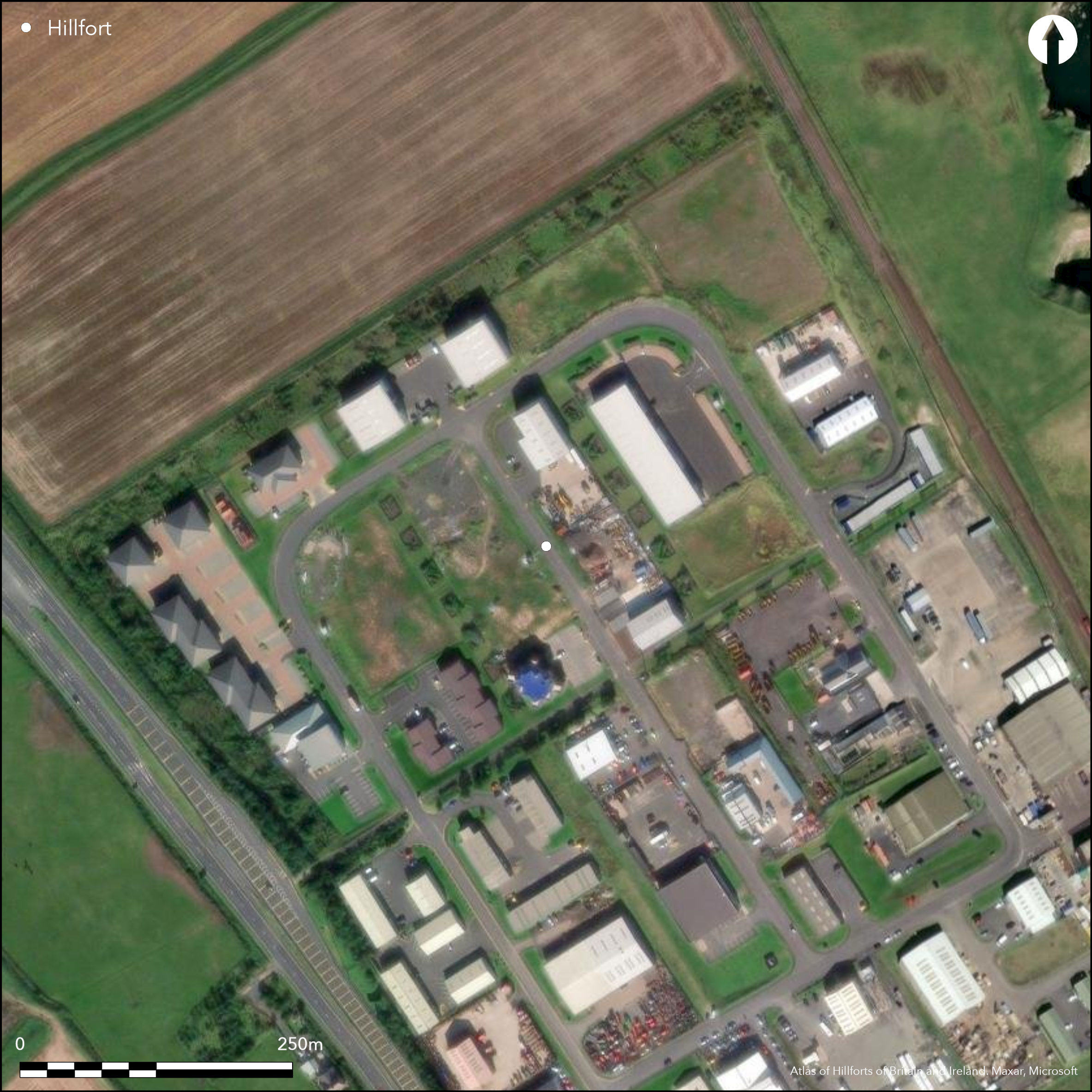
Satellite Imagery
LiDAR 1m DTM Hillshade
Satellite Imagery
Scroll left/right to view further images.
HER: Northumberland 2401 (None)
NMR: NT 95 NE 33 (1472792)
SM: None
NGR: NT 9897 5522
X: 398970 Y: 655220 (OSGB36)
Located approximately 1.7km from the N bank of the River Tweed and to the N of Berwick-on-Tweed, a substantial oval enclosure measuring approximately 125m E-W by 118m N-S enclosing 1.26ha. It lies close to the cliff edge at Needle's Eye and is overlooked by higher ground to the W. The site was identified from cropmarks and investigated by Pre-Construct Archaeology in 2005-6 prior to an extension to the North Road Industrial Estate, now Ramparts Business Park (Proctor 2012). A railway line running NW-SE cuts through the enclosure and an area to the W of this, encompassing the SW quadrant of the enclosure, underwent investigation. The earliest phase recorded was a palisade trench 1m wide by 0.45m deep within which several postholes were identified. This was superseded by a sequence of ramparts each becoming more substantial than the former. Charred cereal grain and charcoal from the ditch fills and a pit, submitted for radiocarbon dating, produced a series of late Iron Age dates. Where excavated it was ascertained that the location of the entrance varied over time, although during the earlier phases it was maintained in the same location in the N of the SW quadrant, being in the region of 6m wide. During a later phase entrances lay in the N and S of that quadrant, with that in the N 13m wide, and in the S 10m wide. Cropmarks indicate a further everted entrance 15m wide in the NE. Evidence for buildings was lacking although a rich artifactual assemblage of domestic material was recovered and environmental evidence showed crop processing and animal husbandry in the vicinity. In addition, a large assemblage of briquetage demonstrated the site had been an important centre for salt manufacture. Proctor suggests the enclosure might have been occupied seasonally and functioned as a gathering place for the wider community where salt and other commodities were traded and exchanged, some of the pottery sourced from the Cheviots with the site fulfilling an important social function (ibid, 113). The location continued as an open settlement into the 1st-2nd century AD after the ditches had been backfilled. Outside the enclosure to the west, field boundaries run in a NW to SE direction for approximately 329m. A further field boundary is visible to the S. Not recorded on OS mapping.
Citizen Science: ✗
Reliability of Data: Confirmed
Reliability of Interpretation: Confirmed
X: -224641 Y: 7516788 (EPSG: 3857)
Longitude: -2.0179857255830385 Latitude: 55.7903227471327 (EPSG:4326)
Country: England
Current County or Unitary Authority: Northumberland
Historic County: Northumberland
Current Parish/Community/Council/Townland: Berwick-on-Tweed
None
| Extant | ✗ |
| Cropmark | ✓ |
| Likely Destroyed | ✓ |
None
| Woodland | ✗ |
| Commercial Forestry Plantation | ✗ |
| Parkland | ✗ |
| Pasture (Grazing) | ✗ |
| Arable | ✓ |
| Scrub/Bracken | ✗ |
| Bare Outcrop | ✗ |
| Heather/Moorland | ✗ |
| Heath | ✗ |
| Built-up | ✓ |
| Coastal Grassland | ✗ |
| Other | ✗ |
Lying at approximately 44m OD on land sloping eastwards towards the cliff edge
| Contour Fort | ✗ |
| Partial Contour Fort | ✗ |
| Promontory Fort | ✗ |
| Hillslope Fort | ✓ |
| Level Terrain Fort | ✗ |
| Marsh Fort | ✗ |
| Multiple Enclosure Fort | ✗ |
| Hilltop | ✗ |
| Coastal Promontory | ✗ |
| Inland Promontory | ✗ |
| Valley Bottom | ✗ |
| Knoll/Hillock/Outcrop | ✗ |
| Ridge | ✗ |
| Cliff/Plateau-edge/Scarp | ✓ |
| Hillslope | ✓ |
| Lowland | ✗ |
| Spur | ✗ |
Dominant Topographic Feature: Cliff edge
| North | ✗ |
| Northeast | ✗ |
| East | ✓ |
| Southeast | ✗ |
| South | ✗ |
| Southwest | ✗ |
| West | ✗ |
| Northwest | ✗ |
| Level | ✗ |
Altitude: 44.0m
N/A
Shell midden: 1280 ad (43.6%) 1330 ad 1340 ad (51.8%) 1400 ad. Ditches and a pit: 40 bc (95.4%) 130 ad; 160 bc (3.0%) 130 bc, 120 bc (92.4%) 60 ad; 350 bc (10.9%) 300 bc, 210 bc (84.5%) 50 bc; 60 bc (1.5%) 130 bc, 120 bc (93.9%) 60 ad; 210 bc (95.4%) 40 bc; 160 bc (5.1%) 130 bc 120 bc (90.3%) 50 ad; 356 bc (30.4%) 286 bc, 253 bc (0.2%) 250 bc, 234 bc (63.6%) 91 bc, 72 bc (1.2%) 60 bc (Proctor 2012)
Reliability: A - High
| Pre 1200BC | ✗ |
| 1200BC - 800BC | ✗ |
| 800BC - 400BC | ✓ |
| 400BC - AD50 | ✓ |
| AD50 - AD400 | ✗ |
| AD400 - AD 800 | ✗ |
| Post AD800 | ✗ |
| Unknown | ✗ |
| Pre Hillfort: | None |
| Post Hillfort: | None |
| Artefactual: | Pottery |
| C14: | None |
Geophysical survey in 2004; Excavation in 2005-6
| Geophysical Survey (2004): | Magnetometer |
| 1st Identified Written Reference (2012): | None |
| Excavation (None): | None |
Pits excavated; range of artefacts from excavation
None
| None | ✓ |
| Spring | ✗ |
| Stream | ✗ |
| Pool | ✗ |
| Flush | ✗ |
| Well | ✗ |
| Other | ✗ |
None
| No Known Features | ✓ |
| Round Stone Structures | ✗ |
| Rectangular Stone Structures | ✗ |
| Curvilinear Platforms | ✗ |
| Other Roundhouse Evidence | ✗ |
| Pits | ✗ |
| Quarry Hollows | ✗ |
| Other | ✗ |
None
| No Known Excavation | ✗ |
| Pits | ✓ |
| Postholes | ✗ |
| Roundhouses | ✗ |
| Rectangular Structures | ✗ |
| Roads/Tracks | ✗ |
| Quarry Hollows | ✗ |
| Other | ✗ |
| Nothing Found | ✗ |
Magnetometry confirmed the data from cropmarks
| No Known Geophysics | ✗ |
| Pits | ✓ |
| Roundhouses | ✗ |
| Rectangular Structures | ✗ |
| Roads/Tracks | ✗ |
| Quarry Hollows | ✗ |
| Other | ✗ |
| Nothing Found | ✗ |
Briquetage, quernstones; glass bangles;
| No Known Finds | ✗ |
| Pottery | ✓ |
| Metal | ✓ |
| Metalworking | ✗ |
| Human Bones | ✗ |
| Animal Bones | ✓ |
| Lithics | ✗ |
| Environmental | ✓ |
| Other | ✓ |
None
| APs Not Checked | ✗ |
| None | ✗ |
| Roundhouses | ✗ |
| Rectangular Structures | ✗ |
| Pits | ✓ |
| Postholes | ✗ |
| Roads/Tracks | ✗ |
| Other | ✗ |
In the SW quadrant the location of the entrance varied over time, although during the earlier phases it was maintained in the same location in the N of the SW quadrant, being in the region of 6m wide. During a later phase entrances lay in the N and S of that quadrant, with that in the N 13m wide, and in the S 10m wide. A further everted entrance 15m wide was recorded as a cropmark in the NE
| 4: | None |
| 2: | None |
Guard Chambers: ✗
Chevaux de Frise: ✗
| 1. Simple Gap (North west): | None |
| 2. Simple Gap (North west): | None |
| 3. Simple Gap (South west): | None |
| 4. In-turned (North east): | None |
Palisade trench represents the earliest phase, 1m wide by 0.45m deep within which several postholes were identified. This was superseded by a sequence of ramparts each becoming more substantial than the former.
| Area 1: | 1.26ha. |
| Total: | 1.26ha. |
Total Footprint Area: Noneha.
None
| ✓ | None |
| ✓ | None |
| NE Quadrant: | 1 |
| SE Quadrant: | 1 |
| SW Quadrant: | 1 |
| NW Quadrant: | 1 |
| Total: | 1 |
| Partial Univallate | ✗ |
| Univallate | ✓ |
| Partial Bivallate | ✗ |
| Bivallate | ✗ |
| Partial Multivallate | ✗ |
| Multivallate | ✗ |
| Unknown | ✗ |
| Partial Univallate | ✗ |
| Univallate | ✗ |
| Partial Bivallate | ✗ |
| Bivallate | ✗ |
| Partial Multivallate | ✗ |
| Multivallate | ✗ |
None
| None | ✓ |
| Earthen Bank | ✗ |
| Stone Wall | ✗ |
| Rubble | ✗ |
| Wall-walk | ✗ |
| Evidence of Timber | ✗ |
| Vitrification | ✗ |
| Other Burning | ✗ |
| Palisade | ✗ |
| Counter Scarp Bank | ✗ |
| Berm | ✗ |
| Unfinished | ✗ |
| Other | ✗ |
None
| None | ✗ |
| Earthen Bank | ✗ |
| Stone Wall | ✗ |
| Murus Duplex | ✗ |
| Timber-framed | ✗ |
| Timber-laced | ✗ |
| Vitrification | ✗ |
| Other Burning | ✗ |
| Palisade | ✓ |
| Counter Scarp Bank | ✗ |
| Berm | ✗ |
| Unfinished | ✗ |
| No Known Excavation | ✗ |
| Other | ✗ |
| ✗ | None |
| ✓ | The site was univallate but comprised successive recutting of the ditches |
Number of Ditches: 1
| ✗ | None |
GSB Prospection, 2004. Geophysical Survey, North Road Industrial Estate. Unpublished
Proctor, J. 2012 The Needles Eye Enclosure, Berwick-upon-Tweed. Arch Aeliana, 5th Series, 41, 19-122
Atlas of Hillforts:
Wikidata:
This work is licensed under CC BY-SA 4.0

 and should be cited as:
Lock, Gary and Ralston, Ian. 2024. Atlas of Hillforts of Britain and Ireland. Available at: https://hillforts.arch.ox.ac.uk
Document Version 1.1