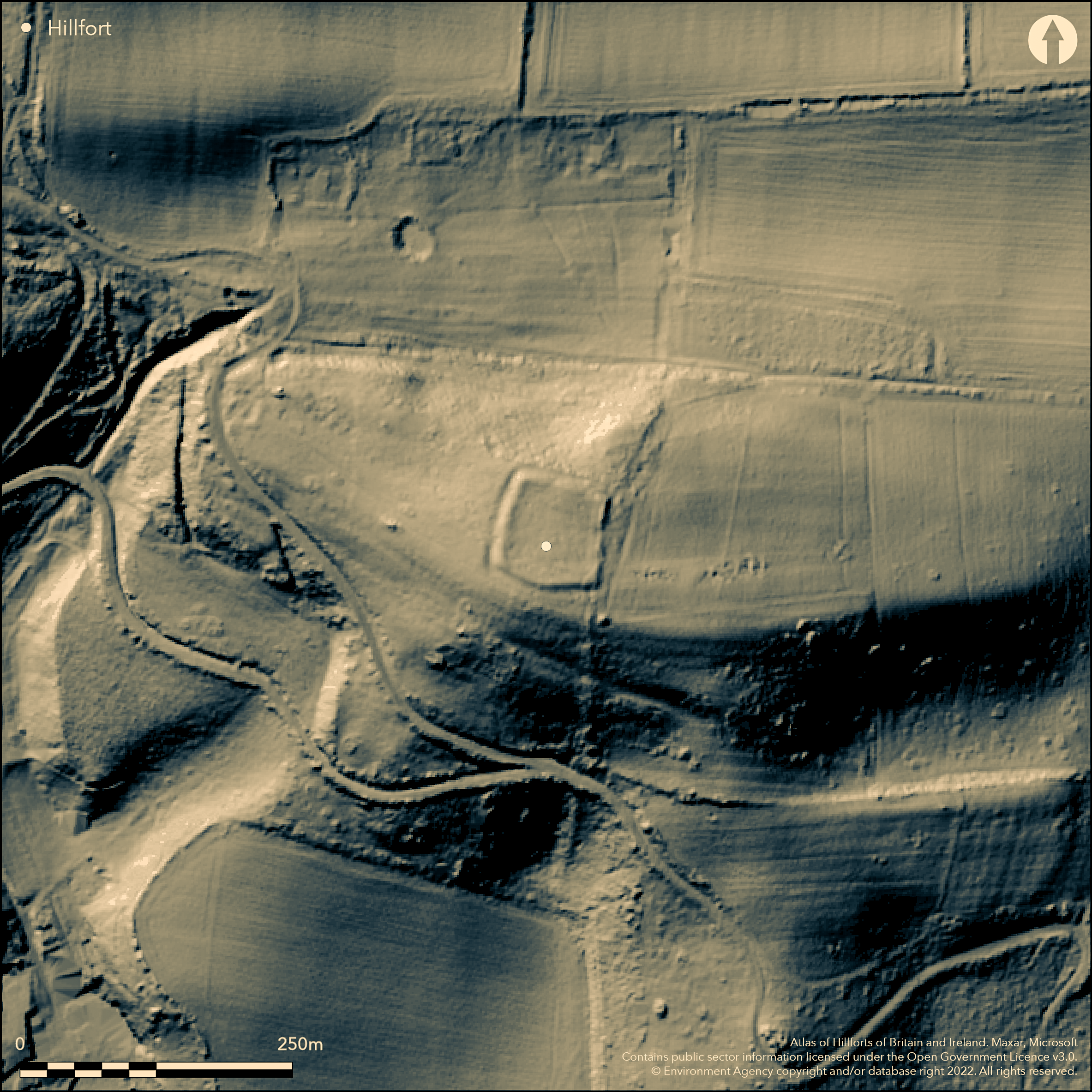
LiDAR 1m DTM Hillshade
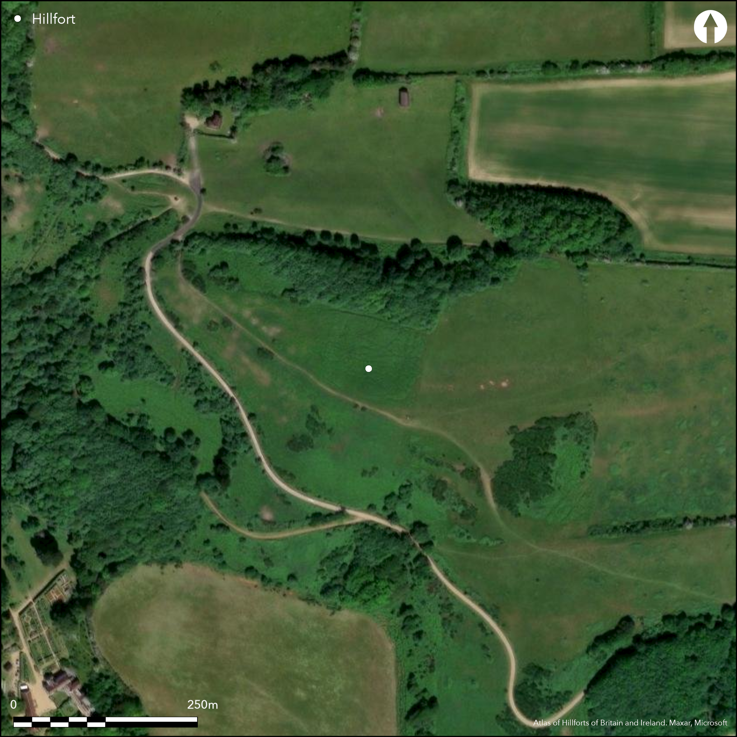
Satellite Imagery
LiDAR 1m DTM Hillshade
Satellite Imagery
Scroll left/right to view further images.
HER: Isle of Wight MIW255 (None)
NMR: SZ 48 SW 8 (460362)
SM: 1013290
NGR: SZ 4088 8408
X: 440885 Y: 84081 (OSGB36)
Small, partial contour hillfort located on hilltop on on fairly steep N-facing slopes of the Upper Greensand ridge of downs above sea to SW on SW of island. Extensive views over coastal plain and sea to S, and the downs to N. Steep surrounding slopes to SE-SW, moderate to strong elsewhere. Roughly square, and aligned slightly SE-NW, internal area c. 55m long and c. 58m wide, with area c. 0.32ha. Defined by bank generally c. 5m wide and c. 0.3m high, but to 9m wide and 1.6m high where best to S along top of ridge, with ditch c. 5.75m wide and 0.5m deep and outer counterscarp bank c. 10m wide and c. 0.5m high. Stops at field boundary on E side. So-called outwork to S is natural lie of ridge slope. No definite original entrance visible, gap midway on E side possibly modern breach. Has been interpreted in past as Bronze Age or Iron Age defended settlement, but good hillfort commanding position. Well-preserved. Within state forest planted with fir trees. On 1st Ed. OS map (1862). Few investigations. Undated.
Citizen Science: ✗
Reliability of Data: Confirmed
Reliability of Interpretation: Confirmed
X: -158408 Y: 6560477 (EPSG: 3857)
Longitude: -1.4230066574250901 Latitude: 50.65491115090574 (EPSG:4326)
Country: England
Current County or Unitary Authority: Isle of Wight
Historic County: Hampshire and Isle of Wight
Current Parish/Community/Council/Townland: Brighstone
Well-preserved.
| Extant | ✓ |
| Cropmark | ✗ |
| Likely Destroyed | ✗ |
Within state forest planted with fir trees.
| Woodland | ✗ |
| Commercial Forestry Plantation | ✓ |
| Parkland | ✗ |
| Pasture (Grazing) | ✗ |
| Arable | ✗ |
| Scrub/Bracken | ✗ |
| Bare Outcrop | ✗ |
| Heather/Moorland | ✗ |
| Heath | ✗ |
| Built-up | ✗ |
| Coastal Grassland | ✗ |
| Other | ✗ |
Small, partial contour hillfort located on hilltop on on fairly steep N-facing slopes of the Upper Greensand ridge of downs above sea to SW on SW of island. Extensive views over coastal plain and sea to S, and the downs to N. Steep surrounding slopes to SE-SW, moderate to strong elsewhere.
| Contour Fort | ✗ |
| Partial Contour Fort | ✓ |
| Promontory Fort | ✗ |
| Hillslope Fort | ✗ |
| Level Terrain Fort | ✗ |
| Marsh Fort | ✗ |
| Multiple Enclosure Fort | ✗ |
| Hilltop | ✓ |
| Coastal Promontory | ✗ |
| Inland Promontory | ✗ |
| Valley Bottom | ✗ |
| Knoll/Hillock/Outcrop | ✗ |
| Ridge | ✓ |
| Cliff/Plateau-edge/Scarp | ✗ |
| Hillslope | ✗ |
| Lowland | ✗ |
| Spur | ✗ |
Dominant Topographic Feature: Hill top
| North | ✗ |
| Northeast | ✓ |
| East | ✗ |
| Southeast | ✗ |
| South | ✗ |
| Southwest | ✗ |
| West | ✗ |
| Northwest | ✗ |
| Level | ✗ |
Altitude: 140.0m
N/A
Unknown, but has been interpreted as Bronze Age or Iron Age defended settlement.
Reliability: D - None
| Pre 1200BC | ✗ |
| 1200BC - 800BC | ✗ |
| 800BC - 400BC | ✗ |
| 400BC - AD50 | ✗ |
| AD50 - AD400 | ✗ |
| AD400 - AD 800 | ✗ |
| Post AD800 | ✗ |
| Unknown | ✓ |
| Pre Hillfort: | None |
| Post Hillfort: | None |
On 1st Ed. OS map (1862). Ordnance Survey investigation 1967. Survey C.K. Currie 1999.
| 1st Identified Map Depiction (1862): | OS map. |
| Other (1967): | OS investigation. |
| Other (1999): | Survey C.K. Currie. |
None.
None
| None | ✓ |
| Spring | ✗ |
| Stream | ✗ |
| Pool | ✗ |
| Flush | ✗ |
| Well | ✗ |
| Other | ✗ |
None
| No Known Features | ✓ |
| Round Stone Structures | ✗ |
| Rectangular Stone Structures | ✗ |
| Curvilinear Platforms | ✗ |
| Other Roundhouse Evidence | ✗ |
| Pits | ✗ |
| Quarry Hollows | ✗ |
| Other | ✗ |
None
| No Known Excavation | ✓ |
| Pits | ✗ |
| Postholes | ✗ |
| Roundhouses | ✗ |
| Rectangular Structures | ✗ |
| Roads/Tracks | ✗ |
| Quarry Hollows | ✗ |
| Other | ✗ |
| Nothing Found | ✗ |
None
| No Known Geophysics | ✓ |
| Pits | ✗ |
| Roundhouses | ✗ |
| Rectangular Structures | ✗ |
| Roads/Tracks | ✗ |
| Quarry Hollows | ✗ |
| Other | ✗ |
| Nothing Found | ✗ |
None
| No Known Finds | ✓ |
| Pottery | ✗ |
| Metal | ✗ |
| Metalworking | ✗ |
| Human Bones | ✗ |
| Animal Bones | ✗ |
| Lithics | ✗ |
| Environmental | ✗ |
| Other | ✗ |
None
| APs Not Checked | ✓ |
| None | ✗ |
| Roundhouses | ✗ |
| Rectangular Structures | ✗ |
| Pits | ✗ |
| Postholes | ✗ |
| Roads/Tracks | ✗ |
| Other | ✗ |
No definite original entrance visible, gap midway on E side possibly modern breach.
| 1: | Possible modern breach on E side. |
| 2: | None defined. |
Guard Chambers: ✗
Chevaux de Frise: ✗
Defined by bank generally c. 5m wide and c. 0.3m high, but to 9m wide and 1.6m high where best to S along top of ridge, with ditch c. 5.75m wide and 0.5m deep and outer counterscarp bank c. 10m wide and c. 0.5m high. Stops at field boundary on E side. So-called outwork to S is natural lie of ridge slope.
| Area 1: | 0.32ha. |
| Total: | 0.32ha. |
Total Footprint Area: Noneha.
None
| ✗ | None |
| ✓ | None |
| NE Quadrant: | 1 |
| SE Quadrant: | 1 |
| SW Quadrant: | 1 |
| NW Quadrant: | 1 |
| Total: | 1 |
| Partial Univallate | ✗ |
| Univallate | ✓ |
| Partial Bivallate | ✗ |
| Bivallate | ✗ |
| Partial Multivallate | ✗ |
| Multivallate | ✗ |
| Unknown | ✗ |
| Partial Univallate | ✗ |
| Univallate | ✗ |
| Partial Bivallate | ✗ |
| Bivallate | ✗ |
| Partial Multivallate | ✗ |
| Multivallate | ✗ |
None
| None | ✗ |
| Earthen Bank | ✓ |
| Stone Wall | ✗ |
| Rubble | ✗ |
| Wall-walk | ✗ |
| Evidence of Timber | ✗ |
| Vitrification | ✗ |
| Other Burning | ✗ |
| Palisade | ✗ |
| Counter Scarp Bank | ✓ |
| Berm | ✗ |
| Unfinished | ✗ |
| Other | ✗ |
None
| None | ✗ |
| Earthen Bank | ✗ |
| Stone Wall | ✗ |
| Murus Duplex | ✗ |
| Timber-framed | ✗ |
| Timber-laced | ✗ |
| Vitrification | ✗ |
| Other Burning | ✗ |
| Palisade | ✗ |
| Counter Scarp Bank | ✗ |
| Berm | ✗ |
| Unfinished | ✗ |
| No Known Excavation | ✓ |
| Other | ✗ |
| ✗ | None |
| ✓ | None |
Number of Ditches: 1
| ✗ | None |
Adams, W.H. Davenport, 1856. The history, topography and antiquities of the Isle of Wight, London: Smith, Elder, 133.
Currie, C.K. 2003. An archaeological survey of earthworks on Castle Hill, Mottistone, Isle of Wight, Proc Hants Field Club Archaeol Soc, 58, 24-32.
Wrench, C.L. 2012. Evidence of hillforts on the Isle of Wight, Unpublished paper, University of Oxford.
Atlas of Hillforts:
Wikidata:
This work is licensed under CC BY-SA 4.0

 and should be cited as:
Lock, Gary and Ralston, Ian. 2024. Atlas of Hillforts of Britain and Ireland. Available at: https://hillforts.arch.ox.ac.uk
Document Version 1.1