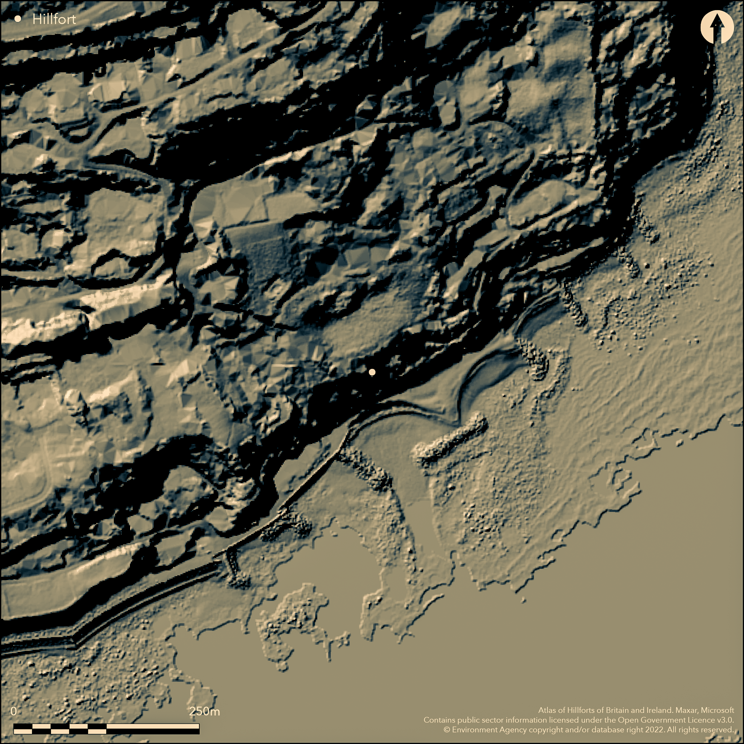
LiDAR 1m DTM Hillshade
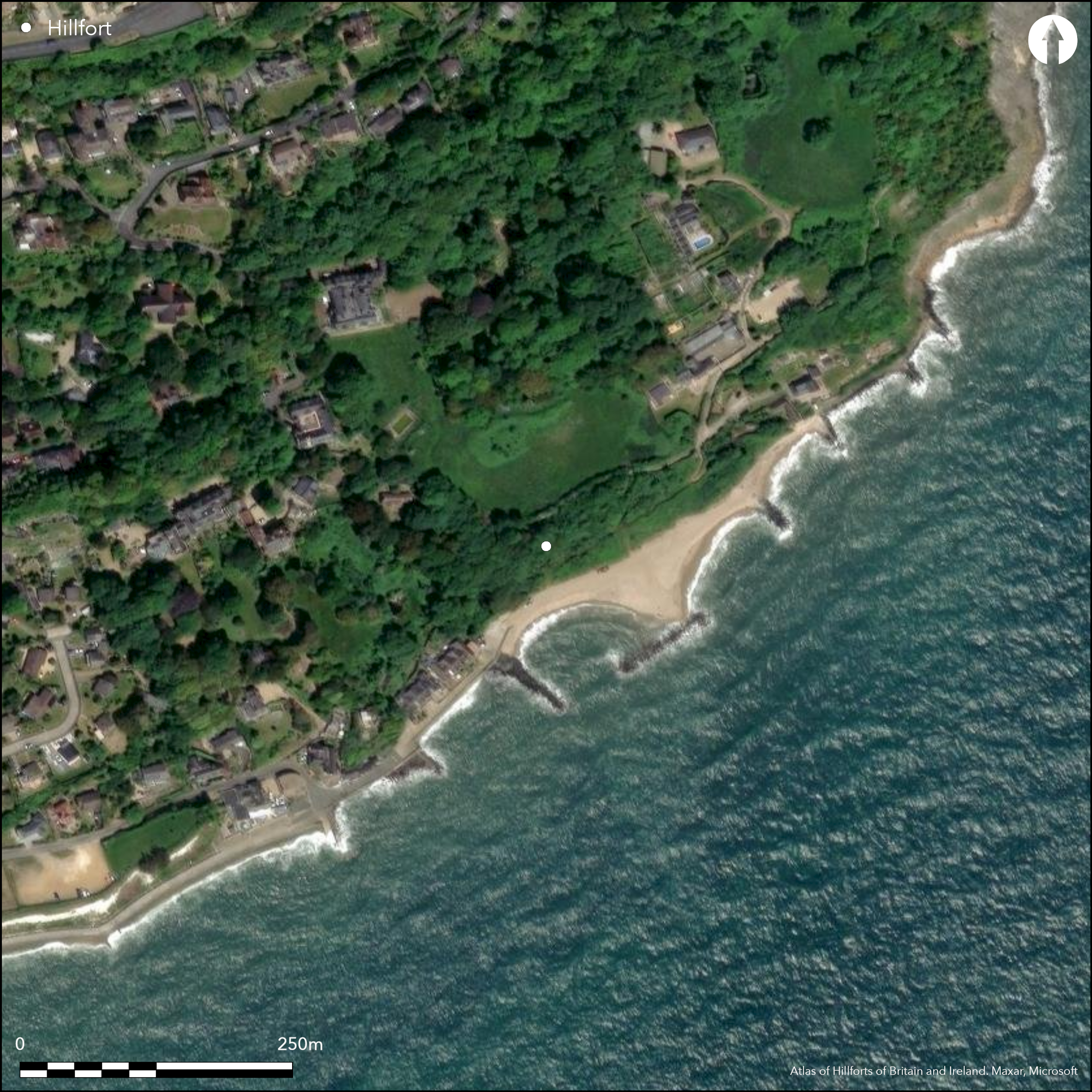
Satellite Imagery
LiDAR 1m DTM Hillshade
Satellite Imagery
Scroll left/right to view further images.
HER: Isle of Wight MIW817 (None)
NMR: SZ 57 NE 43 (460949)
SM: None
NGR: SZ57877802
X: 457870 Y: 78003 (OSGB36)
Probable site of coastal promontory or possible hillslope fort, formerly located on eroding SE-facing chalk cliffs overlooking Monks Bay, Ventnor. Boniface Down to N. Thought possibly lost to sea when visited by Ordnance Survy 1955, survey in 1999 suggested that trace may still remain on cliff edge. G.A. Martin mentioned site in poor state in 1849: ÇSome works, apparently belonging to an ancient fortification, also exist near the edge of the cliff below East Dene, though much of them has been destroyed by the falling of the cliff within these few years'. Later in 1870 C.S.M. Lockhart stated that Çjust below the old church may still be seen a small portion of an old Roman camp. The sea, encroaching on the cliff, has already washed away all the interior, and there only remains the bank and the ditch of its land side, but these are in a fine state of preservation. It appears that by the 1930's little remained. Because of the rate of erosion of chalk cliffs on the South coast (Brown 2009, 185-7), it is possible that the fort was located a distance inland in prehistory, akin to Flower's Barrow in Dorset (Atlas No 3593) and Belle Tout in Sussex (Atlas No 3750). Scrub and coastal grassland. On 1st Ed. OS map (1862) as 'Roman Camp'.
Citizen Science: ✗
Reliability of Data: Unconfirmed
Reliability of Interpretation: Unconfirmed
X: -131769 Y: 6550634 (EPSG: 3857)
Longitude: -1.1836985855846358 Latitude: 50.59882007289257 (EPSG:4326)
Country: England
Current County or Unitary Authority: Isle of Wight
Historic County: Hampshire and Isle of Wight
Current Parish/Community/Council/Townland: Ventnor
Probably lost to sea, but trace may still remain.
| Extant | ✗ |
| Cropmark | ✗ |
| Likely Destroyed | ✓ |
Scrub and coastal grassland.
| Woodland | ✗ |
| Commercial Forestry Plantation | ✗ |
| Parkland | ✗ |
| Pasture (Grazing) | ✗ |
| Arable | ✗ |
| Scrub/Bracken | ✓ |
| Bare Outcrop | ✗ |
| Heather/Moorland | ✗ |
| Heath | ✗ |
| Built-up | ✗ |
| Coastal Grassland | ✓ |
| Other | ✗ |
Probable site of coastal promontory or possible hillslope fort, formerly located on eroding SE-facing chalk cliffs overlooking Monks Bay, Ventnor. Boniface Down to N.
| Contour Fort | ✗ |
| Partial Contour Fort | ✗ |
| Promontory Fort | ✓ |
| Hillslope Fort | ✓ |
| Level Terrain Fort | ✗ |
| Marsh Fort | ✗ |
| Multiple Enclosure Fort | ✗ |
| Hilltop | ✗ |
| Coastal Promontory | ✓ |
| Inland Promontory | ✗ |
| Valley Bottom | ✗ |
| Knoll/Hillock/Outcrop | ✗ |
| Ridge | ✗ |
| Cliff/Plateau-edge/Scarp | ✓ |
| Hillslope | ✗ |
| Lowland | ✗ |
| Spur | ✗ |
Dominant Topographic Feature: Chalk promontory cliffs.
| North | ✗ |
| Northeast | ✗ |
| East | ✗ |
| Southeast | ✓ |
| South | ✗ |
| Southwest | ✗ |
| West | ✗ |
| Northwest | ✗ |
| Level | ✗ |
Altitude: 15.0m
N/A
None.
Reliability: D - None
| Pre 1200BC | ✗ |
| 1200BC - 800BC | ✗ |
| 800BC - 400BC | ✗ |
| 400BC - AD50 | ✗ |
| AD50 - AD400 | ✗ |
| AD400 - AD 800 | ✗ |
| Post AD800 | ✗ |
| Unknown | ✓ |
| Pre Hillfort: | None |
| Post Hillfort: | None |
Mention by G.A. Martin 1849.Visted by British Archaeological Association 1855. On 1st Ed. OS map (1862) as 'Roman Camp'. Prdnance Survey investigation 1955.
| 1st Identified Written Reference (1849): | G.A. Martin mention isite n poor atate. |
| Other (1855): | Visted by British Archaeological Association/. |
| 1st Identified Map Depiction (1862): | OS map. |
| Other (1955): | OS investigation. |
None - site probably destroyed.
None
| None | ✓ |
| Spring | ✗ |
| Stream | ✗ |
| Pool | ✗ |
| Flush | ✗ |
| Well | ✗ |
| Other | ✗ |
None
| No Known Features | ✓ |
| Round Stone Structures | ✗ |
| Rectangular Stone Structures | ✗ |
| Curvilinear Platforms | ✗ |
| Other Roundhouse Evidence | ✗ |
| Pits | ✗ |
| Quarry Hollows | ✗ |
| Other | ✗ |
None
| No Known Excavation | ✓ |
| Pits | ✗ |
| Postholes | ✗ |
| Roundhouses | ✗ |
| Rectangular Structures | ✗ |
| Roads/Tracks | ✗ |
| Quarry Hollows | ✗ |
| Other | ✗ |
| Nothing Found | ✗ |
None
| No Known Geophysics | ✓ |
| Pits | ✗ |
| Roundhouses | ✗ |
| Rectangular Structures | ✗ |
| Roads/Tracks | ✗ |
| Quarry Hollows | ✗ |
| Other | ✗ |
| Nothing Found | ✗ |
None
| No Known Finds | ✓ |
| Pottery | ✗ |
| Metal | ✗ |
| Metalworking | ✗ |
| Human Bones | ✗ |
| Animal Bones | ✗ |
| Lithics | ✗ |
| Environmental | ✗ |
| Other | ✗ |
NO APPARENT FEATURES
| APs Not Checked | ✓ |
| None | ✗ |
| Roundhouses | ✗ |
| Rectangular Structures | ✗ |
| Pits | ✗ |
| Postholes | ✗ |
| Roads/Tracks | ✗ |
| Other | ✗ |
Site probably destroyed.
| 0: | None |
| 2: | None |
Guard Chambers: ✗
Chevaux de Frise: ✗
Site probably destroyed, but trace might remain.
| Area 1: | Noneha. |
| Total: | Noneha. |
Total Footprint Area: Noneha.
None
| ✗ | Area not defined. |
| ✗ | Quadrants cannot be defined. Site probably destroyed, but trace might remain. |
| NE Quadrant: | None |
| SE Quadrant: | None |
| SW Quadrant: | None |
| NW Quadrant: | None |
| Total: | None |
| Partial Univallate | ✗ |
| Univallate | ✗ |
| Partial Bivallate | ✗ |
| Bivallate | ✗ |
| Partial Multivallate | ✗ |
| Multivallate | ✗ |
| Unknown | ✓ |
| Partial Univallate | ✗ |
| Univallate | ✗ |
| Partial Bivallate | ✗ |
| Bivallate | ✗ |
| Partial Multivallate | ✗ |
| Multivallate | ✗ |
None
| None | ✓ |
| Earthen Bank | ✗ |
| Stone Wall | ✗ |
| Rubble | ✗ |
| Wall-walk | ✗ |
| Evidence of Timber | ✗ |
| Vitrification | ✗ |
| Other Burning | ✗ |
| Palisade | ✗ |
| Counter Scarp Bank | ✗ |
| Berm | ✗ |
| Unfinished | ✗ |
| Other | ✗ |
None
| None | ✗ |
| Earthen Bank | ✗ |
| Stone Wall | ✗ |
| Murus Duplex | ✗ |
| Timber-framed | ✗ |
| Timber-laced | ✗ |
| Vitrification | ✗ |
| Other Burning | ✗ |
| Palisade | ✗ |
| Counter Scarp Bank | ✗ |
| Berm | ✗ |
| Unfinished | ✗ |
| No Known Excavation | ✓ |
| Other | ✗ |
| ✗ | None |
| ✗ | Site probably destroyed. |
Number of Ditches: 0
| ✗ | None |
Brown, I 2009. Beacons in the landscape. The hillforts of England and Wales, Oxford: Windgather Press/Oxbow Books.
Doubleday, H.A. ed.,1900. A history of Hampshire and the Isle of Wight Vol I, The Victoria history of the Counties of England, (Haverfield), London: Constable, 347.
Lockhart, C.S.M. 1870. A General Guide to the Isle of Wight, (London: Virtue and Co.
Martin, G.A. 1849. The 'Undercliff' of the Isle of Wight: its climate, history, and natural productions, London: J.Churchill.
Wrench, C.L. 2012. Evidence of hillforts on the Isle of Wight, Unpublished paper, University of Oxford.
Atlas of Hillforts:
Wikidata:
This work is licensed under CC BY-SA 4.0

 and should be cited as:
Lock, Gary and Ralston, Ian. 2024. Atlas of Hillforts of Britain and Ireland. Available at: https://hillforts.arch.ox.ac.uk
Document Version 1.1