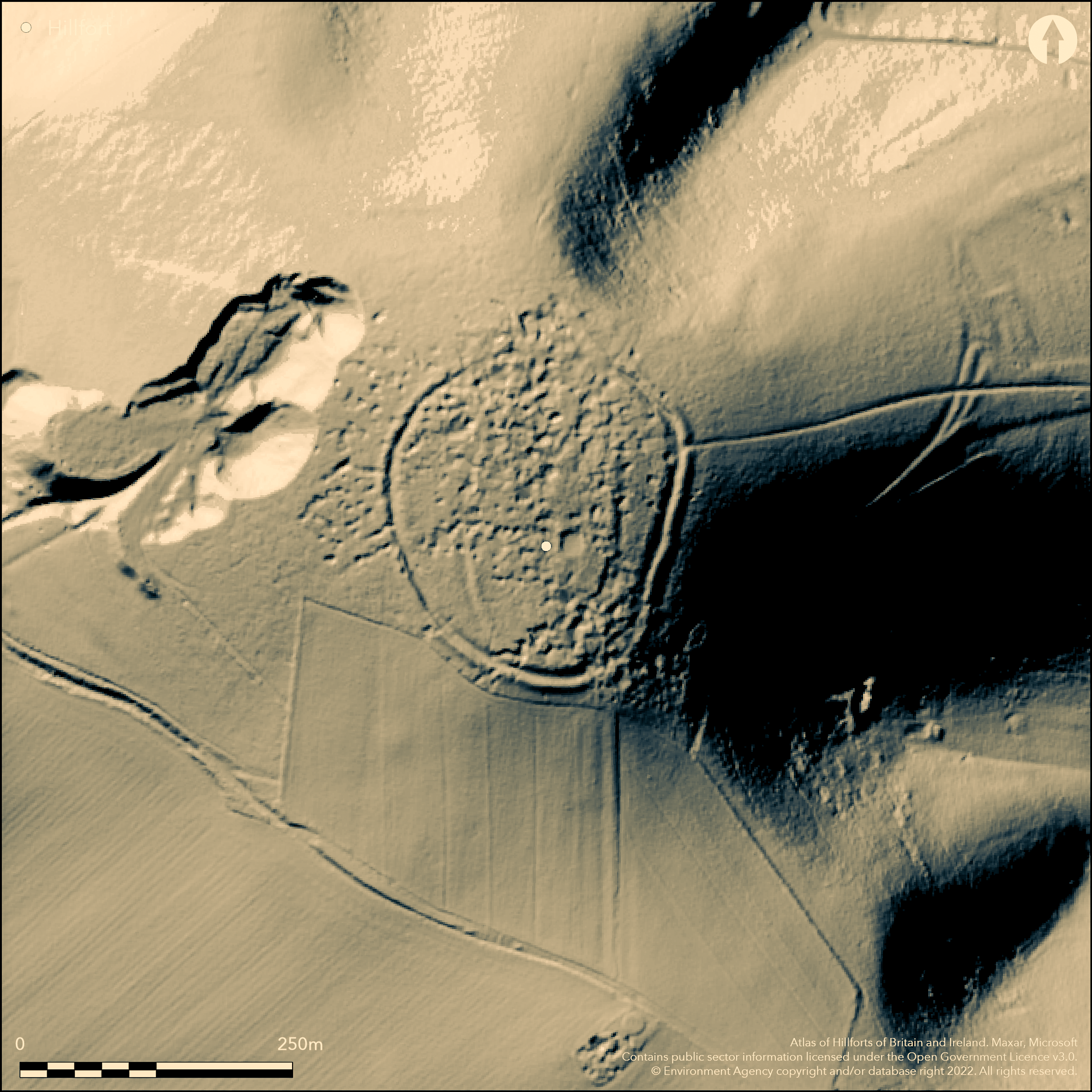
LiDAR 1m DTM Hillshade
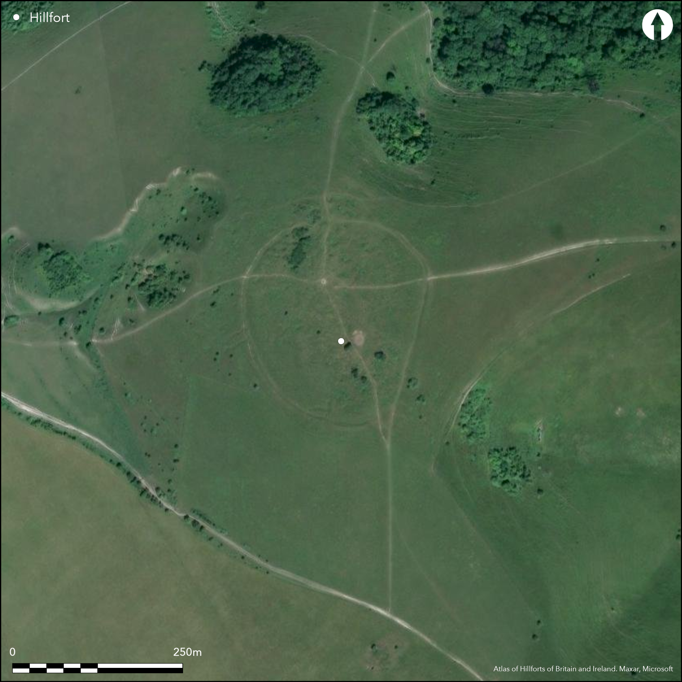
Satellite Imagery
LiDAR 1m DTM Hillshade
Satellite Imagery
Scroll left/right to view further images.
HER: West Sussex MWS6473 (None)
NMR: TQ 21 SE 1 (399066)
SM: 1016153
NGR: TQ28401370
X: 528416 Y: 113791 (OSGB36)
Unusual, contour hillfort located on clay-with-flints capped, chalk Wolstonbury Hill on the Sussex Downs. Steep or very steep surrounding slopes, less along ridge on SE. N-S aligned, roughly oval, enclosure with internal area c. 2.2ha. Part excavation 1929 (Curwen 1930) and Russell (1995), and survey in 1993 showed rampart of dump construction, c. 5m wide and 1.5m high, with flat-bottomed inner ditch, c. 5m wide and 1.2m deep, interrupted by narrow causeways in places. Ditch flanked on SW side by slight internal bank to 0.2 metres high. Two gaps, to N and SE possibly original entrances. Late 18th century to early 19th century flint diggings, mainly excavated by the inmates of Hursterpierpoint workhouse, disturbed earthworks and interior. Surveys found, roughly N-S aligned, curving banks measuring c. 2m-4m wide and to 0.5 metres high, possibly result of cultivation of interior in early Iron Age. Site possibly used as Anglo-Saxon cemetery. Reports in Gentleman's Magazine of 1765 and 1806 suggest inhumation burials with grave goods disturbed by flint quarrying and possibly construction of, now dry, dewpond in the central interior. Finds of worked Neolithic and early Bronze Age flints and Roman coins and pottery. Watching Brief, forming part of post-graduate research by M. Russell 1995, suggested site has Bronze Age origins also suggests it is a causewayed enclosure rather than a hillfort. On 1st Ed. OS map (1873-83).
Citizen Science: ✗
Reliability of Data: Confirmed
Reliability of Interpretation: Unconfirmed
X: -19461 Y: 6605256 (EPSG: 3857)
Longitude: -0.17482442437811294 Latitude: 50.90924706201374 (EPSG:4326)
Country: England
Current County or Unitary Authority: West Sussex
Historic County: Sussex
Current Parish/Community/Council/Townland: Pyecombe
Well-preserved.
| Extant | ✓ |
| Cropmark | ✗ |
| Likely Destroyed | ✗ |
Under pasture. Diggings.
| Woodland | ✗ |
| Commercial Forestry Plantation | ✗ |
| Parkland | ✗ |
| Pasture (Grazing) | ✓ |
| Arable | ✗ |
| Scrub/Bracken | ✗ |
| Bare Outcrop | ✗ |
| Heather/Moorland | ✗ |
| Heath | ✗ |
| Built-up | ✗ |
| Coastal Grassland | ✗ |
| Other | ✓ |
Unusual, contour hillfort located on clay-with-flints capped, chalk Wolstonbury hill on the Sussex Downs. Steep or very steep surrounding slopes, less along ridge on SE.
| Contour Fort | ✓ |
| Partial Contour Fort | ✗ |
| Promontory Fort | ✗ |
| Hillslope Fort | ✗ |
| Level Terrain Fort | ✗ |
| Marsh Fort | ✗ |
| Multiple Enclosure Fort | ✗ |
| Hilltop | ✓ |
| Coastal Promontory | ✗ |
| Inland Promontory | ✗ |
| Valley Bottom | ✗ |
| Knoll/Hillock/Outcrop | ✗ |
| Ridge | ✗ |
| Cliff/Plateau-edge/Scarp | ✗ |
| Hillslope | ✗ |
| Lowland | ✗ |
| Spur | ✗ |
Dominant Topographic Feature: Hill top
| North | ✗ |
| Northeast | ✗ |
| East | ✗ |
| Southeast | ✗ |
| South | ✗ |
| Southwest | ✗ |
| West | ✗ |
| Northwest | ✗ |
| Level | ✓ |
Altitude: 206.0m
N/A
Inner ditch probably late Bronze Age based on pottery - excavation, forming part of post-graduate research by M. Russell 1995 suggested suggest site henge rather than Iron Age hillfort.
Reliability: C - Low
| Pre 1200BC | ✗ |
| 1200BC - 800BC | ✓ |
| 800BC - 400BC | ✓ |
| 400BC - AD50 | ✗ |
| AD50 - AD400 | ✗ |
| AD400 - AD 800 | ✗ |
| Post AD800 | ✗ |
| Unknown | ✗ |
| Pre Hillfort: | None |
| Post Hillfort: | None |
| Artefactual: | Bronze Age pottery. Roman coins and pottery. |
| Morphology/Earthwork/Typology: | None |
On 1st Ed. OS map (1873-83). 1765 written reference. Excavation E.C. Curwen 1929. Measured Survey RCHME: Wolstonbury Hill survey 1993. Watching Brief, as part of post-graduate research, M. Russell 1995.
| 1st Identified Written Reference (1765): | None |
| Excavation (1929): | E.C. Curwen. |
| Earthwork Survey (1993): | None |
| Other (1995): | None |
| 1st Identified Map Depiction (None): | OS map. |
Surveys found, roughly N-S aligned, curving banks measuring c. 2m-4m wide and to 0.5 metres high, possibly result of cultivation of interior in early Iron Age. Reports in Gentleman's Magazine of 1765 and 1806 suggest inhumation burials with grave goods. Finds of Bronze Age pottery, worked Neolithic and early Bronze Age flints and Roman coins and pottery.
Possibly construction of, now dry, dewpond in central interior.
| None | ✗ |
| Spring | ✗ |
| Stream | ✗ |
| Pool | ✗ |
| Flush | ✗ |
| Well | ✗ |
| Other | ✓ |
Surveys found, roughly N-S aligned, curving banks measuring c. 2m-4m wide and to 0.5 metres high, possibly result of cultivation of interior in early Iron Age. Reports in Gentleman's Magazine of 1765 and 1806 suggest inhumation burials with grave goods.
| No Known Features | ✗ |
| Round Stone Structures | ✗ |
| Rectangular Stone Structures | ✗ |
| Curvilinear Platforms | ✗ |
| Other Roundhouse Evidence | ✗ |
| Pits | ✗ |
| Quarry Hollows | ✗ |
| Other | ✓ |
None
| No Known Excavation | ✗ |
| Pits | ✗ |
| Postholes | ✗ |
| Roundhouses | ✗ |
| Rectangular Structures | ✗ |
| Roads/Tracks | ✗ |
| Quarry Hollows | ✗ |
| Other | ✗ |
| Nothing Found | ✓ |
None
| No Known Geophysics | ✓ |
| Pits | ✗ |
| Roundhouses | ✗ |
| Rectangular Structures | ✗ |
| Roads/Tracks | ✗ |
| Quarry Hollows | ✗ |
| Other | ✗ |
| Nothing Found | ✗ |
Bronze Age pottery. Finds of worked Neolithic and early Bronze Age flints and Roman coins and pottery.
| No Known Finds | ✗ |
| Pottery | ✓ |
| Metal | ✗ |
| Metalworking | ✗ |
| Human Bones | ✗ |
| Animal Bones | ✗ |
| Lithics | ✓ |
| Environmental | ✗ |
| Other | ✓ |
None
| APs Not Checked | ✓ |
| None | ✗ |
| Roundhouses | ✗ |
| Rectangular Structures | ✗ |
| Pits | ✗ |
| Postholes | ✗ |
| Roads/Tracks | ✗ |
| Other | ✗ |
Two gaps, to N and SE possibly original entrances.
| 2: | None |
| 2: | None |
Guard Chambers: ✗
Chevaux de Frise: ✗
| 1. Simple Gap (North): | None |
| 2. Simple Gap (South east): | None |
Part excavation 1929 and 1995, and survey in 1993 showed rampart of dump construction, c. 5m wide and 1.5m high, with flat-bottomed inner ditch, c. 5m wide and 1.2m deep, interrupted by narrow causeways in places. Ditch flanked on SW side by slight internal bank to 0.2 metres high.
| Area 1: | 2.2ha. |
| Total: | 2.2ha. |
Total Footprint Area: Noneha.
None
| ✗ | None |
| ✓ | None |
| NE Quadrant: | 1 |
| SE Quadrant: | 1 |
| SW Quadrant: | 2 |
| NW Quadrant: | 1 |
| Total: | 2 |
| Partial Univallate | ✓ |
| Univallate | ✗ |
| Partial Bivallate | ✓ |
| Bivallate | ✗ |
| Partial Multivallate | ✗ |
| Multivallate | ✗ |
| Unknown | ✗ |
| Partial Univallate | ✗ |
| Univallate | ✗ |
| Partial Bivallate | ✗ |
| Bivallate | ✗ |
| Partial Multivallate | ✗ |
| Multivallate | ✗ |
None
| None | ✗ |
| Earthen Bank | ✓ |
| Stone Wall | ✗ |
| Rubble | ✗ |
| Wall-walk | ✗ |
| Evidence of Timber | ✗ |
| Vitrification | ✗ |
| Other Burning | ✗ |
| Palisade | ✗ |
| Counter Scarp Bank | ✗ |
| Berm | ✗ |
| Unfinished | ✗ |
| Other | ✗ |
Part excavation 1929 and 1995, and survey in 1993 showed rampart of dump construction, c. 5m wide and 1.5m high, with flat-bottomed inner ditch, c. 5m wide and 1.2m deep, interrupted by narrow causeways in places. Ditch flanked on SW side by slight internal bank to 0.2 metres high.
| None | ✗ |
| Earthen Bank | ✓ |
| Stone Wall | ✗ |
| Murus Duplex | ✗ |
| Timber-framed | ✗ |
| Timber-laced | ✗ |
| Vitrification | ✗ |
| Other Burning | ✗ |
| Palisade | ✗ |
| Counter Scarp Bank | ✗ |
| Berm | ✗ |
| Unfinished | ✗ |
| No Known Excavation | ✗ |
| Other | ✗ |
| ✗ | None |
| ✓ | Part excavation 1929 and 1995, and survey in 1993 showed rampart of dump construction, c. 5m wide and 1.5m high, with flat-bottomed inner ditch, c. 5m wide and 1.2m deep, interrupted by narrow causeways in places. Ditch flanked on SW side by slight internal bank to 0.2 metres high. |
Number of Ditches: 1
| ✗ | None |
Curwen,E,C. 1930. Wolstonbury (earthworks), Sussex Arch Colls, 71, 237-245
Hamilton, S. and Manley, J.1997. Points of view. Prominent enclosures in 1st millennium Sussex, Sussex Archaeol Coll, 135, 93-112.
Hamilton, S. and Manley, J. 2001. Hillforts, monumentality and place: a chronological and topographic review of first millennium BC hillforts of southeast England, European J Archaeol, 4.1, 7-42.
McOmish, D. and Oswald A. 1993. Flintwork from Woolstonbury Hill, West Sussex, 145-161.
National Trust. 1996. The Dyke Estate, West Sussex - An Archaeological And Land Use History Report, Unpublished monograoh National Trust.
Russell, M. 1995. Archaeological Watching brief at Wolstonbury Hill, Pycombe, West Sussex, Unpublished monograph Bournemouth University School of Conservation Sciences.
Atlas of Hillforts:
Wikidata:
This work is licensed under CC BY-SA 4.0

 and should be cited as:
Lock, Gary and Ralston, Ian. 2024. Atlas of Hillforts of Britain and Ireland. Available at: https://hillforts.arch.ox.ac.uk
Document Version 1.1