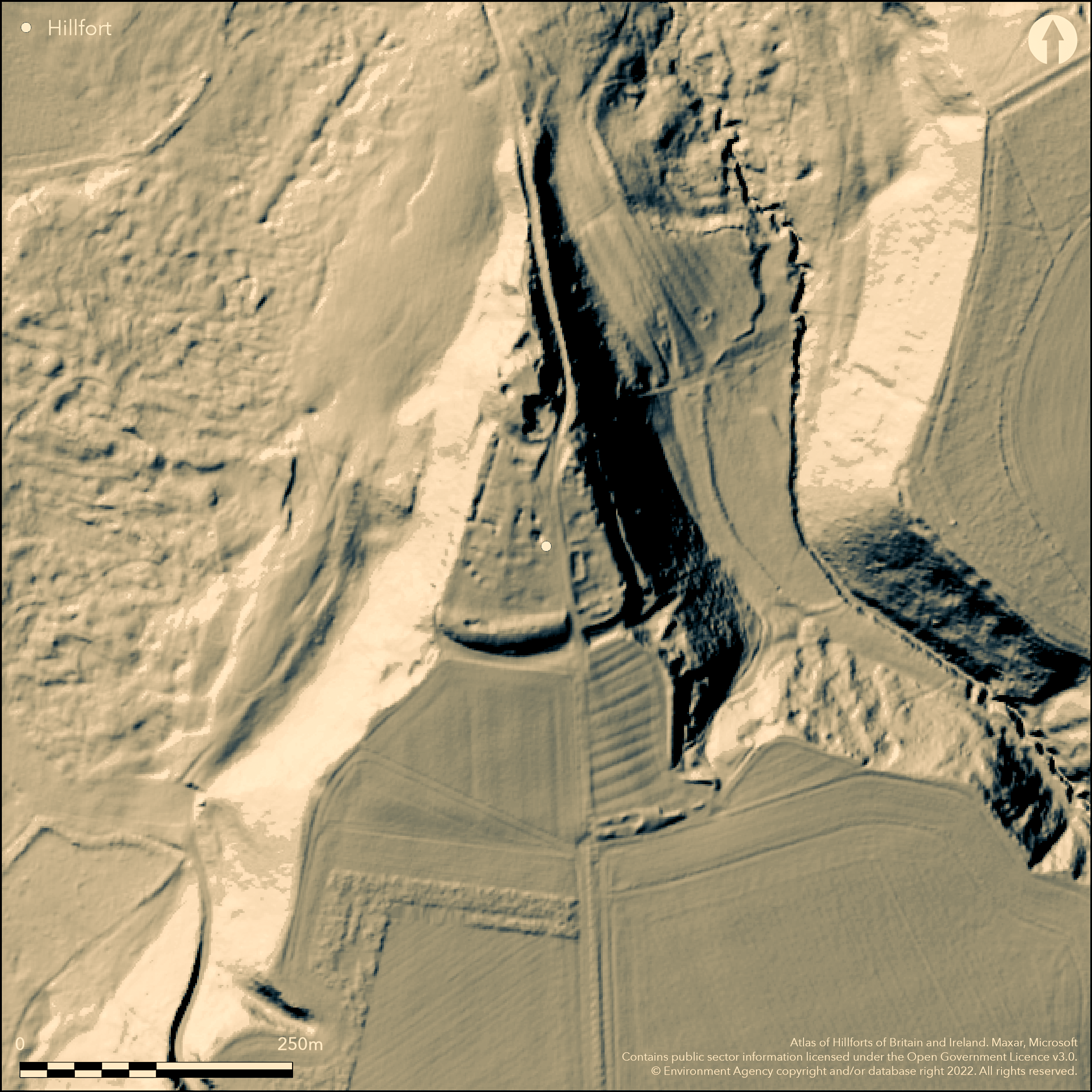
LiDAR 1m DTM Hillshade
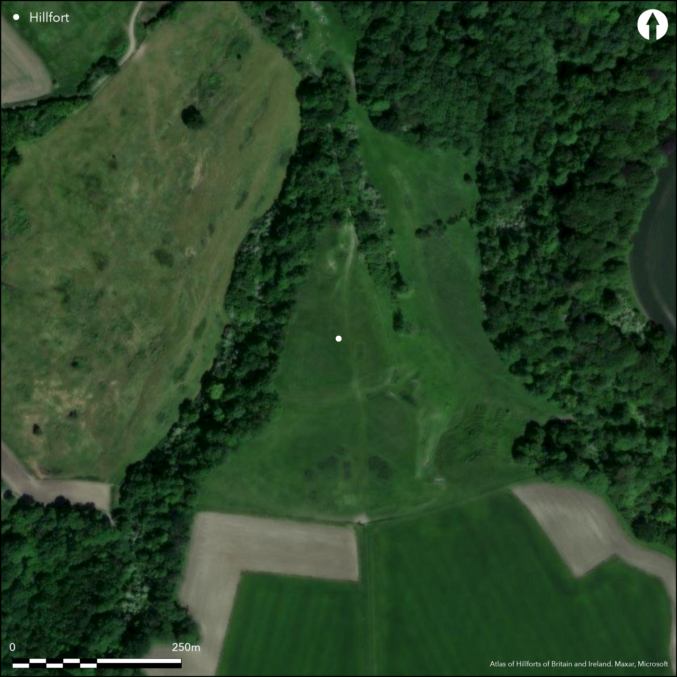
Satellite Imagery
LiDAR 1m DTM Hillshade
Satellite Imagery
Scroll left/right to view further images.
HER: Wiltshire and Swindon MW115243 (None)
NMR: SU 17 NW 2 (221351)
SM: 1005685
NGR: SU107792
X: 410772 Y: 179270 (OSGB36)
Medieval motte and bailey castle sited on isolated N-facing spur of the chalk escarpment. Steep slopes to E and W, moderate along ridge to S. Evidence of settlement within outer bailey. Suggested in surveys by RCHME 2003 to be possibly Iron Age origin with medieval and/or later elements. Area enclosed c. 1.4ha. The 'motte', severely mutilated by quarrying, measures 52m diameter by 3.2m high, with ditch is 2.3m deep. Inner enclosure with bank and ditch 3.4m high dividing it from outer enclosure, with causeway entrance. Evidence of settlement, agricultural activity and later quarrying within the bailey. Bicknoll Castle lay at centre of five contiguous estates of Gilbert de Breteuil at Domesday, and probably the chief caput. Whether the site was an Iron Age hillfort is open to question. If so, possibly promontory fort. Site under pasture. On 1st Ed. Os map (1885).
Citizen Science: ✗
Reliability of Data: Unconfirmed
Reliability of Interpretation: Unconfirmed
X: -205516 Y: 6712402 (EPSG: 3857)
Longitude: -1.8461816006835339 Latitude: 51.51220594516726 (EPSG:4326)
Country: England; None
Current County or Unitary Authority: Wiltshire
Historic County: Wiltshire
Current Parish/Community/Council/Townland: Broad Hinton; Broad Town
The 'motte', severely mutilated by quarrying.
| Extant | ✓ |
| Cropmark | ✗ |
| Likely Destroyed | ✓ |
Under pasture. 'Motte', severely mutilated by quarrying
| Woodland | ✗ |
| Commercial Forestry Plantation | ✗ |
| Parkland | ✗ |
| Pasture (Grazing) | ✓ |
| Arable | ✗ |
| Scrub/Bracken | ✗ |
| Bare Outcrop | ✗ |
| Heather/Moorland | ✗ |
| Heath | ✗ |
| Built-up | ✗ |
| Coastal Grassland | ✗ |
| Other | ✓ |
Indeterminate medieval motte and bailey castle sited on isolated N-facing spur of the chalk escarpment. Steep slopes to E and W, moderate along ridge to S. Hillfort, it existed, possibly promontory fort.
| Contour Fort | ✗ |
| Partial Contour Fort | ✗ |
| Promontory Fort | ✓ |
| Hillslope Fort | ✗ |
| Level Terrain Fort | ✗ |
| Marsh Fort | ✗ |
| Multiple Enclosure Fort | ✗ |
| Hilltop | ✗ |
| Coastal Promontory | ✗ |
| Inland Promontory | ✓ |
| Valley Bottom | ✗ |
| Knoll/Hillock/Outcrop | ✗ |
| Ridge | ✗ |
| Cliff/Plateau-edge/Scarp | ✗ |
| Hillslope | ✗ |
| Lowland | ✗ |
| Spur | ✓ |
Dominant Topographic Feature: Spur
| North | ✗ |
| Northeast | ✗ |
| East | ✗ |
| Southeast | ✗ |
| South | ✗ |
| Southwest | ✗ |
| West | ✗ |
| Northwest | ✗ |
| Level | ✓ |
Altitude: 186.0m
Boundary Type: Parish/Townland
None.
Reliability: D - None
| Pre 1200BC | ✗ |
| 1200BC - 800BC | ✗ |
| 800BC - 400BC | ✗ |
| 400BC - AD50 | ✗ |
| AD50 - AD400 | ✗ |
| AD400 - AD 800 | ✗ |
| Post AD800 | ✗ |
| Unknown | ✓ |
| Pre Hillfort: | None |
| Post Hillfort: | Bicknoll Castle lay at centre of five contiguous estates of Gilbert de Breteuil at Domesday, and probably the chief caput. Possibly medieval pottery. |
Site on 1st Ed. Os map (1885). Field investigation 1975 - no details. Survey RCHME 2003.
| 1st Identified Map Depiction (1885): | OS map. |
| Other (1975): | Field investigation - no details. |
| Earthwork Survey (2003): | Survey RCHME. |
None.
None
| None | ✓ |
| Spring | ✗ |
| Stream | ✗ |
| Pool | ✗ |
| Flush | ✗ |
| Well | ✗ |
| Other | ✗ |
None
| No Known Features | ✓ |
| Round Stone Structures | ✗ |
| Rectangular Stone Structures | ✗ |
| Curvilinear Platforms | ✗ |
| Other Roundhouse Evidence | ✗ |
| Pits | ✗ |
| Quarry Hollows | ✗ |
| Other | ✗ |
None
| No Known Excavation | ✓ |
| Pits | ✗ |
| Postholes | ✗ |
| Roundhouses | ✗ |
| Rectangular Structures | ✗ |
| Roads/Tracks | ✗ |
| Quarry Hollows | ✗ |
| Other | ✗ |
| Nothing Found | ✗ |
None
| No Known Geophysics | ✓ |
| Pits | ✗ |
| Roundhouses | ✗ |
| Rectangular Structures | ✗ |
| Roads/Tracks | ✗ |
| Quarry Hollows | ✗ |
| Other | ✗ |
| Nothing Found | ✗ |
None
| No Known Finds | ✓ |
| Pottery | ✗ |
| Metal | ✗ |
| Metalworking | ✗ |
| Human Bones | ✗ |
| Animal Bones | ✗ |
| Lithics | ✗ |
| Environmental | ✗ |
| Other | ✗ |
None
| APs Not Checked | ✓ |
| None | ✗ |
| Roundhouses | ✗ |
| Rectangular Structures | ✗ |
| Pits | ✗ |
| Postholes | ✗ |
| Roads/Tracks | ✗ |
| Other | ✗ |
None defined.
| 0: | None |
| 2: | None |
Guard Chambers: ✗
Chevaux de Frise: ✗
The 'motte', severely mutilated by quarrying, measures 52m diameter by 3.2m high, with ditch is 2.3m deep. Inner enclosure with bank and ditch 3.4m high dividing it from outer enclosure, with causeway entrance. Evidence of settlement, agricultural activity and later quarrying within the bailey.
| Area 1: | 1.4ha. |
| Total: | 1.4ha. |
Total Footprint Area: Noneha.
None
| ✗ | None |
| ✗ | Quadrants not defined. |
| NE Quadrant: | None |
| SE Quadrant: | None |
| SW Quadrant: | None |
| NW Quadrant: | None |
| Total: | None |
| Partial Univallate | ✗ |
| Univallate | ✗ |
| Partial Bivallate | ✗ |
| Bivallate | ✗ |
| Partial Multivallate | ✗ |
| Multivallate | ✗ |
| Unknown | ✓ |
| Partial Univallate | ✗ |
| Univallate | ✗ |
| Partial Bivallate | ✗ |
| Bivallate | ✗ |
| Partial Multivallate | ✗ |
| Multivallate | ✗ |
None
| None | ✗ |
| Earthen Bank | ✓ |
| Stone Wall | ✗ |
| Rubble | ✗ |
| Wall-walk | ✗ |
| Evidence of Timber | ✗ |
| Vitrification | ✗ |
| Other Burning | ✗ |
| Palisade | ✗ |
| Counter Scarp Bank | ✗ |
| Berm | ✗ |
| Unfinished | ✗ |
| Other | ✗ |
None
| None | ✗ |
| Earthen Bank | ✗ |
| Stone Wall | ✗ |
| Murus Duplex | ✗ |
| Timber-framed | ✗ |
| Timber-laced | ✗ |
| Vitrification | ✗ |
| Other Burning | ✗ |
| Palisade | ✗ |
| Counter Scarp Bank | ✗ |
| Berm | ✗ |
| Unfinished | ✗ |
| No Known Excavation | ✓ |
| Other | ✗ |
| ✗ | None |
| ✓ | Possible. |
Number of Ditches: 1
| ✗ | None |
Field, D. and Maxfield, C. Unpublished English Heritage Archaeological Survey Report, AI/18/2003.
Pugh, R. B. (ed.), 1957. The Victoria History of the Counties of England: A History of Wiltshire, Serial/Publisher: Oxford University Press, Volume I, Part 1, 263-4.
Atlas of Hillforts:
Wikidata:
This work is licensed under CC BY-SA 4.0

 and should be cited as:
Lock, Gary and Ralston, Ian. 2024. Atlas of Hillforts of Britain and Ireland. Available at: https://hillforts.arch.ox.ac.uk
Document Version 1.1