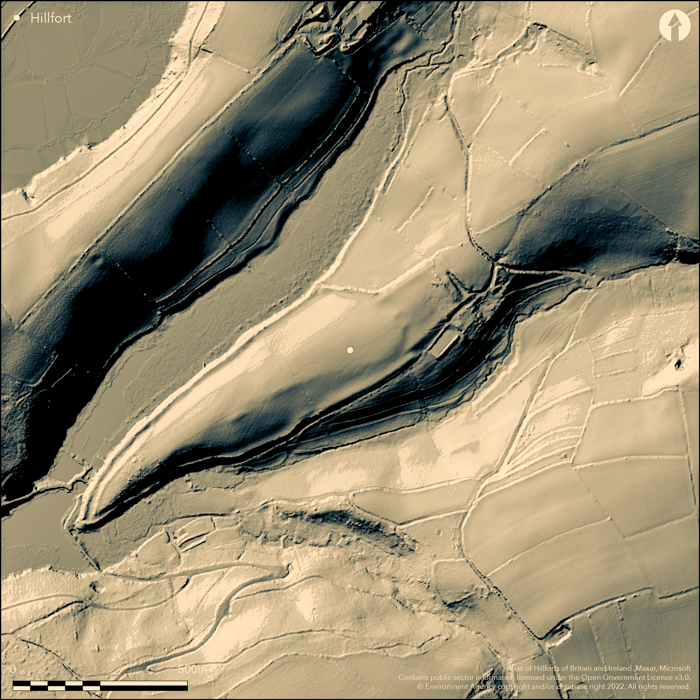
LiDAR 1m DTM Hillshade
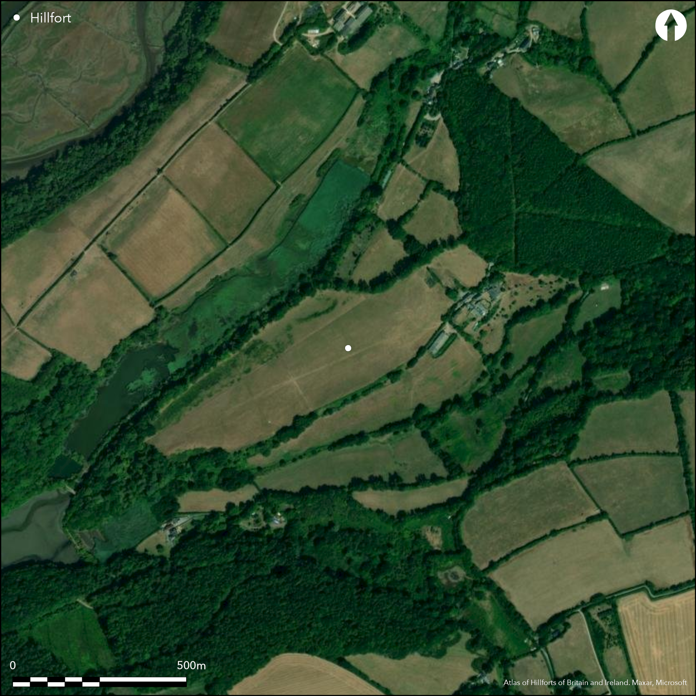
Satellite Imagery
LiDAR 1m DTM Hillshade
Satellite Imagery
Scroll left/right to view further images.
HER: Devon MDV4861 (None)
NMR: SX 64 NW 4 (441015)
SM: 1020234
NGR: SX63344934
X: 263340 Y: 49340 (OSGB36)
Possibly partial contour hillfort. Earth and stone walls cut off and/or surround SW-facing spur at confluence of two small streams where join short arm of River Erme. Appear to be two periods of construction. Firstly rectangular enclosure at NE end of spur, secondly much larger work occupying whole spur and incorporating all but SW side of smaller work in its circuit enclosing c. 13.0ha. Stone wall of larger site survives to c. 74.2m long by 3m wide and to 2.7m high. Excavation (Farley and Whittle 1968) found a Samian sherd suggesting the early feature may be Roman fort or signal station and has been suggested that later feature may be fortified port or possibly fortified manor house. However, although this has been disputed, it seems agreed that the full enclosure was indeed later that the smaller. The exact nature of the site seems open to question, and it is possible that there was some type of earlier enclosure of maybe late Iron Age or Romano-British date on the site in Phase I. Phase II much later and AMS dating of late Saxon for extant stonework (Rainbird and Druce 2004, 177-80). Earliest evidence of stone secular building in England is palace site at Northampton (late 8th/early 9th century), and not until c. 10th century that stone again used in defensive works. By analogy, has been suggested that site appears to be a burh of the reign of Aethelraed II. Some stonework survives. Improved pasture. On 1st Ed. OS map (1887).
Citizen Science: ✗
Reliability of Data: Confirmed
Reliability of Interpretation: Unconfirmed
X: -436527 Y: 6503280 (EPSG: 3857)
Longitude: -3.9213922062458555 Latitude: 50.32803073810355 (EPSG:4326)
Country: England; None
Current County or Unitary Authority: Devon
Historic County: Devon
Current Parish/Community/Council/Townland: Modbury; Kingstone
Some stonework remains in good condition. .
| Extant | ✓ |
| Cropmark | ✗ |
| Likely Destroyed | ✗ |
Improved pasture.
| Woodland | ✗ |
| Commercial Forestry Plantation | ✗ |
| Parkland | ✗ |
| Pasture (Grazing) | ✓ |
| Arable | ✗ |
| Scrub/Bracken | ✗ |
| Bare Outcrop | ✗ |
| Heather/Moorland | ✗ |
| Heath | ✗ |
| Built-up | ✗ |
| Coastal Grassland | ✗ |
| Other | ✗ |
Possibly partial contour hillfort. Earth and stone walls cut off and/or surround SW-facing spur at confluence of two small streams where join short arm of River Erme.
| Contour Fort | ✗ |
| Partial Contour Fort | ✓ |
| Promontory Fort | ✗ |
| Hillslope Fort | ✗ |
| Level Terrain Fort | ✗ |
| Marsh Fort | ✗ |
| Multiple Enclosure Fort | ✗ |
| Hilltop | ✗ |
| Coastal Promontory | ✗ |
| Inland Promontory | ✗ |
| Valley Bottom | ✗ |
| Knoll/Hillock/Outcrop | ✗ |
| Ridge | ✗ |
| Cliff/Plateau-edge/Scarp | ✗ |
| Hillslope | ✗ |
| Lowland | ✗ |
| Spur | ✓ |
Dominant Topographic Feature: Spur
| North | ✗ |
| Northeast | ✗ |
| East | ✗ |
| Southeast | ✗ |
| South | ✗ |
| Southwest | ✗ |
| West | ✗ |
| Northwest | ✗ |
| Level | ✓ |
Altitude: 30.0m
Boundary Type: Parish/Townland
AMS dating of late Saxon for extant stonework (calibrated dates of AD 873-AD 1020). Possible Romano-British activity on the promontory in Phase I, although appears no direct evidence for this.
Reliability: D - None
| Pre 1200BC | ✗ |
| 1200BC - 800BC | ✗ |
| 800BC - 400BC | ✗ |
| 400BC - AD50 | ✗ |
| AD50 - AD400 | ✗ |
| AD400 - AD 800 | ✗ |
| Post AD800 | ✗ |
| Unknown | ✓ |
| Pre Hillfort: | None |
| Post Hillfort: | Samian pottery found. |
| Artefactual: | Samian pottery. |
| C14: | AMS dating. |
On 1st Ed. OS map (1887). Excavation E.M. Jope and R.I. Threlfall 1938. Evaluation E. Farley and R.I. Little 1968. Geophysical survey 1990. AMS dating 2004. Measured survey AC Archaeology 2015.
| 1st Identified Map Depiction (1887): | OS map. |
| Excavation (1938): | E.M. Jope and R.I. Threlfall. |
| Other (1968): | Evaluation E. Farley and R.I. Little. |
| Geophysical Survey (1990): | To test hypothesis that fourth wall at the head of spur to create a small primary fort of possible Roman date. To attempt to locate positions of two towers noted by antiquaries and marked on the earliest Ordnance Survey 1:2500 sheet 1887 as "site of" towers. To increase available data about the site. |
| Other (2004): | AMS dating. |
| Other (2015): | Measured survey AC Archaeology. |
Samian sherd found in 1968 evaluation.
None
| None | ✓ |
| Spring | ✗ |
| Stream | ✗ |
| Pool | ✗ |
| Flush | ✗ |
| Well | ✗ |
| Other | ✗ |
None
| No Known Features | ✓ |
| Round Stone Structures | ✗ |
| Rectangular Stone Structures | ✗ |
| Curvilinear Platforms | ✗ |
| Other Roundhouse Evidence | ✗ |
| Pits | ✗ |
| Quarry Hollows | ✗ |
| Other | ✗ |
No details.
| No Known Excavation | ✗ |
| Pits | ✗ |
| Postholes | ✗ |
| Roundhouses | ✗ |
| Rectangular Structures | ✗ |
| Roads/Tracks | ✗ |
| Quarry Hollows | ✗ |
| Other | ✓ |
| Nothing Found | ✗ |
No details.
| No Known Geophysics | ✗ |
| Pits | ✗ |
| Roundhouses | ✗ |
| Rectangular Structures | ✗ |
| Roads/Tracks | ✗ |
| Quarry Hollows | ✗ |
| Other | ✓ |
| Nothing Found | ✗ |
Samian sherd found in 1968 evaluation.
| No Known Finds | ✗ |
| Pottery | ✓ |
| Metal | ✗ |
| Metalworking | ✗ |
| Human Bones | ✗ |
| Animal Bones | ✗ |
| Lithics | ✗ |
| Environmental | ✗ |
| Other | ✗ |
None
| APs Not Checked | ✓ |
| None | ✗ |
| Roundhouses | ✗ |
| Rectangular Structures | ✗ |
| Pits | ✗ |
| Postholes | ✗ |
| Roads/Tracks | ✗ |
| Other | ✗ |
No details.
| 0: | None |
| 2: | None |
Guard Chambers: ✗
Chevaux de Frise: ✗
Stone wall survives 74.2m long by 3m wide and to 2.7m high.
| Area 1: | 13.0ha. |
| Total: | 13.0ha. |
Total Footprint Area: Noneha.
None
| ✓ | Possibly two phases to site. First possibly Romano-British, second Roman or medieval. |
| ✗ | Quadrants estimated. Possibly univallate. |
| NE Quadrant: | 1 |
| SE Quadrant: | 1 |
| SW Quadrant: | 0 |
| NW Quadrant: | 1 |
| Total: | 1 |
| Partial Univallate | ✓ |
| Univallate | ✗ |
| Partial Bivallate | ✗ |
| Bivallate | ✗ |
| Partial Multivallate | ✗ |
| Multivallate | ✗ |
| Unknown | ✗ |
| Partial Univallate | ✗ |
| Univallate | ✓ |
| Partial Bivallate | ✗ |
| Bivallate | ✗ |
| Partial Multivallate | ✗ |
| Multivallate | ✗ |
Earth and stone walls. Revetted.
| None | ✗ |
| Earthen Bank | ✓ |
| Stone Wall | ✗ |
| Rubble | ✗ |
| Wall-walk | ✗ |
| Evidence of Timber | ✗ |
| Vitrification | ✗ |
| Other Burning | ✗ |
| Palisade | ✗ |
| Counter Scarp Bank | ✗ |
| Berm | ✗ |
| Unfinished | ✗ |
| Other | ✗ |
None
| None | ✓ |
| Earthen Bank | ✗ |
| Stone Wall | ✗ |
| Murus Duplex | ✗ |
| Timber-framed | ✗ |
| Timber-laced | ✗ |
| Vitrification | ✗ |
| Other Burning | ✗ |
| Palisade | ✗ |
| Counter Scarp Bank | ✗ |
| Berm | ✗ |
| Unfinished | ✗ |
| No Known Excavation | ✗ |
| Other | ✗ |
| ✗ | None |
| ✗ | None |
Number of Ditches: 0
| ✗ | None |
Anon 1846. Gentleman's Magazine, 26, 517.
Farley, M.E. and Whittle, R.I. 1968. Oldaport, Modbury, Proc Devon Archaeol Soc, 26, 31-6.
Jope, E.M. and Threlfall, R.I. 1942. The fort at Oldaport, Ant J, 22, 65-8.
Rainbird, P. 2015. Oldaport Camp, Modbury, Devon, (NGR SX 63515 49445), Report on Conservation Works and Additional Archaeological Survey, AC Archaeology Report No ACD1130/1/0.
Rainbird, P. and Druce, D. 2004. A Late Saxon Date from Oldaport, 177-180.
Welsby, D.A. 1982. Roman Military Defences, BAR 101, 155.
Atlas of Hillforts:
Wikidata:
This work is licensed under CC BY-SA 4.0

 and should be cited as:
Lock, Gary and Ralston, Ian. 2024. Atlas of Hillforts of Britain and Ireland. Available at: https://hillforts.arch.ox.ac.uk
Document Version 1.1