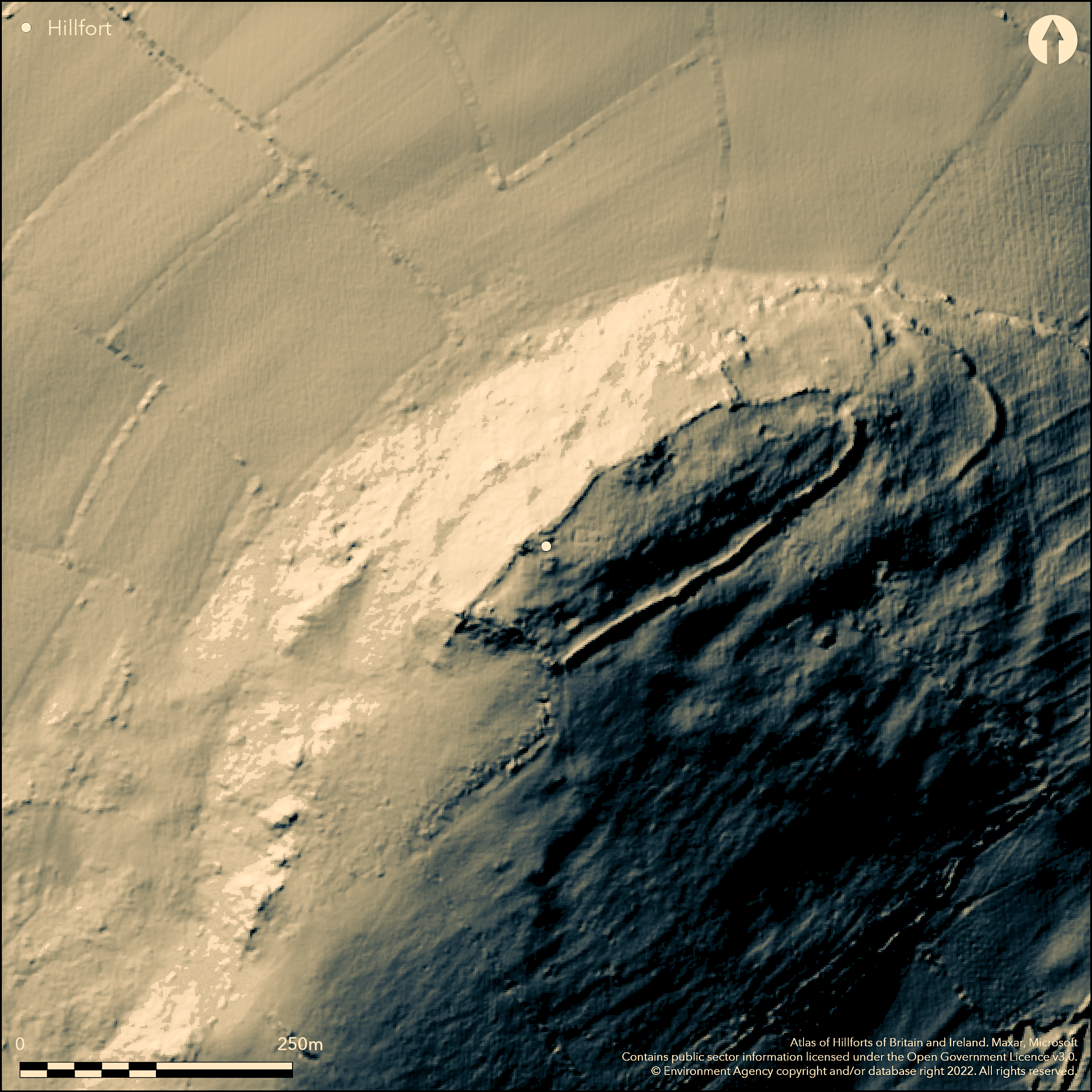
LiDAR 1m DTM Hillshade
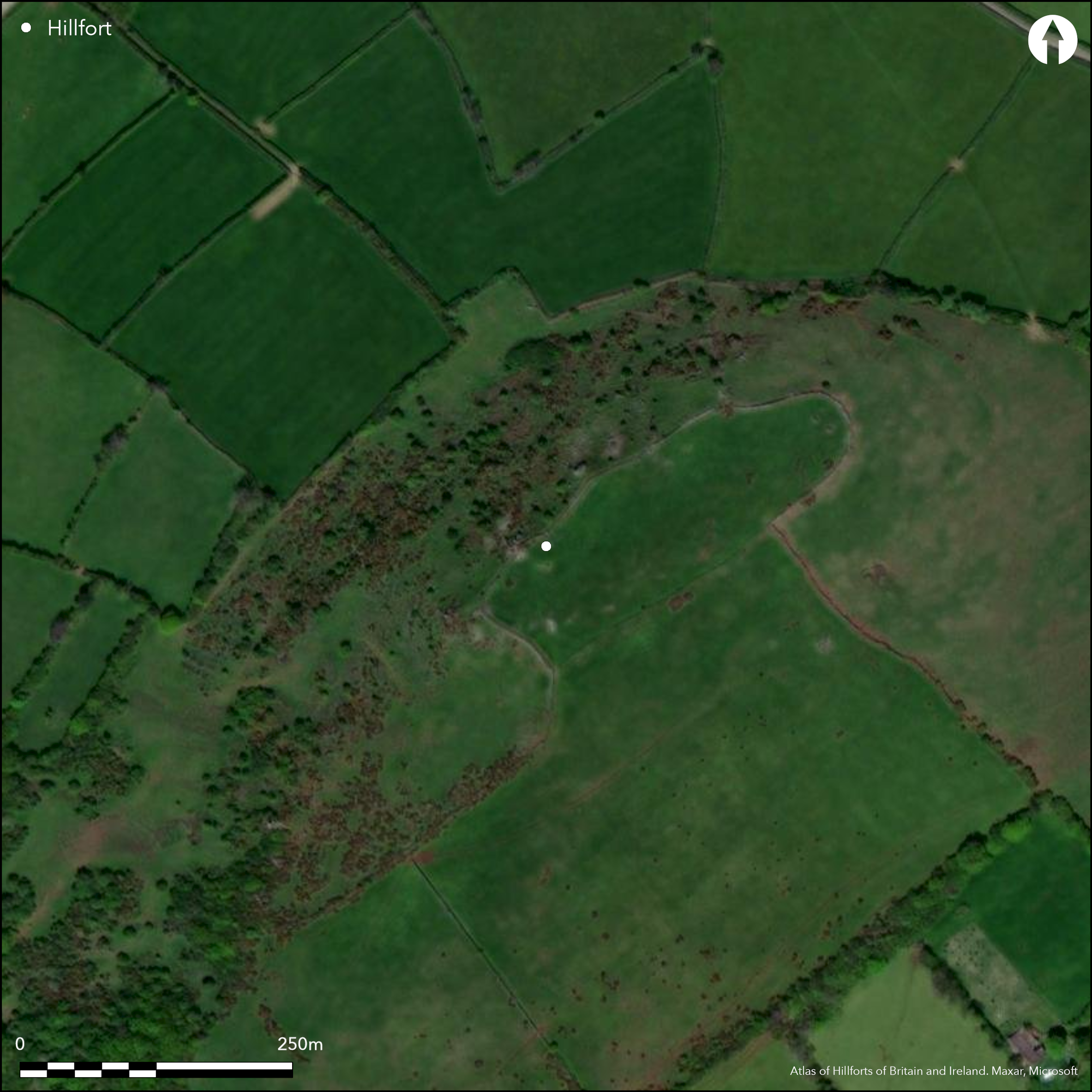
Satellite Imagery
LiDAR 1m DTM Hillshade
Satellite Imagery
Scroll left/right to view further images.
HER: Devon MDV7957 (None)
NMR: SX 76 SW (None)
SM: 1002662
NGR: SX703617
X: 270321 Y: 61703 (OSGB36)
Contour hillfort located in strong defensive position on summit of prominent Brent Hill in Dartmoor National Park. Very steep rocky slopes to NW, steep on SE, less to NE. Irregular shaped with bank, reaching c. 9m wide on S, ditch and natural slopes form almost complete circuit of hill top, but modern field wall overlies it for almost entire circuit and SW less defined. Defined by scarped bank on SE, with possibly inner slope to this bank, but disturbed by this modern field boundary making interpretation uncertain. On NE, where approach easiest, is an outer bank at much lower level, suggesting annexe rather than true outer rampart. Bank fades where reaches steeper ground to SE and NW. Possible additional ramparts to E and S. Definite original entrance on NE with outworks. Apparent gateway into outer earthwork comprising inclined road or ramp through gap at NW terminal of earthwork. Within the gap, two cross-walks suggestive of gatehouse. Three possible hut circles 8m-11m diameter and later 'Brent Beacon' in interior. Improved pasture. Not on OS mapping, Minimal investigations, undated.
Citizen Science: ✗
Reliability of Data: Confirmed
Reliability of Interpretation: Confirmed
X: -426090 Y: 6522957 (EPSG: 3857)
Longitude: -3.8276335470422924 Latitude: 50.44073832093966 (EPSG:4326)
Country: England
Current County or Unitary Authority: Devon
Historic County: Devon
Current Parish/Community/Council/Townland: South Brent
Banks overlain for most of circuit by modern field boundary.
| Extant | ✓ |
| Cropmark | ✗ |
| Likely Destroyed | ✗ |
Improved pasture. Possible watchman's house.
| Woodland | ✗ |
| Commercial Forestry Plantation | ✗ |
| Parkland | ✗ |
| Pasture (Grazing) | ✓ |
| Arable | ✗ |
| Scrub/Bracken | ✗ |
| Bare Outcrop | ✗ |
| Heather/Moorland | ✗ |
| Heath | ✗ |
| Built-up | ✗ |
| Coastal Grassland | ✗ |
| Other | ✓ |
Possible contour hillfort located in strong defensive position on summit of prominent Brent Hill in Dartmoor National Park. Very steep rocky slopes to NW, steep on SE, less to NE.
| Contour Fort | ✓ |
| Partial Contour Fort | ✗ |
| Promontory Fort | ✗ |
| Hillslope Fort | ✗ |
| Level Terrain Fort | ✗ |
| Marsh Fort | ✗ |
| Multiple Enclosure Fort | ✗ |
| Hilltop | ✓ |
| Coastal Promontory | ✗ |
| Inland Promontory | ✗ |
| Valley Bottom | ✗ |
| Knoll/Hillock/Outcrop | ✗ |
| Ridge | ✗ |
| Cliff/Plateau-edge/Scarp | ✗ |
| Hillslope | ✗ |
| Lowland | ✗ |
| Spur | ✗ |
Dominant Topographic Feature: Hill top
| North | ✗ |
| Northeast | ✗ |
| East | ✗ |
| Southeast | ✗ |
| South | ✗ |
| Southwest | ✗ |
| West | ✗ |
| Northwest | ✗ |
| Level | ✓ |
Altitude: 310.0m
N/A
None.
Reliability: D - None
| Pre 1200BC | ✗ |
| 1200BC - 800BC | ✗ |
| 800BC - 400BC | ✗ |
| 400BC - AD50 | ✗ |
| AD50 - AD400 | ✗ |
| AD400 - AD 800 | ✗ |
| Post AD800 | ✗ |
| Unknown | ✓ |
| Pre Hillfort: | None |
| Post Hillfort: | Summit of the hill well documented beacon site and named ÇBrent Beacon on Ogilbys map of 1675, Donns Map and Carys map. Dartington churchwardens accounts of 1591, 1628 and 1690 list parish contributions for upkeep of beacon and 1591 entry includes items paid for the construction of a house for the watchman. Rectangular structure visible on site often interpreted as this house. |
Various field visits 1970's and 1980's.
| Other (None): | Various field visits. |
Three possible hut circles 8m-11m diameter.
None
| None | ✓ |
| Spring | ✗ |
| Stream | ✗ |
| Pool | ✗ |
| Flush | ✗ |
| Well | ✗ |
| Other | ✗ |
Three possible hut circles 8m-11m diameter.
| No Known Features | ✗ |
| Round Stone Structures | ✗ |
| Rectangular Stone Structures | ✗ |
| Curvilinear Platforms | ✗ |
| Other Roundhouse Evidence | ✓ |
| Pits | ✗ |
| Quarry Hollows | ✗ |
| Other | ✗ |
None
| No Known Excavation | ✓ |
| Pits | ✗ |
| Postholes | ✗ |
| Roundhouses | ✗ |
| Rectangular Structures | ✗ |
| Roads/Tracks | ✗ |
| Quarry Hollows | ✗ |
| Other | ✗ |
| Nothing Found | ✗ |
None
| No Known Geophysics | ✓ |
| Pits | ✗ |
| Roundhouses | ✗ |
| Rectangular Structures | ✗ |
| Roads/Tracks | ✗ |
| Quarry Hollows | ✗ |
| Other | ✗ |
| Nothing Found | ✗ |
None
| No Known Finds | ✓ |
| Pottery | ✗ |
| Metal | ✗ |
| Metalworking | ✗ |
| Human Bones | ✗ |
| Animal Bones | ✗ |
| Lithics | ✗ |
| Environmental | ✗ |
| Other | ✗ |
None
| APs Not Checked | ✓ |
| None | ✗ |
| Roundhouses | ✗ |
| Rectangular Structures | ✗ |
| Pits | ✗ |
| Postholes | ✗ |
| Roads/Tracks | ✗ |
| Other | ✗ |
Original entrance on NE where the outwork adds additional protection. Apparent gateway into outer earthwork comprising inclined road or ramp through gap at NW terminal of earthwork. Within the gap, two cross-walks suggestive of gatehouse.
| 1: | None |
| 2: | Apparent gateway into outer earthwork comprising inclined road or ramp through gap at NW terminal of earthwork. Within the gap, two cross-walks suggestive of gatehouse. |
Guard Chambers: ✓
Chevaux de Frise: ✗
| 1. Outworks (North east): | None |
| 2. Simple Gap (North west): | Apparent gateway into outer earthwork comprising inclined road or ramp through gap at NW terminal of earthwork. |
| 2. Recesses/Guard Chambers (North west): | Within the gap, two cross-walks suggestive of gatehouse. |
Irregular shaped with bank, reaching c. 9m wide on S, ditch and natural slopes form almost complete circuit of hill top, but modern field wall overlies it for almost entire circuit and SW less defined. Defined by scarped bank on SE, with possibly inner slope to this bank, but disturbed by this modern field boundary making interpretation uncertain. On NE, where approach easiest, is an outer bank at much lower level, suggesting annexe rather than true outer defence. Bank fades where reaches steeper ground to SE and NW. Possible additional defences to E and S.
| Area 1: | 1.7ha. |
| Total: | 1.7ha. |
Total Footprint Area: Noneha.
None
| ✗ | Area calculated from modern field bank on wall.. |
| ✓ | On NE, where approach easiest, is an outer bank at much lower level, suggesting annexe rather than true outer rampart. |
| NE Quadrant: | 1 |
| SE Quadrant: | 1 |
| SW Quadrant: | 1 |
| NW Quadrant: | 1 |
| Total: | 1 |
| Partial Univallate | ✗ |
| Univallate | ✓ |
| Partial Bivallate | ✗ |
| Bivallate | ✗ |
| Partial Multivallate | ✗ |
| Multivallate | ✗ |
| Unknown | ✗ |
| Partial Univallate | ✗ |
| Univallate | ✗ |
| Partial Bivallate | ✗ |
| Bivallate | ✗ |
| Partial Multivallate | ✗ |
| Multivallate | ✗ |
None
| None | ✗ |
| Earthen Bank | ✓ |
| Stone Wall | ✗ |
| Rubble | ✗ |
| Wall-walk | ✗ |
| Evidence of Timber | ✗ |
| Vitrification | ✗ |
| Other Burning | ✗ |
| Palisade | ✗ |
| Counter Scarp Bank | ✗ |
| Berm | ✗ |
| Unfinished | ✗ |
| Other | ✗ |
None
| None | ✗ |
| Earthen Bank | ✗ |
| Stone Wall | ✗ |
| Murus Duplex | ✗ |
| Timber-framed | ✗ |
| Timber-laced | ✗ |
| Vitrification | ✗ |
| Other Burning | ✗ |
| Palisade | ✗ |
| Counter Scarp Bank | ✗ |
| Berm | ✗ |
| Unfinished | ✗ |
| No Known Excavation | ✓ |
| Other | ✗ |
| ✗ | None |
| ✓ | Ditch part buried in places. |
Number of Ditches: 1
| ✓ | Possibly. On NE where approach easiest is an outer bank at much lower level, suggesting annexe rather than true outer defence. |
No related records
Atlas of Hillforts:
Wikidata:
This work is licensed under CC BY-SA 4.0

 and should be cited as:
Lock, Gary and Ralston, Ian. 2024. Atlas of Hillforts of Britain and Ireland. Available at: https://hillforts.arch.ox.ac.uk
Document Version 1.1