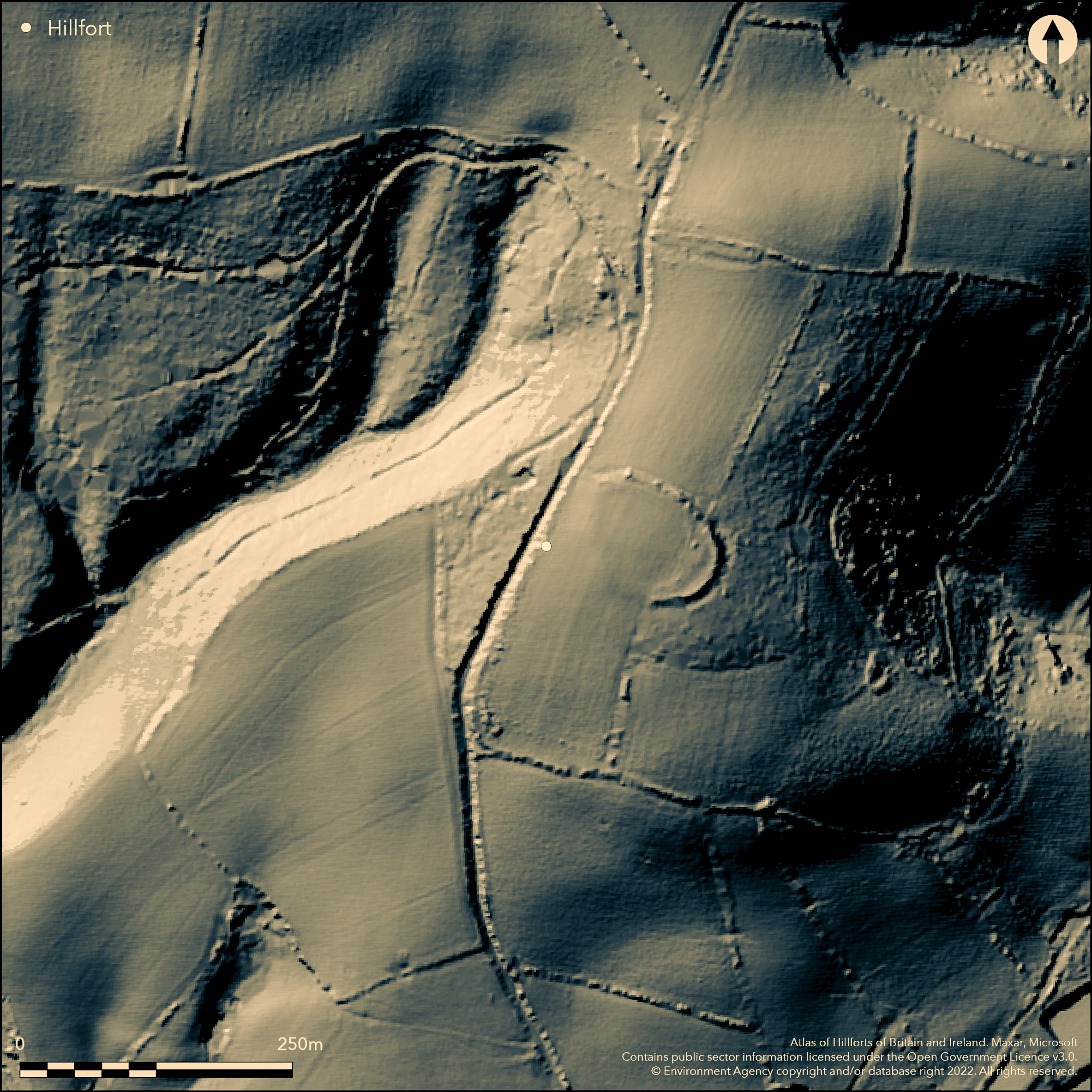
LiDAR 1m DTM Hillshade
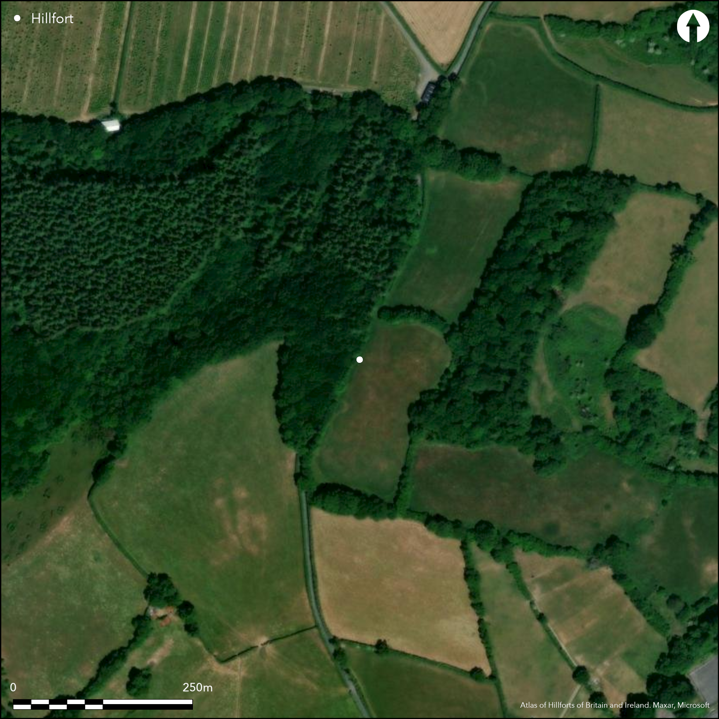
Satellite Imagery
LiDAR 1m DTM Hillshade
Satellite Imagery
Scroll left/right to view further images.
HER: Devon MDV8209 (None)
NMR: SX 77 SE (None)
SM: None
NGR: SX761713
X: 276100 Y: 71398 (OSGB36)
Very slight remains of possible, circular, contour hillfort located on Tower Hill, between Woodencliff Wood and Place Wood above River Yeo to W in two fields called Castle Parks in Dartmoor National Park. Good natural position. Site measures c. 91m long SE-NW by c. 69m wide enclosing c. 0.6ha. Traces of scarp from N to E and then S, in places to 4.5m wide and 1.25m high, but mostly ploughed-out and ditch likewise, latter, in part, showing as cropmark. Some slight change in slope follows line of 183m contour and this may indicate circuit. Mentioned in 'A Tour across Dartmoor into North Devon' by Rev. John Swete 1789. Arable interior. On 1st Ed. OS map (1880-99). Undated.
Citizen Science: ✗
Reliability of Data: Unconfirmed
Reliability of Interpretation: Unconfirmed
X: -417393 Y: 6538422 (EPSG: 3857)
Longitude: -3.749505319559196 Latitude: 50.5291364668625 (EPSG:4326)
Country: England
Current County or Unitary Authority: Devon
Historic County: Devon
Current Parish/Community/Council/Townland: Ashburton
Mostly ploughed-out and nearly gone. Just visible as slight undulations.
| Extant | ✓ |
| Cropmark | ✓ |
| Likely Destroyed | ✓ |
Arable interior.
| Woodland | ✗ |
| Commercial Forestry Plantation | ✗ |
| Parkland | ✗ |
| Pasture (Grazing) | ✗ |
| Arable | ✓ |
| Scrub/Bracken | ✗ |
| Bare Outcrop | ✗ |
| Heather/Moorland | ✗ |
| Heath | ✗ |
| Built-up | ✗ |
| Coastal Grassland | ✗ |
| Other | ✗ |
Very slight remains of possible, circular, contour hillfort located on Tower Hill, between Woodencliff Wood and Place Wood above River Yeo to W in two fields called Castle Parks in Dartmoor National Park.
| Contour Fort | ✓ |
| Partial Contour Fort | ✗ |
| Promontory Fort | ✗ |
| Hillslope Fort | ✗ |
| Level Terrain Fort | ✗ |
| Marsh Fort | ✗ |
| Multiple Enclosure Fort | ✗ |
| Hilltop | ✗ |
| Coastal Promontory | ✗ |
| Inland Promontory | ✗ |
| Valley Bottom | ✗ |
| Knoll/Hillock/Outcrop | ✗ |
| Ridge | ✗ |
| Cliff/Plateau-edge/Scarp | ✗ |
| Hillslope | ✗ |
| Lowland | ✗ |
| Spur | ✗ |
Dominant Topographic Feature: Hill top
| North | ✗ |
| Northeast | ✗ |
| East | ✗ |
| Southeast | ✗ |
| South | ✗ |
| Southwest | ✗ |
| West | ✗ |
| Northwest | ✗ |
| Level | ✓ |
Altitude: 187.0m
N/A
None.
Reliability: D - None
| Pre 1200BC | ✗ |
| 1200BC - 800BC | ✗ |
| 800BC - 400BC | ✗ |
| 400BC - AD50 | ✗ |
| AD50 - AD400 | ✗ |
| AD400 - AD 800 | ✗ |
| Post AD800 | ✗ |
| Unknown | ✓ |
| Pre Hillfort: | None |
| Post Hillfort: | None |
Mention in 'A Tour across Dartmoor into North Devon' by Rev. John Swete 1789. On 1st Ed. OS map (1880-99). Outline of NE and S sides shown on 19th century Tithe Map. Field Number 702, Higher Castle and Field Number 742, Lower Castle which were arable in 1839. Field visits 1951, 1995. Aerial photograph project RCHME 1985.
| 1st Identified Written Reference (1789): | Mention in 'A Tour across Dartmoor into North Devon' by Rev. John Swete |
| Other (1985): | Aerial photograph project RCHME. |
| Other (None): | OS map. |
| Other (None): | Field visits - no details. |
| 1st Identified Map Depiction (None): | Outline of NE and S sides shown on 19th century Tithe Map. Field Number 702, Higher Castle and Field Number 742, Lower Castle which were arable in 1839. |
Flints found after ploughing.
None
| None | ✓ |
| Spring | ✗ |
| Stream | ✗ |
| Pool | ✗ |
| Flush | ✗ |
| Well | ✗ |
| Other | ✗ |
None
| No Known Features | ✓ |
| Round Stone Structures | ✗ |
| Rectangular Stone Structures | ✗ |
| Curvilinear Platforms | ✗ |
| Other Roundhouse Evidence | ✗ |
| Pits | ✗ |
| Quarry Hollows | ✗ |
| Other | ✗ |
None
| No Known Excavation | ✓ |
| Pits | ✗ |
| Postholes | ✗ |
| Roundhouses | ✗ |
| Rectangular Structures | ✗ |
| Roads/Tracks | ✗ |
| Quarry Hollows | ✗ |
| Other | ✗ |
| Nothing Found | ✗ |
None
| No Known Geophysics | ✓ |
| Pits | ✗ |
| Roundhouses | ✗ |
| Rectangular Structures | ✗ |
| Roads/Tracks | ✗ |
| Quarry Hollows | ✗ |
| Other | ✗ |
| Nothing Found | ✗ |
Flints found after ploughing.
| No Known Finds | ✗ |
| Pottery | ✗ |
| Metal | ✗ |
| Metalworking | ✗ |
| Human Bones | ✗ |
| Animal Bones | ✗ |
| Lithics | ✓ |
| Environmental | ✗ |
| Other | ✗ |
None
| APs Not Checked | ✓ |
| None | ✗ |
| Roundhouses | ✗ |
| Rectangular Structures | ✗ |
| Pits | ✗ |
| Postholes | ✗ |
| Roads/Tracks | ✗ |
| Other | ✗ |
Not defined.
| 0: | None |
| 2: | None |
Guard Chambers: ✗
Chevaux de Frise: ✗
Traces of scarp from N to E and then S, in places to 4.5m wide and 1.25m high, but mostly ploughed out and ditch likewise, latter, in part, showing as cropmark. Some slight change in slope follows line of 183m contour and this may indicate circuit.
| Area 1: | 0.6ha. |
| Total: | 0.6ha. |
Total Footprint Area: Noneha.
None
| ✗ | None |
| ✗ | None |
| NE Quadrant: | 1 |
| SE Quadrant: | 1 |
| SW Quadrant: | 0 |
| NW Quadrant: | 0 |
| Total: | 1 |
| Partial Univallate | ✓ |
| Univallate | ✗ |
| Partial Bivallate | ✗ |
| Bivallate | ✗ |
| Partial Multivallate | ✗ |
| Multivallate | ✗ |
| Unknown | ✗ |
| Partial Univallate | ✗ |
| Univallate | ✗ |
| Partial Bivallate | ✗ |
| Bivallate | ✗ |
| Partial Multivallate | ✗ |
| Multivallate | ✗ |
None
| None | ✗ |
| Earthen Bank | ✓ |
| Stone Wall | ✗ |
| Rubble | ✗ |
| Wall-walk | ✗ |
| Evidence of Timber | ✗ |
| Vitrification | ✗ |
| Other Burning | ✗ |
| Palisade | ✗ |
| Counter Scarp Bank | ✗ |
| Berm | ✗ |
| Unfinished | ✗ |
| Other | ✗ |
None
| None | ✗ |
| Earthen Bank | ✗ |
| Stone Wall | ✗ |
| Murus Duplex | ✗ |
| Timber-framed | ✗ |
| Timber-laced | ✗ |
| Vitrification | ✗ |
| Other Burning | ✗ |
| Palisade | ✗ |
| Counter Scarp Bank | ✗ |
| Berm | ✗ |
| Unfinished | ✗ |
| No Known Excavation | ✓ |
| Other | ✗ |
| ✗ | None |
| ✓ | Ditch either not visible or shows as cropmark. |
Number of Ditches: 1
| ✗ | None |
Amery, J.S.1924. Presidential Address: Ashburton of Past Days. Trans Devonshire Assoc, 56, 44.
Amery, P.F.S. 1900 - 1901. A Tour across Dartmoor into North Devon by the Rev. John Swete 1789, Devon and Cornwall Notes and Queries, 1, page unknown.
Devon County Council, 1838-1848, Tithe Mosaic, approximately 1838-1848 (Cartographic).
Pilkington-Rogers, C.W. 1932. The Date of the Dartmoor Antiquities, Trans Devonshire Assoc, 64. 385.
Wall, J.C. 1906. Ancient Earthworks, In ed W. Page, The Victoria County History of the County of Devon, Vol I, 602, London: James Street, Haymarket.
Atlas of Hillforts:
Wikidata:
This work is licensed under CC BY-SA 4.0

 and should be cited as:
Lock, Gary and Ralston, Ian. 2024. Atlas of Hillforts of Britain and Ireland. Available at: https://hillforts.arch.ox.ac.uk
Document Version 1.1