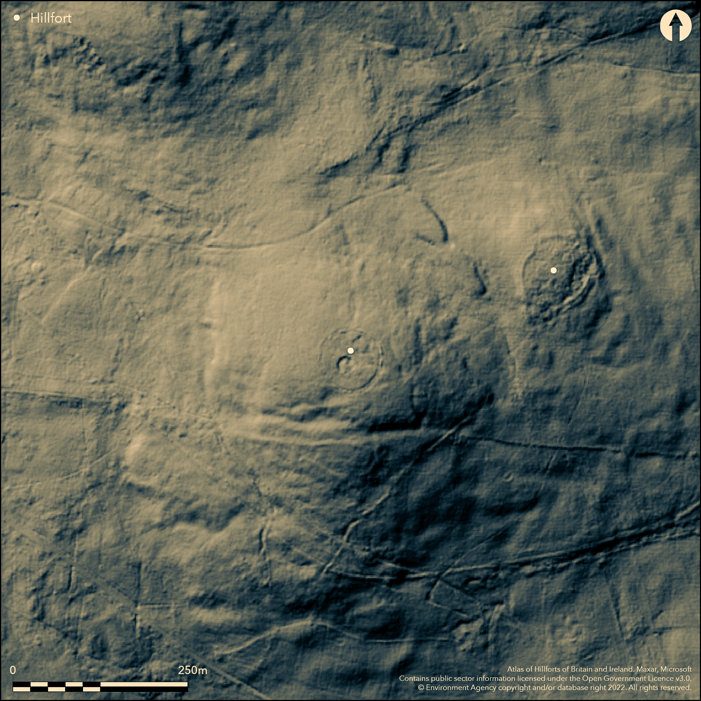
LiDAR 1m DTM Hillshade
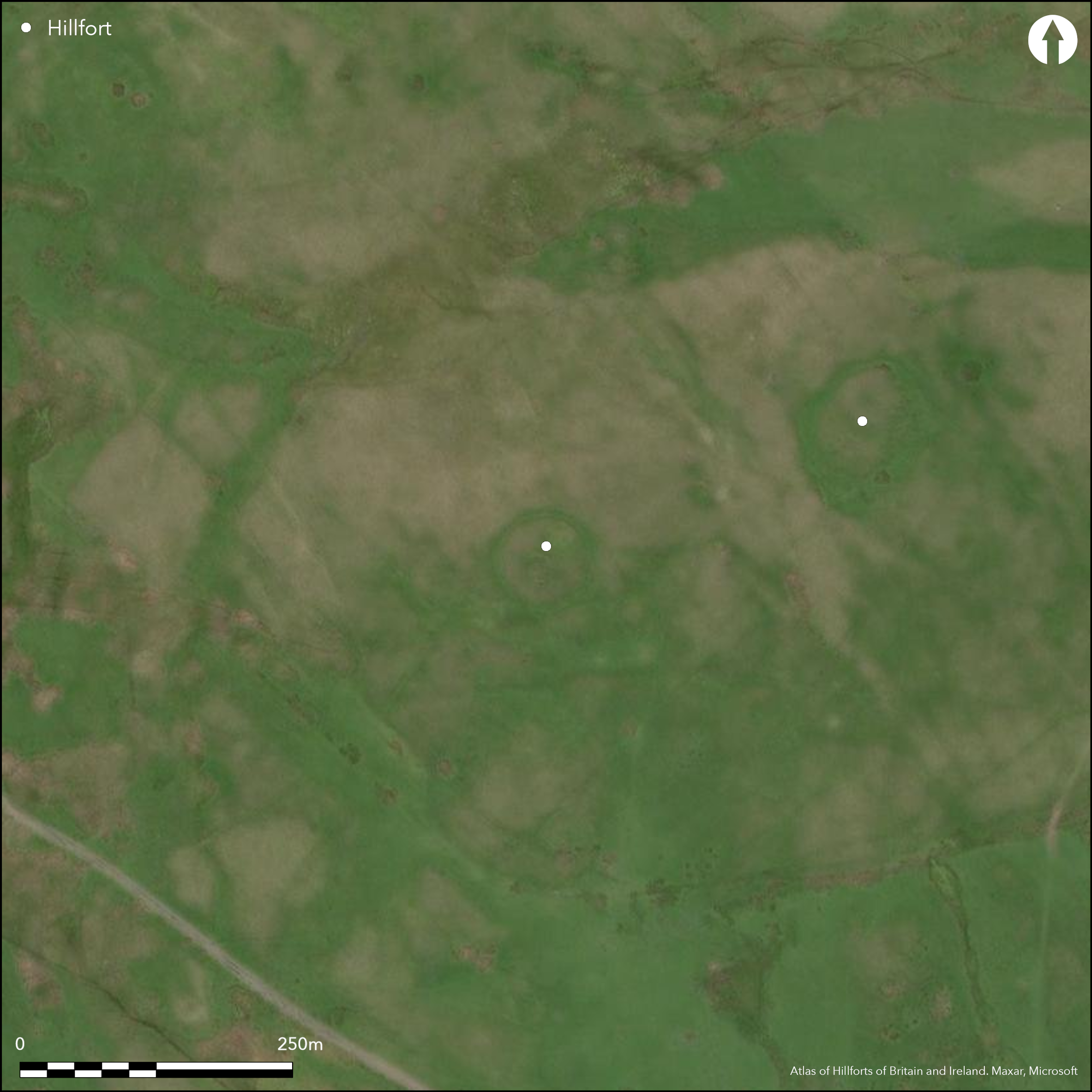
Satellite Imagery
LiDAR 1m DTM Hillshade
Satellite Imagery
Scroll left/right to view further images.
HER: Northumberland 1340 (None)
NMR: NT 91 SE 11 (2272)
SM: 1020254
NGR: NT 9707 1244
X: 397070 Y: 612440 (OSGB36)
Occupying the summit of a SW shoulder of High Knowes at 366m OD, a palisaded enclosure visible on the surface as two closely spaced palisade trenches. It lies approximately below the summit of High Knowes and offers extensive views to the NE and E. The enclosure is formed from two circular concentric trenches spaced 3m apart and 45m in diameter, enclosing 0.17ha. The inner survives as a maximum width of 1.2m and depth of 0.3m, the outer 1m wide and 0.3m deep. Upcast from the trenches has created a 2m wide and 0.4m high medial bank. Oswald et. al. (2006, 51) suggests that rather than palisade trenches the grooves could represent the remains of hollow box ramparts. An entrance, now 4m wide lies in the E. Partial excavation of this in 1962-3 by Newcastle University (Jobey and Tait 1966) showed the original entrance was 2m wide with a posthole at the terminal end of each trench. Shallow depressions either side of the passageway were interpreted as containing wooden hurdles to secure the entrance with that in the S set slightly back, possibly for a gate. Internally, two large ring-ditches, and two smaller ring-grooves between 4-12m in diameter represent the remains of four hut circles. Excavation showed these were constructed from timber uprights placed directly into foundation slots with rings of roof support posts. No finds were recovered during the excavation. The site it located 275m to the SW of a further palisaded enclosure, High Knowes B (Atlas No 4343) and in an area of cairnfields and field systems. A prominent linear boundary, interpreted as the boundary bank of a prehistoric farm unit encloses approximately 38.5ha around High Knowes containing the two palisaded settlements and what are considered to be associated field system. Recorded on 1863 1:2,500 OS mapping. Scheduled as a settlement. Undated.
Citizen Science: ✗
Reliability of Data: Confirmed
Reliability of Interpretation: Unconfirmed
X: -227962 Y: 7441048 (EPSG: 3857)
Longitude: -2.04781625729262 Latitude: 55.40591694288354 (EPSG:4326)
Country: England
Current County or Unitary Authority: Northumberland
Historic County: Northumberland
Current Parish/Community/Council/Townland: Alnham
Survives as two concentric trenches
| Extant | ✓ |
| Cropmark | ✗ |
| Likely Destroyed | ✗ |
Grass moorland
| Woodland | ✗ |
| Commercial Forestry Plantation | ✗ |
| Parkland | ✗ |
| Pasture (Grazing) | ✗ |
| Arable | ✗ |
| Scrub/Bracken | ✗ |
| Bare Outcrop | ✗ |
| Heather/Moorland | ✓ |
| Heath | ✗ |
| Built-up | ✗ |
| Coastal Grassland | ✗ |
| Other | ✗ |
A palisaded enclosure occupying the summit of a SW shoulder of High Knowes at 366m OD
| Contour Fort | ✓ |
| Partial Contour Fort | ✗ |
| Promontory Fort | ✗ |
| Hillslope Fort | ✗ |
| Level Terrain Fort | ✗ |
| Marsh Fort | ✗ |
| Multiple Enclosure Fort | ✗ |
| Hilltop | ✓ |
| Coastal Promontory | ✗ |
| Inland Promontory | ✗ |
| Valley Bottom | ✗ |
| Knoll/Hillock/Outcrop | ✗ |
| Ridge | ✗ |
| Cliff/Plateau-edge/Scarp | ✗ |
| Hillslope | ✗ |
| Lowland | ✗ |
| Spur | ✗ |
Dominant Topographic Feature: Shoulder of High Knowes
| North | ✗ |
| Northeast | ✗ |
| East | ✗ |
| Southeast | ✗ |
| South | ✓ |
| Southwest | ✗ |
| West | ✗ |
| Northwest | ✗ |
| Level | ✗ |
Altitude: 366.0m
N/A
The site is undated
Reliability: D - None
| Pre 1200BC | ✗ |
| 1200BC - 800BC | ✗ |
| 800BC - 400BC | ✗ |
| 400BC - AD50 | ✗ |
| AD50 - AD400 | ✗ |
| AD400 - AD 800 | ✗ |
| Post AD800 | ✗ |
| Unknown | ✓ |
| Pre Hillfort: | None |
| Post Hillfort: | None |
Recorded on 1863 1:2,500 OS mapping. Ecavated in 1962-3. Field investigation in 1969. Scheduled as a settlement in 1987.1988 Peter Topping/16-MAY-1988/RCHME: SE Cheviots Project
| 1st Identified Map Depiction (1863): | None |
| 1st Identified Written Reference (1966): | None |
| Other (1969): | Field Investigation |
| Other (1987): | Scheduled |
| Other (1988): | SE Cheviots project |
| Excavation (None): | None |
Remains of four timber round-houses
None
| None | ✓ |
| Spring | ✗ |
| Stream | ✗ |
| Pool | ✗ |
| Flush | ✗ |
| Well | ✗ |
| Other | ✗ |
Ring-ditch houses
| No Known Features | ✓ |
| Round Stone Structures | ✗ |
| Rectangular Stone Structures | ✗ |
| Curvilinear Platforms | ✗ |
| Other Roundhouse Evidence | ✓ |
| Pits | ✗ |
| Quarry Hollows | ✗ |
| Other | ✗ |
None
| No Known Excavation | ✗ |
| Pits | ✗ |
| Postholes | ✗ |
| Roundhouses | ✓ |
| Rectangular Structures | ✗ |
| Roads/Tracks | ✗ |
| Quarry Hollows | ✗ |
| Other | ✗ |
| Nothing Found | ✗ |
None
| No Known Geophysics | ✓ |
| Pits | ✗ |
| Roundhouses | ✗ |
| Rectangular Structures | ✗ |
| Roads/Tracks | ✗ |
| Quarry Hollows | ✗ |
| Other | ✗ |
| Nothing Found | ✗ |
None
| No Known Finds | ✓ |
| Pottery | ✗ |
| Metal | ✗ |
| Metalworking | ✗ |
| Human Bones | ✗ |
| Animal Bones | ✗ |
| Lithics | ✗ |
| Environmental | ✗ |
| Other | ✗ |
None
| APs Not Checked | ✗ |
| None | ✗ |
| Roundhouses | ✓ |
| Rectangular Structures | ✗ |
| Pits | ✗ |
| Postholes | ✗ |
| Roads/Tracks | ✗ |
| Other | ✗ |
Entrance, now 4m wide lies in the E. Partial excavation in 1962-3 (Jobey and Tait 1966) showed the original entrance was 2m wide with a posthole at the terminal end of each trench. Shallow depressions either side of the passageway were interpreted as containing wooden hurdles to secure the entrance with that in the S set slightly back, possibly for a gate.
| 1: | None |
| 2: | None |
Guard Chambers: ✗
Chevaux de Frise: ✗
| 1. Simple Gap (East): | None |
Two circular concentric shallow trenches spaced 3m apart and 45m in diameter, enclosing 0.17ha. The inner trench has a maximum width of 1.2m and depth of 0.3m, the outer trench 1m wide and 0.3m deep. Upcast from the trenches has created a 2m wide and 0.4m high medial bank. Oswald (2002, 51) suggests that rather than palisade trenches the grooves could represent the remains of hollow box ramparts.
| Area 1: | 0.17ha. |
| Total: | 0.17ha. |
Total Footprint Area: 0.23ha.
None
| ✗ | Whole site footprint measured from satellite imagery |
| ✓ | Palisade trenches |
| NE Quadrant: | 2 |
| SE Quadrant: | 2 |
| SW Quadrant: | 2 |
| NW Quadrant: | 2 |
| Total: | 2 |
| Partial Univallate | ✗ |
| Univallate | ✗ |
| Partial Bivallate | ✗ |
| Bivallate | ✓ |
| Partial Multivallate | ✗ |
| Multivallate | ✗ |
| Unknown | ✗ |
| Partial Univallate | ✗ |
| Univallate | ✗ |
| Partial Bivallate | ✗ |
| Bivallate | ✗ |
| Partial Multivallate | ✗ |
| Multivallate | ✗ |
None
| None | ✗ |
| Earthen Bank | ✗ |
| Stone Wall | ✗ |
| Rubble | ✗ |
| Wall-walk | ✗ |
| Evidence of Timber | ✗ |
| Vitrification | ✗ |
| Other Burning | ✗ |
| Palisade | ✓ |
| Counter Scarp Bank | ✗ |
| Berm | ✗ |
| Unfinished | ✗ |
| Other | ✗ |
None
| None | ✗ |
| Earthen Bank | ✗ |
| Stone Wall | ✗ |
| Murus Duplex | ✗ |
| Timber-framed | ✗ |
| Timber-laced | ✗ |
| Vitrification | ✗ |
| Other Burning | ✗ |
| Palisade | ✓ |
| Counter Scarp Bank | ✗ |
| Berm | ✗ |
| Unfinished | ✗ |
| No Known Excavation | ✗ |
| Other | ✗ |
| ✗ | None |
| ✗ | Palisade trenches |
Number of Ditches: 0
| ✗ | None |
Jobey, G and Tait, J 1966 Excavations on palisaded settlements and cairnfields at Alnham, Northumberland Archaeol Aeliana 4th series, 44, 5-48.
Oswald, A. Ainsworth, S. and Pearson, T. 2006 Hillforts: Prehistoric Strongholds of Northumberland National Park. English Heritage
Topping, P. and Pearson, T. 1988. The South-East Cheviots Project: A Descriptive Account of the Prehistoric Landscape. Research Department Report Series no. 83-2003. https://www.academia.edu/17310729/-2008-The-South-East-Cheviots-Project-a-descriptive-account-of-the-prehistoric-landscape. Accessed May 2016
Atlas of Hillforts:
Wikidata:
This work is licensed under CC BY-SA 4.0

 and should be cited as:
Lock, Gary and Ralston, Ian. 2024. Atlas of Hillforts of Britain and Ireland. Available at: https://hillforts.arch.ox.ac.uk
Document Version 1.1